Menu:
National Parks
The approximate route is shown by a blue line.
Use your mouse to drag the map to the area of interest and
zoom in/out using the controls on the left hand side of the map.
Please use my map to find the route on your own large scale
walking map such as the OS Explorer series at 1:25000.
If you have time if you do this walk please let me know how you get on.
That would be very helpful to me to keep my information accurate and up to date.
Please note that I provide this free service to you as a fellow walker on the
understanding that you walk
the route entirely at your own risk and that the information is not used for
any commercial purpose.
Library Route 970329
Carlton, Pen Hill, Pen Hill Farm,
West Burton, Cote Bridge circuit - 21km
Wensleydale . . .
Map: OS Explorer OL30 Yorkshire Dales Northern & Central Areas area at 1:25000
General Directions (see markers on the route map)
The walk starts at map ref. SE 069 847, that's the village hall car park (honesty box) in Carlton in Coverdale. (The River Cover is a tributary of the River Ure and joins it about 1.5km south east of Middleham) From the village hall car park entrance turn right and walk along the road for about 300m, then turn left off the road on to a public footpath heading roughly north west just to the east of Micklethwaite Gill.
Follow this footpath for about 1km across the fields and into the open access moorland to meet a track at map ref. SE 064 857. At the track turn left and follow the track heading westwards across the open access moorland. After about 1km the track bends to the right and climbs about 150m up the side of Pen Hill and crosses the summit plateau to map ref. SE 046 866 at the wall at the top of the Black Scar crags.
At the wall above Black Scar crags turn right and follow the track alongside the wall to the trig point (526m) at map ref. SE 050 867. From the trig point continue along the track by the wall for about 500m to the public bridleway at map ref. SE 054 865. (Take care here with the navigation as there are informal paths and it's easy to end up on the path heading northwards directly to Flint Lane shortening the walk by about 2km)
At the bridleway turn left to follow the bridleway heading down from the summit plateau for about 1.5km to a minor road at map ref. SE 067 869. At the road turn left and follow the road to the road junction at Penhill Farm. Next to the farm and immediately before the road junction turn left off the road and follow the walled track called Flint Lane heading west.
After about 2km Flint Lane track becomes a path across the fields. The path bends round to the right and drops down across the rough pasture to the walled track called High Lane at map ref. SE 044 878.
At the High Lane track turn left and follow the track for about 1.7km to map ref. SE 029 879 where there is a fork in the track. Here take the left hand fork past Morpeth Scar and continue along the public footpath along this track for about 1.4km from the fork in the track to map ref. SE 026 865. At this point turn sharp right to follow the public footpath down the hillside towards West Burton for about 800m to map ref. SE 021 867.
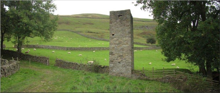
Here turn left and follow the public footpath southwards dropping down to Walden Beck and continue beside the beck to the road at Cote Bridge. Continue southwards along the road for about 100m to a stony track on the left where there is the old restored Braithwaite Lead Smelt Mill Chimney dating from the mid 1800's.
Turn left here off the road to follow the bridleway along the stony track past the old chimney to climb up the steep valley side for about 1.6km to map ref. SE 033 850 at the saddle between the Height of Hazely and Harland Hill. From the saddle continue along the bridleway following the track down across the moor for about 3km to the road on the edge of Carlton village at map ref. SE 062 845. Continue along the road heading eastwards through the village for about 500m back to the village hall car park and the end of the walk.
(top of page)