Menu:
National Parks
| Routes Library | North York Moors | Yorkshire Dales |
| Yorkshire Wolds | Howgill Fells | Teesdale |
| Lake District | Peak District |
| 2001 walks | 2002
walks | 2003 walks | 2004
walks |
| 2005 walks | 2006
walks | 2007 walks | 2008
walks |
| 2009 walks | 2010
walks | 2011 walks | 2012 walks |
| 2013 walks | 2014 walks | 2015 walks | 2016 walks |
| 2017 walks | 2018 walks | 2019 walks | 2020 walks |
| 2021 walks | 1993-2000 library | Find a Route Index |
| A few Routes to print out | Request a Route... |
Library Route 980511,
Hole-of-Horcum, Havern Beck,
Newtondale, Needle Point, Killing Nab Scar,
Waterpale Slack, Hardigate Road, Yorfall Wood,
Dundale Pond, Dundale Griff circuit - 15km
North York Moors . . .
Map: OS Explorer OL27 North York Moors Eastern area at 1:25000
Printer friendly version (opens
in a separate window)
The approximate route is shown by a blue line.
Use your mouse to drag the map to the area of interest and
zoom in/out using the controls on the left hand side of the map.
Please use my map to find the route on your own large scale
walking map such as the OS Explorer series at 1:25000.
If you have time if you do this walk please let me know how you get on.
That would be very helpful to me to keep my information accurate and up to date.
Please note that I provide this free service to you as a fellow walker on the
understanding that you walk
the route entirely at your own risk and that the information is not used for
any commercial purpose.
Library Route 980511, Hole-of-Horcum, Havern Beck,
Newtondale, Needle Point, Killing Nab Scar,
Waterpale Slack, Hardigate Road, Yorfall Wood,
Dundale Pond, Dundale Griff circuit - 15km
North York Moors . . .
Map: OS Explorer OL27 North York Moors Eastern area at 1:25000
General Directions
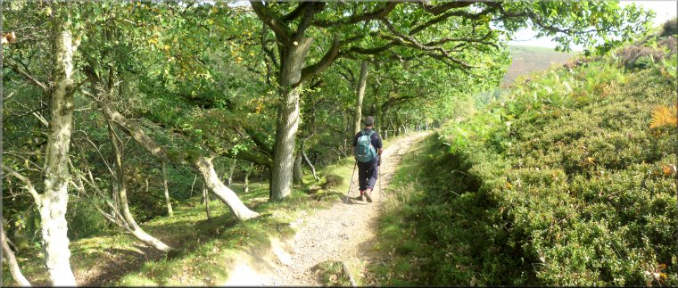
The walk starts at the Saltergate car park (map ref. SE 852 936) overlooking the Hole-of-Horcum on the A169 Pickering to Whitby road. From the northern end of the car park head north along the roadside verge for about 250m then turn right off the road to follow a footpath into the plantation and down the steep bank to emerge on to the A169 at map ref. SE 851 943. Cross the road and walk about 30m along the road to the access track to Glebe Farm on the left hand side of the road.
Turn off the road here and follow the public footpath along the farm access track through Glebe Farm and across the fields to the open access moorland above the steep little valley of Havern Beck to the right of the path. Continue along the path following Havern Beck and dropping down the steep valley side to an unmanned level crossing at the North York Moors railway in Newtondale. Cross the railway, with due care, and follow the path up to the access track that runs along the valley bottom.
Follow the path southwards along the access track for about 200m and round a right hand bend. Just round the bend turn right off the access track to climb a steep footpath directly up the end of the hillside through the forest to Needle Point at the top of the valley side. Follow the path around the edge of the cliffs and along Killing Nab Scar. There are a couple of seats with lovely views of Newtondale and the steam trains on the railway in the valley bottom.
Continue along the footpath around the rim of the valley to join a bridleway at map ref. SE 827 951. Follow the bridleway along one of the forest access tracks to map ref. SE 825 952. Turn left here, off the bridleway and follow a forest track through this open access forest heading south west for a little over 1km to a junction in the tracks at map ref. SE 818 941. Keep right at the junction for about 100m to another junction in the tracks. At this second junction turn left to follow a bridleway along the track called Waterpale Slack.
After about 500m along Waterpale Slack, the track drops steeply down the end of the hill to join a forest access road called Hardigate Road in the valley bottom next to the railway. Continue along this access road to an old platelayer's cottage (now a holiday cottage?) on the right hand side of the road at map ref. SE 813 923.
Opposite the cottage turn left off the access road and follow a path across a level crossing over the railway and up through Yorfalls Wood to emerge on to the open moor at map ref. SE 815 919. Follow a path heading south east across the moor for about 700m to a hair-pin bend in a minor road at map ref. SE 820 916. From the road follow the path climbing up the hillside and across the moor to Dundale Pond at map ref. SE 828 918. Continue along the public footpath past the pond and down the little valley called Dundale Griff for about 1km to the bank of Levisham Beck at map ref. SE 838 917.
Turn left here and follow the path heading northwards on the east side of Levisham Beck. Continue along the public footpath past the buildings of Low Horcum farm and cross Levisham Beck again about 300m beyond the farm buildings. From the beck continue along the path through the Hole-of-Horcum for about 500m to map ref. SE 848 938. Turn right here where there is a path shown on the map but not much sign of it on the ground. Head east for about 150m to cross the beck again and follow a footpath past the remains of a ruined farm and up a steep grassy slope to a stile at the top edge of the field into some woodland around the slopes of the Hole-of-Horcum. Continue along the narrow footpath climbing diagonally up the valley side through the woodland for a few hundred metres to the A169 opposite the car park at the end of the walk.
(top of page)