| 2001 walks | 2002
walks | 2003 walks | 2004
walks |
| 2005 walks | 2006
walks | 2007 walks | 2008
walks |
| 2009 walks | 2010
walks | 2011 walks | 2012 walks |
| 2013 walks | 2014 walks | 2015 walks | 2016 walks |
| 2017 walks | 2018 walks | 2019 walks |2020 walks |
| 2021 walks | 1993-2000 library | Find a Route Index |
| A few Routes to print out | Request a Route... |
Route No 9 - 22 September 2001
Gunnerside Gill,
Blakethwaite Dams circuit - 9 miles
Swaledale, Yorkshire Dales . . .
Route map from Ordnance Survey Open Space service.
Map: OS
Explorer OL30 Yorkshire Dales Northern & Central areas at
1:25000
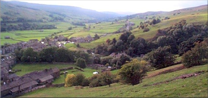
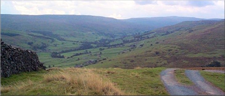
Looking down into Gunnerside Gill from Jungle Pot Edge
My usual walking companions were all otherwise engaged to-day, e.g. Jim is still sunning himself in the Greek islands, so I have had a very pleasant day walking on my own in Swaledale. It's just over an hour's drive from home to Gunnerside and I parked there at about 10 this morning. All the parking spaces in the little square were already taken so I parked a little way out of the village near the bridge. There was quite a bit of cloud about but plenty of sunny breaks too, in fact a great day for walking. |
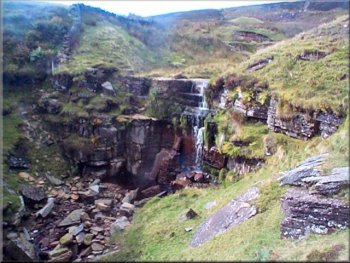
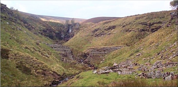
Waterfall at Botcher Gilll
A very clean dark green land rover and trailer came along the track whilst I sat there admiring the view. The two young men in it were very smart with white shirts and dark ties. I thought that they were probably game keepers but they looked very well scrubbed. I followed the track down into the valley to the ruins of an old stone peat store - used to dry peat supplies when the whole valley was a hive of mining activity in the 18th and 19th centuries. |
I took the path straight out of the village square up to a bridle way on a good track along Jingle Pot Edge. There's a good view back down Gunnerside Gill with the beck snaking it's way in the bottom and the patchwork of stone walls up the valley side. I followed the track to Botcher Gill, about 2 miles from Gunnerside. There is a pretty waterfall just below the track and I stopped for a drink and a sandwich.
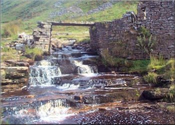
Stone flag bridge beside the old peat store
|
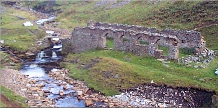
Ruins of peat store near Blakethwaite smelt mill
|
I crossed the stream on a stone flag bridge and climbed a little way up the valley side to a green path upstream to the two ruined Blakethwaite dams which also date from the mining era. I sat on top of the upper dam to have my lunch and just admire the scenery for half an hour. The reservoir behind the dam is all silted up and overgrown with cotton grass.
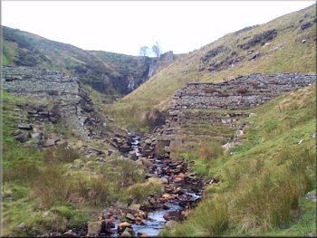
First of the breached Blakethwaite Dams
|
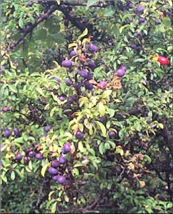
Sloes on a blackthorn bush near the end of the walk
|
The two breached Blakethwaite Dams
|
|
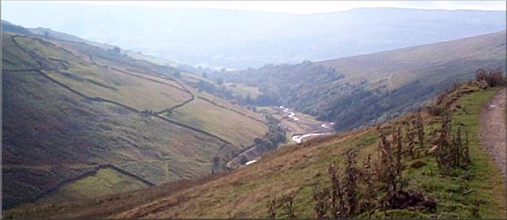
Looking down into Swaledale from the start of the descent from Fremington Edge
After lunch I climbed a bit higher up the valley side onto a stone track past a shooting hut heading back towards Gunnerside. I had just set off when I met another walker coming towards me. He looked about my age but a lot fitter, with a blue head band and red shorts. Like me he was ready for a chat after a solo walk. He came from Tesside and leads guided walks. After about a mile the track leads into a vast desolate area of mining waste on which nothing has been able to grow. Here I turned off the track onto a greener path parallel to the valley until I was opposite Botcher Gill where I had stopped in the morning. As I looked at the view a convoy of 4x4's was snaking its way along the track I had walked. They all parked in a row beside the track and it was clear it was a shooting party - that's why the game keepers were so well turned out when I saw them this morning.
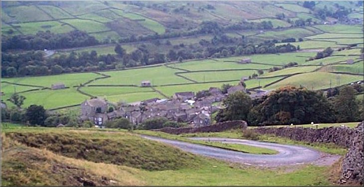
The steep winding lane down to Reeth from Fremington Edge
|
I continued on my way past an old lime kiln at Winterings Scar until the path reached a steep tarmac lane that descended the hillside to the main road in Gunnerside. The whole route was about 9 miles and you can find a detailed description of it in a book by Stephen I. Robinson
(ISBN 1-898550-00-X)
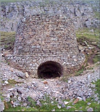
Lime kiln at Winterings Scar
|
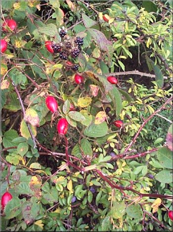
Autumn hedgerow at Gunnerside
|