| 2001 walks | 2002
walks | 2003 walks | 2004
walks |
| 2005 walks | 2006
walks | 2007 walks | 2008
walks |
| 2009 walks | 2010
walks | 2011 walks | 2012 walks |
| 2013 walks | 2014 walks | 2015 walks | 2016 walks |
| 2017 walks | 2018 walks | 2019 walks |2020 walks |
| 2021 walks | 1993-2000 library | Find a Route Index |
| A few Routes to print out | Request a Route... |
Route No 32 - 31 January 2002
Northdale Rigg, Shunner Howe
Hartoft Dale circuit - 8.5 miles (13km)
North York Moors . . .
Route map from Ordnance Survey Open Space service.
Maps:
OS Outdoor Leisure 27 North York Moors Eastern area. 1:25000
OS Outdoor Leisure 26 North York Moors Western area. 1:25000
(The route is split between both sides of both maps - it's a real
pain to navigate)
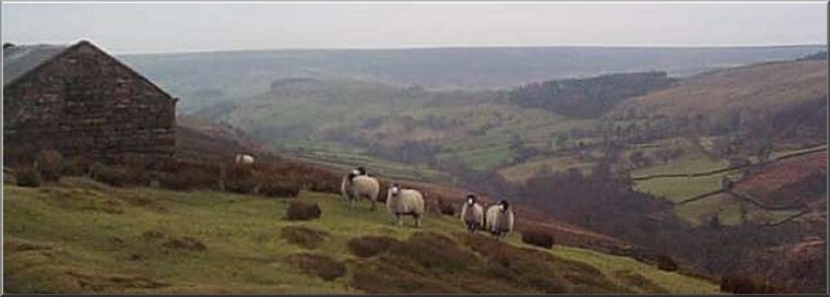
Rosedale from Heygate Bank
|
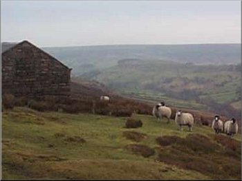
View from the shooting hut on Heygate Bank
He stopped his bike and in a most courteous, charming and totally disarming way pointed out that the track was not a right of way. We had a very interesting and friendly chat about the numbers of wading birds nesting on the moor (golden plover, lapwing and curlew) and he agreed that we would not be doing any harm to continue but implied that this was a not to be repeated concession and we parted on good terms. This is exactly the situation that should be addressed by the recent "Right to Roam" legislation. If the new Act does not give us access to this kind of track over open moor in a national park then it will be utterly useless. I must admit that I am very suspicious that the current procedure to establish maps of areas where the Act gives access is just a delaying tactic and very little new access will ever result from the process (I hope I'm proved wrong) |
After a slow start caused by the York rush hour and an unexpected road closure at Scackleton, I arrived with two friends in Rosedale Abbey at about 10.15. We drove up the Egton Bridge road (Heygate Bank), turned right onto Hancow Road and parked off the road near the cattle grid at the corner of Russell's Wood. The weather was cloudy and dry, but the forecast was for wet and windy weather moving in during the afternoon. We set off back along the road for a few hundred yards and then took a bridle way across the moor to the top of Heygate Bank and followed the grouse shooters track across Northdale Rigg. There was a farmer ahead of us taking feed to his sheep on the moor. We were heading for the route of the Lyke Wake Walk that follows the parish boundary a couple of miles ahead. We were about half way along the track to the LWW when we were met by a young game keeper on a quad bike coming the other way.
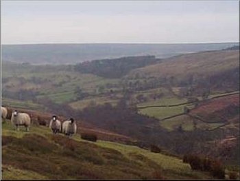
Looking down to Rosedale from Heygate Bank
|
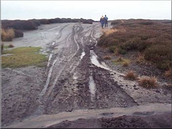
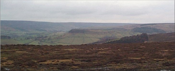
Motor bike tracks on the Lyke Wake Walk near Shunner Howe
We continued on this bridleway for just over 3 miles to a point before St. James Farm. Here we turned down the valley side to Head House and took the footpath across the fields to cross the footbridge over the stream in the valley bottom and climb up to Rock House (very aptly named as it is the site of a reclaimation business for demolition stone) The fields in the valley bottom are a complete quagmire - at least we got our money's worth from our hiking boots and gaiters. At the road at Rock House we took the bridleway through the woods to Hancow Road and followed the road for half a mile back to the car. The whole route was about eight and a half miles and took us four and a half hours including two stops. |
We sat in the heather beside the Lyke Wake Walk for a drink and a sandwich - it was very comfortable - before continuing along the Lyke Wake Walk to Shunner Howe and a few hundred yards further on to the ruins of Hamer House at the road. We turned right onto the road for two hundred yards and took the bridle way to the left over Hamer Moor to the edge of Cropton Forest. We stopped in the shelter of the forest for a drink and to put our wet weather gear on. The forecast rain and wind had started and did not let up for the rest of the walk. The path goes though a little spur of forest then skirts the edge of Cropton Forest overlooking Hartoft Dale.
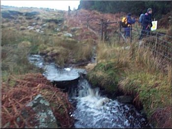
Moorland stream on the edge of Cropton Forest
|
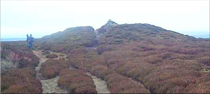
Shunner Howe through the rain
|