| 2001 walks | 2002
walks | 2003 walks | 2004
walks |
| 2005 walks | 2006
walks | 2007 walks | 2008
walks |
| 2009 walks | 2010
walks | 2011 walks | 2012 walks |
| 2013 walks | 2014 walks | 2015 walks | 2016 walks |
| 2017 walks | 2018 walks | 2019 walks |2020 walks |
| 2021 walks | 1993-2000 library | Find a Route Index |
| A few Routes to print out | Request a Route... |
Route No 110 - Tuesday 13 July 2004
Masham, Ilton River Ure circuit - 17km
Wensleydale . . .
Maps: OS Explorer 298 & 302 at 1:25000Ordnance Survey route map on the Landranger series map base
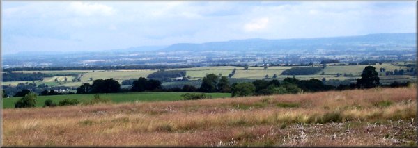
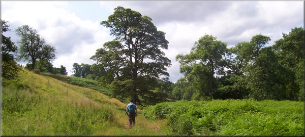
 This
morning the weather seemed to be a bit brighter so we drove to
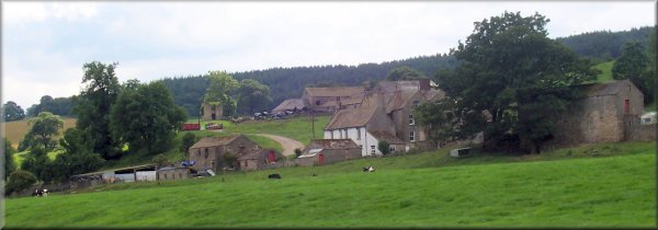
Masham on the river Ure, about half an hour from home, and parked
in the sports field car park by the river on the edge of the town
at map ref. SE 226810. We left the town on the Ripon Rowel route
heading west to Micklebury Lane and then to the road junction
at map ref. SE 187800. Here we turned left along the road to map
ref. SE 193799 where we took the path along the valley to rejoin
the Ripon Rowel route on the road at map ref. SE 186786. We continued
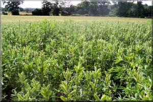
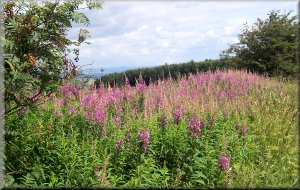
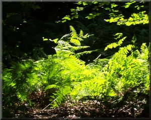
on the route through Ilton village and up across on to the rough
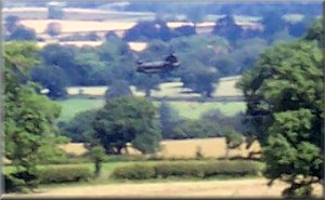
pasture where we stopped for a drink and a sandwich with a wonderful
view over to the North York Moors. As we sat there a couple of
huge military transport helicopters made their way below us -
yes below us barely above tree top height tracking accross country
from east to west. After lunch we continued across the rough pasture
to the lane at map ref. SE 198774. Here we turned left onto the
lane and followed it for just over a kilometer to the edge of
the woods at Nutwith Common.
This
morning the weather seemed to be a bit brighter so we drove to
Masham on the river Ure, about half an hour from home, and parked
in the sports field car park by the river on the edge of the town
at map ref. SE 226810. We left the town on the Ripon Rowel route
heading west to Micklebury Lane and then to the road junction
at map ref. SE 187800. Here we turned left along the road to map
ref. SE 193799 where we took the path along the valley to rejoin
the Ripon Rowel route on the road at map ref. SE 186786. We continued
on the route through Ilton village and up across on to the rough
pasture where we stopped for a drink and a sandwich with a wonderful
view over to the North York Moors. As we sat there a couple of
huge military transport helicopters made their way below us -
yes below us barely above tree top height tracking accross country
from east to west. After lunch we continued across the rough pasture
to the lane at map ref. SE 198774. Here we turned left onto the
lane and followed it for just over a kilometer to the edge of
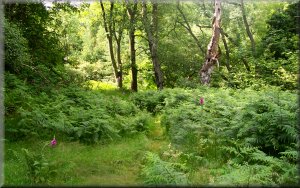
the woods at Nutwith Common.  We
turned into the woods and took the forest track for about 2km
to the road at map ref. SE 230774. There is a footpath shown on
the map through the woods to this point but I think it must have
been lost in the forestry operations - at any rate we didn't find
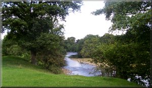
it. We crossed the road and took the path down the slope to the
river where we rejoined the Ripon Rowel route on its way upstream
into Masham and followed it back to our starting point. As we
approached the car park the prize giving ceremony was in progress
for the local school sprots day on the playing fields by the river.
There was quite a good crowd and lots of applause from the assembled
children and their proud parents.The whole route was about 17km
and took us about five and a half hours including a couple of
stops. We finished off with a cup of tea and a toasted teacake
in the market square. It was very pleasant in the sunshine as
the school children and their parents made their way home across
the square after the sports day.
We
turned into the woods and took the forest track for about 2km
to the road at map ref. SE 230774. There is a footpath shown on
the map through the woods to this point but I think it must have
been lost in the forestry operations - at any rate we didn't find
it. We crossed the road and took the path down the slope to the
river where we rejoined the Ripon Rowel route on its way upstream
into Masham and followed it back to our starting point. As we
approached the car park the prize giving ceremony was in progress
for the local school sprots day on the playing fields by the river.
There was quite a good crowd and lots of applause from the assembled
children and their proud parents.The whole route was about 17km
and took us about five and a half hours including a couple of
stops. We finished off with a cup of tea and a toasted teacake
in the market square. It was very pleasant in the sunshine as
the school children and their parents made their way home across
the square after the sports day.