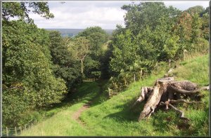
Looking
back up Westerdale
Menu:
National Parks
 The
weather has been awful for weeks, but today there is
plenty of blue sky and sunshine with lots of billowing white clouds
and, acording to the forecast, there is the risk of a shower.
We drove Blakey Ridge to Westerdale and parked at the southern
end of the village away from people's front doors, near the junction
at map ref NZ 665057. From the junction we took the path across
the fields to the lane through Broad Gate Farm. We followed the
bridleway through the farm across Tower Beck and up to Dale Head
where there is an interseting old stone structure with alcoves,
each one designed to hold a straw skep type of bee hive. We continued
uo the valley side on an old pack horse route through the rocks
with a lovely view behind us over to Roseberry Topping. The bridleway
joined the road on Castleton Rigg at map ref. NZ 682039
The
weather has been awful for weeks, but today there is
plenty of blue sky and sunshine with lots of billowing white clouds
and, acording to the forecast, there is the risk of a shower.
We drove Blakey Ridge to Westerdale and parked at the southern
end of the village away from people's front doors, near the junction
at map ref NZ 665057. From the junction we took the path across
the fields to the lane through Broad Gate Farm. We followed the
bridleway through the farm across Tower Beck and up to Dale Head
where there is an interseting old stone structure with alcoves,
each one designed to hold a straw skep type of bee hive. We continued
uo the valley side on an old pack horse route through the rocks
with a lovely view behind us over to Roseberry Topping. The bridleway
joined the road on Castleton Rigg at map ref. NZ 682039 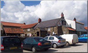 We
crossed the road and sat at the edge of an old quarry looking
over Danby Dale to have a drink before continuing along the road
to map ref. NZ 682028 where we turned onto the path across the
moor to the left of the road as the road itself swings right.
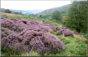
The whole moor is purple now that the heather is in full bloom
and we followed the boundary stones across the moor to the road
at map ref. NZ 681019 where there is a large square boundary stone
with a large stone ball on top, all painted white called officially
"White Cross", but really known as "Fat Betty".
From this point we joined the Lyke Wake Walk route heading west.
We crossed the road and followed the path across Rosedale Head
to the road at map ref. NZ 675012 and followed the
We
crossed the road and sat at the edge of an old quarry looking
over Danby Dale to have a drink before continuing along the road
to map ref. NZ 682028 where we turned onto the path across the
moor to the left of the road as the road itself swings right.
The whole moor is purple now that the heather is in full bloom
and we followed the boundary stones across the moor to the road
at map ref. NZ 681019 where there is a large square boundary stone
with a large stone ball on top, all painted white called officially
"White Cross", but really known as "Fat Betty".
From this point we joined the Lyke Wake Walk route heading west.
We crossed the road and followed the path across Rosedale Head
to the road at map ref. NZ 675012 and followed the 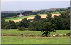 road
to the Lion Inn at map ref. SE 678996. We had been promising ourselves
a walk with lunch at the Lion Inn for a couple of years and at
long last we had organised a route to do it. They serve good tasty
pub food - I had roast beef and yorkshire pudding with lots of
vegetables and chips. We got there around 12 o'clock before it
was too busy. The pub is in the middle of nowhere and is always
busy. After lunch we took the path from the Lion Inn to the old
railway track at map ref. SE 675997 and followed it up Farndale
to map ref. NZ 653007. Here we left the present day route of the
Lyke Wake Walk to follow the path down to Esklets. In the 1960's
&70's the Lyke Wake Walk came this way too, instead of going
to the Lion Inn but the route was changed to allow the path to
recover from erosion. Now the path has been swept away altogether
and replaced with a stone track for the grouse shooters' vehicles.
We followed the path down Westerdale for several kilometers to
the farm road at New House Farm, map ref. NZ 652047. We followed
the farm road for a few hundred metres to map ref. NZ 655051 where
we turned right to follow the lane back into Westerdale village
to the car. The whole route was around 17km. and took us almost
6 hours including a longish lunch stop at the Lion Inn. It had
been a perfect day for walking with plenty of sunshine, a nice
breeze and no showers.
road
to the Lion Inn at map ref. SE 678996. We had been promising ourselves
a walk with lunch at the Lion Inn for a couple of years and at
long last we had organised a route to do it. They serve good tasty
pub food - I had roast beef and yorkshire pudding with lots of
vegetables and chips. We got there around 12 o'clock before it
was too busy. The pub is in the middle of nowhere and is always
busy. After lunch we took the path from the Lion Inn to the old
railway track at map ref. SE 675997 and followed it up Farndale
to map ref. NZ 653007. Here we left the present day route of the
Lyke Wake Walk to follow the path down to Esklets. In the 1960's
&70's the Lyke Wake Walk came this way too, instead of going
to the Lion Inn but the route was changed to allow the path to
recover from erosion. Now the path has been swept away altogether
and replaced with a stone track for the grouse shooters' vehicles.
We followed the path down Westerdale for several kilometers to
the farm road at New House Farm, map ref. NZ 652047. We followed
the farm road for a few hundred metres to map ref. NZ 655051 where
we turned right to follow the lane back into Westerdale village
to the car. The whole route was around 17km. and took us almost
6 hours including a longish lunch stop at the Lion Inn. It had
been a perfect day for walking with plenty of sunshine, a nice
breeze and no showers.
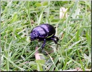
A dung beetle, just going about its business |
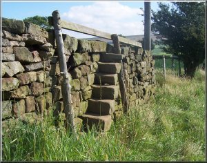 High
stone stile near Westerdale village
High
stone stile near Westerdale village |
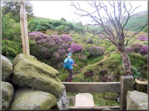
 Path
up from Tower Beck
Path
up from Tower Beck |
 Approaching
Dale Head
Approaching
Dale Head
on the way to Castleton Rigg |
 Looking
back to Dale Head
Looking
back to Dale Head |
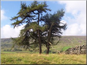 Larch
tree at Dale Head
Larch
tree at Dale Head |
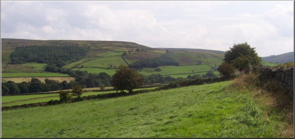
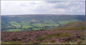
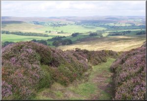 View
from Castleton Rigg across Westerdale
View
from Castleton Rigg across Westerdale |
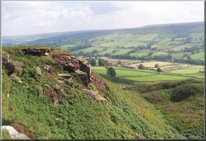 View
from Castleton Rigg down Danby Dale
View
from Castleton Rigg down Danby Dale |
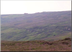 Distant
view of the Lion Inn across Rosedale Head
Distant
view of the Lion Inn across Rosedale Head |
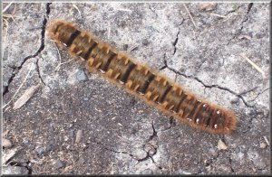 Hairy
caterpillar at Rosedale head
Hairy
caterpillar at Rosedale head |
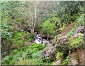 Infant
River Esk in Westerdale
Infant
River Esk in Westerdale |
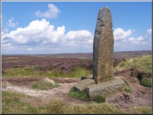 Stone
marker at the Lion Inn
Stone
marker at the Lion Inn |
 Farndale
from the old railway track
Farndale
from the old railway track |
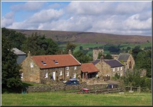
 The
head of Westerdale
The
head of Westerdale |
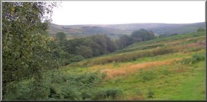
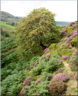
 Path
down Westerdale near Esklets
Path
down Westerdale near Esklets |
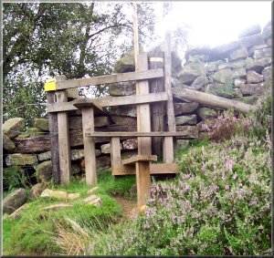 Multi-layered
stile in Westerdale
Multi-layered
stile in Westerdale |
 Above:
Path down Westerdale
Above:
Path down Westerdale
Top right: Heather in Westerdale
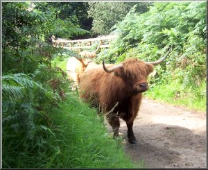
Bottom right: Highland Cattle in Westerdale |
|
Looking
back up Westerdale
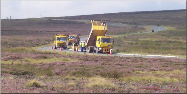
Road
repairs on Castleton Rigg
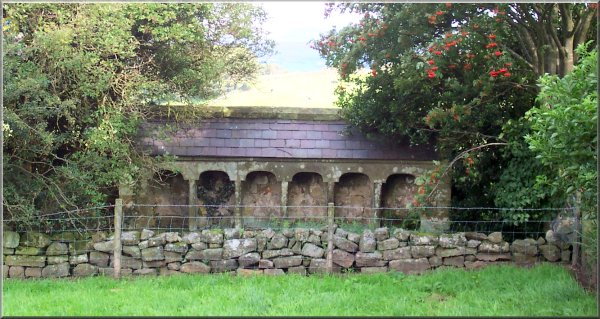
Alcoves
for Skep bee hives at Dale Head