| 2001 walks | 2002
walks | 2003 walks | 2004
walks |
| 2005 walks | 2006
walks | 2007 walks | 2008
walks |
| 2009 walks | 2010
walks | 2011 walks | 2012 walks |
| 2013 walks | 2014 walks | 2015 walks | 2016 walks |
| 2017 walks | 2018 walks | 2019 walks |2020 walks |
| 2021 walks | 1993-2000 library | Find a Route Index |
| A few Routes to print out | Request a Route... |
Route No 124 - Saturday
29 January 2005
Hutton-le-Hole, Ana Cross,
Lastingham circuit - 13km
North York Moors
Map: OS Explorer OL26 North York Moors Western area at 1:25000
Route
Map on 'Landranger' map base from OS Open Space service
Open this route in
Google Earth
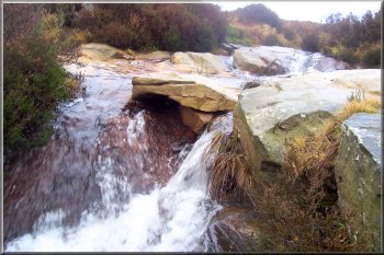
Ford over one of the tributaries of Loskey Beck |
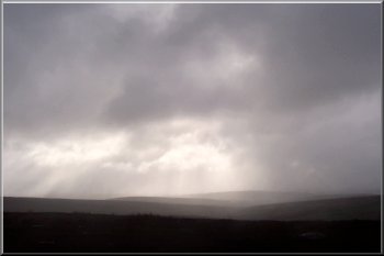
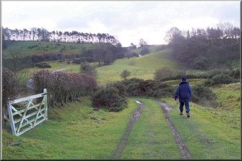
This
morning the weather was overcast and drizzly but it was
due to brighten this afternoon so we had a leisurely start
with plenty of time to read the morning paper over breakfast.
Then my wife and I drove to Hutton-le-Hole where we parked
at about 10.30. We crossed the road in front of the car
park on to the grassy bank and followed the fence line up
the hill to a pedestrian gate in the fence at map ref. SE
704904. We went through the gate and followed a pleasant
grassy track around the hill overlooking Hutton Beck until
we came to the tarmac drive to Spaunton Lodge at map ref.
SE 705913. We followed the drive for about 250m and where
the drive turned left we continued straight on along a public
footpath on a muddy track. |
| After
about 500m the track bears to the left and there is a small
cairn marking the point where the footpath bears to the
right.We continued along the foot path to map ref. SE 704930
where the path turns right onto a stony moorland track.
We followed the track across the first main tributary of
Loskey Beck where there is a ford with a couple of uneven
stepping stones on the downstream side as the water tumbles
down a series of little rapids. We climbed over to the second
tributary of Loskey Beck where the path leaves the track
and breaks off to the left before crossing the stream and
climbing up the moor to the road at map ref. SE 717939.
|
Pinfold sculpture in Hutton-le-Hole |
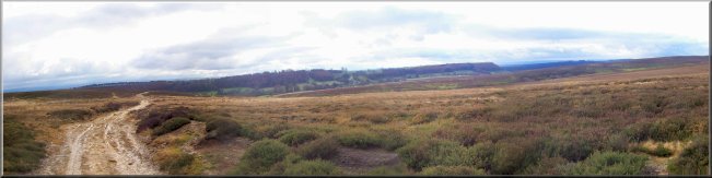
Threatening skies in the morning
We turned left off the road here on to a path through
some woodland and across the fields into Hutton-le-Hole
at map ref. SE 705899. The path emerges into the village
next to the Barn tea rooms - very pleasant with a carpet
and nice cosy fire, but a bit too clean and tidy in
muddy hiking gear - a bit further down the street is
the Old Forge cafe, a bit more spartan but a very nice
cup of tea and Yorkshire curd tart. Suitably refreshed
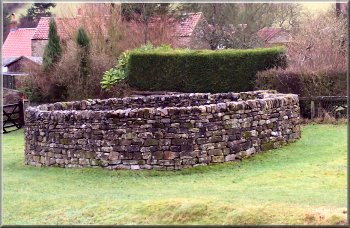
we made our way back up the village to the car park
opposite a circular dry stone wall structure that looks
like an old pinfold but I think it's a fairly recently
constructed sculpture. The whole route was about 13km
and took us about four hours to walk including a short
lunch break.
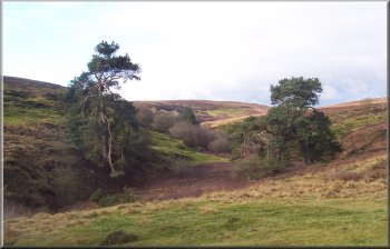
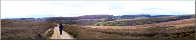
The valley of Hole Beck near Lastingham
|
At the road we turned left walk along the road for about
500m to map ref. SE 720945 where we turned right off
the road onto a stoney moorland track to Ana Cross.
We on a bank near the cross for some lunch but it was
quite cold once we stopped walking. After our break
we set off heading roughly south for about 3km to map
ref. SE 729909 near Lastingham. Here we turned right
at the point where there is a seat to admire the view
next to the Footpath signpost and the Lastingham millennium
stone. We followed the path across the steep little
valley of Hole Beck to the road below Spaunton at map
ref. SE 721903. We turned on to the road and headed
towards Hutton-le-Hole for about 600m to map ref. SE
713904.
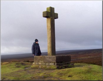
Ana Cross
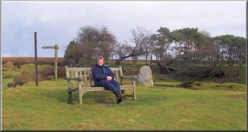
Seat by the millennium stone near Lastingham
|
Coming out onto the road below Spaunton |
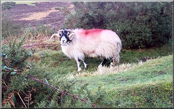
Swaledale Tupp giving us a hard stare |