| 2001 walks | 2002
walks | 2003 walks | 2004
walks |
| 2005 walks | 2006
walks | 2007 walks | 2008
walks |
| 2009 walks | 2010
walks | 2011 walks | 2012 walks |
| 2013 walks | 2014 walks | 2015 walks | 2016 walks |
| 2017 walks | 2018 walks | 2019 walks |2020 walks |
| 2021 walks | 1993-2000 library | Find a Route Index |
| A few Routes to print out | Request a Route... |
Route No 152 - Saturday
6 August 2005
Bishop
Wilton, Great Givendale,
Millington Grange, Deep Dale - 12km
Yorkshire Wolds
Maps: OS Explorer 294 Market Weighton & Yorkshire Wolds Central
at 1:25000
Route
Map on 'Landranger' base from OS Open Space service
|
To-day
we met a group of friends in the wolds village of Bishop
Wilton at about 1.00pm. It was the 60th birthday of one
of our group and he and his wife had invited all of us to
a barbecue at their bungalow in Melbourne about 15km from
Bishop Wilton. They were at home getting ready for our invasion
and we were going to have a walk before heading for the
barbecue at about 5 o'clock.
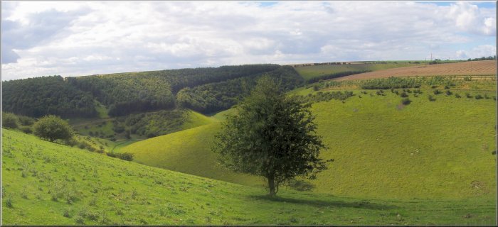
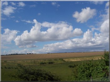
View from the Minster Way above Bishop
Wilton
|
From the centre of the village we set off on the road
towards Pocklington for about 350m to map ref. SE 799547.
Here we turned left off the road onto the Minster Way
footpath up onto the edge of the wolds. We followed the
Minster Way through Great Givendale, past the old church
and across Whitekeld Dale to map ref. SE 823533 just before
Little Givendale farm.
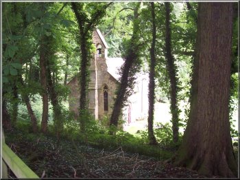
The church at Great Givendale
|
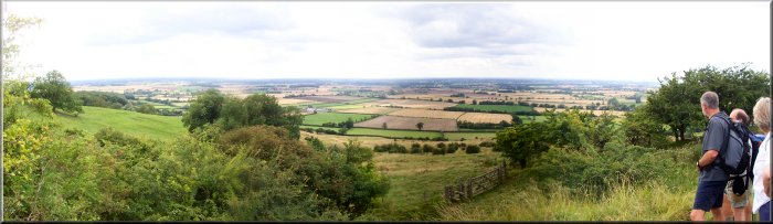
Rich wolds farmland
At this point we left the Minster Way and took a path
along the edge of a huge ripening wheat field to the road
at map ref. SE 830533. At the road we turned left to follow
the road for about 3km to map ref. SE 828560. This was
a lot more road walking than we would normally do but
it allowed us to do a pleasant route of the right length
for to-days birthday plan.
|
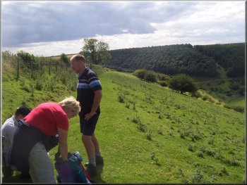
We had a break before crossing Deep Dale |
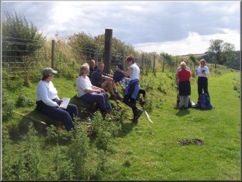
We had a break before crossing Deep Dale |
We turned left off the road to follow a path across Deep
Dale - a very steep decent and long climb out to the road
at map ref. SE 812559. We crossed the road and followed
the footpath for about 300m to the corner of a wood at
map ref. SE 808558 where we turned left to follow the
path round the head of a pretty valley before dropping
down from the edge of the wolds back into Bishop Wilton.
We got back at about 4.45pm just in time to drive to Melbourne
for the birthday barbecue.
|
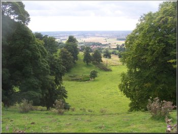
|
|
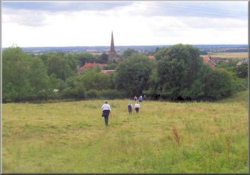
Left & above: Returning to Bishop
Wilton from the edge of the wolds |