| 2001 walks | 2002
walks | 2003 walks | 2004
walks |
| 2005 walks | 2006
walks | 2007 walks | 2008
walks |
| 2009 walks | 2010
walks | 2011 walks | 2012 walks |
| 2013 walks | 2014 walks | 2015 walks | 2016 walks |
| 2017 walks | 2018 walks | 2019 walks |2020 walks |
| 2021 walks | 1993-2000 library | Find a Route Index |
| A few Routes to print out | Request a Route... |
Route No. 168 - Saturday
4 March 2006
Blubberhouses, Fewston & Swinsty Reservoirs
Dob Park Bridge,Timble
- 14.5km
Washburn Valley, Lower Wharfedale . . .
Maps: OS Explorer 297 Lower Wharfedale & Washburn Valley at
1:25000
Route
Map on 'Landranger' base from OS Open Space service
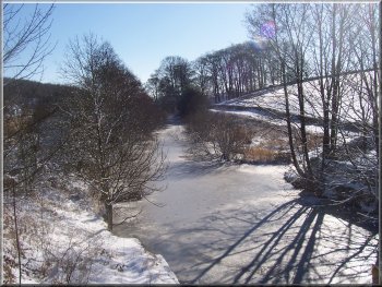
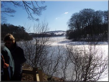
The frozen river Washburn as it
approaches Fewston reservoir
From
the car park we crossed the road bridge over the river
Washburn and set off along the water company's permissive
path down the east side of the reservoir. After about
1.5km we reached the reservoir dam. From the road over
the dam we continued on the permissive path down the
side of the dam to follow the shore of Swinsty reservoir.
|
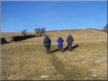
At
about 10.30 this morning I met a group of friends in
the little car park at Blubberhouses at the head of
Fewston Reservoir, map ref. SE 168553. It was an absolutely
fabulous day for a good walk, with crisp cold air, clear
blue sky, bright winter sunshine and a sprinkling of
snow on top of the hard frost of the last few days.
The frozen head of Fewston reservoir
|
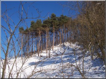
Scots Pine on the hillside by Fewston
Reservoir |
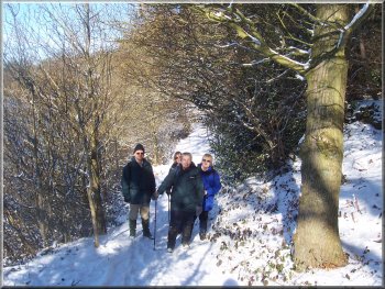
The permissive path round Fewston
reservoir |

The
permissive path round Fewston reservoir |
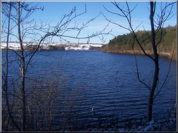
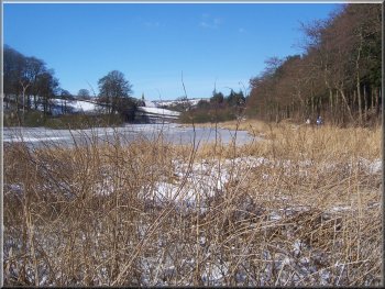
Fewston reservoir |
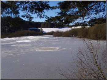
The head of Swinsty reservoir solid
with slushy snow |
The head of Swinsty reservoir solid
with slushy snow
|
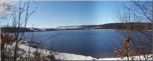
Swinsty reservoir looking towards
the dam |
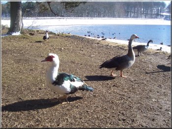
A muscovy duck and a young goose
try their luck for a share of our lunch
From
the picnic area we crossed an arm of the reservoir on
a road bridge and then continued on the permissive path
to the dam of Swinsty reservoir at map ref. SE 197527.
|
After
about 1km we reached a picnic area next to a car park
at map ref. SE 197536 where we stopped for a drink and
we were instantly the focus of attention for a huge
flock of geese and ducks.
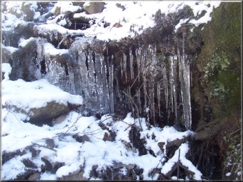
Icicles next to the riverside path
|
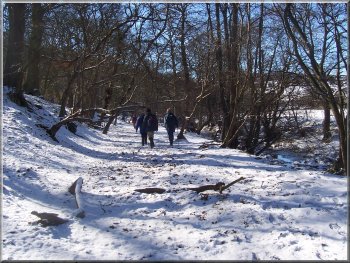
Path
beside the river Washburn below Swinsty Reservoir
Here we turned away from the river and climbed the track
up the hill to a farm called Folly Hall. The farm house
is an imposing three storey stone building. We walked
through the farm yard and continued to climb the hill
on the lane with a lovely view across the Washburn valley.
|
By this point we had joined a public footpath which
we followed down the side of the dam to the River Washburn.
We walked beside the river for about 1km to map ref.
SE 190517 where there is a bridge over the river.
Climbing
up the track towards Folly Hall
|
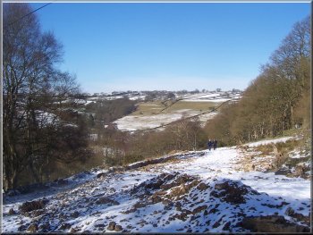
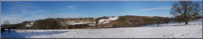
Looking across the Washburn valley
from Hanging Banks above Dob Park bridge |
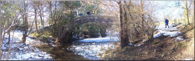
The
lane joined a minor road at map ref. SE 195515 and we
walked down the hill on the road to Dob Park Bridge
over the river Washburn at map ref. SE 196508. Dob Park
Bridge is a lovely old stone pack horse bridge. Once
over the pack horse bridge we turned upstream to follow
the river for about 1km to map ref. SE 188517.
|
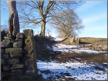
Here
there is a tiny stone footbridge over Timble Gill Beck,
built in 1967 as a memorial to a rambler, Arthur Adamson.
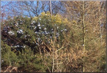
Gorse in flower and hazel catkins
- it's spring despite the snow
|
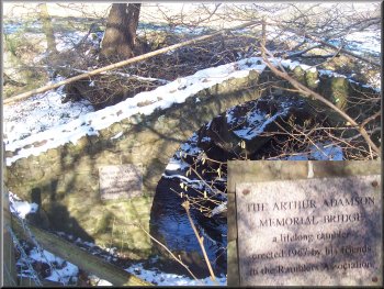
Arthur Adamson memorial bridge over
Timble Gill Beck |
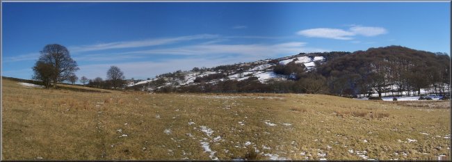
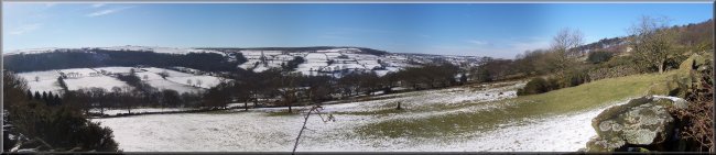
Looking across the Washburn valley
from the hill below Nether Timble |
From
the memorial bridge we followed the path up the hill
to Nether Timble where we joined the track to the village
of Timble about 1km farther on. One of my friends had
fond memories of the Timble Inn as a good walkers' pub
with stone flag floors but the pub today was closed
down and unoccupied.
Climbing the hill to Nether Timble
|
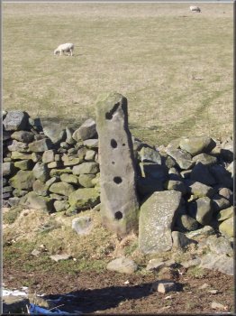
Old stone gate post with holes for
the poles that formed the gate |
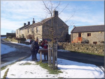
Keen interest in the information
board in Timble village
We crossed the road and continued through the woods
to join the Dales Way Link route (from Harrogate) at
map ref. SE 175538.
|
From
Timble village, map ref. SE 179529, we took the path
northwards to a minor road at map ref. SE 177534.
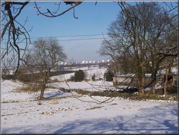
Menwith Hill Air Base seen from
Timble
|
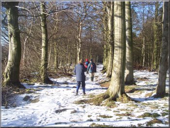
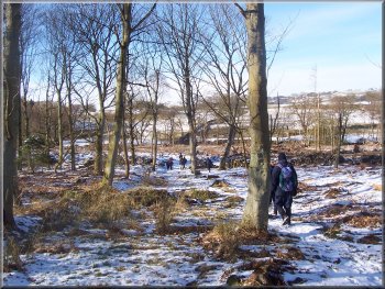
Path through Beecroft Moor Plantation
|
Path through Beecroft Moor Plantation
|
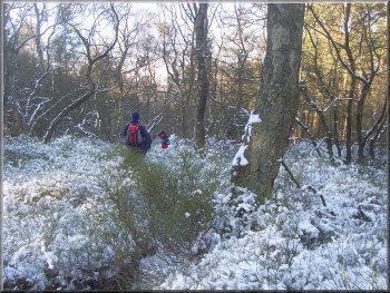
The Dales Way Link route heading
towards Blubberhpuses |
The Dales Way Link route heading
towards Blubberhpuses
|
Fewston reservoir from the Dales
Way Link as we returned to the car park |
|
|
We
followed the Dales Way Link route for the last 1.5km back
to the car park. The whole route had been about 14.5km
and had taken us 5 hours to walk including a couple of
refreshment stops. It had been a perfect day for walking.
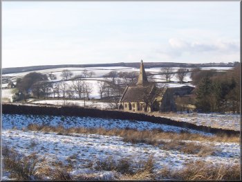
Left:
The church at Blubberhouses seen from
the Dales Way Link route as we approached the car park.
|