| 2001 walks | 2002
walks | 2003 walks | 2004
walks |
| 2005 walks | 2006
walks | 2007 walks | 2008
walks |
| 2009 walks | 2010
walks | 2011 walks | 2012 walks |
| 2013 walks | 2014 walks | 2015 walks | 2016 walks |
| 2017 walks | 2018 walks | 2019 walks |2020 walks |
| 2021 walks | 1993-2000 library | Find a Route Index |
| A few Routes to print out | Request a Route... |
Route No. 195 - Wednesday 13 September
2006
Clay Bank, Botton Head, Ingleby Incline
Greenhow Plantation -
circuit 12km
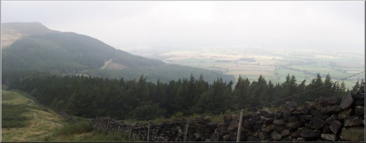
Cleveland Hills,
North York Moors
Map: OS
Explorer OL26 North York Moors Western area at 1:25000
Route
Map on 'Landranger' base from OS Open Space service
Open this route in Google Earth
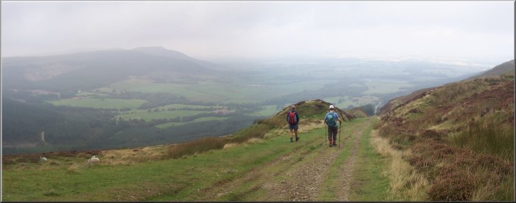
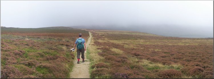
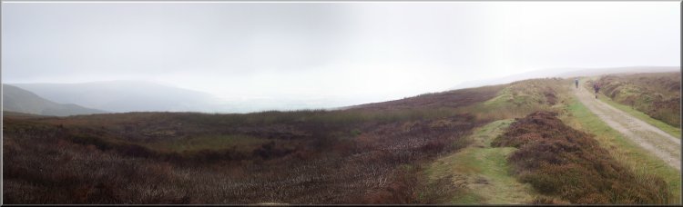
The Cleveland Way climbing up from Clay Bank
We
started walking just after 10.00am and followed the Cleveland
Way up the climb to the trig point above Botton Head at
the highest place on the North York Moors at 454m.
|
This
morning three of us met at the car park at the top of
Clay Bank at the head of Bilsdale in the North York Moors,
map ref. NZ 572036.
The Cleveland Way climbing up from Clay Bank
|
|
Looking down to Clay Bank from the Cleveland Way |
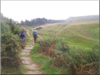
The Cleveland Way heading for the trig point at the top
of the moor
|
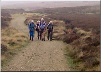
The four ladies from Devon who were walking the Coast
to Coast route
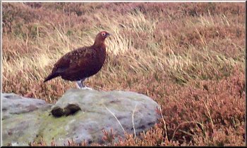
A grouse posing for the camera
|
On
the way up we caught up a group of four very pleasant
ladies from Devon who were walking Wainwright's Coast
to Coast route.
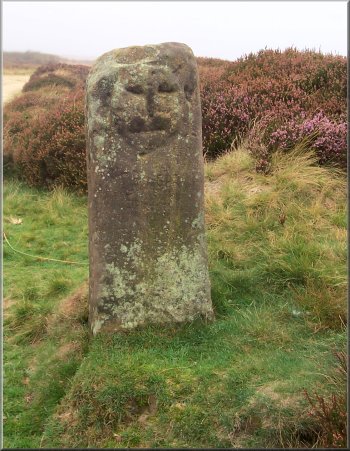
The "Face Stone" by the Cleveland Way at map ref. NZ 599015
|
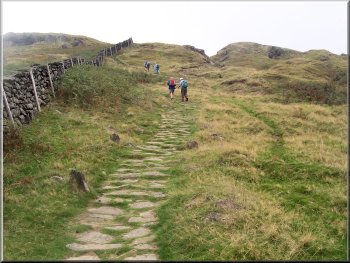
About
1km beyond the trig point at map ref. NZ 604015 we turned
off the Cleveland Way on to a rough track across the moor
to join the route of the old ironstone railway at map
ref. NZ 608020. We followed the bed of the railway for
a few hundred metres to the top of Ingleby Incline at
map ref. NZ 609025. The incline was a death defying contraption.
The railway track was laid down a very steep gradient
about 1.5km long and drops about 300m.
Following the railway bed to the top of Ingleby Incline
There
were two sets of wagons connected by a steel cable around
a large pulley wheel at the top. One set of wagons was
loaded with iron ore at the top and this set off down
the slope hauling the empty set of wagons up from the
bottom there was a passing place with two sets of rails
in the middle of the slope. I don't know how the braking
system worked but there were accidents on the incline
at least one fatal - I must borrow my friend's book on
the ironstone railway.
|
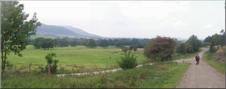
The bottom of Ingleby Incline meets the forest road where
we turned left to follow the road |
At
the bottom of the incline we turned left to walk along
the stone forest road along the edge of the woods. About
400m along the road we came to a very old oak tree at
the side of the road. The
Woodland Trust, the Ancient
Tree Forum and the Tree
Register have all joined forces to carry out a national
survey of ancient trees to put together a reliable database.
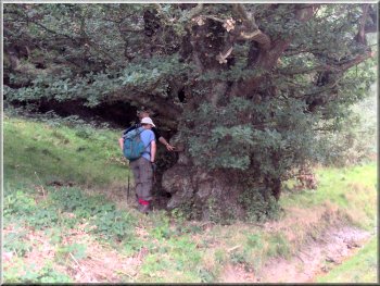
Our ancient oak
Anyone
interested can report
an ancient tree to the survey via their web site so
I had come armed with a clipboard, pen, tape measure and
gps gadget to record all the details they want. The tree
turned out to have a girth of over 10m and I got very
excited and thought the tree could be over 1000 years
old. Later on when I thought about it again I had got
my mental arithmetic all wrong and the tree is probably
over 800 years old, but that's still quite impressive.
|
Our
ancient oak
The
idea is that each year the tree puts on another growth
ring. In the case of oak these average about 2mm wide
which is an extra 4mm on the tree's diameter or about
12mm on the tree's girth. So a tree with a 10m girth is
about 800 years old.
|
The path climbing up from the forest road
We
continued along the forest road for another few hundred
metres to map ref. NZ 601026 where we turned left off
the road to climb a steep track up almost to the top of
the wood at map ref. NZ 601022. Here the track turned
right to follow the contour round the hill side near the
top of the wood for about 500m to the shaley landslip
area of Botton Head.
|
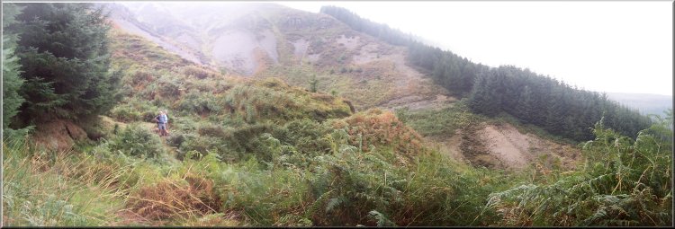
The path below Botton Head |
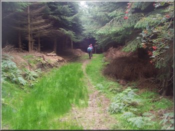
Path winding its way through the woodland |
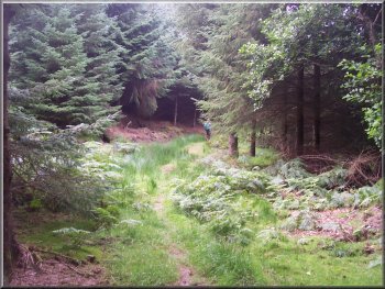 Path
winding its way through the woodland
Path
winding its way through the woodland |
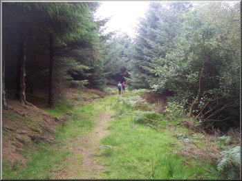
Path winding its way through the woodland |
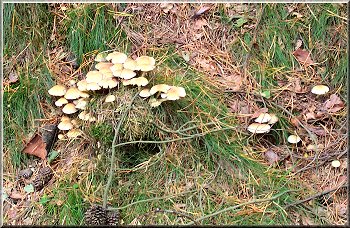
Autumn fungus by the path
We
continued along this track for over 1km to map ref. NZ
586027 where everything changed. Up to this point we had
been walking along a pretty woodland track with misty
views through the trees to the north.
|
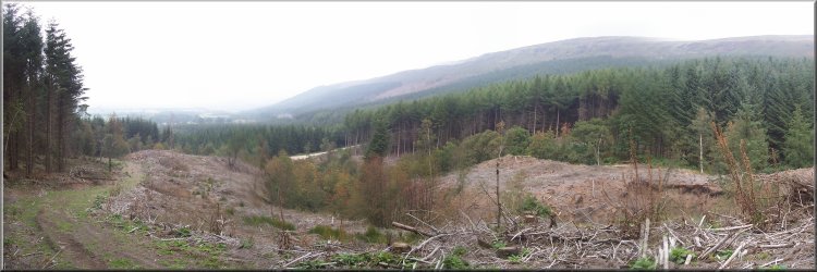
At this point we met the disruption caused by the forestry
operations (no-one working today). Our pleasant woodland
track was turned into a deeply rutted quagmire with a
debris of branches underfoot making for very difficult
walking conditions. These conditions persisted for most
of the way back to the road at Clay Bank. When we were
almost back we met a man on a mountain bike who was checking
out the route for a party of school children at the weekend.
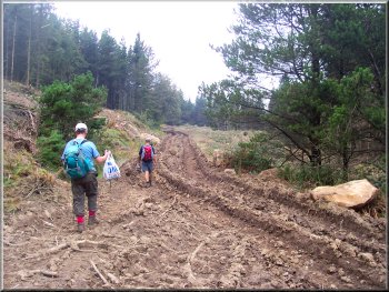
The woodland path churned up by the forestry operations
|
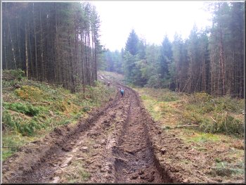
The woodland path churned up by the forestry operations
I think he will be looking for an alternative! The whole
route had been about 12km and had taken us four and a
half hours to walk including our lunch stop at the top
of Ingleby Incline and our tree recording exploits. There
was a cafe caravan in the car park when we got back so
we sat down for a tea and a bacon roll before driving
home. The low cloud and mist had not lifted all day but
it had been very mild.
|
|
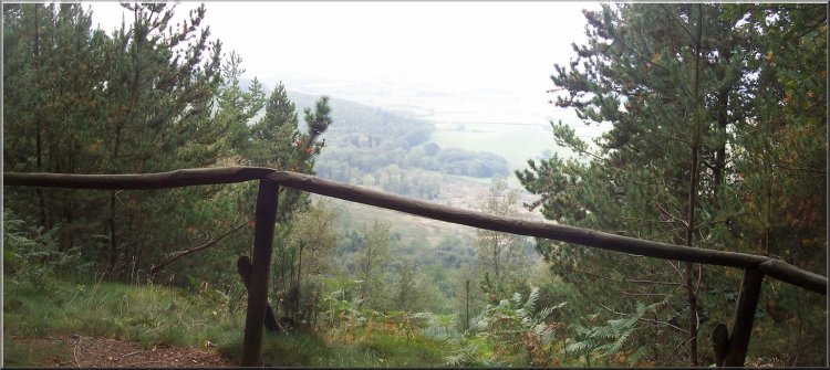
Viewpoint on the woodland track at map ref. NZ 579034 |
|
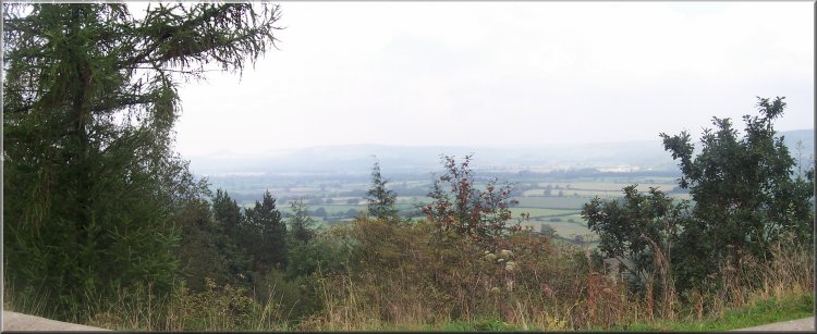
Looking north from Clay Bank car park towards Roseberry
Topping and Captain Cook's Monument hidden in the mist |