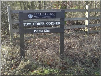
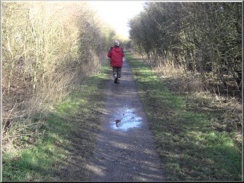
The start of
our walk at Towthorpe Corner
It's
on the A614 near Market Weighton on the southern edge
of the Yorkshire Wolds. We parked at the north east end
of the lay-by where the Wolds Way route crosses the A614.
|
This
morning My neighbour, Jim, and I drove to the large lay-by
with a few picnic tables at Towthorpe Corner, map ref.
SE878439.
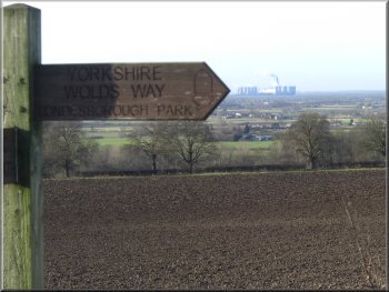
Looking across to Drax power station from the Wolds Way
|
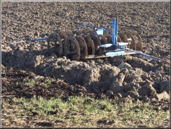
Large disc harrow
parked by the path
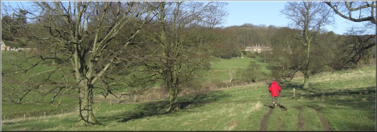
The
parkland is laid out with groups of trees which are now
mature, making some very pleasant countryside in the rolling
foothills of the wolds.
|
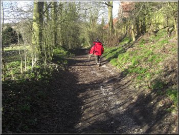
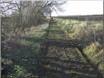
We
crossed the road and set off along the Wolds Way toward
Londesborough. As we approached Londesborough we were
crossing old parkland.
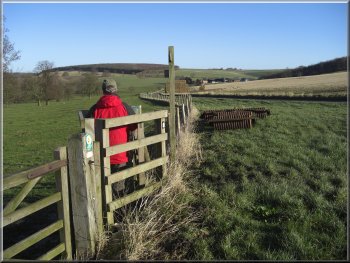
Rolling farmland in the foothills of the wolds
|
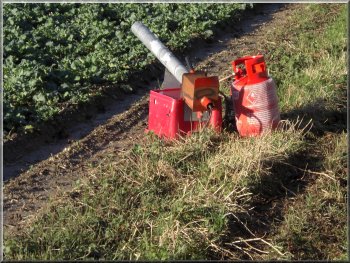
Gas fired bird scarer at the edge of a field |
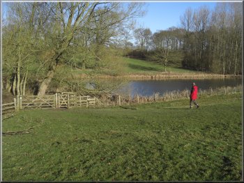
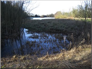
Lake in the parkland below Londesborough |
|
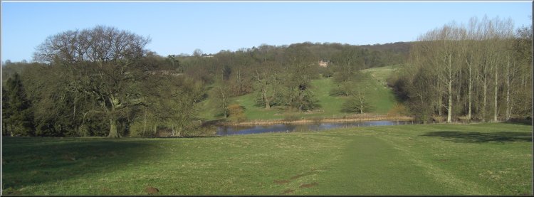
Lake in the parkland below Londesborough |
Lake in the parkland below Londesborough |
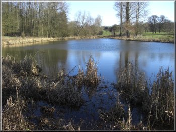
Lake in the parkland below Londesborough |
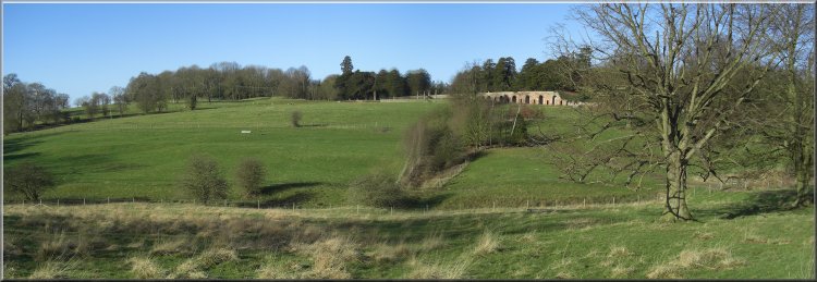
Crossing the parkland toward Londesborough |
We
walked a few hundred yards into Londesborough village
just to have a look and then retraced our steps and followed
the Wolds Way again down to Towthorpe
Village. This the site of a medieval village abandoned
in the mid 1600's.
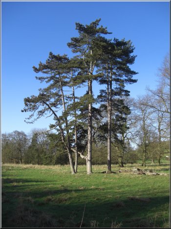
A lovely group of Scots Pines in the parkland at Londesborough
|
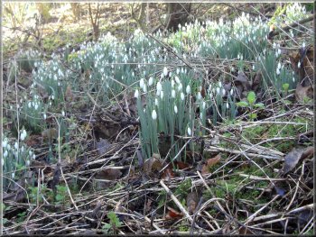
Snowdrops in the woods at Londesborough
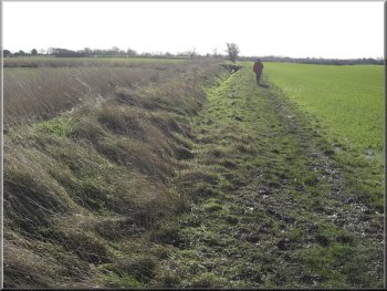
Drainage
ditch across the flat land approaching Market Weighton
From
there we continued along the Wolds Way across the A614
and across the fields to Market Weighton.
|
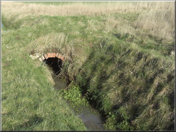
Drainage ditch across the flat land approaching Market
Weighton
At
last just as the shops seemed to be coming to an end we
found a very nice little coffee shop where we had our
usual bacon sandwich and coffee and a good sit down for
me to rest before the second part of our route.
|
We
were relying on a cafe in Market Weighton for some lunch
and we were getting rather worried as we progressed along
the main street with no sign of one.
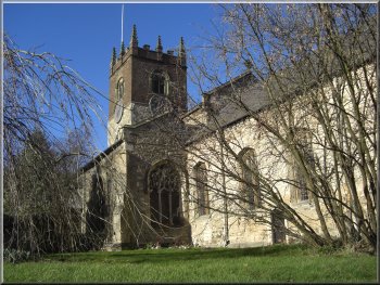
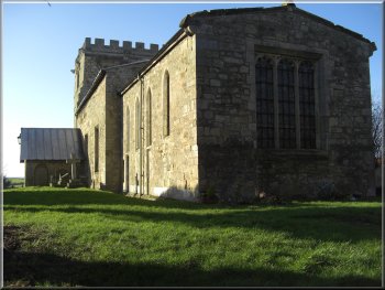
The church at Market Weighton
|
Path along the disused railway from Market Weighton
There
was no way we were going back at that stage. We continued
on another 150m and found a couple of men with a machine
spreading gravel on the path. We said "Hello"
and carried on.
|
We
followed the Wolds Way out of Market Weighton on a disused
railway line that is now a footpath. After about 500m
we came to a sign in the middle of the path which read
"Footpath Closed".
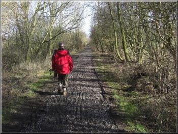
Path along the disused railway from Market Weighton
|
The church at Goodmanham
At
first we did not realise it was the road because there
was a large stack of gravel that was being used on the
path and the loading of the little dump trucks had spread
the gravel all over the road so it looked just like a
rough farm track.
|
A
couple of other little dump trucks came along the path
with more gravel as we walked on the path as far as the
road at map ref. SE899426.
The lane leading out of Goodmanham along the Wolds Way
|
The lane leading out of Goodmanham along the Wolds Way
The
whole route had been about 10km and had taken us four
and a half hours including our long lunch stop in Market
Weighton. This was a longer route than I have tackled
for some time and I found it quite hard, but I've just
got to keep some walking going.
|
Eventually
we realised that it was indeed the road to Goodmanham
and began the climb up to the village. I was finding it
hard going by this time, but finally we made it up the
hill to the village. We stayed on the Wolds Way through
the village and across the fields back to the start of
our walk at Towthorpe Corner.
Wolds Way heading back to Towthorpe Corner
|
|
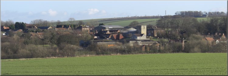
Looking back over Goodmanham from the Wolds Way heading
back to Towthorpe Corner |
Background Notes:
This is a route of about 10km, 6 miles through Market Weighton on the Southwestern edge of the Yorkshire Wolds. Our walk starts at a large lay-by and picnic area called Towthorpe Corner off the A614 2km due North of Market Weighton. From the picnic area we follow the Yorkshire Wolds Way to Londesborough through the grounds of Londesborough Hall. The original hall was built in 1589 by Lord Clifford, whose father, a Lancastrian leader at the battle of Wakefield, played a pretty brutal role in the Wars of the Roses and his two sons were hidden by their mother on a nearby farm disguised as shepherds to escape their white rose enemies. From this Henry Clifford became known as “the Shepherd Lord” and it was he who in 1669, together with several other landowners, made an endowment to the Kiplingcotes Derby, which is said to be the oldest flat race in England, dating from 1519. It is still run on the third Thursday in March in keeping with the original race rules and is run over 4 miles on farm lanes and tracks to the Northeast of Market Weighton.
In 1818, the then owner of Londesborough Hall, the Duke of Devonshire, had it demolished so that he could concentrate his funds on improvements at Chatsworth House in Derbyshire. In 1845 George Hudson of railway fame, bought the Londesborough estate to prevent the building of a rival railway line from York to Hull, through the estate lands. We continue through the estate parkland and out past the lake to follow a path across the fields to Towthorpe Grange where the remains of the medieval village of Towthorpe, abandoned over 400 years ago, can be seen. That's simply a few grassy mounds in the field beside Towthorpe Beck. The name Towthorpe means ‘Tove’s Farmstead’ and is derived from the Viking personal name 'Tove' or something similar and ‘thorpe’, an old Viking word for farmstead.
From Towthorpe Grange we follow the Wolds Way to Market Weighton, which is referred to as 'Wicstun' in the Domesday Book (1086) and the town was granted a royal charter by Henry III in 1251 to become an offical Market Town giving us Market Wicstun. The town prospered, and in the late 1700's the Market Weighton September sheep fair was a huge affair with 10's of thousands of sheep for sale.
A famous resident of Market Weighton was William Bradley, the Yorkshire Giant, who was born in Market Weighton in 1787. He was the only one of a family of thirteen, who was such an enormous size. By the time he was 20 he was nearly eight feet tall, and weighed 27 stones. He died in 1820 at the age of 33.
His house, in York Road, Market Weighton, was specially constructed for him, with rooms and doorways big enough for him to get through. There's a plaque on the wall of his house, showing the size of the shoes that he wore, 15 inches long by almost 6 inches wide. Market Weighton has a "Giant Bradley Day" each year and there's a life size oak statue of William Bradley standing in front of the Council Buildings in the town.
In the late 1800's, Market Weighton became an important junction on the York & North Midland Railway for the lines to York, Selby, Beverley and Driffield. All these lines were closed in the Beeching era of the 1960's and there's not much to be seen of them today except for the disused railway bed, now a cycleway and footpath running roughly eastwards from Market Weighton and that's where our walk takes us next.
We follow the railway path and the Wolds Way to Goodmanham. There was once a pagan temple here, but in 627 King Edwin of Northumberland, who ruled this area, converted to Christianity and had the temple demolished and a church built on the site and this is the site of the present day church.
From Goodmanham we continue along the Wolds Way back to the Towthorpe Corner picnic area. This last few miles along the Wolds Way were in fact the first few miles of the Wolds Way to be opened in October 1973, 4 years before the whole route of 79 miles from Hessle at the Humber Bridge to Filey Brigg was opened in 1977.
Top of Page
|