| 2001 walks | 2002
walks | 2003 walks | 2004
walks |
| 2005 walks | 2006
walks | 2007 walks | 2008
walks |
| 2009 walks | 2010
walks | 2011 walks | 2012 walks |
| 2013 walks | 2014 walks | 2015 walks | 2016 walks |
| 2017 walks | 2018 walks | 2019 walks |2020 walks |
| 2021 walks | 1993-2000 library | Find a Route Index |
| A few Routes to print out | Request a Route... |
Route No. 287 - Wednesday 1 April 2009
Cod Beck Reservoir, Oak Dale, Osmotherley,
Cleveland Way, Scarth Nick circuit - 12km
North York Moors. . .
Ordnance Survey route map on
the Landranger series map base.
View the route in Google Earth
Map: Ordnance Survey Explorer OL26 North York Moors Western area at 1:25000
|
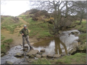
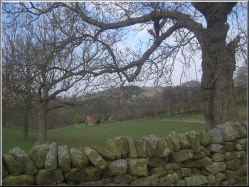
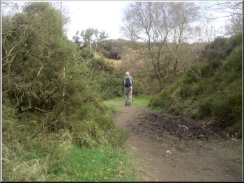
Crossing Cod Beck near the car park at the start of our walk
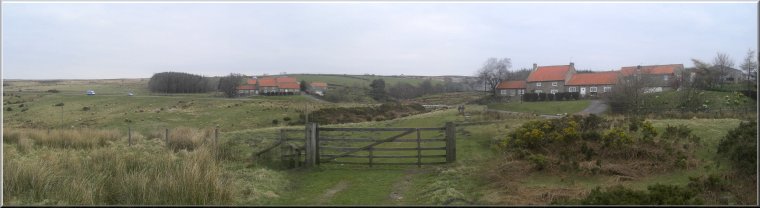
We drove to a little car park near the inlet to Cod Beck Reservoir
at map ref. SE467992.
|
This morning I met a member of the Easingwold Wayfarers walking group
called Max, who lives about half a mile from me.
Cod Beck Reservoir
|
|
Permissive path around Cod Beck Reservoir
Even mid week in school term time we passed a few people along the
reservoir path. When we reached the track at the dam end of the reservoir
we turned left to follow the track up the hill side.
|
From the car park we set off along the permissive path around the east
side of the reservoir. It's a pretty and popular walk. The weather was
fine warm and sunny.
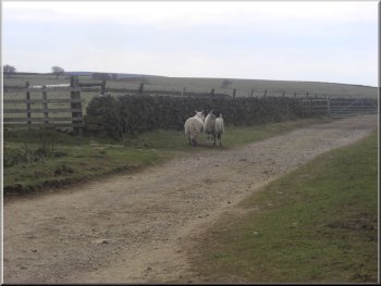
Two panicky ewes feeling trapped by us
|
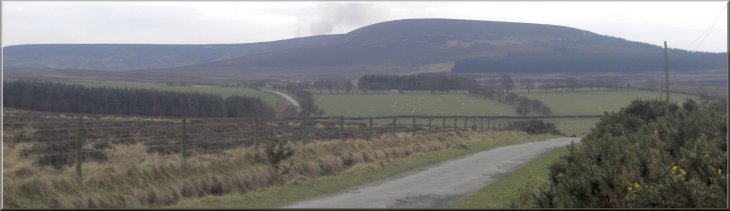
Looking to Black Hambleton as we approached the road near Chequers Farm
|
Looking across Oak Dale from the road near Chequers Farm |
|
Heading for Osmotherley on the Cleveland Way
We followed this track for another kilometer out to the road at map
ref. SE473972.
|
We climbed up through the woods for about a kilometer to the track
between the woodland and the open moor at map ref.SE472983.
Looking towards Osmotherley from the Cleveland Way
|
|
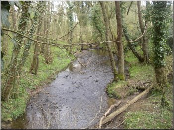
Crossing Cod Beck on the Cleveland Way
Just beyond Chequers farm we turned right off the road to follow a
path down into Oak Dale. In the bottom of Oak Dale we joined the Cleveland
Way route at map ref. SE468963
|
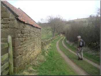
We walked along the road for about 200m past what used to be the Chequers
Inn, but is now a B&B establishment called Chequers Farm.
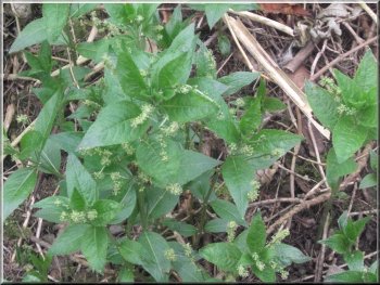
Dogs Mercury covers the little wooded valley of Cod Beck where the Cleveland
way crosses it and suggests that this has been woodland for at least
several centuries
|
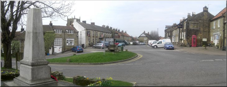
Entering Osmotherley on the Cleveland Way |
|
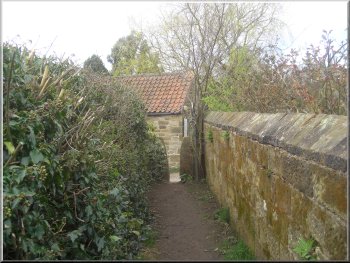
An alleyway which the Cleveland way follows to emerge in the centre
of Osmotherley
This took us through Osmotherley and Arncliffe Wood to Scarth Nick.
|
From here we continued along the Cleveland Way route for over 5km.
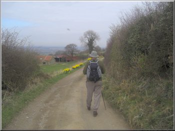
Leaving Osmotherley for Arncliffe wood on the Cleveland Way
|
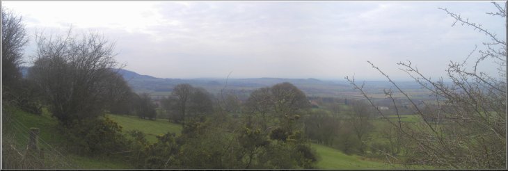
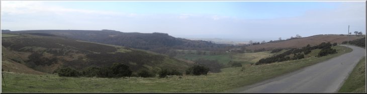
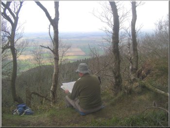
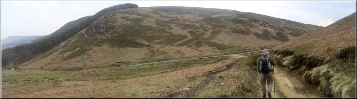
Looking south from the Cleveland Way along the western edge of the North
York Moors |
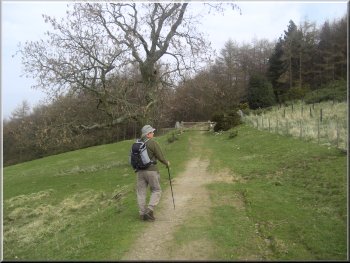
The Cleveland Way at Arncliffe Wood |
The Cleveland Way at Arncliffe Wood |
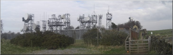
BT microwave relay station beside the Cleveland Way above Arncliffe Wood
|
|
Lunch stop on the edge of Arncliffe Wood
The whole walk had been 12km and had taken us just under four hours
to walk including two very pleasant refreshment stops to admire the
views in the spring sunshine.
|
Just before Scarth Nick we took a path off to the right which cut a
little corner off and brought us to the road at map ref. NZ472001. We
walked along the road for almost a kilometer back to our starting point
at the car park.
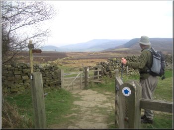
Cleveland Way heading for Scarth Nick
|
Leaving the Cleveland Way and heading for the road above Scarth Nick |
|
At this time of year when the temperature and humidity are just right
hundreds of toads make their way from the moor to the shallows on the
reservoir fringes to spawn.
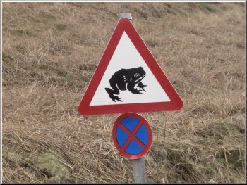
It's toad watch time!
|
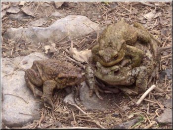
A male toad clinging to the back of a female ready to spawn Has the
other male lost out or is he about to make his move?
Local people organise a toad watch to get the creatures safely across
the road where in the past scores have been crushed by the traffic.
|
Background Notes:
This is a circular walk of 12km, that's about 8 miles, from a little car park at the inlet to Cod Beck reservoir near Osmotherley on the Western edge of the North York Moors. The parking spaces are marked out and the one nearest to the road has a little plaque stating "Reserved for Ice Cream Van" but it only turns up when the weather is good. Just across the road from the car park is a stone cloumn with the words "Lyke Wake Walk" carved on it. This car park makes a good place to start the Lyke Wake Walk. That's a challenge walk of almost 40 miles from Osmotherley across the North York Moors to Ravenscar on the coast to be walked within 24 hours. It was devised by Bill Cowley, a farmer who was interested in the local dialect and folklore and contributed atricles to newspapers and magazines. He made the first crossing of the Lyke Wake Walk on 1 October 1955 and in the 1960's and 70's it became a very popular challenge walk with thousands of people walking the route every year. Our walk follows a Yorkshire Water permissive path around the edge of Cod Beck reservoir. It's a very pleasant start to the walk. From the reservoir dam our route climbs up along a track to the top edge of the wood where we reach a rocky track running roughly North/South. This was part of the Hambleton Drove Road used particularly in the 1700's by cattle drovers bringing herds of cattle from the pastures in Durham, Northumberland and the Scottish borders to the growing city of London and other towns of England. At its height there were around 2000 head of cattle per week driven south in this way. It must have been a bit like the wild west here in those days and it wasn't just cattle, sheep and pigs were driven along this route and even flocks of geese. The geese were fitted with felt pads to protect their feet. We follow the drove road out past the Chequers Inn which was used by the drovers in the past. Now it's a B&B. From there we follow a path down into a steep sided valley called Oak Dale to the side of Oakdale reservoir. where we join the Cleveland Way route. The Cleveland Way goes from Helmsley all the way around the eastern and northern edge of the North York Moors, then down the coast to Filey a total of 109 miles. There is now a linking walk called the Tabular Hills Walk from Helmsley along the southern edge of the North York Moors to the coast 49 miles away, so that there is a route all around the perimerter of the National Park. Our route follows the Cleveland Way out of Oak Dale to cross Cod Beck in a pretty little valley with quite steep sides and then into Osmotherley to emerge through an archway over an alley to the road junction in the center of the village where the public toilets proudly display the many "Best Loos" certificates that they've won over the years. The walk continues to follow the Cleveland way past an excellent view point just north of Osmotherley. Then up above Arncliffe Wood past a BT relay station which I think is quite interesting to see even though it's not at all rural in character. The path comes out onto the open moor and crosses the moor to Scarth Nick. From this part of the route there is a great view North Eastwards along the line of the Cleveland Hills. These are the row of peaks that form the skyline of the North York Moors seen from Teesside. From Scarth Nick we make our way back to the car park and an ice cream if the sun is out and the van is there.
Top of Page
|