| 2001 walks | 2002
walks | 2003 walks | 2004
walks |
| 2005 walks | 2006
walks | 2007 walks | 2008
walks |
| 2009 walks | 2010
walks | 2011 walks | 2012 walks |
| 2013 walks | 2014 walks | 2015 walks | 2016 walks |
| 2017 walks | 2018 walks | 2019 walks |2020 walks |
| 2021 walks | 1993-2000 library | Find a Route Index |
| A few Routes to print out | Request a Route... |
Route No. 338 - Wednesday 5 May 2010
Forge Valley, R.Derwent, Wrench Green,
Hackness, Sea Cut, Raincliffe Woods circuit - 11km
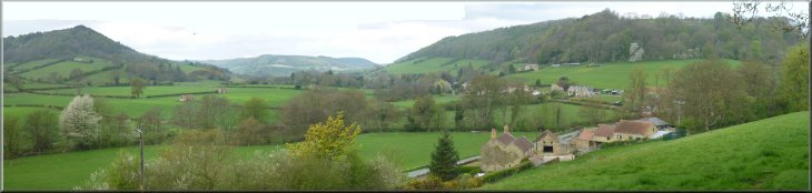
North York Moors . . .
Route map from Ordnance
Survey Open Space service.
Map: OS Explorer OL27 North York Moors Eastern area at 1:25000
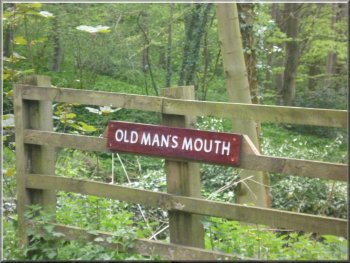
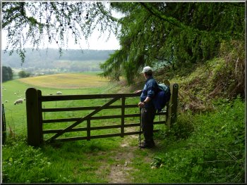
Entrance to The Old Man's Mouth car park
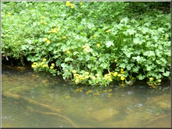
Kingcups on the riverside
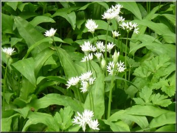
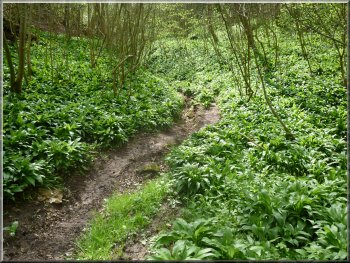
Wild garlic in the woods
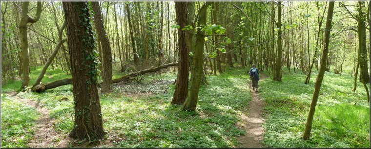
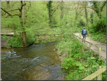
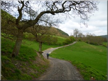
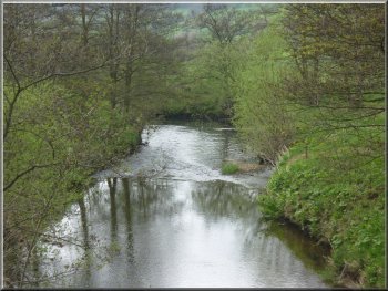
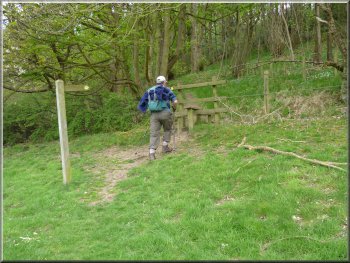
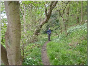
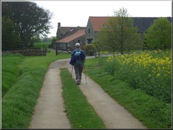
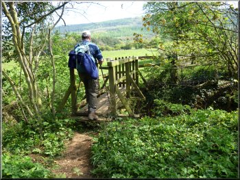
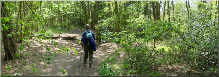
From the car park we crossed the footbridge over the river to the
boardwalk on the far bank. At the boardwalk we turned right to walk
along the boardwalk for about 300m to the edge of the wood. |
This morning my friend, Jim, and I drove to Forge Valley and parked
at a little car park by the River Derwent called "Old Man's Mouth"
at map ref. SE983873 off the East Ayton to Hackness road up the valley.
Leaving the car park for the footbridge
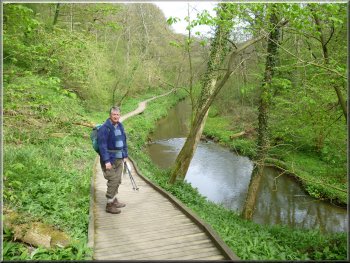
The boardwalk beside the River Derwent
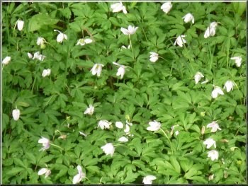
Wood anemones by the path
|
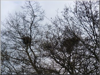
Large untidy nests of a small heronry
These are a heronry and to confirm it a heron flew off as we approached.
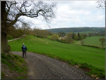
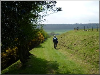
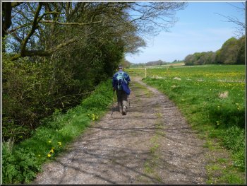
We followed the path across the fields to the sluices at the start of
the Sea Cut. This is a man made watercourse used as an overflow to the
River Derwent, taking high flows from the river directly to the sea
at Scalby on the Northern edge of Scarborough. |
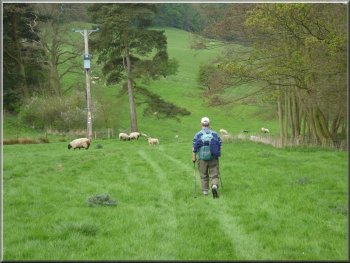
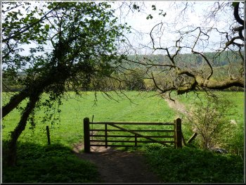
Here the path on the map goes straight across a field which today
had a herd of cattle and some young calves grazing. There is a well
used path around the edge of the field that rejoins the public footpath
route a few hundred metres further on. The diverted path took us past
several huge nests in the tree tops.
Path heading upstream towards the sluices
|
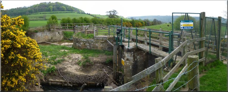
The sluice gates controlling the flow down the River Derwent
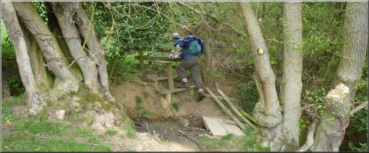
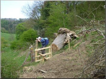
A stream crossing followed by an awkward stile
|
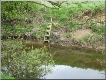
Anglers' ladder into the river
Farm access track towards Cockrah House
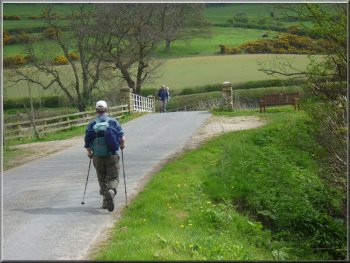
The public footpath does continue across the field but there is also
a public footpath along the farm access road and it's much easier walking.
We followed the farm access road for almost 600m to the start of the
public road at Cockrah House farm. |
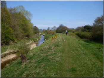
We continued around the flood bank past the sluices and then along
the path above the river for about 500m from the sluices. Here just
after crossing a small stream and an awkward stile we turned directly
up the hillside for about 70m to join a farm access road.
Farm access track towards Cockrah House
Nearing the road bridge over the River Derwent
|
Approaching Cockrah House farm along a farm access track |
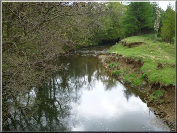
River Derwent from the road bridge
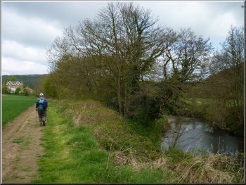
Path by the River Derwent
Bluebells by the path
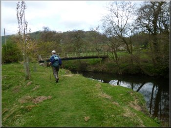
Nearing the footbridge over the River Derwent
At the bridge we turned left off the road on to a footpath along the
Western river bank. We walked along the river bank for about 350m to
a footbridge over the river at map ref. SE967896. Here we crossed the
footbridge to the road. |
We continued along the road to the edge of the hamlet of Wrench Green,
and at the road junction at map ref. SE965892, we turned right and followed
the road for about 200m down to the bridge over the River Derwent.
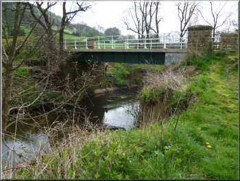
Looking back to the road bridge from the riverside path
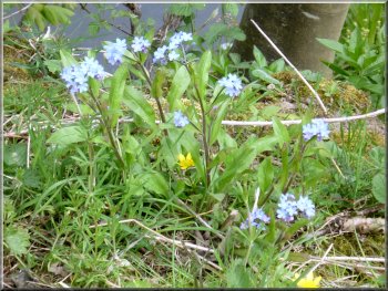
Forget-me-nots by the path
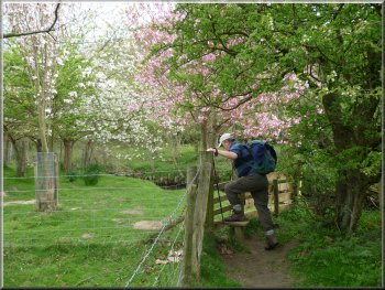
Blossom on the riverside
River Derwent from the footbridge
|
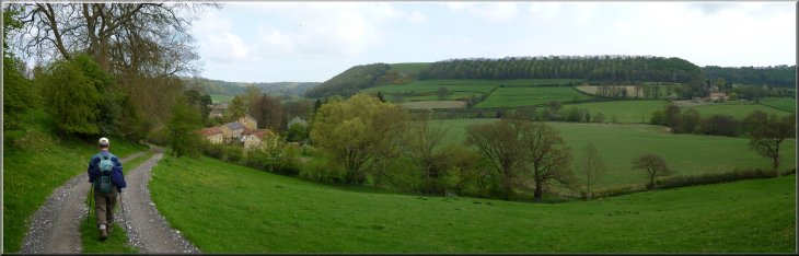
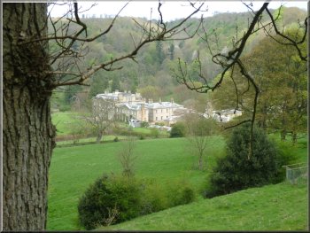
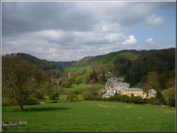
Looking up the valley from the path above Hackness |
Stile into the woods
Hackness Hall below the path
Path starting to descend from the wood
We passed above Hackness Hall with very pleasant views up the valley
for about 1km until the path dropped back down the hillside to the road
at map ref. SE975906. |
We continued across the road to follow a path climbing up the hillside
across a field to the edge of some woodland. We followed the path around
the edge of the woodland.
Path along the edge of the woods
Looking up the valley over Hackness Hall
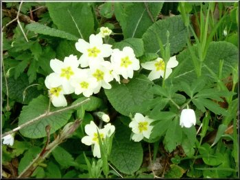
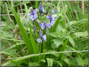
Primroses by the path
|
Walking alongside the road near Hackness |
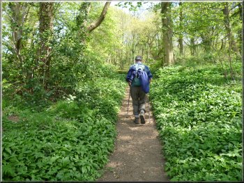
Path up the garlic filled valley
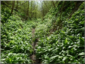
Path up the garlic filled valley
|
Here we walked along the wide grassy area beside the road for about
150m. There we joined a public footpath continuing around the edge of
the wood and then turned away from the road to follow the path entering
a narrow little valley through the woods on our right. It was a very
pretty climb up the valley, full of wild garlic. The scent of it filled
the air as we followed the path to the top of the climb. Just beyond
the edge of the wood we passed an old lime link on the right of the
path
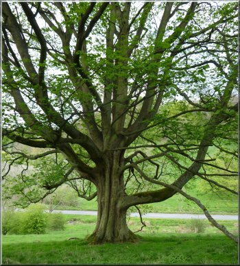
A fine sycamore tree on the roadside
|
An old lime kiln at the top of the woods |
Approaching Suffield Ings farm
We continued past Suffield Ings farm and after about 200m we came to
the edge of the woods above the Sea Cut. We followed the path down the
steep hillside through the wood |
Beyond the lime kiln we joined a farm access track and after about
500m we came to Suffield Ings farm, now a holiday cottage.
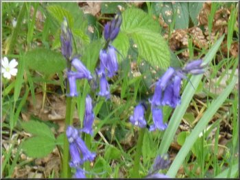
Bluebells by the path
|
Path down through the wood beyond Suffield Ings farm
View out from the woods at our lunch stop
|
Leaving the wood after our lunch stop
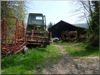
Machinery at Mowthorpe farm
At the road we turned left to walk along the road for about 200m to
the bridge over the Sea Cut. Here we tuned left off the road to follow
the path along the Southern bank of the Sea Cut. |
Near the bottom edge of the wood we found a little bank to sit on
with a view out from the wood where we stopped for our lunch break.
After our break we continued along the path down across the fields to
the road at map ref. SE979883 near Mowthorpe Farm.
Heading for the road near Mowthorpe Farm
Path along the Sea Cut flood bank
|
Leaving the Sea Cut for the path across the fields
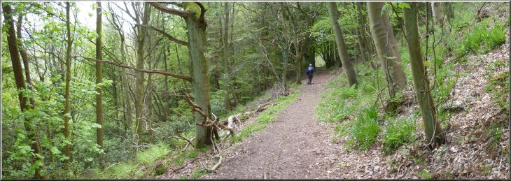
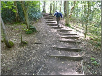
Path into Raincliffe Woods
We continued along this track which turned left after about 250m and
brought us out to the road at the edge of Raincliffe Woods. We crossed
the road and followed a path in the woods running parallel to the road
about 50m into the wood. |
After about 800m we turned right away from the Sea Cut to follow
a path down the embankment and over a narrow wooden footbridge into
the fields. We followed the path across the fields for about 300m to
turn right onto a bridleway along a farm access track.
Track to the road alongside Raincliffe Woods
Looking back to the fields from the road
|
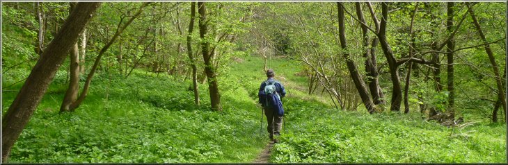
Path through Raincliffe Woods parallel to the road |
Path through Raincliffe Woods
Dropping down to the road at the end of the walk
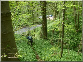
However from the car park near the road junction we took a path along
a track climbing up the hillside and where the path forked we kept to
the right hand fork contouring round the valley side. After about 500m
from the car park there is a feint path off to the right straight down
the steep wooded hillside beside a small watercourse. At the bottom
of the slope the path emerges onto the road beside an opening that the
stream flows though at the road side opposite the Old Man's Mouth car
park and the end of the walk. But beware this path is very easy to miss
and the simpler route around the road is much safer. |
Where the path crosses paths and tracks coming down the hillside
to the road it may not continue directly opposite the crossing but there
was a well walked path all the way when we explored a little. After
about 1.2km we came to a car park at map ref. SE985875 near a road junction.
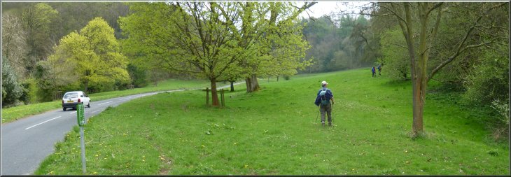
From here you can simply walk along the road to the junction and turn
left to follow the road back to the Old Man's Mouth car park and the
end of the walk.
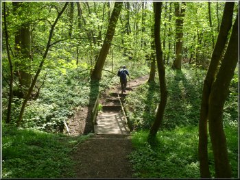
Path through Raincliffe Woods
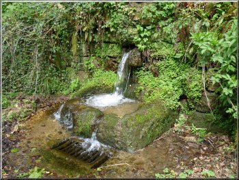
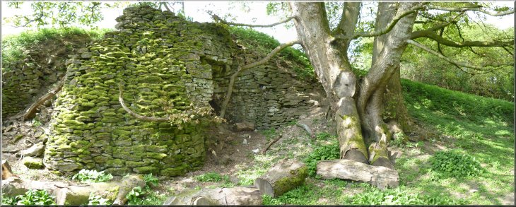
Old Man's Mouth - stream through the wall
|
Path through Raincliffe Woods contouring round the hillside near the end
of the walk |
Background Notes:
This walk starts in Forge Valley on the River Derwent almost 2 miles north of East Ayton near Scarborough. The name Forge Valley refers to the fact that in the 1400's there were forges in the valley that used locally produced charcoal to smelt iron ore that was also mined locally at that time. The woods here are a National Nature Reserve because this ancient native woodland spans changing habitats from the alder and willow wetland on the valley floor to the oak woods on the acidic soils around the valley rim, and so supports a huge variety of speces in this valley. Our walk is a circular route of 11km, just over 6 miles starting from a car park by the river Derwent, marked Old Man's Mouth. This is the name of an ancient holy well, a spring flowing through the wall on the opposite side of the road. The North York Moors are full of tales about the giant Wade and his wife Bell who are the Old Man and Old Wife so often refered to in names on the moors.
From the car park we cross a footbridge over the river to a wheelchair friendly board walk along the river bank. The board walk goes south from here but we head north and after a after about 250m we come to the end of the board walk and follow a footpath across the fields. In a stand of trees along the edge of the field there is a small heronry with several large untidy herons nests in the tree tops. The path across the fields takes us past the wier and sluices at the start of the "Sea Cut". Before the last ice age this was the natural course of the River Derwent flowing straight out to sea at Scarborough. Towards the end of the ice age when this area was right on the edge of the receeding ice sheet, the sea was still covered by a deep ice sheet and the melt water inland had no route out to the sea and was forced to flow south. When the ice sheet finally melted the new channel for the River Derwent was already established taking the river on its present course away from the sea at Scarborough and south to join the River Ouse at Barmby around 40 miles inland. The sea cut was made as an overflow channel to alleviate flooding downstream. We continue across the fields to the hamlet of Wrench Green and follow the river bank towards Hackness. Our route takes us up the hillside to walk along the bottom edge of a wood overlooking Hackness and the little valleys leading to it. The most obvious feature of Hackness is Hackness Hall, a Georgean Mansion designed by John Carr, the celebrated York architect, in the late 1700's. The famous abbess of Whitby, St Hilda, founded a nunnery in Hackness in the late 600's but it was destroyed by Viking raiders less than 200 years later.
Just to the east of Hackness we take a path up a wooded gulley to Suffield Ings farm passing a well preserved old lime kiln as the path emerges from the wood to a track across the fields. Suffield Ings farm is now a holiday cottage complex and beyond the farm we go through some pretty woodland called Hawthorn woods. As we come out of the woods there is a very nice view across the sea cut to Rainclife Woods and across the River Derwent valley. Our route takes us down the hillside past Mowthorpe farm to the Sea Cut that drains the River Derwent floodwater to the sea at Scalby. We follow the path along the southern side of the sea cut for a few hundred metres before turning away to follow a path across the fields to Raincliffe Woods. This wood has been forest for many hundreds of years and has survived because it was part of the Royal Hunting Forest of Pickering. This was a huge area kept for the king's pleasure since the Norman invasion. Our route follows a path along the edge of the woods back to the road by the river and the car park at the end of our walk.
top of page
|