| 2001 walks | 2002
walks | 2003 walks | 2004
walks |
| 2005 walks | 2006
walks | 2007 walks | 2008
walks |
| 2009 walks | 2010
walks | 2011 walks | 2012 walks |
| 2013 walks | 2014 walks | 2015 walks | 2016 walks |
| 2017 walks | 2018 walks | 2019 walks |2020 walks |
| 2021 walks | 1993-2000 library | Find a Route Index |
| A few Routes to print out | Request a Route... |
Route No. 362 - Wednesday 25 August 2010
Danby Visitor Centre, Little Fryup Dale,
Danby Rigg, Ainthorpe, Danby circuit - 10km
Esk Valley,
North York Moors . . .
Route map from Ordnance
Survey Open Space service.
Map: OS Explorer OL26 North York Moors Western Area at 1:25000
|
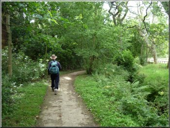
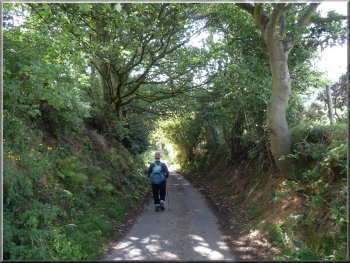
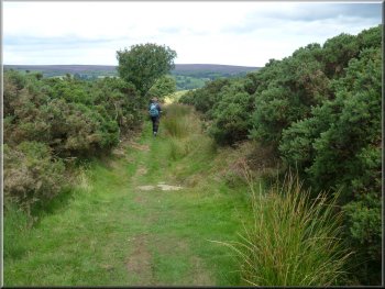
Leaving the car park for the woodland path
Following the road near the visitor centre car
park
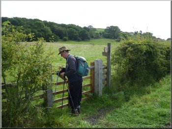
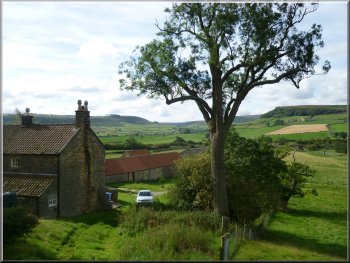
Crossing the field to the track above Park House
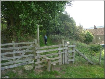
Here the path turns left into the wood but we continued straight on
and out onto the road. This last 20m is not an official path but clearly
many people had done the same thing before us and it's a much more pleasant
start than just walking down the road. We continued along the road for
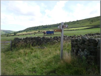
about 150m and turned off the road at map ref. NZ719081. We went through
the gate into a field and across the field to the far left hand corner
up a slight rise to a stile at map ref. NZ722081.
|
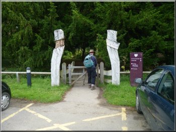
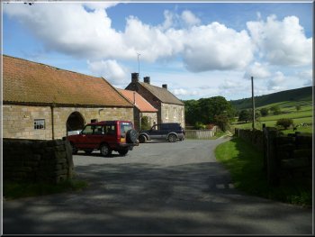
This morning my friend, Jim, drove us to the car park at the Moors
Visitor Centre at Danby in the Esk valley on the North York Moors at
map ref. NZ717083. We set off from the car park a little after 10.00am
and crossed the footbridge into the wood at the side of the car park.
Over the footbridge we turned right and walked along the path by the
little stream down the edge of the car park for about 200m.
Woodland path next to the car park
Leaving the road near the visitor centre car park
Stile on to the track above Park House
|
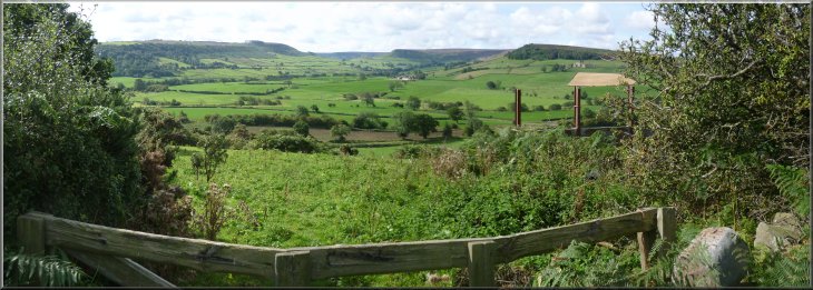
View from the track above Park House |
|
View from the track above Park House
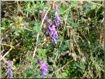
Purple vetch in the hedgerow
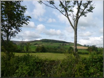
Looking across Little Fryup Dale to the Northern
end of Danby Rigg
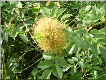
Rose hip gall in the hedgerow. The gall wasp lavae
live & feed inside it
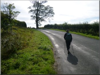
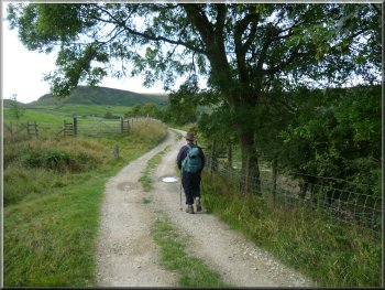
At the road junction we turned left and walked along the road for
about 450m. Here we turned right off the road on to the farm access
track to Crag Farm. Where the access track turns left just before the
farm we continued straight on along a grassy track up the slope towards
some woods.
|
This led us on to an access track which we followed for about 300m
to the road junction. Here we turned right to walk down the hill along
the lane and under the railway bridge to another road junction at map
ref. NZ722077.
Coming down the hill from the track above Park
House
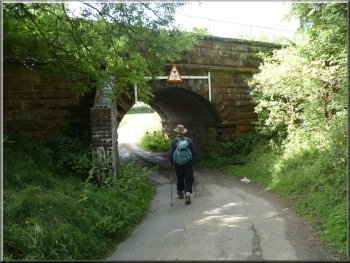
Passing under the Whitby to Middlebrough railway
Bridge over the River Esk on Crag Farm access
road
Leaving the access road to Crag Farm
|
|
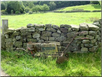
Welcome sign at Crag Farm
Our track up Little Fryup Dale
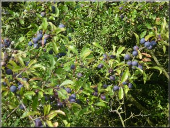
A good crop of sloes on the blackthorn
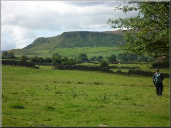
Looking up Little Fryup Dale to a crag on Danby
Rigg
Looking back down Little Fryup Dale
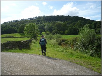
After about a kilometer we came to the farm access road to Forester's
Lodge, a holiday cottage complex now, at map ref. NZ714053.
|
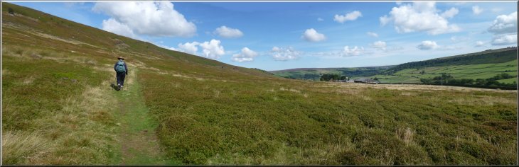
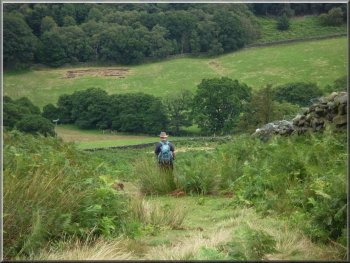
As we reached the edge of the woods at map ref. NZ728069, we turned
right and followed the track along the hillside going up Little Fryup
Dale.
Track up Little Fryup Dale between the stone gateposts
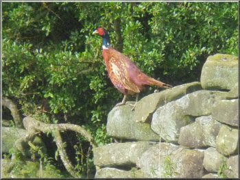
Colourful male pheasant
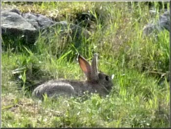
This rabbit thinks we haven't seen it
Finger post on the access road to Forester's Lodge
Heading for Stonebeck Gate Farm
|
|
Looking back down Little Fryup Dale with Forester's
Lodge on the left
|
|
The road at Stonebeck Gate Farm
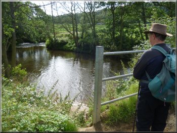
At the road we turned right to walk a few hundred metres across Little
Fryup Beck and up the slope to a road junction at map ref. NZ710055.
|
We followed the access road for about 700m to the road at Stonebeck
Gate Farm.
Stonebeck Gate Farm
|
|
Path climbing up onto Danby Rigg from Little Fryup
Dale
|
|
Path up onto Danby Rigg
It was a very pleasant spot in the warm sunshine, marred slightly
by numerous moorland flies, but a hat seemed to be all that was needed
to keep them at bay.
|
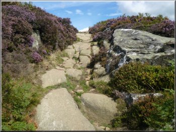
At the junction we crossed the road ahead and took the path straight
ahead climbing steadily up the side of Danby Rigg to map ref. NZ710061.
There was a lovely view from this point all along Little Fryup Dale
and we sat there for an early lunch break.
Our lunchtime view point over looking Little Fryup
Dale
|
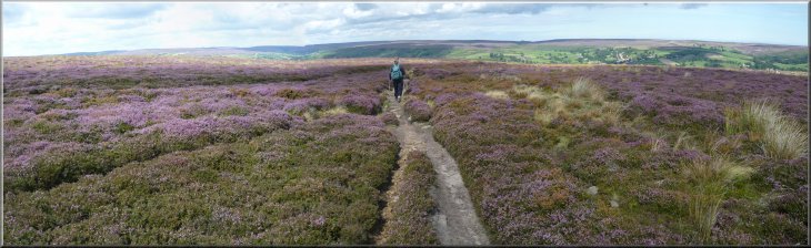
Path through the heather across Danby Rigg |
|
Path through the heather across Danby Rigg
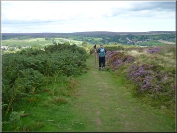
Path from Danby Rigg down to Ainthorpe
The fragments of the others are strewn across the surrounding moor.
We followed the path through the heather and down to the road at map
ref. NZ706073.
|
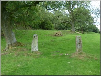
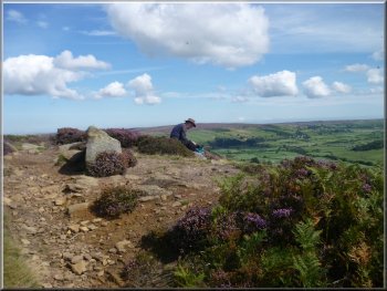
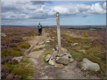
After our break we continued across Danby Rigg, or is it Ainthorpe
Rigg here? Anyway the path took us past a standing stone on our left.
This is the only stone left standing from an ancient stone circle.
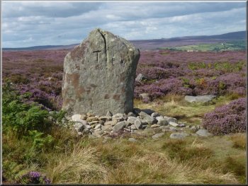
The last stone standing of an ancient stone circle
on Danby Rigg
Path from Danby Rigg down to Ainthorpe
|
|
Heading down the road to Ainthorpe
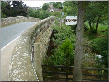
Roadbridge over the River Esk between Ainthorpe
and Danby
We crossed the bridge over the river and at once crossed the bridge
over the railway with Danby station over to our left.
|
At the road we continued down the hill through the village of Ainthorpe
and down to the road bridge over the river Esk at map ref. NZ708083.
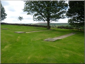
The quoits ground opposite the pub in Ainthorpe
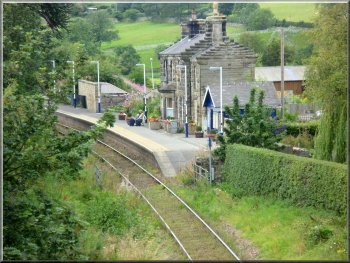
Danby railway station
|
Roadbridge over the River Esk between Ainthorpe
and Danby |
|
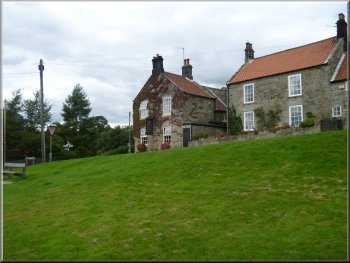
Duke of Wellington Inn at the crossroads in Danby
At the crossroads we turned right along the side of the pub and continued
along the road up quite a steep hill for about 250m to map ref. NZ710086.
Here we turned left up a stony track.
|
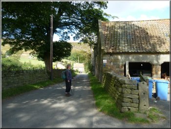
We followed the road up the hill through Danby to the crossroads at
map ref. NZ707086, with the Duke of Wellington Inn on the corner.
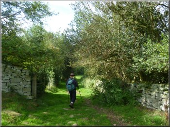
Stony track heading out of Danby
|
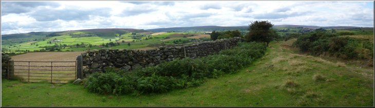
Looking back along the track from the place where
we turned off to follow a grassy path by the drystone wall |
|
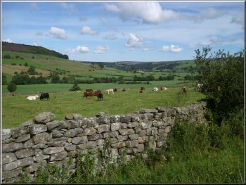
Grassy path down a steep hill beside a drystone wall
Gate out of the woods to the road at the Visitor
Centre
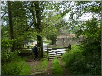
We left the woods through a gate and crossed the road to walk down
the side of the Moors Visitor Centre where we called in for a quick
look around before walking through the grounds back to the car park
where we had started our walk. The whole route had been 10km and it
had taken us almost four hours to walk including our lunch break and
photography stops. We stopped for our usual coffee and toasted teacake
in Helmsley on the way home to round off a very pleasant walk.
|
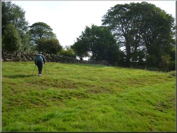
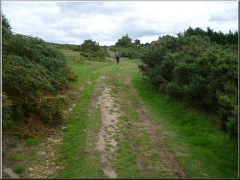
We followed the track round a right hand bend and then at a fork in
the track we took the left hand fork going straight ahead. After another
300m we turned right off the track to follow a grassy path down a steep
hill beside a drystone wall. After about 200m we came to a path crossing
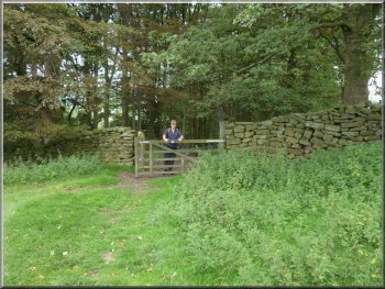
our's and here we turned right. This path took us around the valley
side for about 200m to a gate into a wood. Through the gate we followed
the path down through the woods for about 150m to the road at map ref.
NZ716084.
Gate into the woods leading down to the Visitor
Centre
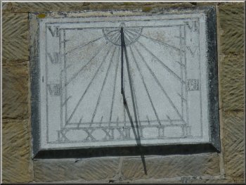
Sundial on the visitor centre wall
|
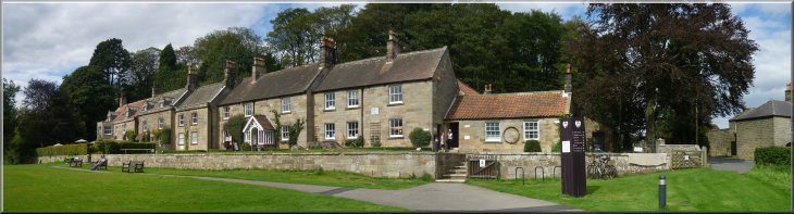
The Moors Visitor Centre at Danby in the River Esk
Valley
|
Background Notes:
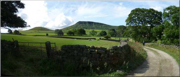
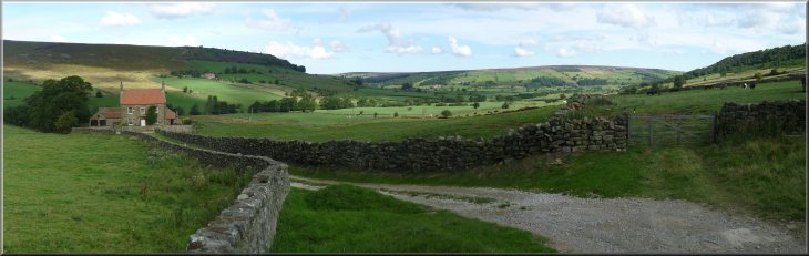
This walk starts from the North York Moors National Park Visitor Centre at Danby in the Esk Valley in the northern half of the park. There are all the facilities you'd expect at the centre plus exhibitions and children's play areas. This year is the 60th anniversary of the North York Moors National Park and there's a special exhibition about the landscape at the centre until the 17 July.
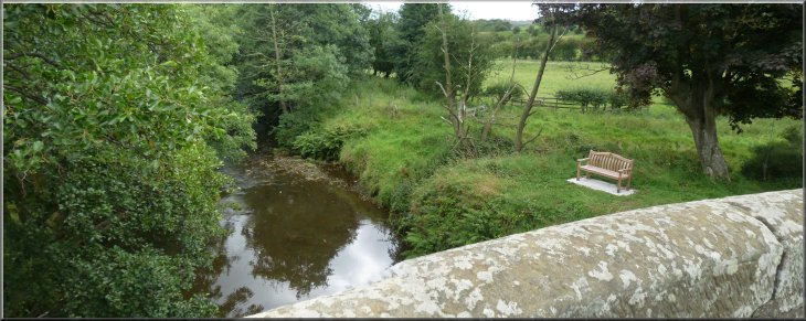
From the centre we follow a path down the valley, part way up the valley side with pleasant views across to Little Fryup Dale. Then we drop down to cross the River Esk in the valley bottom where it's only a short diversion of about 150m to see the ancient pack horse bridge over the river esk called 'Duck Bridge'. It's named after a local man, George Duck, who was the stonemason who restored the bridge in the mid 1700's.
From the valley bottom we follow a path into Little Fryup Dale past Crag Farm. We walk along a path and farm track up Little Fryup Dale with Little Fryup Beck about 300m away to our right. The steep hill which rises to just over 300m, or 1000ft, to our left is called 'Fairy Cross Plain' and is alleged to be the home of fairies.
The name Fryup is apparently derrived from the name of the old Norse goddess Frigg who was the wife of Odin, and the Norse word hop normally meaning a land locked bay. Maybe this short valley surrounded by steep hillsides resembled a small bay? I don't know, but anyway Frigg-hop, or Frigg's Bay, became Fri-hop and then Fryup. Incidentally the word 'Friday' has similar origins meaning Frigg's day.
Ahead of us as we walk along the valley is the prominent shape of Danby Rigg and this is our next objective. We reach a narrow lane at Stonebeck Gate Farm and from there follow a steep path up the west side of Little Fryup Dale on to Danby Rigg. This moorland plateau is steeped in stone age remains with earthworks, burial mounds and standing stones. The most prominent is a large standing stone by the path. This is the last remaining stone of a large stone circle on this site.
We follow the path over Danby Rigg and drop down to the village of Ainthorpe. At the pub here there is a quoits court. That's a grassy area with four clay filled pits about a metre square with lids on to keep the rain out. From a set distance the competing teams throw cast iron rings or quoits aiming for an iron pin set in the middle of the clay target area. The ones that miss the pin stick in the clay. There's a similar quoits court in Great Fryup dale with seats for the spectators, and there is a quoits league here.
We cross the Middlebrough to Whitby raiway line on the road bridge and continue along the road to Danby. In the later half of the 1800's
Canon Atkinson was the Vicar of Danby and was a renowned amateur archeologist who is famous for his book called 'Forty Years in a Moorland Parish' all about the people and the landscape of the Esk valley around Danby. From Danby village we follow a path over the moor and down a little wooded valley back to the visitor centre and the end of our walk
top of page
|