| 2001 walks | 2002
walks | 2003 walks | 2004
walks |
| 2005 walks | 2006
walks | 2007 walks | 2008
walks |
| 2009 walks | 2010
walks | 2011 walks | 2012 walks |
| 2013 walks | 2014 walks | 2015 walks | 2016 walks |
| 2017 walks | 2018 walks | 2019 walks |2020 walks |
| 2021 walks | 1993-2000 library | Find a Route Index |
| A few Routes to print out | Request a Route... |
Route No. 370 - Wednesday 8 September 2010
Clapham, Austwick, Norber Erratics circuit - 8km
Yorkshire Dales . . .
Route map from Ordnance
Survey Open Space service.
Map: OS Explorer OL2 Yorkshire Dales Southern & Western areas at 1:25000
This interesting route has been contributed by Ray Brown of
Northallerton - thanks Ray for sharing this routes with us
|
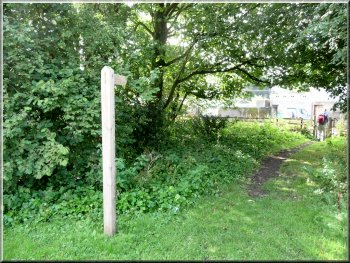
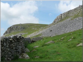
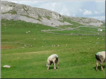
Entering the farmyard from the YDNP car park
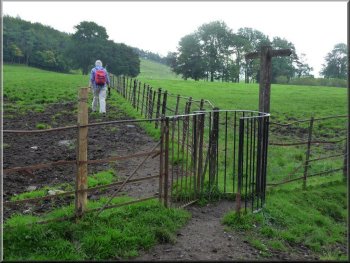
Rusted iron railings and kissing gate
The first half of the route towards Austwick was quite evident: the
path, at first generously bespattered with fresh bovine ordure, ran
through fields and alongside rusted iron fences with a series of kissing
gates suited to travellers of limited girth.
|
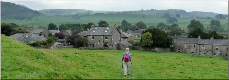
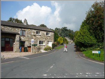
As forecast, the weather today was ideal for walking. Our route began
and ended at the Yorkshire Dales National Park Car Park in Clapham (SD745692).
A signpost in the corner to the right of the entrance led us immediately
into a concreted farmyard where we turned left towards a pedestrian
gate and a path and soon to a second gate.
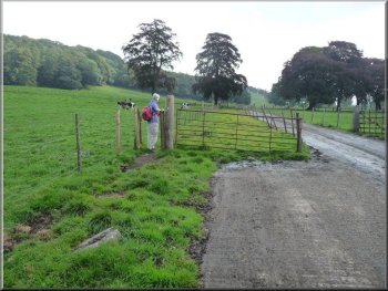
The first gate after the car park
Into open pasture with drystone walls enroute for Austwick
|
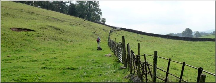
Following iron fences through fields on the way to Austwick |
|
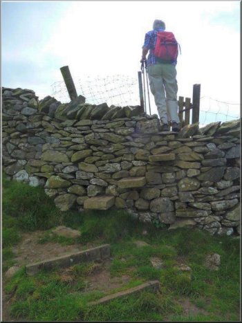
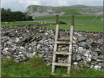
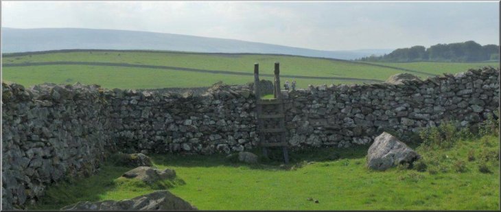
Over a series of gated stiles
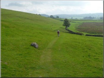
A stile at SD760686 was eventually spotted and used. There was some
evidence of Middle-Ages lynchet terracing on approaching Austwick where
a signpost inaccurately informed that we had travelled 2 miles from
Clapham - a contrast from two estimations of 11/3
and 11/2 miles displayed in Clapham itself.
|
The way continued over grass where the fences gave way to dry stone
walls and the kissing gates to gated stiles more easily climbed than
Annapurna. Here way marks would have been appreciated.
Approaching Austwick through terraced fields
On reaching the road in Austwick
|
Approaching Austwick |
|
Route through Austwick
Canine roadside refreshments in Austwick
Beyond the school at SD 769686 we turned left up Townhead Lane.
|
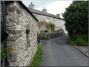
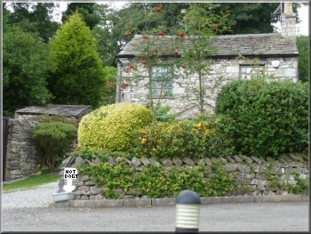
In Austwick we turned left to walk up through the quiet little village.
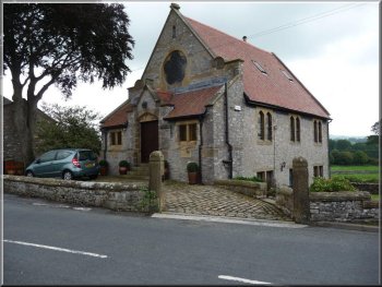
Old chapel now a house in Austwick
Turning at SD769686 into Townhead Lane
|
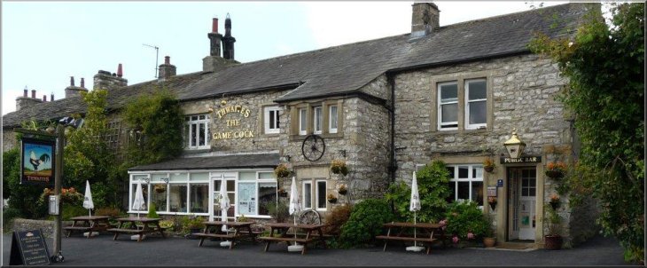
The Gamecock Inn
at Austwick |
|
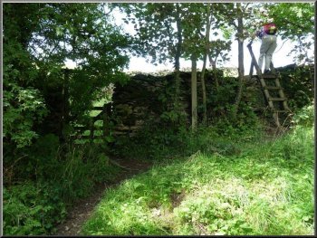
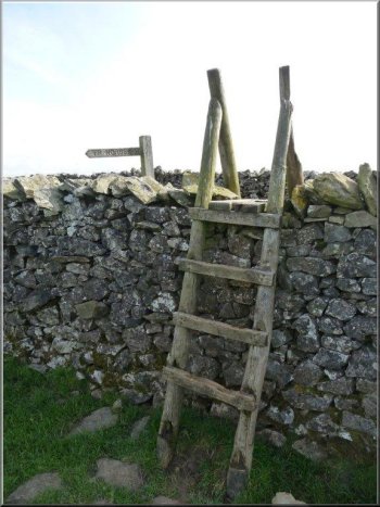
Leaving Townhead Lane by a broken ladder stile
We followed the wall to a stile by a false gate
We then followed the wall around to the left
We continued to follow the wall on our left until at SD766697 by a
large boulder a glance over our right shoulders revealed a path leading
upwards. Very soon a 4-way signpost was reached: Clapham, Austwick,
Norber and Crummack.
|
At SD769690 we crossed over a broken ladder stile on the left into
pasture and proceeded via two further ladder stiles to Thwaite Lane,
a gravel track where we turned right. At SD768692 a gate and stile on
the left led into a pasture with a path leading towards an open farm
gate. Here we ignored the gate and turned right to follow a stone wall
towards an apparent "gate" and an actual stile.
Exiting from a field into Thwaite Lane
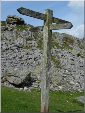
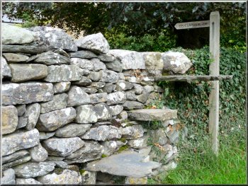
A useful signpost; Claspham, Austwick, Norber, Crummack
|
Continuing towards a stile in the corner of the pasture |
|
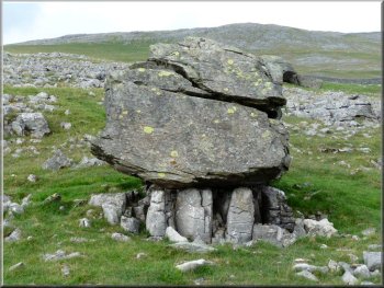
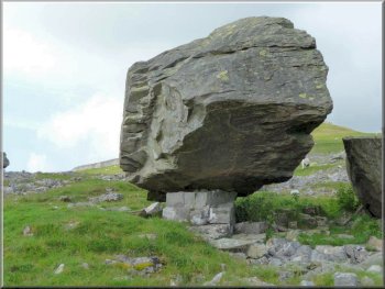
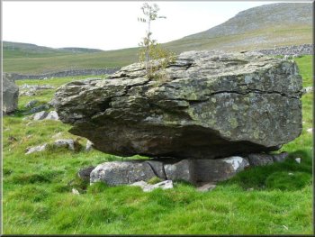
An erratic perched on limestone pedestals
A fissured erratic
A perched erratic
An erratic has been transported to its current location long ago by
incorporation within a glacier which has now melted. Erratics are quite
common but the Norber erratics are especially interesting because of
their large number and because the rock on which they have been deposited
is limestone. As limestone weathers relatively quickly, these erratics
have lost much of their supporting bedrock and sometimes remain perched
only on pedestals of surviving limestone.
|
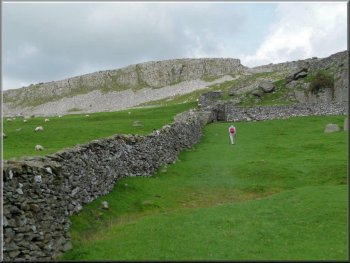
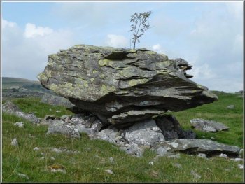
By now the first of the erratics was within sight and by heading towards
Norber we were soon within a huge rough pasture where scores of the
"foreign" rocks have lain since the end of the last ice age - about
13 millennia ago - following their journeys within a glacier from Crummockdale,
a kilometre distant. Erratic is a geological term for a rock that is
out of place i.e. its age and composition differ from those of the local
bedrock.
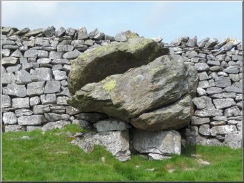
An erratic balanced on a smaller limestone plinth
An erratic supports life
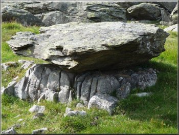
An erratic with plenty of support
|
|
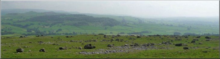
A large area strewn with countless erratics on underlying limestone
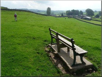
Beginning of the return to Clapham
|
|
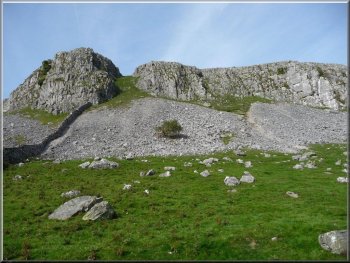
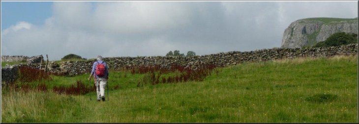
Robin Proctor's Scar at Norber
As we passed by Robin Proctor's Scar on our right some rock climbers
were practicing their skills on its face.
|
After lunch and a period exploring the erratics we returned to the
signpost and headed for Clapham via a ladder stile.
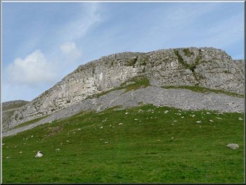
Robin Proctor's Scar at Norber
|
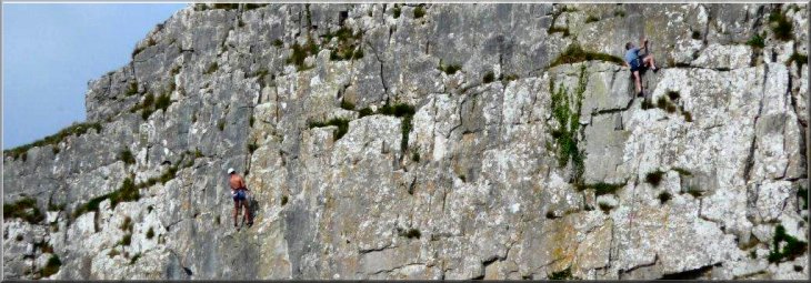
Climbers on Robin Proctor's Scar at Norber - Where do I go next? |
|
Heading back to Thwaite Lane from Norber
Looking back at the route down from Norber
|
The route via SD762695 is quite evident and a stile and gate were reached
at SD760691 where we turned right on to Thwaite Lane.
Returning to Thwaite Lane
|
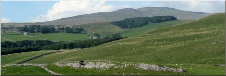
Ingleborough from Thwaite Lane |
|
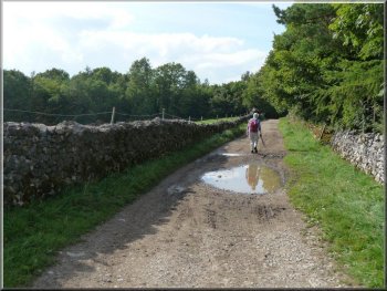
The surface of Thwaite Lane gradually deteriorates
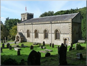
St James Church, Clapham
The tunnels were introduced in bygone times by owners of Ingleborough
Hall supposedly to protect their own privacy. We emerged from the tunnels
by the parish Church of St James and turned left, by a moss-encrusted
monument of recent origin, to access the car park. - Ray
Brown
|
Near to Clapham the surface deteriorated gradually and steepened downhill
as we entered woodland with several notices advising cyclists to dismount.
Thwaite Lane then surprisingly passes through a couple of tunnels.
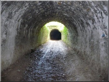
Thwaite Lane passes through a couple of tunnels near Clapham

We turned left at this monument to return to the car park
|
Background Notes:
This is a circular walk of only 5 miles, 8km from Clapham via Austwick to the Norber erratics. This route is all about the scenery and the rocks that have created this place. Clapham lies on a major geological fault system called the Craven Fault. This is an amazing structure itself running for around 30 miles from a point to the Northwest of Clapham heading southeast. The scale of the movement on this fault is quite hard to take in. When Charles Darwin was developing his ideas leading to his book "On the Origin of Species" he realised that immense periods of time were needed to allow evolution to happen and he turned to the geological record to help him prove that such time spans were available. As part of his study of geological faults he noted that - "for since the crust cracked, the surface of the land has been so completely planed down by the action of the sea, that no trace of these vast dislocations is externally visible. The Craven Fault, for instance, extends for upwards of 30 miles, and along this line the vertical displacement of strata has varied from 600 to 3000 feet."
From Clapham at the base of Inglebrough our route follows a path across the fields to Austwick roughly along the route of the Craven Fault. You can see to the left the land rising up to the limestone hills and the softer farmland away to the right. At Austwick we start the climb up onto the limestone plateau of Norber a little over a kilometer to the North. The Norber plateau is really the focus of this walk, because it's here that we encounter the Norber erratics. In geological terms an erratic is a rock that turns up somewhere that it doesn't belong and the geologists have to try to work out how it got there. The Norber plateau is a rather overgrown limestone pavement but well worth a visit. Scattered all over this limestone pavement are large sandstone boulders that do not belong here. For a start the sandstone is about a hundred million years older than the limestone so it should be lower down. If fact the sandstone comes from higher up the valley at the head of Crummack Dale where the layer of ancient sandstone has been exposed by erosion. This sandstone rock was picked up by the advancing glacier during the last ice age and as the ice retreated at the end of the ice age about 13000 years ago the many boulders of all sizes were left behind. They have sat here on the limestone all that time and have protected the soluble limestone underneath them from erosion by the slightly acidic rainfall. The result is that now some of the sandstone boulders are perched on little plinths of limestone up to 60cm tall.
We retraced our steps off the Norber plateau and followed the path below Robin Procter's Scar where the high cliff face is popular with rock climbers. Robin Proctor was a farmer in Crummack Dale, who used to ride into Austwick to enjoy a bit too much ale. His old horse knew the way home and he often just slid off the saddle in the stable and slept it off in the straw. One stormy night he was so drunk that he mounted the wrong horse at the pub. They became lost on the hills and both fell to their deaths over the cliff that now bears his name. The path below Robin Proctor's Scar leads into a rough track called Thwaite Lane and about 900m after we join this track there is another track off to the right called Long Lane. About 1.5km along Long Lane there is a public footpath down into the valley of Clapham Beck and a path along the valley to the Ingleborough show cave. However our route continues along Thwaite Lane which passes through two short tunnels that the owner of Ingleborough Hall had built about 150 years ago. The lane leads us back into Clapham past the parish church of St. James and through the centre of the village on the road following Clapham Beck. The beck rises high up on Ingleborough, then disappears underground running through Gaping Gill pot hole and the Ingleborough show cave where it emerges to flow down the valley into a lake, and through the village where our walk ends.
Top of Page
|