| 2001 walks | 2002
walks | 2003 walks | 2004
walks |
| 2005 walks | 2006
walks | 2007 walks | 2008
walks |
| 2009 walks | 2010
walks | 2011 walks | 2012 walks |
| 2013 walks | 2014 walks | 2015 walks | 2016 walks |
| 2017 walks | 2018 walks | 2019 walks |2020 walks |
| 2021 walks | 1993-2000 library | Find a Route Index |
| A few Routes to print out | Request a Route... |
Route No. 371 - Wednesday 22 September 2010
Hole-of-Horcum, Skelton Tower,
Dundale Pond circuit - 11km
North York Moors . . .
Route map from Ordnance
Survey Open Space service.
Map: OS Explorer OL27 North York Moors Eastern area at 1:25000
|
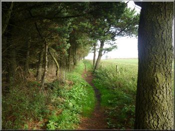
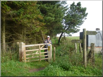
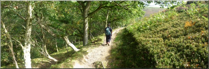
Path along the edge of the plantation
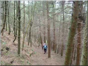
Path down the hillside to the Saltergate Inn
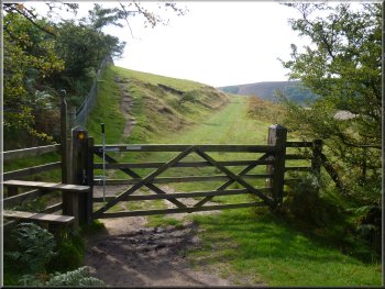
After about 250m along this track we came to a gate across the track
with a sign warning about the anti-terrorist surveillance in the area
surrounding the Fylingdales base. Just before the gate at map ref. SE854938,
we turned left through another gate along the edge of a plantation.
About 400m along this path there was a stile ahead and a pedestrian
gate to the right into some pasture land. We kept straight ahead over
the stile and followed the path down the hillside through the plantation
to the main road next to the near derelict old Saltergate Inn.
|
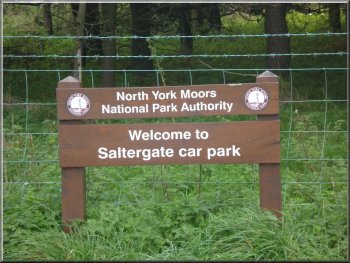
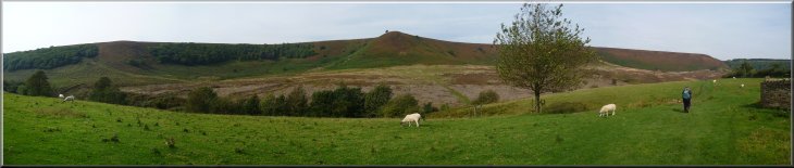
Today was forecast to be the last fine day before a wet cool spell
and it proved to be accurate. We, that's my mate Jim and I, drove to
the car park on the A169 Pickering to Whitby road at the Hole-of-Horcum
at map ref. SE852937. Since we were last here the car park has sprouted
a new name board which proclaims the name as the "Saltergate Car Park".
The Saltergate Inn, now in a state of lapsed renovation, is about 500m
away towards Whitby round a steep hill and hairpin bend. The peat fire
there was alleged to have been burning for centuries but it's definitely
out now. From the car park we set off along the main road northwards
for about 150m and turned right on to a track between the plantations.
Start of the path along the edge of the plantation
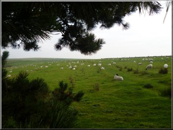
Sheep pasture beside the path
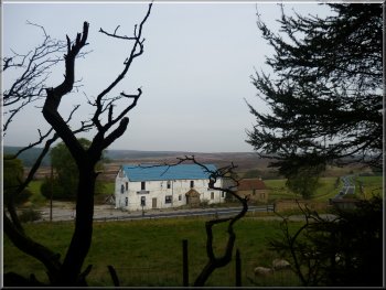
Saltergate Inn awaiting renovation
|
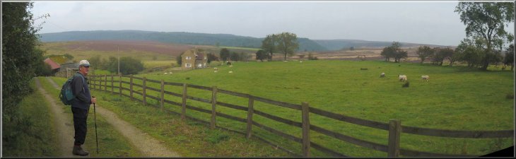
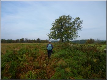
Leaving the main road , heading for Glebe Farm |
Sign at Glebe Farm
We guessed that the house was probably a holiday cottage. Beyond the
house we followed the path across some fields to the open moor.
|
We crossed the main road and took the path signposted down an access
track at the side of the Saltergate Inn, and between some farm buildings,
Glebe Farm, on our left and a stone built house a little further on,
on our right.
Path on to the moor from Glebe Farm
|
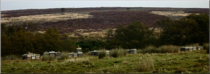
Bee hives on the moor at the end of the heather honey season |
|
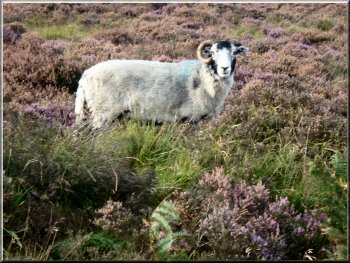
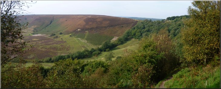
Swaledale ewe watching our progress
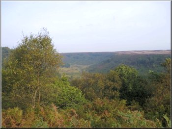
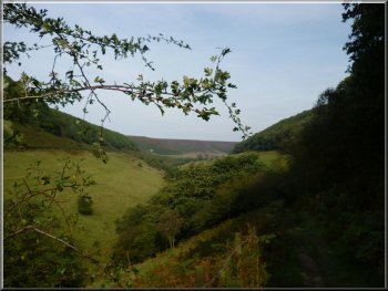
Our first view into Newton Dale
The track of the North York Moors steam railway runs along the valley
bottom, and below us a train hauled by a diesel engine stopped at Newtondale
Halt.
|
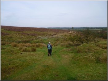
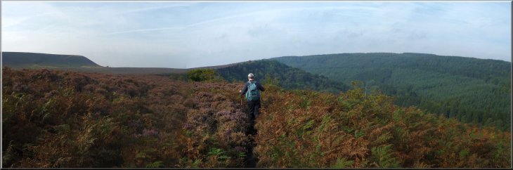
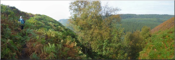
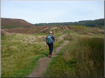
At map ref. SE845948, the path turned left to follow the edge of the
moor above Newtondale. I like this path for the contrast between the
open moorland on our left and the steep sided, wooded valley of Newtondale
on our right.
Heading for the path along the edge of Newton Dale
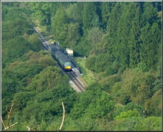
Diesel train at Newtondale Halt
|
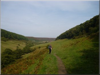
Path along the edge of Newton Dale |
|
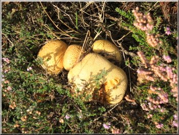
Cluster of autumn fungus in the heather
Path along the edge of Newton Dale
A small disused quarry on the edge of Newton dale
After about 3.5km we reached Skelton Tower at map ref. SE820928.
|
We continued to follow the path along the edge of Newtondale.

A view of the railway along Newton Dale
A small disused quarry on the edge of Newton dale
|
Path along the edge of Newton Dale |
|
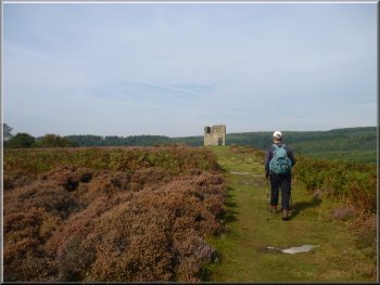
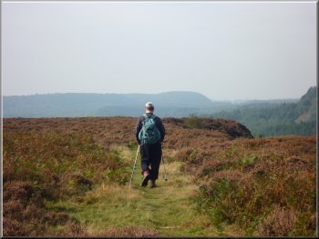
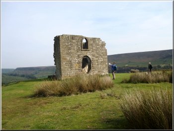
Heading for Skelton Tower
Steam train seen from Skelton Tower
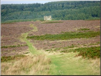
Looking back along the green track to Skelton Tower
After our lunch we turned away from Newtondale and followed a clear
green pathway across the moor and up the hillside to Dundale Pond at
map ref. SE828918.
|
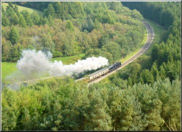
We sat on a ruined stone wall for our lunch with a lovely view along
Newtondale. We could hear a steam engine whistle behind us at Levisham
Station and shortly it came into view hauling a number of coaches with
a lot of smoke as it worked its way way up the incline.
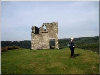
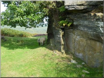
Skelton Tower
Skelton Tower
Green track climbing up towards Dundale Pond
|
Looking back across Newton Dale from the top of the climb |
|
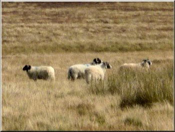
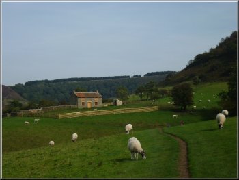
Sheep near Dundale Pond
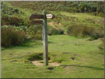
Signpost at Dundale Pond
At the bottom of the slope we came to Levisham Beck at map ref. SE838917.
|
From Dundale Pond we followed the path down Dundale Griff for about
1km.
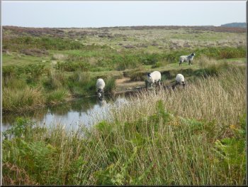
Sheep drinking at Dundale Pond
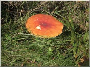
Fly Agaric fungus in Dundale Griff
|
The path down Dundale Griff from Dundale Pond to Levisham Beck |
|
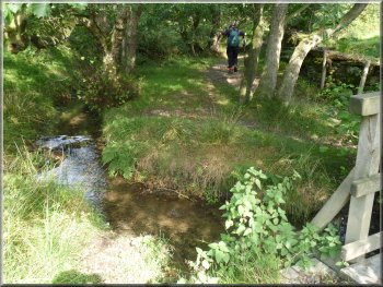
Path following Levisham Beck
Looking back along the path above Levisham Beck
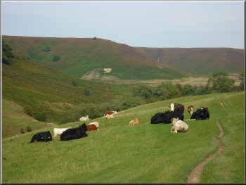
Cattle by the path into the Hole-of-Horcum
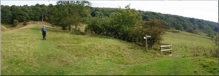
We continued across the fields to a gate next to Levisham Beck at
map ref. SE845934. We followed the path through the gate and over the
beck and into the moorland bowl of the Hole-of-Horcum.
|
There we turned left along a path that followed Levisham Beck upstream
gradually climbing away from the beck. This path led us across fields
past the old farmstead of Low Horcum (now some kind of outdoor centre
I think).
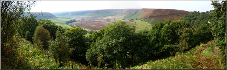
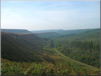
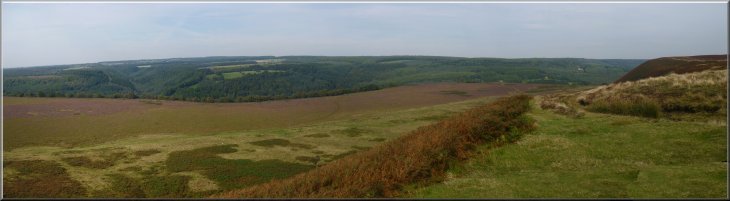
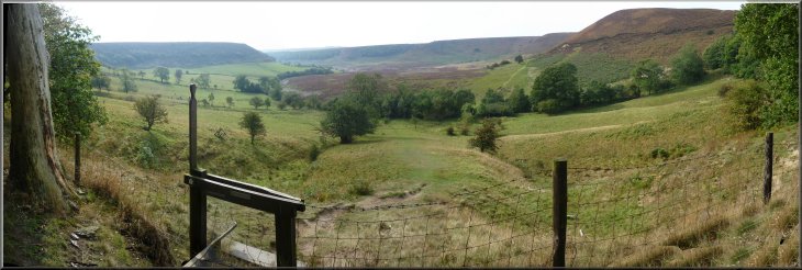
Looking into the Hole-of-Horcum
The path into the Hole-of-Horcum
Approaching Low Horcum
|
The Hole-of-Horcum seen from Low Horcum farmstead |
|
Looking back towards Low Horcum
Then we turned right, off the path, and made our way across the heather
to a gate at map ref. SE 849938.
|
We followed the path starting to climb up slowly for a few hundred
metres.
Path through the Hole-of-Horcum
|
|
Climbing up to the path through the oak woods
Looking back across the Hole-of-Horcum from the edge of the oak woods
|
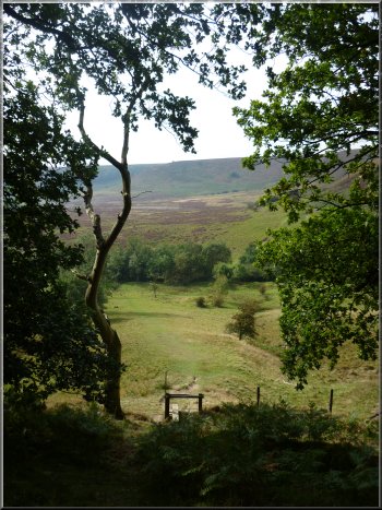
Looking back across the Hole-of-Horcum from the edge of the oak woods
|
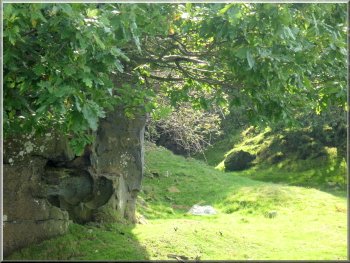
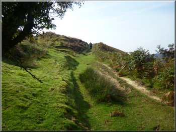
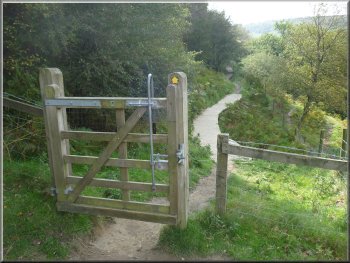
Through the gate the path led us up the steep hillside to a stile
at the edge of the oak woods around the eastern rim of the Hole-of-Horcum
below the main road (A169). We crossed the stile into the woods and
followed the path climbing steeply up to the road with lovely views
through the trees across the Hole-of-Horcum. At the top we came to a
few steps p to the road edge and crossed the road back to the car park
where we had started. The whole walk had been 11km. It had taken us
just over 4 hours to walk including our lunch stop at Skelton Tower.
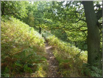
Path up through the oak woods to the car park at the A169
|
Looking back across the Hole-of-Horcum from the path through the oak woods
|