| 2001 walks | 2002
walks | 2003 walks | 2004
walks |
| 2005 walks | 2006
walks | 2007 walks | 2008
walks |
| 2009 walks | 2010
walks | 2011 walks | 2012 walks |
| 2013 walks | 2014 walks | 2015 walks | 2016 walks |
| 2017 walks | 2018 walks | 2019 walks |2020 walks |
| 2021 walks | 1993-2000 library | Find a Route Index |
| A few Routes to print out | Request a Route... |
Route No. 398 - Wednesday 23 March 2011
Sutton Bank, Cleveland Way,
Hambleton House circuit - 4km
North York Moors. . .
Route map from Ordnance Survey
Open Space service.
Map: OS Explorer OL26 North York Moors Western area at 1:25000
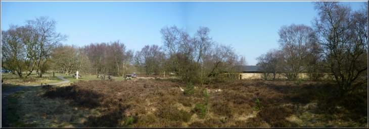
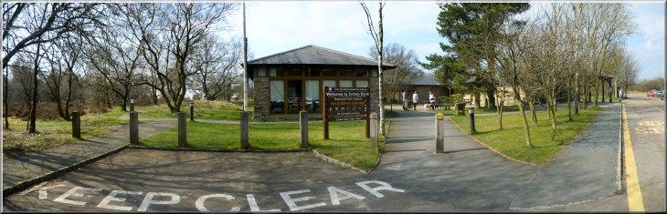
Picnic area at the Sutton Bank Visitor Centre |
|
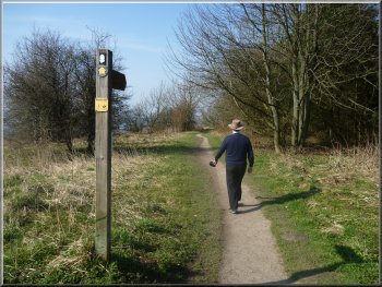
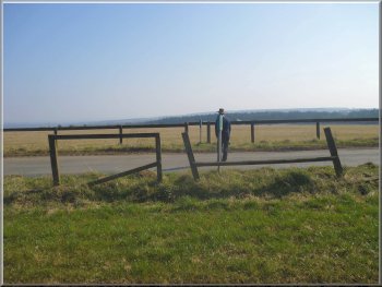
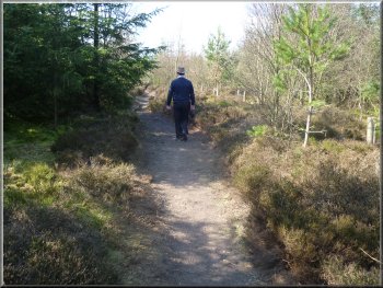
Setting off on the Cleveland Way at Sutton Bank
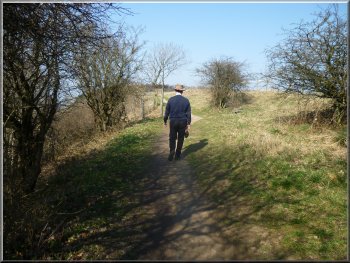
Cleveland Way path near Sutton Bank
I still have over four months to go, but I'm getting a bit further
each time we go out. We set off from the visitor centre to the Cleveland
Way path along the edge of the escarpment. It was a lovely view out
to the West over the Vale of Mowbray but the haze hid the distant Yorkshire
Dales.
|
It's been perfect walking weather all week so today my mate, Jim, and
I drove up to the Sutton Bank visitor centre just a few miles from home.
It was a bright sunny day with some haze in the distance. I'm still
recovering from a knee replacement operation and apparently it will
take around 6 months to get normal function back.
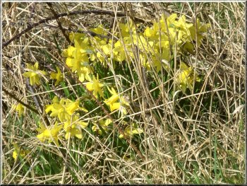
Wild daffodils by the Cleveland Way
Cleveland Way path near Sutton Bank
|
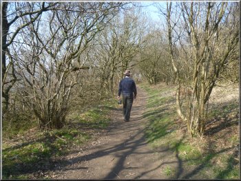
The wooded Cleveland Way path near Sutton Bank |
|
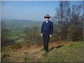
Enjoying the Spring sunshine on the Cleveland Way
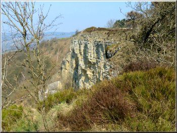
White Stone Cliff next to the Cleveland Way
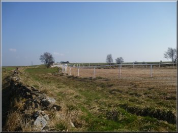
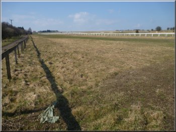
After about 1km there were the white painted railings of some race
horse training gallops on our right and as we approached half a dozen
horses galloped up along the rail.
|
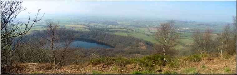
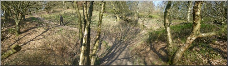
We followed the Cleveland Way Northwards looking down on Gormire Lake
about 150m below us at the foot of the cliffs. It's a very pleasant
path along the wooded edge of the cliffs.
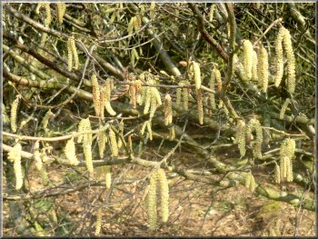
Hazel catkins in the Spring sunshine
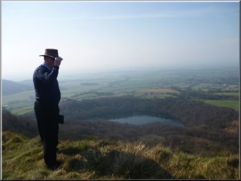
Gormire Lake below the Cleveland Way
|
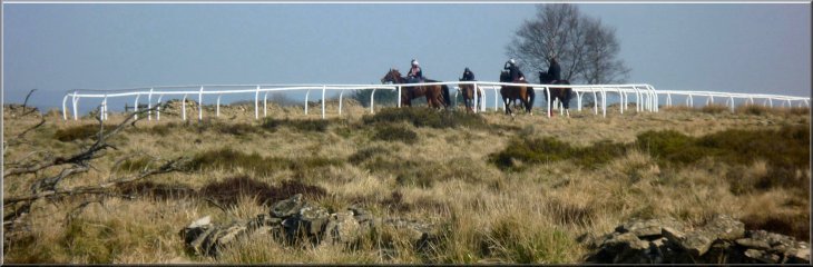
Race horses at the end of the gallops |
|
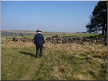
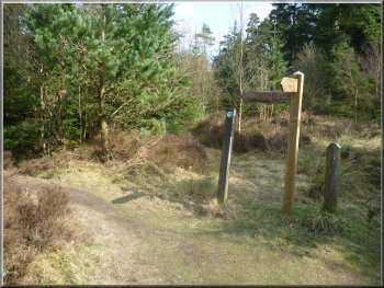
Turning towards Dialstone Farm
The path heading towards Dialstone Farm
The right of way is marked on the OS map and there are way mark posts
at both ends but there is no defined path on the ground. However we
knew that the path skirted the white rails of the gallops near the road
and so we aimed for that spot. As we approached the same group of horses
came thundering by and we kept still whilst they passed us - they're
skittish creatures at the best of times.
|
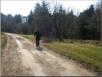
Just beyond the gallops at map ref. SE507838 we turned right off the
Cleveland way to follow a path towards Dialstone Farm, with the race
horse gallops on our right. After almost a kilometer, just beyond a
small wood we turned right to follow a public footpath across the fields
to a minor road at map ref. SE517837.
Path beside the gallops heading for Dialstone Farm
Turning across the fields towards a minor road
|
|
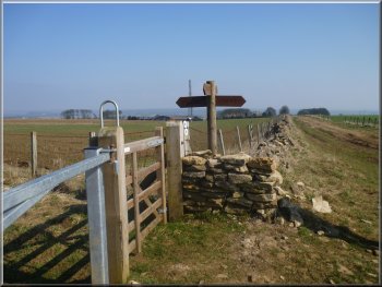
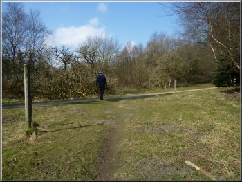
Way marks at the crossing of a minor road
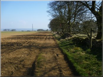
The access road from Hambleton House
We joined the track at map ref. SE523834 and walked along it and then
along the access road away from Hambleton House for about 150m to map
ref. SE523832. Here we turned right off the access road onto a footpath
through the plantation.
|
We crossed the road and continued along the same right of way towards
Hambleton House. Again there was no defined path on the ground, but
we aimed for a tall hedge screening the house from the field where we
knew there was a crossing point on the gallops.
Looking back across the field from Hambleton House
Turning off the access road into the plantation
|
|
Path through the plantation towards the visitor centre
Path through the plantation towards the visitor centre
The whole walk had been about 4km, a record for me so far, and it
had taken 2 hours to walk. We stopped at a cafe on the way home for
a coffee and a bacon sandwich and despite the short distance it was
starting to feel as though I could get out on the hills again properly
by the end of this year.
|
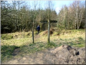
We followed this path through the plantation for about 800m to the
edge of the visitor centre site. We walked along the path through the
woods next to the road by the visitor centre for about 150m to a wooden
footbridge over a ditch that gave us access onto the road and back into
the visitor centre car park.
Path through the plantation towards the visitor centre
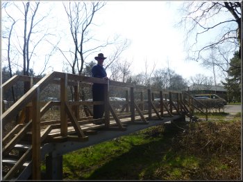
Footbridge to the road at the visitor centre
|
Back at the Sutton Bank Visitor Centre car park |