| 2001 walks | 2002
walks | 2003 walks | 2004
walks |
| 2005 walks | 2006
walks | 2007 walks | 2008
walks |
| 2009 walks | 2010
walks | 2011 walks | 2012 walks |
| 2013 walks | 2014 walks | 2015 walks | 2016 walks |
| 2017 walks | 2018 walks | 2019 walks |2020 walks |
| 2021 walks | 1993-2000 library | Find a Route Index |
| A few Routes to print out | Request a Route... |
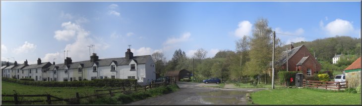
Route No. 406 - Wednesday 20 April 2011
Grosmont, Rail Trail, Goathland,
Eller Beck, Crag Cliff Wood, circuit - 10km
North York Moors . . .
Route map from Ordnance Survey
Open Space service.
Map: OS Explorer OL27 North York Moors Eastern area at 1:25000
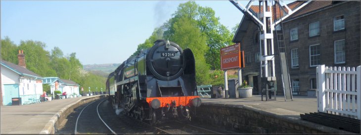
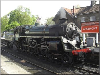
Our train in Grosmont station on the North York Moors Railway |
|
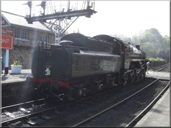
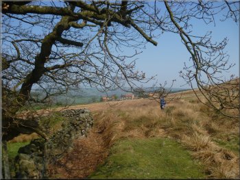
A steam engine manoeuvring at Grosmont station
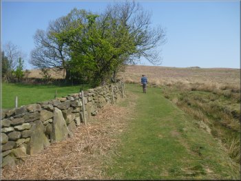
Looking back towards Grosmont along the Rail Trail
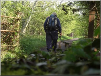
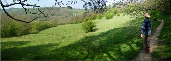
The spell of fine sunny weather is continuing and it's so frustrating
that I've been limited to three or maybe four kilometers with my replacement
knee. I decided to try a slightly longer walk today. I took the 10.30am
steam train one stop along the line from Grosmont station to Goathland
station. It was a very pleasant, fun way, to start the trip. The Rail
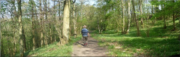
Trail from Grosmont to Goathland and the walk I did do today from Goathland
back to Grosmont via Eller Beck and Crag Cliff wood together make
an excellent circular walk of 10km. (Note, the
photos along the Rail Trail are taken from Route
no. 291 which I walked on 29 April 2009)
|
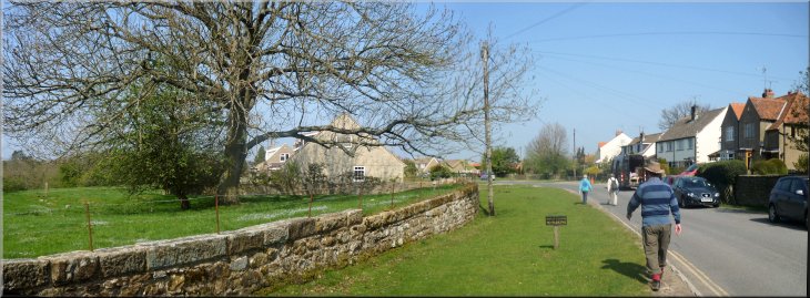
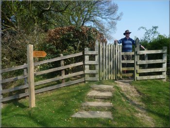
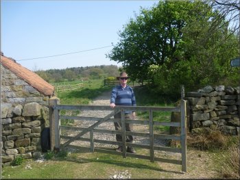
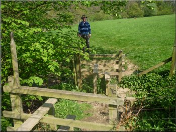
This route starts at the large pay and display car park on the edge
of Grosmont, map ref. NZ826054 From the top edge of the car park nearest
to the village cross the footbridge to Grosmont Station. At this stage
it's worth calling into the station bookshop to get a copy of a booklet
called "The Rail Trail", published by the North York Moors National
Park Authority at £1.50 (ISBN 978-0-907480-40-2). I did not walk
the Rail Trail myself today. Earlier this year I had a complete knee
joint replacement operation and I will not have full use of my new knee
for another few months.
A steam engine manoeuvring at Grosmont station
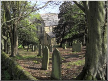
The church at Grosmont
|
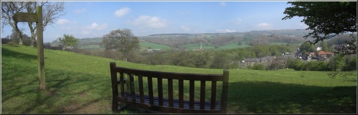
Looking over Grosmont from the Rail Trail |
|
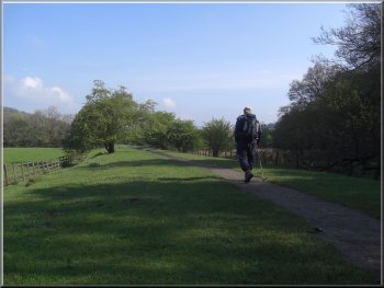
Looking back towards Grosmont along the Rail Trail
It was designed in 1836 by George Stephenson, before the main development
of steam engines. The railway had wooden rails and the trucks were horsedrawn.
|
From Grosmont station the route follows the Rail Trail for about 5km
to Goathland. The booklet includes a route map and lots of information
about the long disused railway that the walk follows.

Steam train beginning the climb up to Goathland
|
Esk Valley miners' cottages, a relic of the old ironstone industry |
|

Sculptured seat by the Rail Trail
Looking back towards Grosmont along the Rail Trail
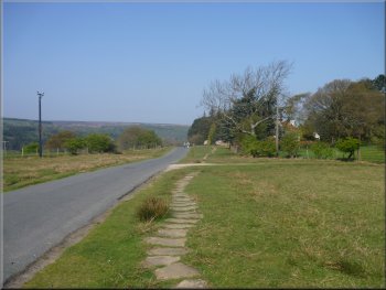
The rail trail continues to Goathland station and the route is shown
on the route map for this
walk. We walked from Goathland station at map ref. NZ837013, up the
slope and at the top we turned right to follow a public footpath along
a private road.
|
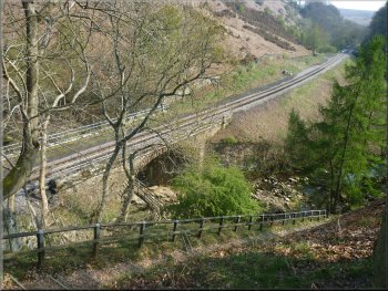
At Beck Hole the railway began a steep incline up to the level of Goathland
village. Here the horses were unhitched and tanker trucks filled with
water were used with a pulley system to haul the train up the incline
as the tanker trucks descended.
Old railway bridge over the Murk Esk
Looking back towards Grosmont along the Rail Trail
|
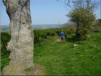
Walking through Goathland at the start of our walk |
|
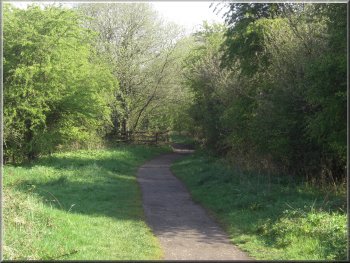
Old paved path leaving Goathland
The path to Eller Beck
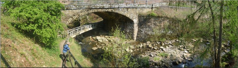
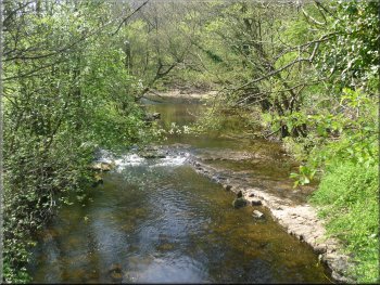
Eller Beck under the railway bridge
Under the railway bridge Eller Beck is squeezed through
a gap in the rocks, but after the recent dry weather there was not much
water in the beck.
|
After about 250m we joined a public road and continued along the road
out of Goathland towards Beck Hole for about 500m to map ref. NZ829018.
Here we turned right off the road to follow a public footpath between
fences to cross both the railway line and the Eller Beck.
Path to Eller Beck leaving the road
North York Moors Railway crossing Eller Beck
Footbridge over Eller Beck
|
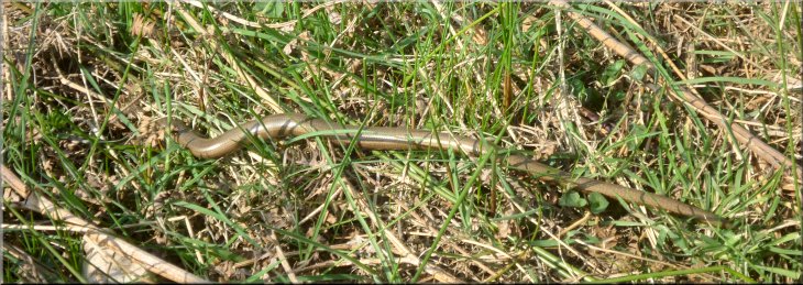
Jim spotted a slowworm rushing away to hide |
|
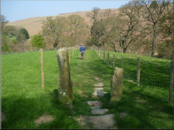
Path from Lins Farm
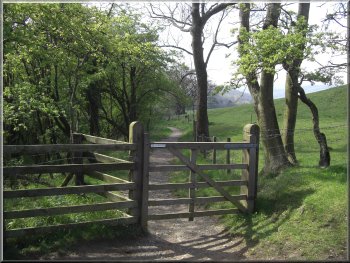
The bridleway leaving Green End
Bridleway from Green End
We came through a farm yard on to an access track at Green End where
we turned left to walk down the track for about 150m before turning
right at the end of the track to follow a bridleway across the fields.
|
We crossed the footbridge and followed the path above the beck to Lins
Farm, with some holiday cottages. We turned right by the farm and followed
the path out to the road at Hollin Garth. We walked along the road for
about 150m and at map ref. NZ824029 we turned left off the road to walk
along a path across the fields to Green End.
Path from Lins Farm to Hollin Garth
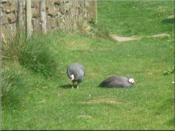
Guinea fowl on the bridleway
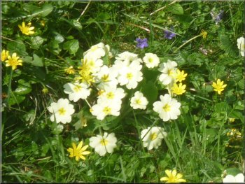
Primroses by the path
|
There were great banks of primroses, violets and cellandines by the path
|
|
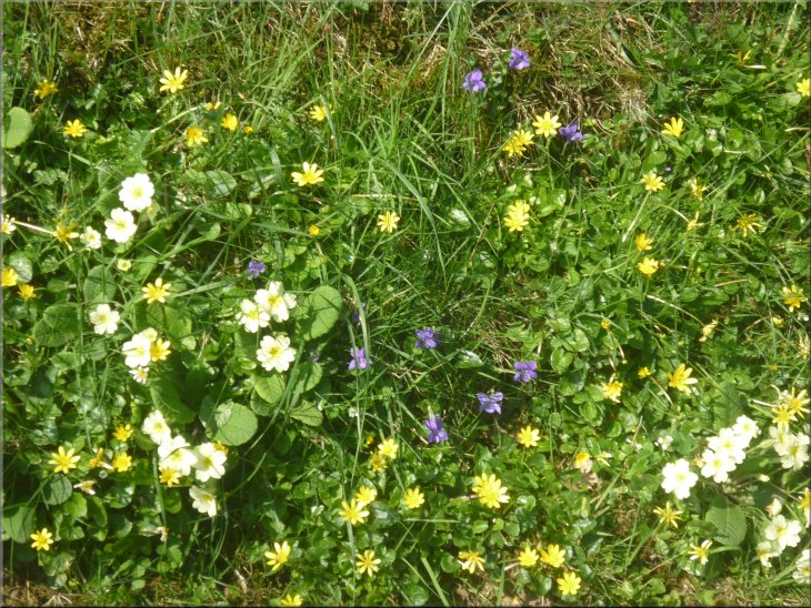
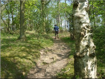
Path from Green End
The path led us down a slope thorough some wooded banks covered with
primroses, cellandines and violets glistening with colour and fresh
green leaves in the warm Spring sunshine. It was simply lovely!
|
The bridleway leads down to the river Murk Esk where there used to
be a bridge but this has been washed away and there is no longer a river
crossing. After about 200m we took a footpath which forked to the right
off the bridleway.
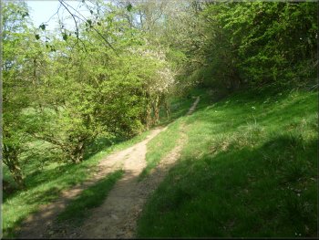
Path from Green End to Crag Cliff Wood
|
Path from Green End heading towards Crag Cliff wood |
|
Path through Crag Cliff Wood
The wood is carpetted with wild flowers including wild garlic and bluebells.
The bluebells were just starting to open but it looked as though it
would be a couple of weeks before they were in full flower.
|
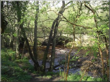
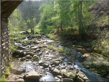
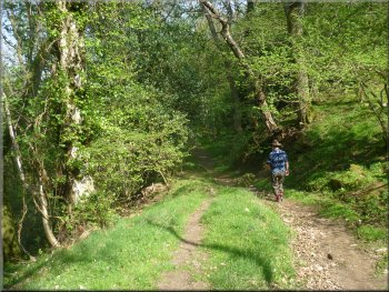
After about 500m, at map ref. NZ826042, we crossed a stile and a little
footbridge over a small beck to enter Crag Cliff Wood. The path through
the wood follows an old paved pannier way, an old pack horse route.
Path through Crag Cliff Wood
|
Path through Crag Cliff Wood |
|
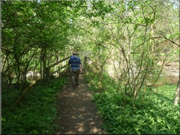
Approaching the footbridge over the Murk Esk
We crossed the river to a path by the church and walked through the
church yard to a path by the railway. This brought us out to the road
at the level crossing in Grosmont. We stopped at a tea shop in the village
for some lunch before collecting the car from the car park for the journey
home after a very pleasant walk. Our walk from Goathland to Grosmont
had been a little over 5km and is my longest walk to date after my knee
operation, so things are still improving and I'm hoping to be back to
normal by the autumn. The whole route incliding the Rail Trail from
Grosmont to Goathland is about 10km.
|
At map ref. NZ828046 the public footpath leaves the wood and goes along
the field edge to an access track at map ref. NZ829047. Where the path
leaves the wood we bore left on a well walked but unofficial path inside
the wood but parallel to the public footpath. The wild flowers here
are lovely and include orchids in the early spring. We could see a few
of them down the bank but they were dying off and well past their best.
We came out onto the access track to rejoin the public footpath along
the access track. After about 350m we turned left off the track to follow
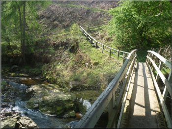
a footpath to a footbridge over the river Murk Esk at map ref. NZ828051.
This is a pretty stretch of river with low cliffs along one bank.
The Murk Esk seen from the footbridge
|
|
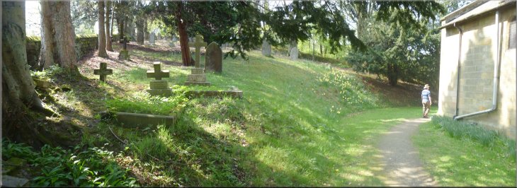
Path through the church yard into Grosmont
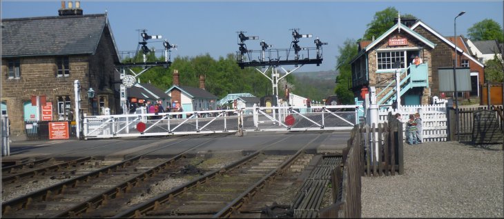
The level crossing in Grosmont at the end of our walk
|
Background Notes:
This is a circular walk of 10km, about 6 miles from Grosmont on the North York Moors. We start at the large public car park on the northern edge of Grosmont. The North York Moors Railway is based in Grosmont and their engine repair shed is open to the public and worth a visit to see these amazing engines being skilfully taken apart, repaired and rebuilt.
When you can tear yourself away from the engine sheds the next part of the walk is called "The Rail Trail", and it's worth getting a little booklet about the Rail Trail from the station bookshop. The booklet is published by the North York Moors National Park Authority and it descrbes the walk along a long disused railway from Grosmont to Goathland. This railway was built in 1836 and was designed by George Stephenson. It had wooden rails and the trucks were horsedrawn. This was before the massive development of steam engines. There's a wealth of information about it in the booklet and a route map. Between Beck Hole and Goathland the old railway went up an incline that was much too steep at 1 in 49 for horses to haul the trucks. So here the horses were unhitched and an ingenious system was used where tanker trucks filled with water and attached to a pulley wheel, hauled the train up the incline as the tanker trucks descended. There was a passing loop in the tracks half way up the incline. There were some serious accidents when the rope broke and some fatalities are recorded. In 1847 the line converted to steam engines and in 1865 the present day line was opened by-passing the incline. The line was closed in 1965 following the Beeching review of the railways, but in 1967 a group of railway enthusiasts bought the line and it reopened in 1973 as the North York Moors Railway which is still run largely by volunteer railway enthusiasts.
For the return leg of the walk from Goathland follow the road towards Beck Hole and turn off on the footpath across the fields to a footbridge over Eller Beck. This footbridge is at the point where the present day railway crosses the beck and the footpath crosses over the beck and under the railway viaduct. There's a plaque mounted on a stone here to commemorate a boy drowned in the beck in June 1902. The path follows Eller Beck round an amphitheatre of land with the railway viaducts as the backdrop. It's a pretty spot with a couple of benches to sit and watch the river and the railway. The path then climbs up to the road above Beck Hole. From there we cross the fields to Green End and on into Crag Cliff Wood. These woods are full of wild flowers. Early in the season there are cellandines, then banks of primroses and violets and orchids in the lower wood. Other parts are covered with wood anemonies and wood sorrel. Later the wild garlic flowers open and the bluebells. Just now the bluebells should be in full flower and there is a huge carpet of them in the lower part of the wood. The path through the wood follows an old stone paved Pannier Way or Trod. There was a network of these routes used by strings of pack horse and travellers generally a few hundred years ago and remnants of them can still be seen all over the North York Moors.
The walk finishes across a footbridge over the river called the Murk Esk, much prettier than its name suggests. Then through the churchyard to the level crossing in Grosmont.
If you want to do just half of this walk for any reason, you can do the other half on the steam train between Grosmont and Goathland and still have a lovely day out.
Top of Page
|