| 2001 walks | 2002
walks | 2003 walks | 2004
walks |
| 2005 walks | 2006
walks | 2007 walks | 2008
walks |
| 2009 walks | 2010
walks | 2011 walks | 2012 walks |
| 2013 walks | 2014 walks | 2015 walks | 2016 walks |
| 2017 walks | 2018 walks | 2019 walks |2020 walks |
| 2021 walks | 1993-2000 library | Find a Route Index |
| A few Routes to print out | Request a Route... |
Route No. 422 - Tuesday 7 June 2011
Lundy Island, Threequarter Wall circuit - 8km
Bristol Channel
North Devon Coast . . .
Route map from Ordnance Survey
Open Space service.
Map: OS Explorer 139 Bideford, Ilfracombe & Barnstaple
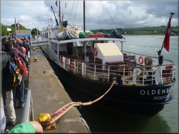
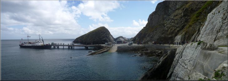
Queuing to board the Lundy Island ferry at Bideford
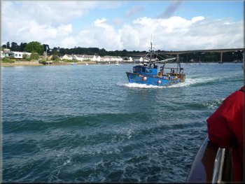
Fishing boats were coming up river on the tide as we left
At 9.30am we set off down the River Torridge estuary past Appledore
and out into the Bristol Channel. There was a strong southwesterly wind
and ominous shower clouds about. The estuary had been quite calm but
now the sea was choppy and the ferry rolled and pitched and we were
both feeling pretty queasy. The crossing took two hours and was not
very pleasant. Many people were "unwell" during the crossing.
|
This week my wife and I are staying in a holiday cottage in the village
of Appledore on the North Devon Coast. This morning we drove a couple
of miles to Bideford and queued at the Lundy Ferry office to collect
our tickets for the MS Oldenburg. There were many people who were going
to stay in one of the cottages on this National Trust owned island.
Their baggage was being loaded into large wooden crates to be ferried
to the island.
Leaving Bideford for Lundy Island
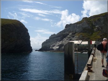
The jetty on Lundy Island
|
The jetty on Lundy Island |
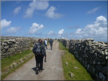
Start of the climb up from the jetty
The track climbing up from the jetty
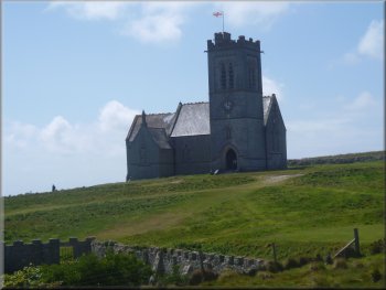
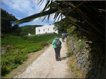
The church on Lundy Island
There was a church, a farmstead, a shop, artists workshops and a collection
of old and new holiday accommodation, and even a pub. We set off for
a walk around part of the island along the main track from the farm
heading northwards along the island. |
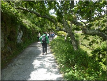
When we landed at the jetty on Lundy the rain had stopped and we
were in the lee of the island so once we were back on dry land everything
suddenly seemed a lot better. The whole island is a nature reserve.
There was a long climb up about 120m (400ft) along a wide track cut
into the cliff face to a settlement on the island plateau.
The track climbing up from the jetty
The track climbing up from the jetty
Pony at the top of the climb up from the jetty
|
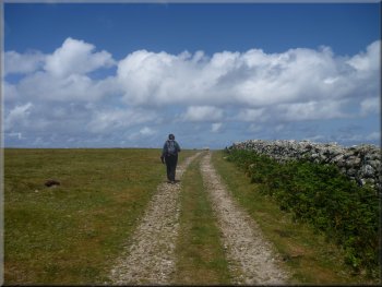
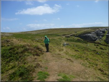
Setting off along the track North from the settlement |
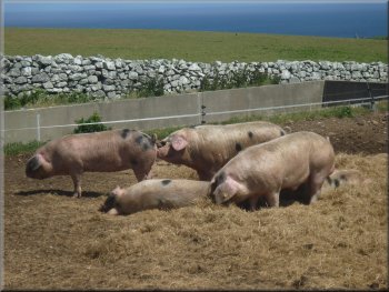
Gloucester Old Spot pigs at the farm on Lundy |
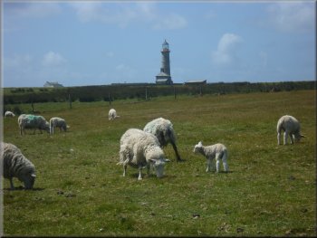
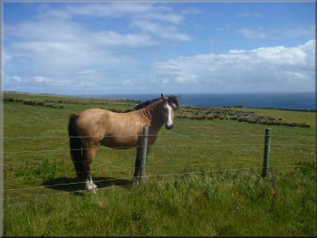
Sheep pasture by the track going North
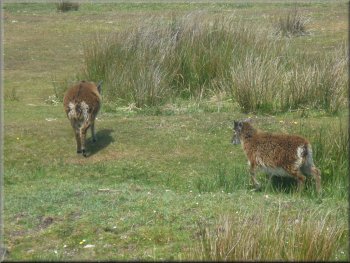
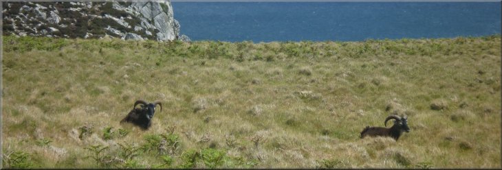
Soay Sheep beyond the Quarter Wall
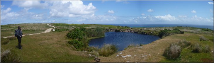
Beyond the wall the open heathland stretches out to the north of the
island. Just beyond the wall is a pretty little pond. We stood there
to look at the view all around us before continuing along the track
northwards. |
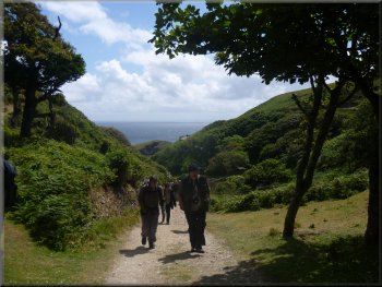
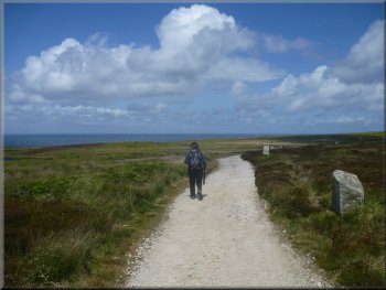
The track led us through the fields where sheep were grazing for
about 1km to the Quarter Wall. This is the end of the cultivated pasture.
The track heading North along the island
The track heading North along the island
|
Pond by the Halfway Wall |
Approaching the Halfway Wall
They were not very cooperative when I tried to take their photo. |
There were Soay Hebridean sheep in two's and three's scattered over
this area.
|
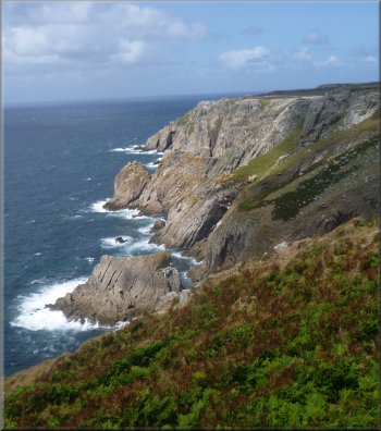
Soay sheep on the Eastern cliff top |
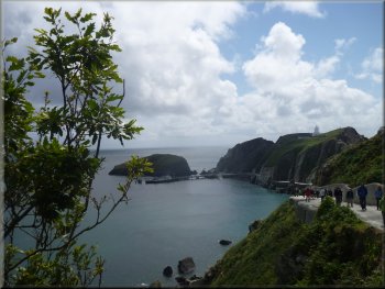
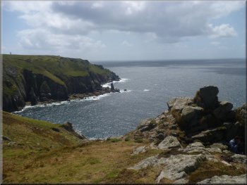
Looking back to the jetty from our lunch stop near Tibbett
|
Approaching the house at Tibbett's
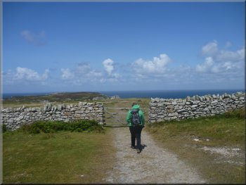
Approaching the Threequarter Wall
We found a sheltered spot down the slope on the eastern side of Tibbet's
to sit for our lunch with an amazing view along the cliffs to the jetty
where we had landed. After our lunch we followed a track from Tibbett's
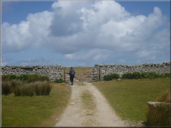
to the gate in the Threequarters Wall. |
Away to our left was a large lake with a great many gulls around
it. We continued along the track to the Halfway Wall. Beyond the wall
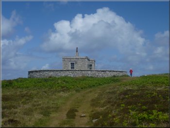
at the top of a rise was a building with a circular wall around it.
This is called Tibbett's and seems to be a holiday cottage - what a
location!
Track from Tibbett's to the Threequarter Wall
Our first view of the West coast
|
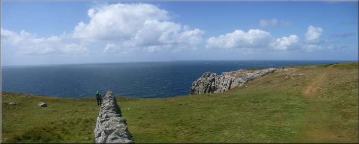
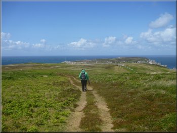
Following the Threequarter Wall out to the West coast of Lundy Island
|
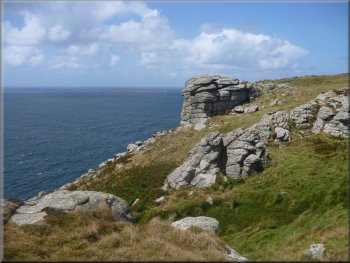
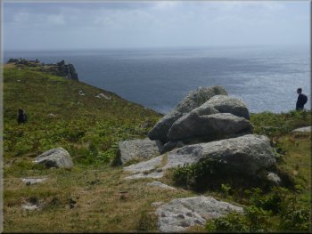
Rock formations by the cliff top path
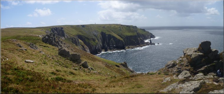
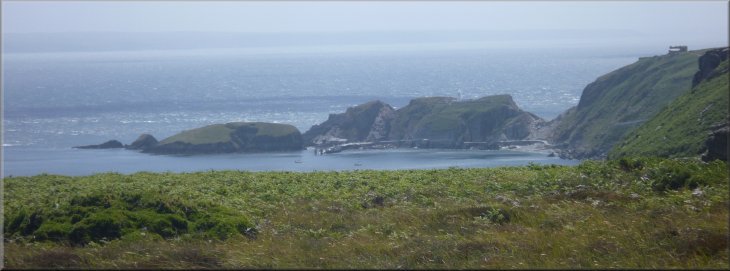
One of the many spectacular views off the West coast
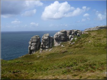
Rock formations by the cliff top path
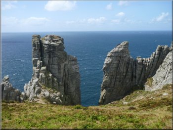
More rock formations on the West coast
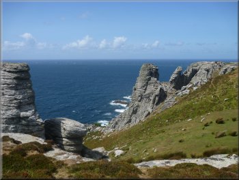
Rounded rock columns on the West coast
|
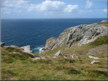
We did not cross this wall but instead we took the path following
the wall westwards to join the path heading southwards along the cliff
tops on the western side of the island. The scenery was amazing with
the contorted bedding planes of the rocks giving rise to all manner
of shapes in the cliffs. The sea was driven by the south westerly winds
into a mass of boiling surf on the rocks below. I got carried away taking
far too many photos, lots of them not good at all. We made our way back
along the cliff tops with frequent stops just to look down at the images
of the sea and surf and rocks below us.
Rock formations by the cliff top path
Looking North up the West coast of Lundy Island
Cliff top path along the West coast
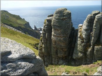
Rounded rock columns on the West coast
|
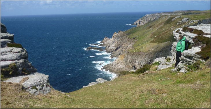
Looking North up the West coast of Lundy Island
|
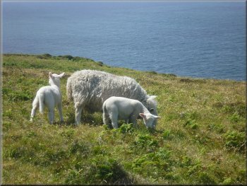
Ewe and lambs on the cliff top
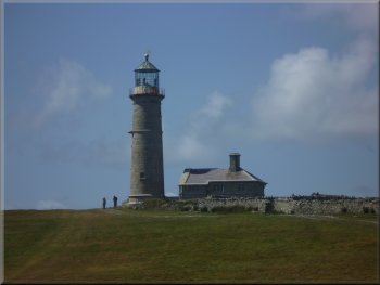
The Old Lighthouse
The path led us to the main settlement passing the helicopter landing
area on our right near the church. |
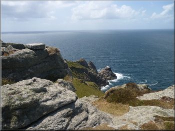
After about 3km we came to the Old Lighthouse. We followed the path
around the south side of the lighthouse.
A last look at the rocky West coast of the island
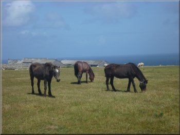
Ponies near the main settlement
|
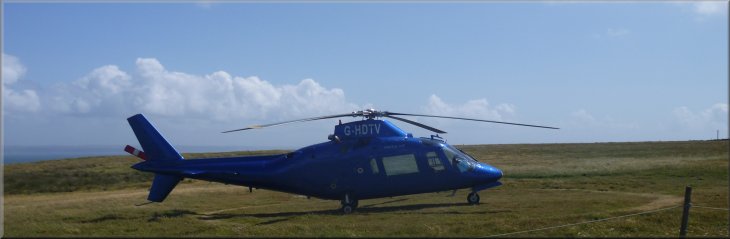
Helicopter on the Lundy Island landing pad |
Start of the long descent to the ferry at the jetty
There was not enough water in the River Torridge to return to Bideford
at that state of the tide and we were all returned to Bideford by coach
from Ilfracombe (included in the ferry fare). What a fabulous day out
despite the rather queasy start. |
From the settlement we retraced our steps down the long descent back
to the jetty where people were already starting to board the ferry.
Our walk had been about 8km and it had taken us three and a half hours
to walk with our frequent stops. The ferry left at 4.15pm and took us
to its scheduled stop at Ilfracombe.
|
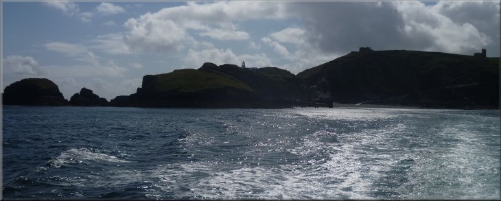
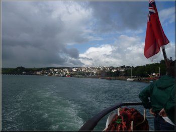
Looking back to the cliffs of Lundy Island as we left on the ferry to
Ilfracombe |