| 2001 walks | 2002
walks | 2003 walks | 2004
walks |
| 2005 walks | 2006
walks | 2007 walks | 2008
walks |
| 2009 walks | 2010
walks | 2011 walks | 2012 walks |
| 2013 walks | 2014 walks | 2015 walks | 2016 walks |
| 2017 walks | 2018 walks | 2019 walks |2020 walks |
| 2021 walks | 1993-2000 library | Find a Route Index |
| A few Routes to print out | Request a Route... |
Route No. 425 - Wednesday 29 June 2011
Mallerstang Edge (B6275 to Gregory Chapel
via High Pike Hill & High Seat),
Hell Gill & Hell Gill Force - 10km
Eden Valley . . .
Route map from Ordnance Survey
Open Space service.
Map: OS Explorer OL19 Howgill Fells & Upper Eden Valley
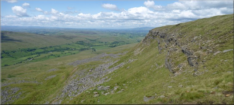
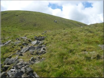
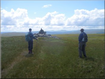
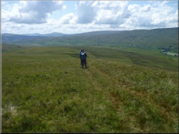
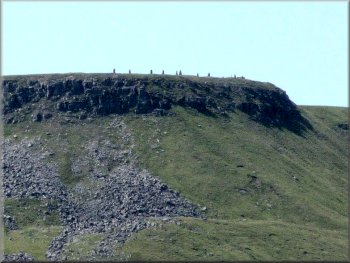
High Pike Hill seen from the start of our walk |
|
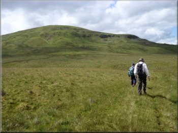
Setting out to climb High Pike Hill
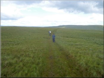
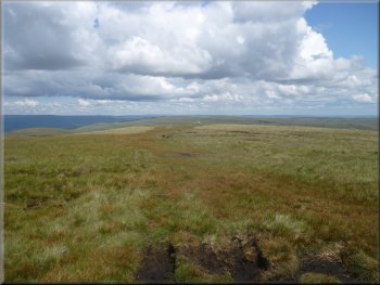
Looking back along the track on High Pike Hill
It's a steep climb of about 120m which I found quite hard with my
new knee joint and it took me almost 40 minutes to reach the top of
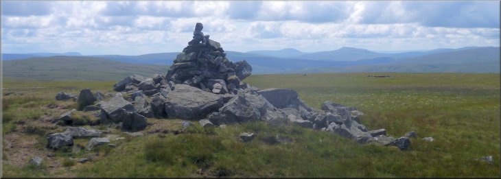
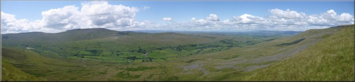
the hill at 642m. But what a view from the top! The scenery here is
big and magnificent. Away to the north are the North Pennines with Cross
Fell above the cone of Dufton Pike and the radome on Little Dun Fell
glinting white in the sunshine as a pointer to Cross Fell. To the northwest
is the Lake District and even at this distance the knobbly ridge of
Scafell Pike is clearly visible. Across the Eden Valley is Wild Boar
Fell with its distinctive ridge and behind it are the Howgill Fells.
Whilst to the south are the Yorkshire Dales. Such a wealth of big open
upland walking country looking beautiful on this sunny morning with
the sky peppered with shower clouds that did not develop into anything
all day.
|
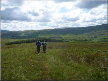
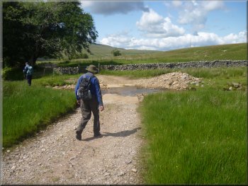
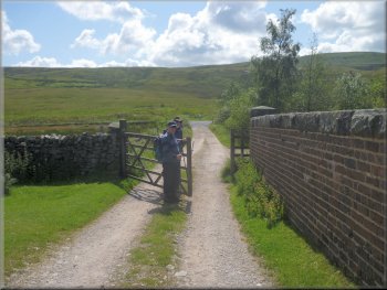
This morning my mate, Jim, and I drove to Kirby Stephen in the Eden
valley and on up the valley through the village of Nateby to Aisgill
Cottages on the B6259 at map ref. map ref. SD777963. Here we met Ray
who has been contributing some great walks to this web site for almost
a year now. This would be the end of our walk and we left our car there
whilst we all went in Ray's car back to Nateby and there turned right
up along the B6270 for about 4km to map ref. NY811041. There is a little
gravel parking area on the north side of the road by a black and white
post used to mark the road in deep snow. The road here is at an altitude
of just over 500m. Across the road to the southwest is High Pike Hill
and we crossed the road to follow a quad bike track up the hill.
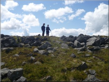
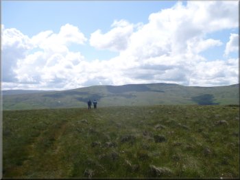
Jim & Ray were well in front of me on the climb
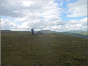
The summit cairn on High Pike Hill
|
Wild Boar Fell & the Howgill Fells from the top of High Pike Hill |
|
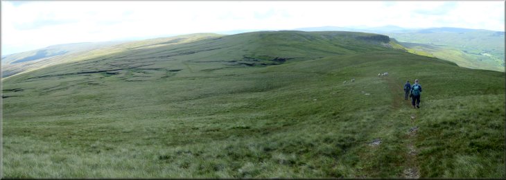
Following the track up High Seat
Track on top of High Seat
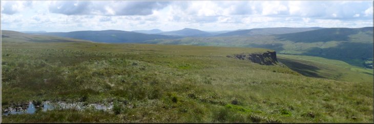
Looking north to the North Pennines from High Seat
From High Seat we continued along the ridge to Gregory Chapel. This
first part of the route from the car park at the road along the ridge
to Gregory Chapel follows the county boundary between North Yorkshire
and Cumbria. It's also the boundary of the Yorkshire Dales National
Park. From Gregory Chapel looking south about 25km away we could see,
on the horizon, the distinctive shapes of Whernside and Ingleborough
and Pen-y-ghent a little farther east.
|
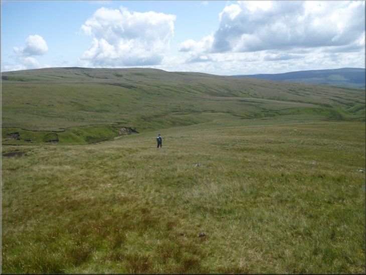
From High Pike Hill we followed the quad bike track along the ridge
to High Seat about 2km to the south. In places the quad bike track is
easy to loose as it crosses the marshy ground. High Seat is the highest
point on our walk at 709m, a fraction higher than Wild Boar Fell across
the Eden Valley. At High Seat we paused again to gaze at the wonderful
scenery all around us. It's breathtaking and so big it's very hard to
capture it in a photo.
Approaching the top of High Seat
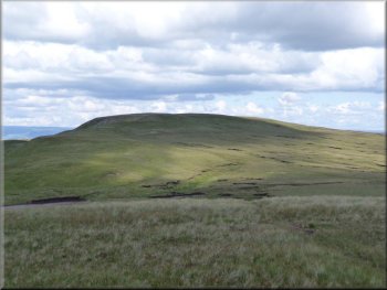
Looking back to High Seat
The summit cairn on Gregory Chapel
|
|
Heading for Gregory Chapel from High Seat
From right to left on the horizon,Whernside, Ingleborough and Pen-y-ghent
seen from Gregory Chapel
Descending from Gregory Chapel to Hangingstone Scar
|
|
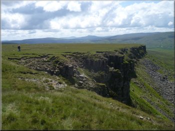
Still following the quad bike track above Hangingstone Scar
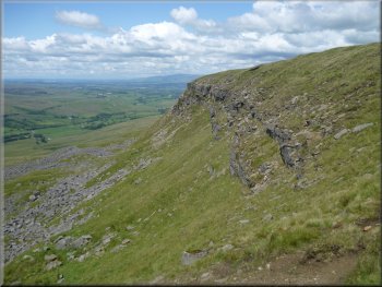
Looking north along Mallerstang Edge
Heading down towards Hell Gill
From the southern end of Hangingstone Scar we continued along the quad
bike track for almost 2.5km to Lady Anne's Highway at map ref. SD786969.
|
From Gregory Chapel we left the county boundary and continued along
the quad bike track to walk along the top of Hangingstone Scar.
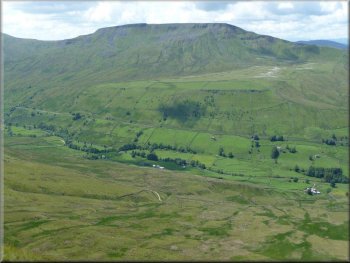
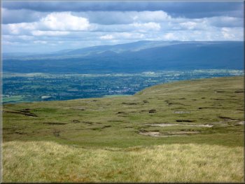
Wild Boar Fell across the Eden Valley
Hangingstone Scar
A sculpture beside Lady Anne's Highway below us
|
|
Following the quad bike track alongside Hell Gill
The Eden Valley with Wild Boar Fell on the left & Mallerstang Edge on
the right
|
|
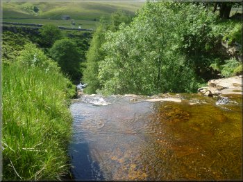
Heading down to Hell Gill
A first glimpse of Hell Gill Beck
Hell Gill from the footpath
We crossed Lady Anne's Highway and followed the public footpath down
past a small farmstead to a bridge over Hell Gill Beck at map ref. SD781966.
|
We tried to look down into the gorge of Hell Gill Beck from Hell Gill
Bridge but the sun was too bright to see anything beyond the overhanging
leafy branches.
Heading down to Hell Gill
Crossing Lady Anne's Highway
The "Stone Men" cairns on Wild Boar Fell
|
|
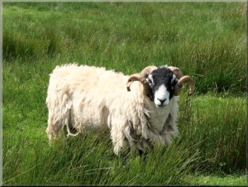
Swaledale tupp giving us a hard stare
Turning towards Hell Gill Force
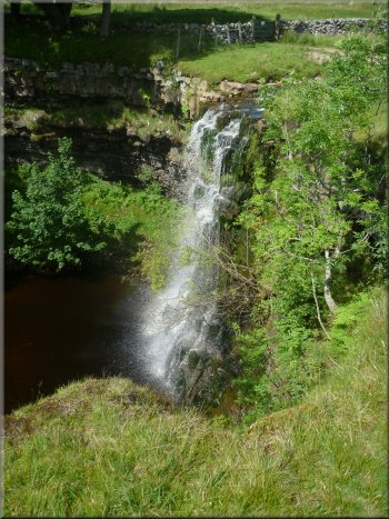
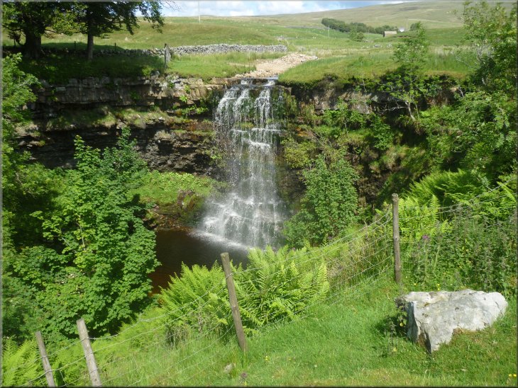
Hell Gill Force
It was very pretty indeed with the cascade of water falling around
8m from the top of a curved wall of rock into the pool below, with ferns
growing from the rocky banks. We were close to the end of our walk so
we sat for a drink just looking at this lovely scene.
|
Foot bridge over Hell Gill Beck
A few hundred metres farther on at map ref SD779965 we turned left
to walk about 30m to the top of Hell Gill Force. We walked around the
edge of the drop formed by the falls for a few metres to get a view
of the whole waterfall.
Approaching the head of the waterfall
The top of Hell Gill Force
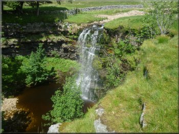
Hell Gill Force
|
Hell Gill Force |
|
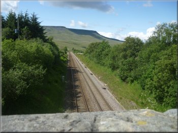
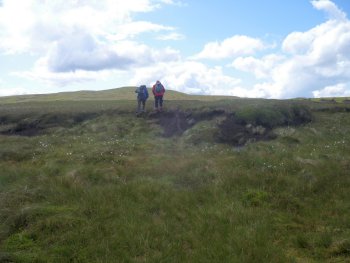
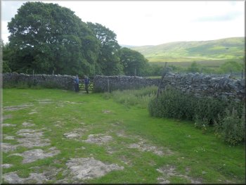
Crossing the Settle to Carlisle railway line
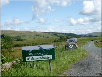
The North Yorkshire boundary at the road
We all got into Jim's car to drive to the start of our walk to collect
Ray's car. Then we all drove into Kirby Stephen for a coffee and toasted
tea cake to round off a lovely day out in the most wonderful open walking
country.
|
At last we had to leave and we followed the path from the falls across
the Settle to Carlisle Railway line and out to the road (B6259). Here
we had rejoined the county boundary just next to Aisgill Cottages at
the end of our walk.
The track out to the road at the end of our walk
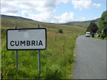
The Cumbria boundary at the road
|
Background Notes:
Here's another idea for a summer day out. This one is more adventurous and it's a linear walk so you need two cars to park one at the end of the route. The walk is 10km, about 6 miles, along Mallastang Edge above the Eden Valley. This is high wild country, open access land without a defined public right of way although there is a farmer's quad bike track to follow. You do need to be able to read your map and keep track of your position. You need good visibility to make the most of the fabulous scenery here.
The walk starts at the county boundary between North Yorkshire and Cumbria from a small car park off the high moorland road between Keld in Swaledale and the village of Nateby, near Kirkby Stephen. We start by following a quad bike track along the county boundary up a climb of about 120m, 350ft, for almost a kilometer to the summit of High Pike Hill.
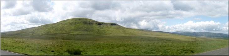
This is the start of the ridge above Mallerstang Edge, running roughly southwards at a height over 600m, 2000ft, forming one side of the Eden Valley. Sometimes, when a high pressure system is starting to develop over this area a thick white cloud gathers sitting along Mallerstang Edge. It rolls off the edge into the valley 400m, 1200 ft, below us to the west to dissipate into whispy strands and disappear as it goes. This is called the 'Helm Cloud' accompanied by a strong wind along the valley called the 'Helm Wind'. It is usually a harbinger of a spell of settled fine weather.
Already the grandeur of the scenery here is evident. At the top of High Pike Hill look around at the full 360 degree panorama! There are the North Pennines to the north, the distant Lake District ridges to the northwest, Wild Boar Fell and the Howgill Fells to the west, the Yorkshire 3 peaks to the south and the rolling hills of the Yorkshire Dales to the east. You'll want to just stand and look before continuing along the ridge heading south over a little summit called High Seat to Gregory Chapel with its tall cairn and ruined sheep shelter, at the halfway point along our route.
So far we have been following the undulating ridge, but from Gregory Chapel we start the long descent into the valley. The path drops down to skirt the top of a cliff called Hangingstone Scar. Over to our right, that's southeast, there is the beginning of a valley around a network of small moorland streams that merge to become Hell Gill Beck. This is the source of the River Eden that flows northwards along the Eden valley to Carlisle and out to sea via the Solway Firth on the west coast.
From Gregory Chapel we descend along a tongue of high moor land with the Eden Valley on our right and the developing valley of Hell Gill on our left until we reach an old green road at Hell Gill Bridge. This ancient trackway is Lady Anne's Highway. The Lady Anne in question is Lady Anne Clifford. The Cliffords were a very powerful family in the 1600's with many castles across Northern England including Skipton and Pendragon Castle in the Eden Valley, but Lady Anne's base was in Appleby Castle. She had the route improved all the way from Hawse to Kirkby Stephen for her to use on her inspections of her vast estates.
Our walk continues across Lady Anne's Highway straight down the hillside, but to our left, about 500m along it the old green road crosses another beck that if you look carefully at your map you'll see it's called the River Ure. Yes, it's true the River Eden and the River Ure rise a few hundred metres from each other on the same hillside and flow down into the same valley that has a hump in it so that the River Eden flows out to the west coast and the River Ure flows out to the east coast via the River Humber.
Down in the valley, just before our path crosses the Settle to Carlisle railway we make a short diversion to a lovely and quite impressive waterfall called Hell Gill Force, a very pretty spot indeed. From there we walk out to the road still on the border between North Yorkshire and Cumbria at the end of a really exhilarating walk.
top of page
|