| 2001 walks | 2002
walks | 2003 walks | 2004
walks |
| 2005 walks | 2006
walks | 2007 walks | 2008
walks |
| 2009 walks | 2010
walks | 2011 walks | 2012 walks |
| 2013 walks | 2014 walks | 2015 walks | 2016 walks |
| 2017 walks | 2018 walks | 2019 walks |2020 walks |
| 2021 walks | 1993-2000 library | Find a Route Index |
| A few Routes to print out | Request a Route... |
Route No. 452 - Sunday 25 January 2012
Church Houses, Bragg Farm, Blakey Ridge,
Rosedale Railway, Lion Inn, circuit - 10km
North York Moors . . .
Route map from Ordnance Survey
Open Space service.
Map: OS Explorer OL26 North York Moors Western area
Church Houses from the village hall where we parked |
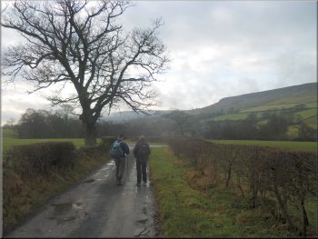
Lane from Church Houses to the Daffodil Walk
Path leading away from the river and up the hillside
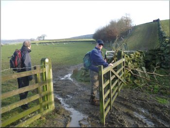
We followed the access tack through the buildings to a field gate
where and followed the path through the gate and along the side of the
River Dove. After about 300m at map ref. SE670968 we turned sharp left.
At this point the river makes a long pointed meander and the path makes
a shortcut across the head of the meander. We turned left in the middle
and headed for a gate in the wall at the top of the field. |
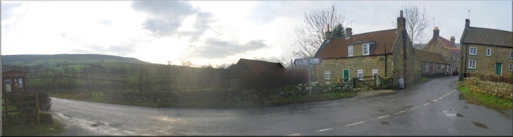
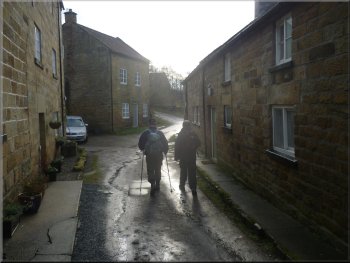
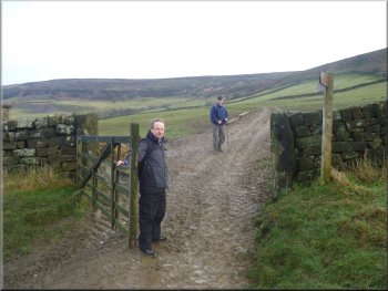
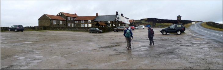
This morning three of us drove to the little village of Church Houses
in Farndale and parked the car by the wooden village hall at the road
junction at map ref. SE669975. From this junction we walked west past
the Feversham Arms pub and turned along the lane to the 'Daffy Cafe'
and the Farndale daffodil walk. After a few hundred metres we came to
a little cluster of stone buildings which includes the Daffy Cafe, closed
today.
Stone cottages by the Daffy Cafe
Looking back to the cottage above Bragg Farm
|
Approaching to public road above Bragg Farm
Crossing the field to climb up to Blakey Ridge
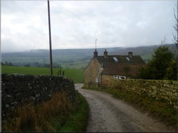
We passed a stone cottage where an elderly gentleman was waiting for
his lift into Kirkbymoorside. We continued to the public road at map
ref. SE676970. We crossed the road and followed a path heading northeast
climbing up the valley side. |
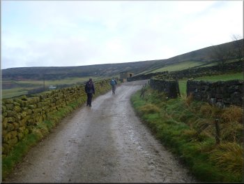
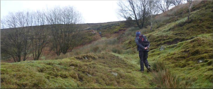
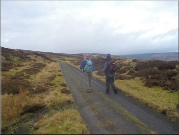
We began to climb up the valley side following a path along the edge
of the fields to skirt the edge of Bragg Farm. The path led us round
the front of the farm and up the farm access road.
Leaving the road to climb up to Blakey Ridge
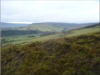
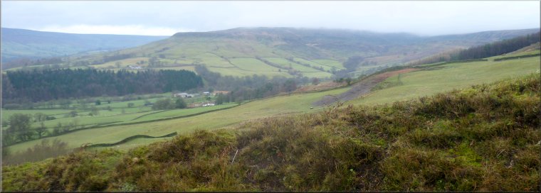
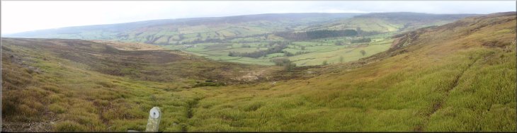
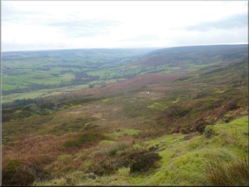
Looking across Farndale to Potter's Nab
|
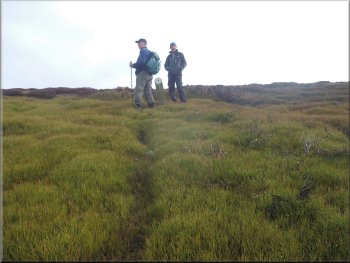
Steep path up to the gate onto the open moor |
Almost at the gate onto the open moor
Looking back across Farndale
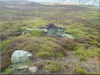
The first of a line of grouse butts
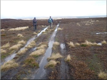
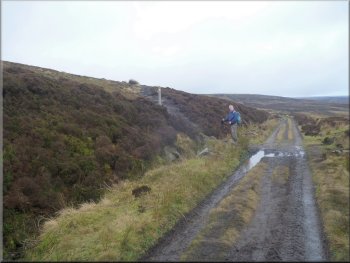
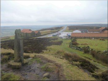
The marker turned out to be on a line of grouse shooting butts and
we followed the access path along the line of shooting butts for a few
hundred metres to the public road along Blakey Ridge. The line of shooting
butts is about 150m south of the line of the public footpath marked
on the map, but it was an easy route to follow and the moor is all open
access land. |
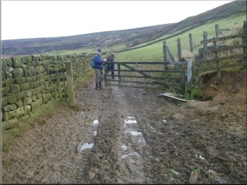
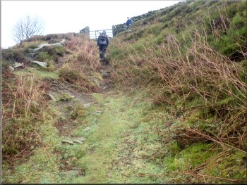
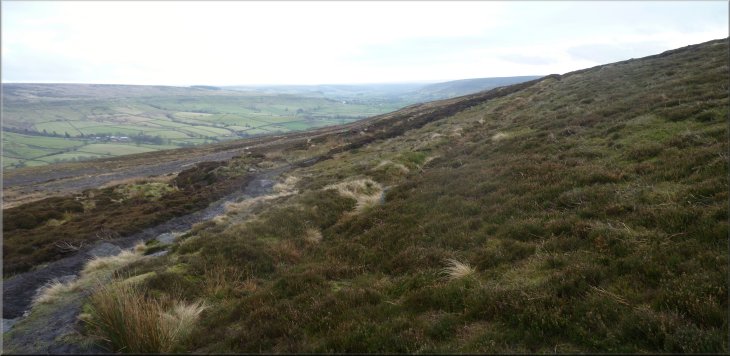
The path became steeper and after about 600m we reached a gate through
a wall out onto the open moor. From this position there was a good view
over Farndale. From the gate we could see a small marker post on the
skyline east of us and as we made our way towards it climbing steeply
up amongst the heather there was an ill defined path.
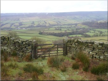
The gate onto the open moor
Climbing up the moor from the gate
Small marker post on the skyline from the gate
|
Looking back across Farndale from the small marker post
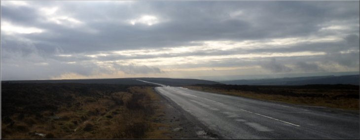
The public road along Blakey Ridge under a winter sky
|
Looking back along the track by the grouse butts
The track across to the Rosedale railway path
Looking down Rosedale from the railway path
We had joined the railway path about 150m south of the public footpath
marked on the map. We were south of a rectangular pond and the public
footpath is marked north of the pond. |
We crossed the Blake Ridge road and continued along another access
track on the other side of the road in the same easterly direction.
We kept on in this direction for about 500m until we came to the bed
of the old railway running around Rosedale.
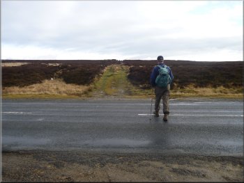
Crossing the Blakey Ridge road
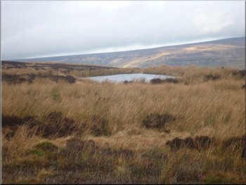
Rectangular pond to the north of our route
Heading for the Lion Inn along the railway path
|
Looking back across Rosedale from the path to the Lion Inn |
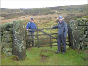
Leaving the railway path for the Lion Inn
We followed this path and crossed the road to the Lion Inn where we
had a very pleasant lunch at a corner table next to an open fire. It
was just what we needed on this sharp winter's day. |
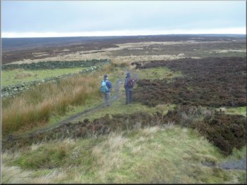
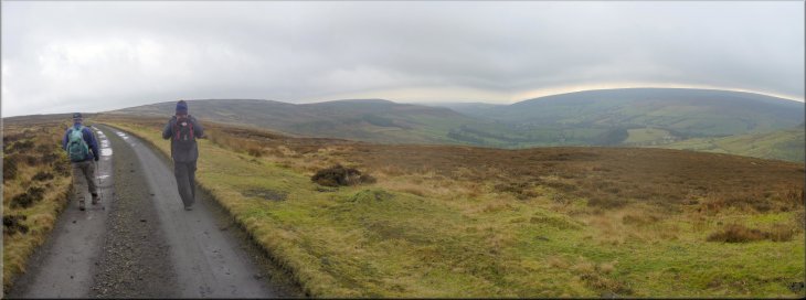
There was a good view along Rosedale and we followed the railway
path for almost 2km to map ref. SE682995 where there is a public footpath
off to the left climbing up across the moor to the road near the Lion
Inn on Blakey Ridge.
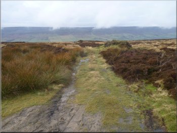
Path from the railway to the Lion Inn
|
Heading for the Lion Inn and our lunch
|
Looking back over the Lion Inn
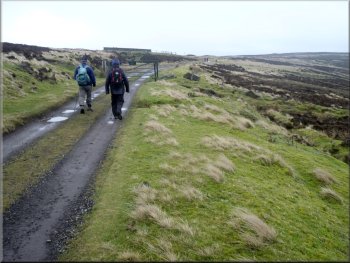
The railway path above Farndale
We turned left to walk along the railway path for about 1km to the
road from Farndale that comes up Blakey Bank. |
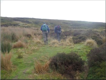
After quite a long break we had to set off again. We took the path
to the north of the pub and followed it down the moor to the railway
path above Farndale at map ref. SE675997.
Path down the moor from the Lion Inn
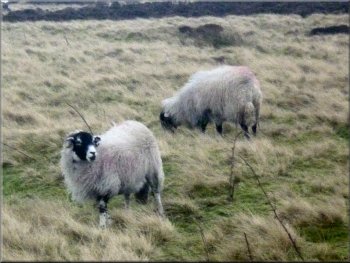
Swaledale sheep by the railway path
|
The railway path above Farndale |
Walking down Blakey Bank back to Church Houses
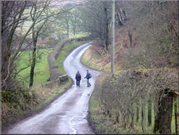
The road back into Church Houses
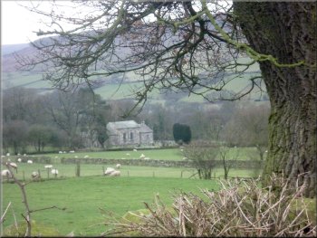
We could see the village church across the fields as we approached
the village and our car by the village hall. The whole walk had been
about 10km and including our rather leisurely lunch stop at the Lion
Inn it had taken us three and a half hours to walk. |
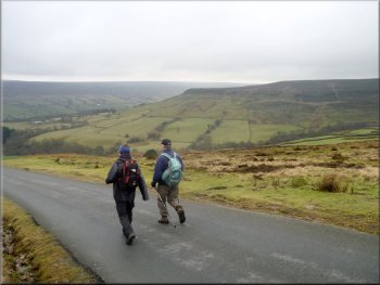
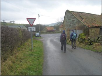
When we reached the road we turned right to follow the road for almost
2km down the steep descent back into Church Houses. There was a lovely
view of Farndale as we walked down the hill.
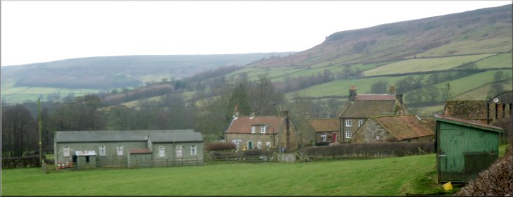
The village church at Church Houses
Arriving back at the car in Church Houses
|
Church Houses under Horn End Crag
|