| 2001 walks | 2002
walks | 2003 walks | 2004
walks |
| 2005 walks | 2006
walks | 2007 walks | 2008
walks |
| 2009 walks | 2010
walks | 2011 walks | 2012 walks |
| 2013 walks | 2014 walks | 2015 walks | 2016 walks |
| 2017 walks | 2018 walks | 2019 walks |2020 walks |
| 2021 walks | 1993-2000 library | Find a Route Index |
| A few Routes to print out | Request a Route... |
Route No. 456 - Thursday 23 February 2012
Forge Valley geological trail, Raincliffe Wood,
River Derwent circuit - 5km
North York Moors . . .
Route map from Ordnance Survey
Open Space service.
Map: OS Explorer OL27 North York Moors Eastern area
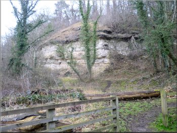
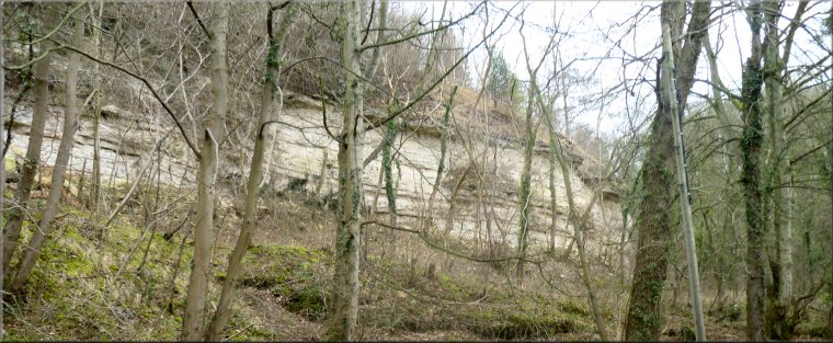
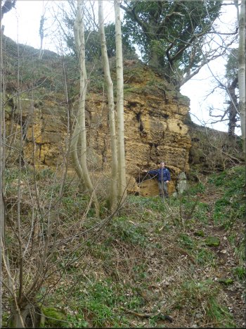
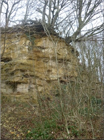
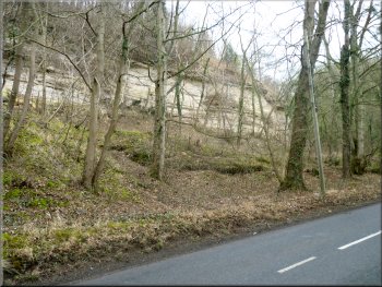
Whitestone Quarry seen from Seave Gill car park
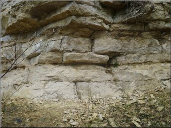
Massive blocks of Hambleton Oolite at Whitestone Quarry
Just next to the car park is Whitestone Quarry. It's disused now and
the rock exposed in the quarry face is called Hambleton Oolite that
is around 160 million years old. The quarry face looks almost as though
it has been built from huge blocks. The bedding planes are level and
the natural joint cracks are vertical giving the appearance of carefully
coursed blocks of stone. |
The weather forecast for today seemed to be better near the coast
so my mate, Jim, and I drove to East Ayton on the River Derwent at the
southern end of Forge Valley. We parked a few hundred metres north of
the village at the little car park at Seave Gill, map ref. SE989852.
We planned to walk the Forge
Valley Geological Trail from a leaflet published by Natural
England. The geological information in my notes of this route is
taken from the Natural England leaflet.
Massive blocks of Hambleton Oolite
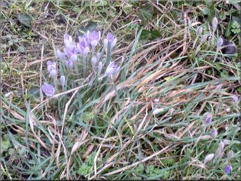
Is this flower Meadow Saffron, or Naked Lady?
If it is it should flower in the autumn, not early spring.
|
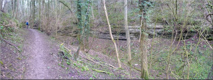
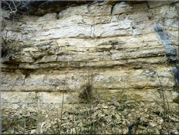
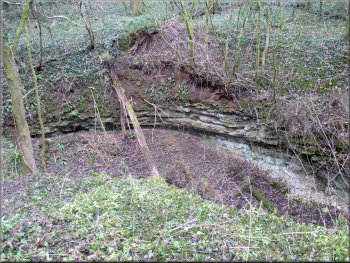
Hambleton Oolite beds in Seave Gill, undercut by the ice age torrent
of glacial melt water
Hambleton Oolite beds in Seave Gill, undercut by the ice age torrent
of glacial melt water
|
The path up Seave Gill
The melt water came from the glacier as the ice retreated at the end
of the last ice age. You can see where the water has eroded the softer
layers of the Oolite undercutting the harder layers above. |
After looking at Whitestone Quarry we set off from the car park to
walk up Seave Gill. The gill, or steep sided narrow valley, was formed
by a torrent of melt water.
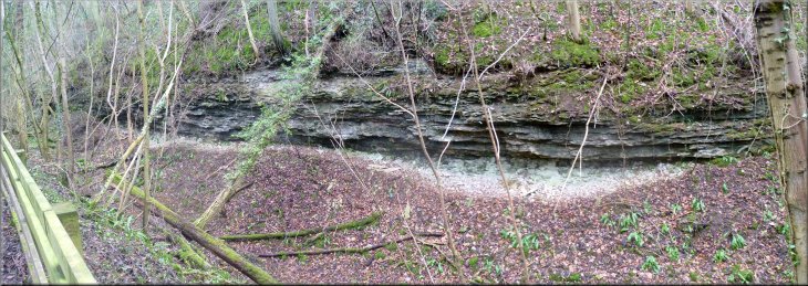
Hambleton Oolite beds in Seave Gill, undercut by the ice age torrent
of glacial melt water
|
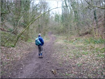
One of the little valleys that channeled melt water to Seave Gill |
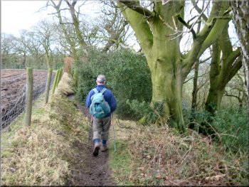
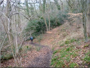
Our path up the other melt water channel
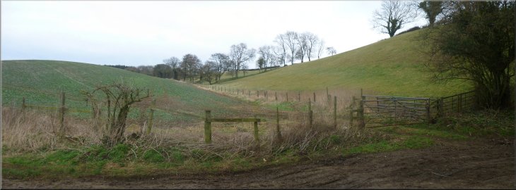
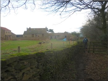
Path across the fields to Raincliffe Woods
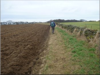
Path across the fields to Raincliffe Woods
At the last field boundary before the farm we turned right off the
access road to follow the fence to a gate through a wall at the end
of the field. We passed through the gate to walk around the edge of
a ploughed field next to the wall to the edge of Raincliffe Woods at
map ref. SE990875. |
At the top of the gill, map ref. SE992858, we followed the path bearing
left up one of the two melt water channels that fed into Seave Gill.
After a little over a kilometer we came to the access road leading to
Osborne Lodge farm. We turned left to walk along the access road.
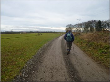
Access road to Osborne Lodge farm
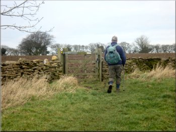
Path across the fields to Raincliffe Woods
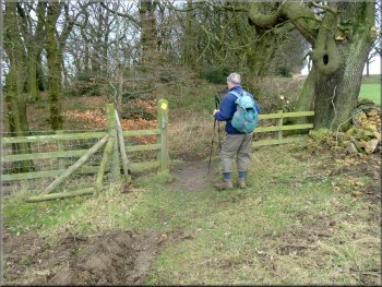
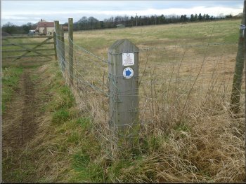
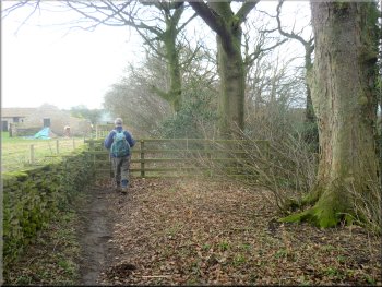
Gate into Raincliffe Woods
|
| |
|
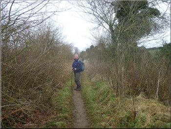
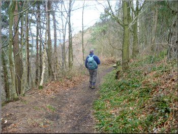
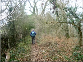
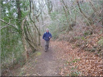
Path along the top edge of Raincliffe Woods
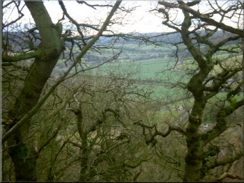
Looking across the Derwent valley
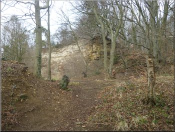
The path down to Whetstone Quarry
We turned left to drop down this path to Whetstone Quarry. The rock
here is a calcarious grit, a little older than the Oolites at 163 million
years. The rock was quarried to make whetstones for sharpening steel
tools. |
We went through a pedestrian gate into the wood and turned left to
walk along a narrow path alongside the fence at the top edge of the
woods. My map does not show a path all the way around the top edge of
the wood but there is one and it saves dropping down to a lower level
only to climb up again. Below the path at one point there is a large
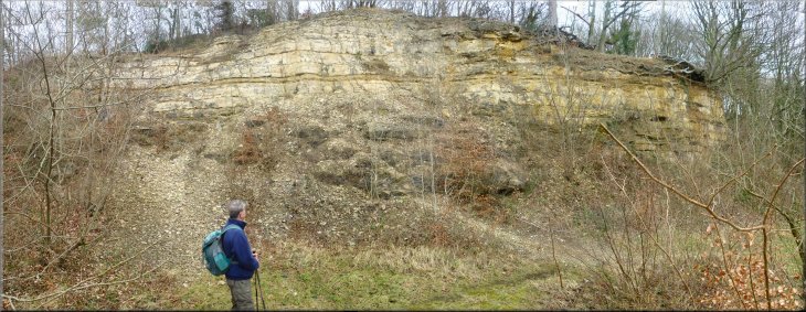
badger sett. We followed the path along the top of Whetstone Quarry
to map ref. SE986870 where a path from a lower level comes up the hillside
to join the top path.
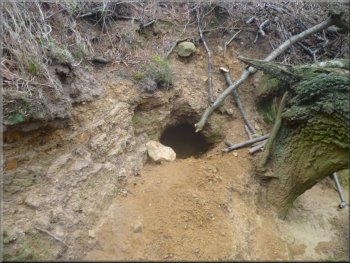
One entrance to a badger sett below the path
Whetstone Quarry
|
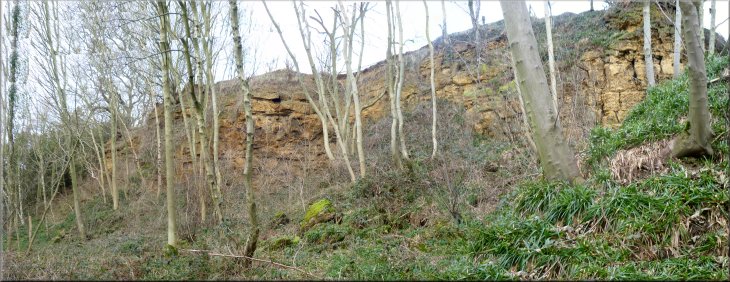
Whetstone Quarry
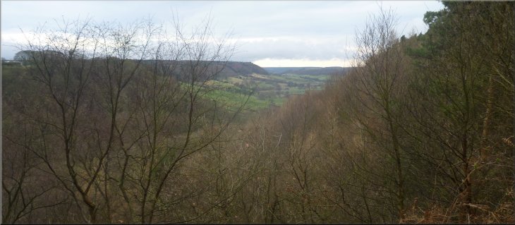
View up the Derwent valley from our lunch stop
|
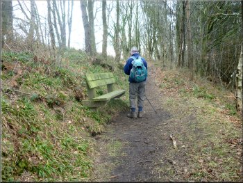
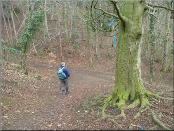
Leaving our lunch stop
The path past Osborne Lodge farm
She was happy to chat whilst we munched our sandwiches. After our break
we continued along the top path past Osborne Lodge farm where our leaflet
advised us to lookout for fossil shells in the stones of the dry stone
walls around the farm, but could not see any! |
From this quarry we retraced out steps to a view point seat near
the top path where we stopped for our lunch with a lovely view through
the trees and up the River Derwent valley. A very pleasant lady with
two short haired collie type dogs came by.
The path past Osborne Lodge farm
The top path beyond Osborne Lodge farm
|
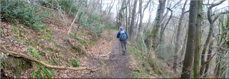
The middle path heading for Willis's Quarry
|
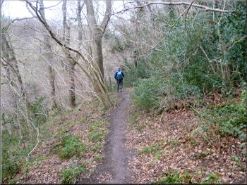
Dropping down from the top to the middle path
The middle path heading for Willis's Quarry
Willis's Quarry
The rock exposed here is the Hambleton Oolite again, a kind of limestone.
It was used for building stone and was burnt to make lime. |
We continued along the top path for another 600m beyond the farm
to map ref. SE986863. The top path goes on beyond this point, but here
there is a narrow little path off to the right the doubles back and
descends the wooded hillside to the middle path. From the middle path
you can see the road in the valley bottom below. We followed the middle
path for about 500m to Wallis's Quarry.
Dropping down from the top to the middle path
Willis's Quarry
|
Willis's Quarry |
Leaving Willis's Quarry
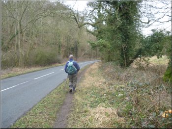
Following the road back to Seave Gill
Whitestone Quarry next to Seave Gill
The walk had been about 5km and it had taken us three hours to walk
with numerous stops to read the leaflet and try to find the geology
it had explained. It is a very pleasant walk through Raincliffe Woods
made all the more interesting with the Forge
Valley Geological Trail leaflet. |
From Willis's Quarry we followed the path out to the road at the
quarry car park. We walked along the road next to the river Derwent
for about 250m to a weir and river gauging station opposite Whitestone
Quarry and Seave Gill car park and the end of our walk.
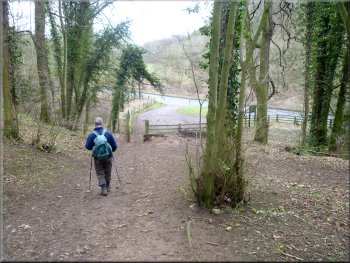
Dropping down to the road from Willis's Quarry
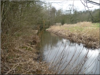
The River Derwent near Seave Gill
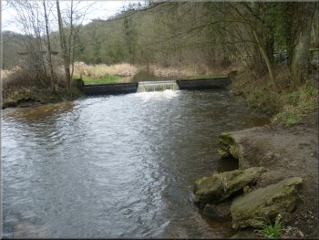
Weir on the R. Derwent at Seave Gill
|
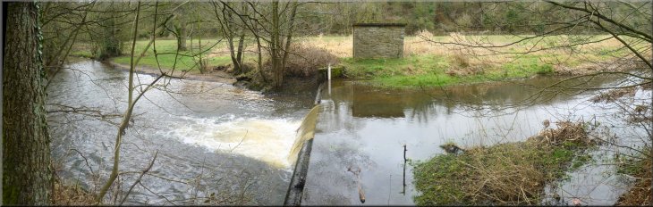
River gauging station on the Derwent opposite Seave Gill car park |
Background Notes:
This walk is based on the Forge Valley Geological Trail in Raincliffe Woods near Scarborough. There is a leaflet about the trail published by English Nature that is free to download from their web site. My version of the walk starts in Forge Valley at Seave Gill car park a few hundred meters north of East Ayton. The route goes to several disused quarries and the first of these is right next to the car park where we're straight into the local geology with Whitestone Quarry. The rock exposed in the quarry face is Hambleton Oolite, a type of limestone that was formed when this whole area was under a shallow tropical sea, a bit warmer than the east coast these days. This limestone has roughly level bedding planes and frequent vertical joints and these cracks together give the quarry face the appearance of having been built out of large limestone blocks. If you look carefully at the loose stones on the quarry floor there are tiny fossils of the corals and other creatures that lived in those tropical seas about 160 million years ago. From the quarry we return to the car park and walk up Seave Gill. This is a deep steep sided channel cut into the rock by a huge flow of glacial melt water as the ice retreated at the end of the ice age. At several places you can see in the side of the gill the Hambleton Oolite limestone exposed by the rushing water and worn away undercutting the harder slabs of the Malton Oolite above it. There's a good example of this at the top of the gill where the old watercourse swirled round a bend wearing away the rocks on the outside of the bend. At the top of the gill our path tuns left to go up an other little gulley between the fields and where the path turns left there is another shallow valley going straight ahead. These are the two main meltwater channels that fed into Seave Gill. We follow a series of paths and tracks across the fields to the edge of Raincliffe Woods. At the woods we follow a path along the top edge of the wood with the fields on our left. We walk along the top of Whetstone quarry and then double back to drop down to the quarry floor. This quarry was worked for the whet stone, a kind of gritty limestone, to be used for sharpening steel tools. It's quite a high quarry face and at one end of the quarry there's a large badger sett. From the quarry we retrace our steps back up to the path around the top edge of the woods and just before we reach the top there is a seat by the path with a lovely view up the valley of the River Derwent to Hackness. We follow the path along the top edge of the woods past Osborne Lodge farm where the stone that were used to build the drystone walls are said to contain many fossils of tiny sea creatures. They are not easy to find as much of the walls by the path are coverd with moss and anyway you should just look, not touch or damage the walls at all. Beyond the farm we drop down through the woods to the middle path along the valley side to Willis quarry. The rock here is the Hambleton Oolite again that was used as a building stone and burnt to make lime. You should be able to find small fossils in the rock fragments on the quarry floor. From this quarry we drop down to the road by the River Derwent and follow the river a few hundred metres back to Seave Gill and the end of our walk.
top of page
|