| 2001 walks | 2002
walks | 2003 walks | 2004
walks |
| 2005 walks | 2006
walks | 2007 walks | 2008
walks |
| 2009 walks | 2010
walks | 2011 walks | 2012 walks |
| 2013 walks | 2014 walks | 2015 walks | 2016 walks |
| 2017 walks | 2018 walks | 2019 walks |2020 walks |
| 2021 walks | 1993-2000 library | Find a Route Index |
| A few Routes to print out | Request a Route... |
Route No. 470 - Tuesday 22 May 2012
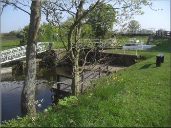
Langthorpe picnic area, Milby Cut, Milby,
Kirby Hill, Moor Lane, River Ure circuit - 7km
Boroughbridge . . .
Route map from Ordnance Survey
Open Space service.
Map: OS Explorer 299 Ripon & Boroughbridge
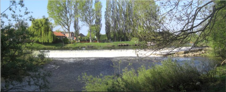
Looking across the River Ure to the weir from the Langthorpe car park
at Boroughbridge |
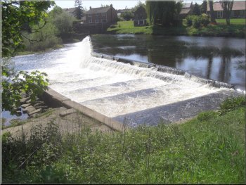
The fish ladder at the weir
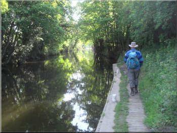
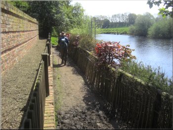
Tow path by the Milby Cut
It's a short flat walk that should be just right for both of us with
our dodgy knees today. The car park looks across the River Ure with
a long weir just upstream and a fish ladder consisting of a series of
cascading pools to allow migratory fish, salmon & trout, to climb
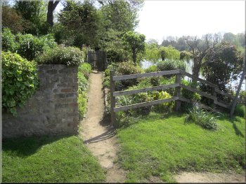
up and bypass the weir From the car park we crossed the road and went
through the little gate to the canal tow path. |
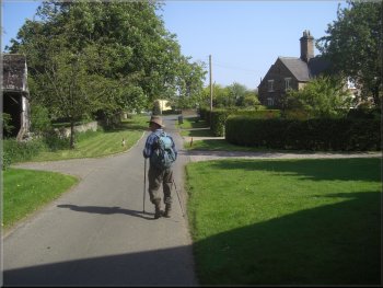
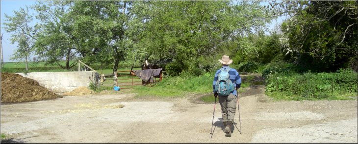
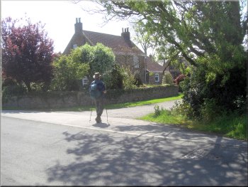
It was a fine sunny day today and my mate, Jim, and I drove to Boroughbridge,
less than 30 minutes from home and parked at the Langthorpe car park
and picnic site on the northern edge of the town next to the River Ure
at map ref. SE395671. The entrance to the car park is off a roundabout
between the Milby Cut canal and the River Ure. The route we planned
to walk today is described on an information
board in the car park.
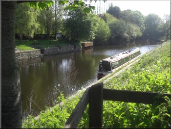
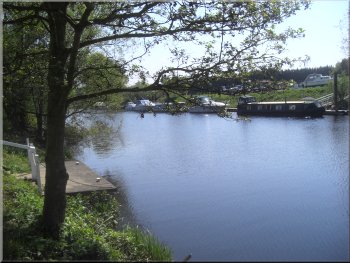
The moorings on the Milby Cut at Boroughbridge
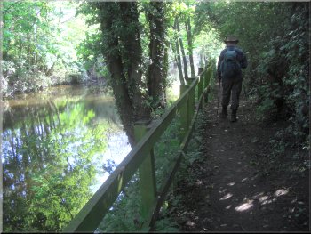
Tow path by the Milby Cut
|
Path on Milby Island between the canal & the River Ure
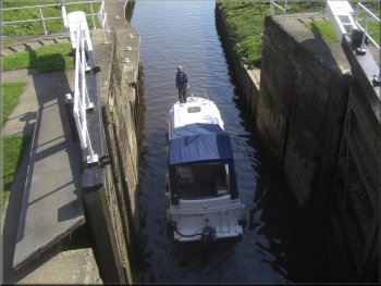
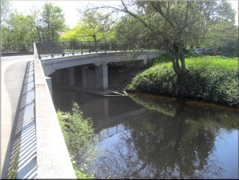
Canal lock at Milby
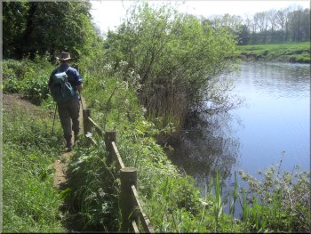
The land really is an island between the canal and the River Ure. At
the canal lock we crossed the canal on the footbridge and turned on
to the track to the hamlet of Milby. |
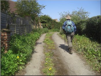
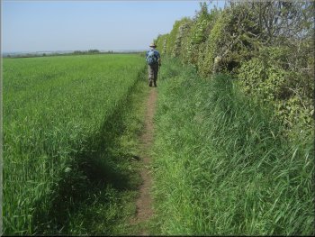
We walked along the tow path for about 700m to the Milby lock on
the canal. The path follows a pleasant route along a strip of land called
Milby Island.
Canal lock at Milby
Canal lock at Milby
|
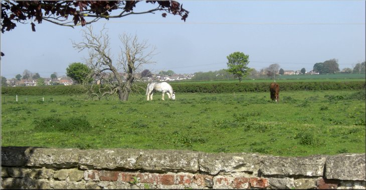
Horses grazing on the edge of Milby |
Track from the canal into Milby
Walking through the hamlet of Milby
Our route through the farm buildings at Milby
With the decline of the railways in the twentieth century the line
was closed in the mid 1960's and the tracks removed. There remains a
low iron railway bridge on the line a few hundred metres to the southwest
of our track into Milby. We walked along the road through Milby and
crossed the busy Boroughbridge to Easingwold road at map ref. SE402678.
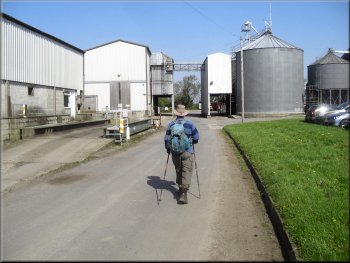
Once across the road we continued along a farm access road through the
complex of farm buildings. |
About 100m from the canal the track crosses the route of a long since
abandoned
railway, but to the left of the track the low embankment of the
railway bed is still visible. The railway, opened in 1847, was a branch
line to Boroughbridge from Pilmoor on the east coast main line between
Easingwold & Thirsk. It was a busy line carrying passengers and
all manner of goods including livestock.
Route of the abandoned branch line to Boroughbridge
Start of the access road through the farm at Milby
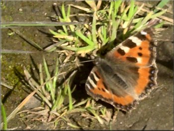
Small tortoise shell butterfly on the path
|
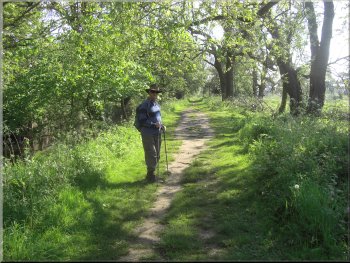
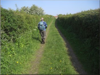
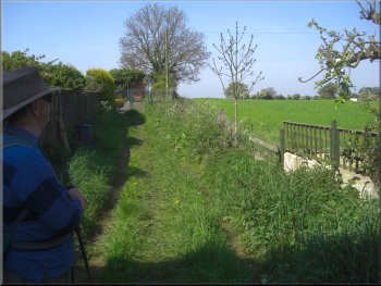
Start of the track between the fields from the farm at Milby |
Track between the fields heading for Kirby Hill
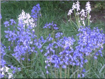
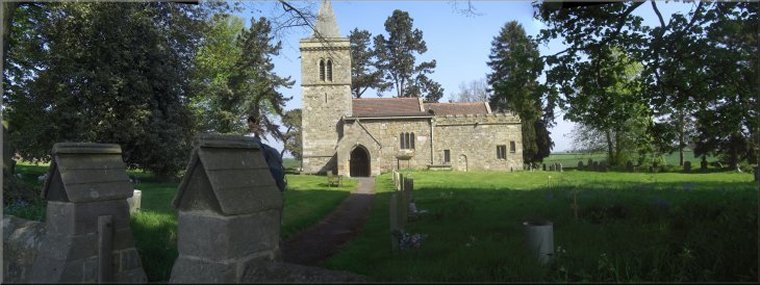
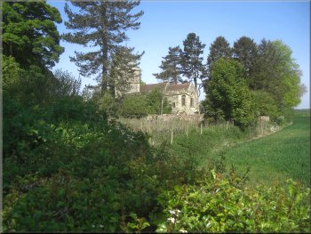
Bluebells in the churchyard at Kirby Hill
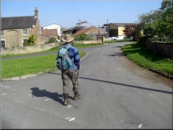
From there we walked along the road to All
Saints Church at Kirby Hill on the edge of the village at map ref.
SE393686. The church web site says that the original buildings were
Saxon and the present church is a grade 1 listed building. |
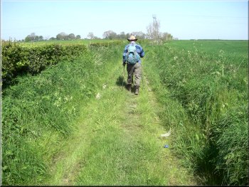
The access road through the farm buildings brought us to a pleasant
track between the fields that led to the road at map ref. SE396684 near
Kirby Hill.
All Saints Church at Kirby Hill
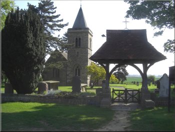
All Saints Church at Kirby Hill
|
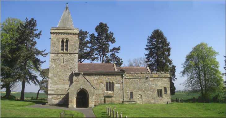
All Saints Church at Kirby Hill |
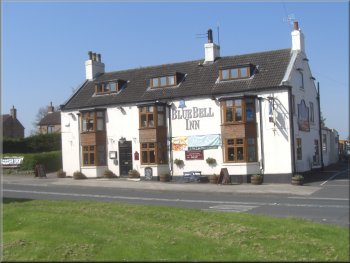
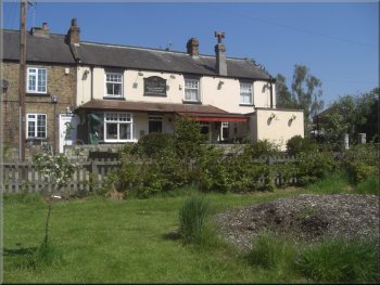
The Blue Bell Inn at Kirby Hill
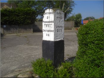
Old mile post on the Great North Road
Just beyond the inn is an old mile post from the days of the stage
coach route north with the towns of Catterick, Piercebridge and Gretabridge
singled out for mention, I imagine because they were also staging posts
along the route. From the inn we walk about 200m along the road to a
turning on the right hand side of the road with a sign post fixed to
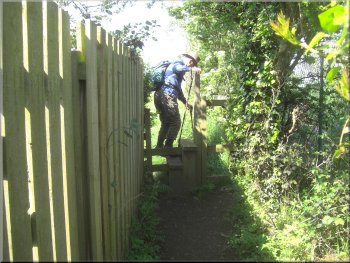
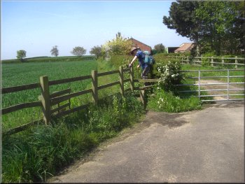
the wall, indicating a public footpath. |
From the church we followed the road through the village to the B6265.
On the opposite side of the road is the Blue Bell Inn and at the edge
of the pub car park is a small somewhat dilapidated brick building with
a pantile roof that was originally used as a cell to hold prisoners
overnight on their way to the courts in York. At the Blue Bell Inn we
turned left to walk along the main road.
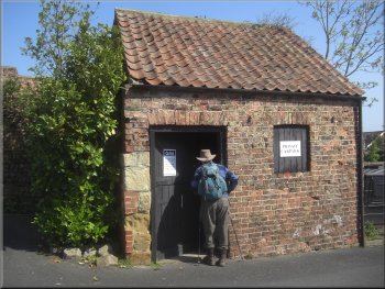
The old prison cell next to the Blue Bell Inn
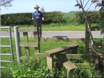
Our turning off the road to a footpath
|
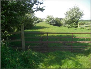
Start of the path away from Kirby Hill
Path around the sub-station
We followed the path across the fields to a farm access bridge over
the A1 Motorway at map ref. SE384683. The old A1 was a coaching route
to the North that ran through Boroughbridge where there were numerous
coaching inns for a change of horses or overnight accommodation. |
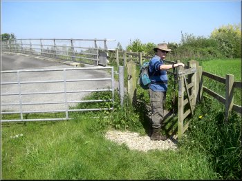
We turned on to this track and followed its winding route to an electricity
sub-station where at first glance the path disappeared, but in fact
there is a stile on the left next to the sub-station and a path between
the fences that skirts the sub-station and leads out to the fields.
The path away from Kirby Hill
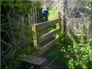
Stile to bypass the sub-station
Path across the fields to the A1 Motorway
|
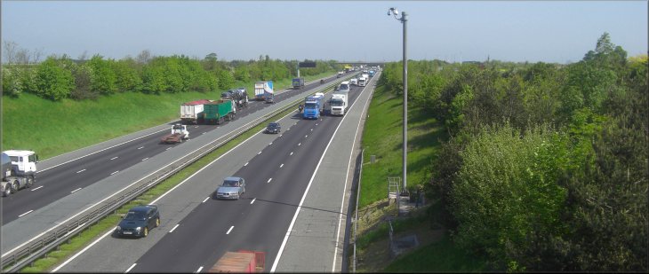
Looking north along the A1 Motorway from the farm access bridge
|
Start of the farm access bridge over the A1(M)
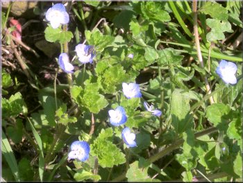
Speedwells by the path
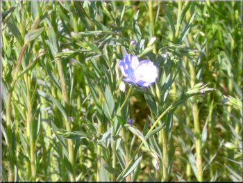
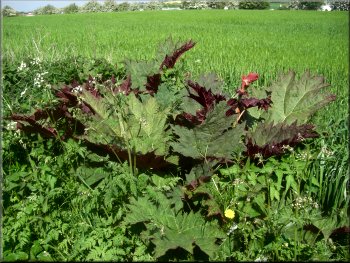
A large field of Flax just coming into flower
My mate, Jim, and I are both quite deaf and a car came along the lane
behind us without either of us noticing. When we did notice and step
aside the young man driving with his window down shouted and gesticulated
in an angry manner but being deaf his words were lost on us both. After
a little over 1km along the lane we came to a junction at map ref. SE384673
where we turned left to walk along the road under the A1Motorway to
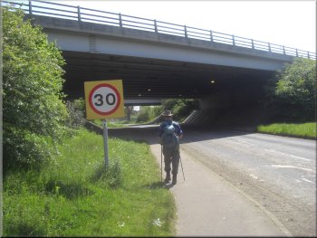
the edge of the village of Langthorpe. |
The A1Motorway is a very busy route and streams of car and lorries
passed beneath us as we crossed the bridge. We followed the path down
the side of Cottage Farm to a quiet little lane at map ref. SE381683.
At the lane we turned left and walked along it. As we walked along the
lane we noticed an unusual crop in a large field on our right which
turned out to be flax with its delicate pale blue flowers just starting
to open. The seeds are used to make linseed oil and the plant stems
are used to make the flax fibre for the manufacture of linen cloth.
Path down the side of Cottage Farm
Stile to the road at Cottage Farm
A1(M) bridge over the road on the edge of Langthorpe
|
Turning off the road in Langthorpe to the river
Riverside path along the back gardens of Langthorpe
Path beside the River Ure at Langthorpe
We walked down this access track for about 80m to the bank of the River
Ure. At the river bank we turned left to follow the riverside path downstream
towards Boroughbridge. |
After about 250m along the road we turned right off the road on to
an access track at the side of a house at map ref. SE388672.
The riverside on the edge of Langthorpe
Riverside path along the back gardens of Langthorpe
Moorings & boat repair yard on the River Ure
|
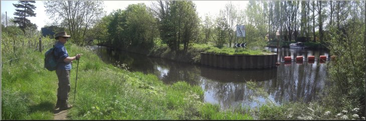
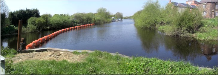
Milby Cut on the left & the River Ure heading for the Boroughbridge
weir on the right |
The Anchor Inn near the end of the walk
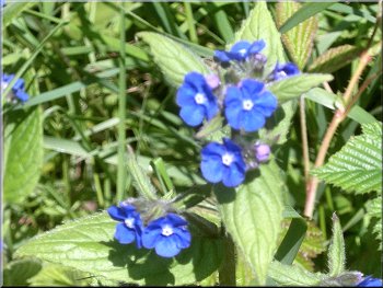
Speedwells in the picnic site by the river
From there we returned to the Langthorpe picnic site. Our walk had
been about 5km and it had taken us about two and a half hours to stroll
in the warm sunshine. |
We walked along this path between the garden fences and the river
bank for about 700m to the Anchor Inn at the roundabout on the edge
of Boroughbridge.
Milby Cut at the roundabout at the end of the walk
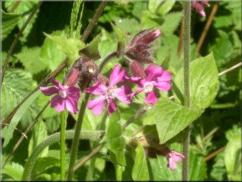
Campion in the picnic site by the river
|
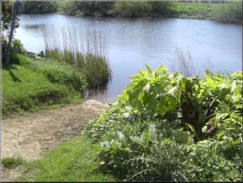
Looking upstream along the River Ure from the picnic site at the end of
Milby Island |