| 2001 walks | 2002
walks | 2003 walks | 2004
walks |
| 2005 walks | 2006
walks | 2007 walks | 2008
walks |
| 2009 walks | 2010
walks | 2011 walks | 2012 walks |
| 2013 walks | 2014 walks | 2015 walks | 2016 walks |
| 2017 walks | 2018 walks | 2019 walks |2020 walks |
| 2021 walks | 1993-2000 library | Find a Route Index |
| A few Routes to print out | Request a Route... |
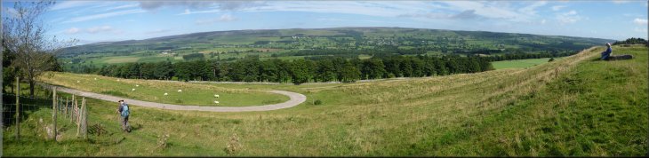
Route No. 483 - Tuesday 4 September 2012
West Witton, Templars' Chapel,
Swinithwaite, River Ure, circuit - 10km
Wensleydale . . .
Route map from Ordnance Survey
Open Space service.
Map: OS Explorer OL30 Yorkshire Dales Northern & Central areas
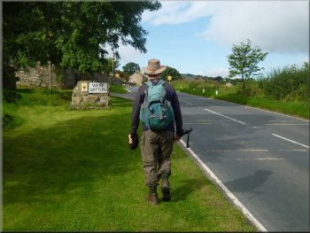
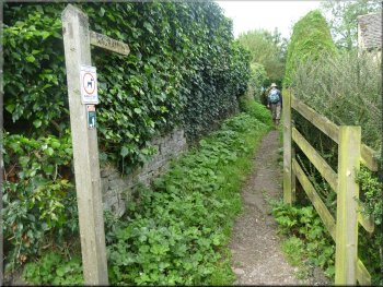
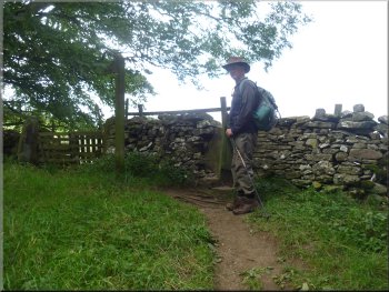
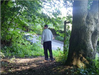
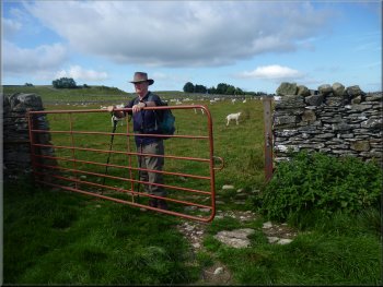
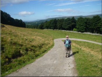
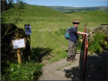
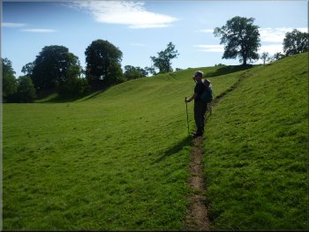
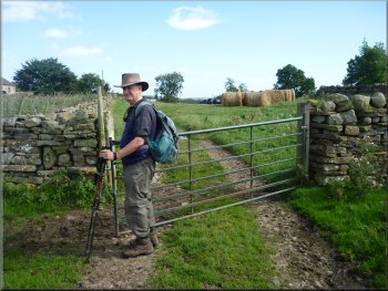
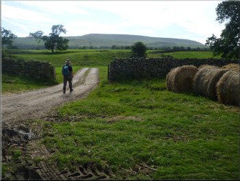
Setting off from the lay-by at West Witton
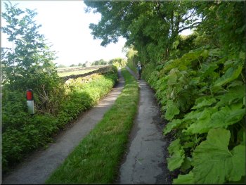
Path off the road to our right
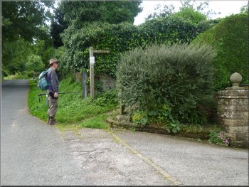
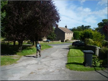
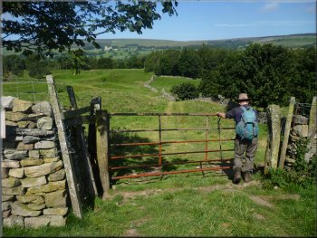
There in the village at a road junction we turned off the main road
to walk along a minor road heading south for about 140m to map ref.
SE062882. Here we turned right off the road onto a footpath out to the
fields. |
This morning my mate. Jim, and I drove up Wensleydale to West Witton
and parked off the road (A684) at a little lay-by just before the village
at map ref. SE066884. From the lay-by we walked about 400m along the
road.
Our turning off the main road in West Witton
Following the path to the fields
|
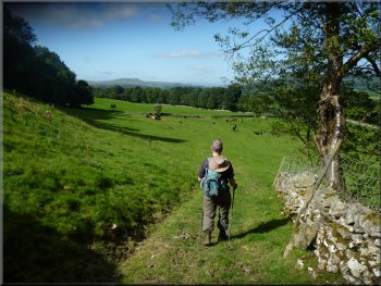
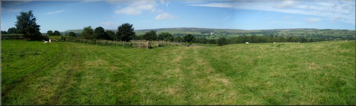
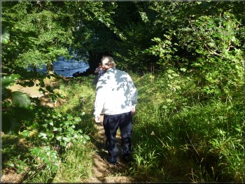
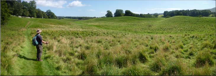
The path out across the fields
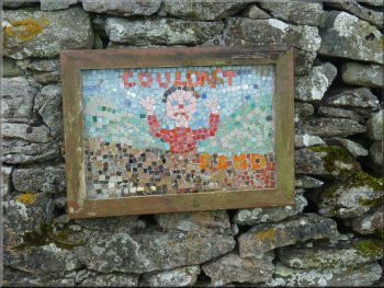
Nursery rhyme mosaic on the Bartle
Trail
Here we turned left to take the path heading south along the field
edge to some woodland about 150m away. At the end of the field we went
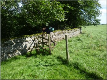
through a stone squeeze stile in the wall to enter the woodland. |
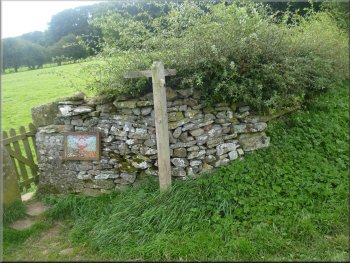
About 200m from the road there is a finger post indicating a fork
in the path. There's a small mosaic on the wall by the finger post.
The mosaic is one of a series of six small mosaics around a short walk
at West Witton called 'The Bartle Trail' and there's a leaflet
you can download giving details of the route. West Witton is known
for the annual celebration of Burning
the Bartle.
Looking back towards West Witton
Taking the left fork up the field edge
|
Looking back down the slope towards West Witton from the edge of the wood |
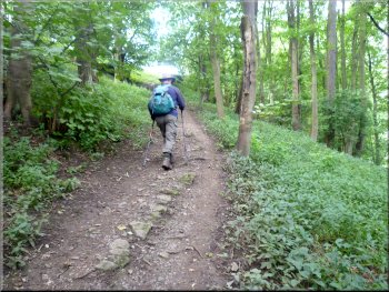
Climbing up through the wood
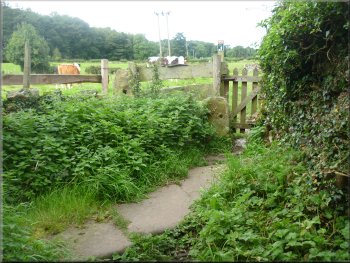
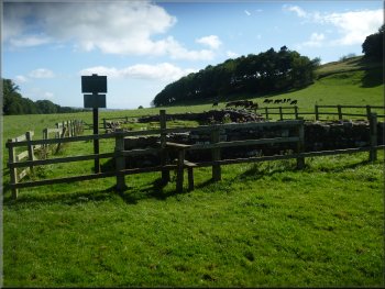
Crossing the fields to the caravan site
We followed the path down some steps into the caravan site. The public
footpath goes to the right following the access road through the site. |
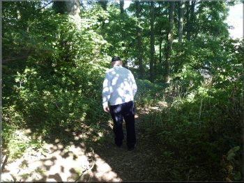
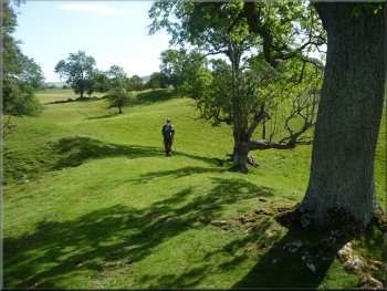
We followed the path up through the woodland to the fields above
the wood. We continued along the path across the fields to the edge
of a large caravan site.
Leaving the wood to cross the fields
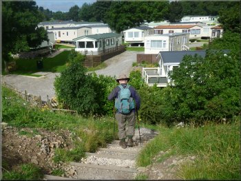
Steps down to the Chantry caravan site
|
After about 30m we turned left
We dropped down a steep slope to a minor road
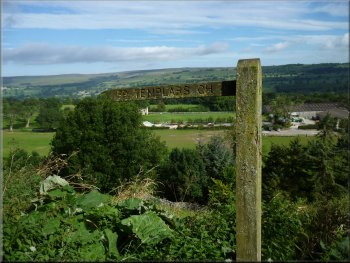
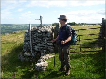
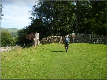
Finger post pointing to the Templars Chapel
We turned left at the road and walked along the road for about 300m
to map ref. SE053882. Here the road bears left climbing up the hillside
and the access road to the caravan site comes in from the left. Straight
ahead is a footpath along a green track with a finger post indicating
that it leads to the Templars' Chapel. |
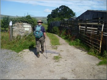
After about 30m we turned left along the access road and then immediately
turned right off the access road onto a path between the caravans. I
didn't notice any footpath sign here. The only landmark I could see
was a bright red dog waste bin at the turn. We walked along the path
between the caravans leaving the site to enter a belt of trees and drop
down a steep slope to a minor road.
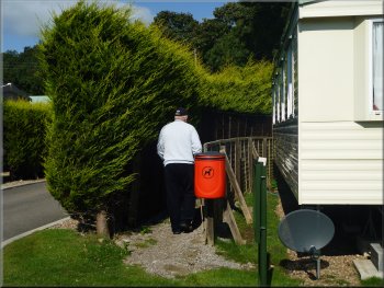
A bright red dog waste bin at the turn
We dropped down a steep slope to a minor road
The path to the Templars Chapel
|
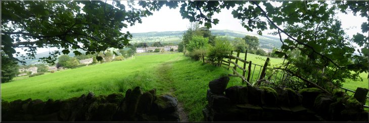
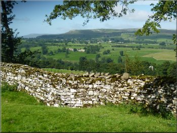
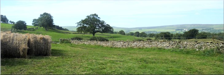
Looking across Wensleydale from the path to the Templars Chapel
Looking across Wensleydale from the path to the Templars Chapel
|
The path to the Templars Chapel
The path to the Templars Chapel
The path to the Templars Chapel
Another string of horses was working on the gallops near by. We continued
along this path for about 1.5km to a view point above a concrete farm
access road at map ref. SE039886, overlooking Wensleydale to Bolton
Castle |
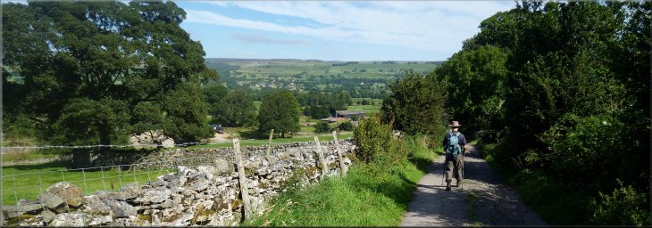
We followed this path with lovely views across Wensleydale to our
right. There was a race horse training establishment below us with a
string of horses exercising in the yard
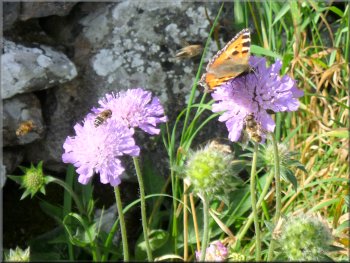
Tortoise shell butterfly on scabius flowers
The path to the Templars Chapel
The path to the Templars Chapel
|
View point above a concrete farm access road overlooking Wensleydale
to Bolton Castle
|
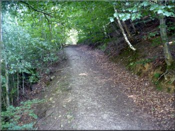
Following the farm access road down the hillside
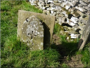
Victorian replica of a marker at the edge of the Knights Templar land
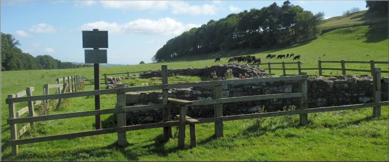
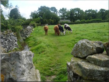
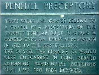
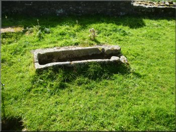
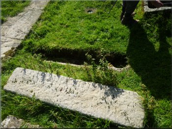
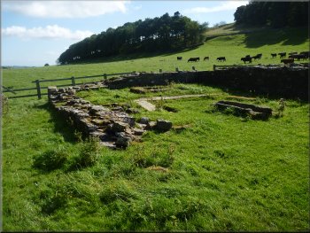
The path led us down past the wood and across some pasture land where
a herd of beef cattle was grazing. In the bottom left hand corner of
this field in a small enclosure containing the ruins of the Knights
Templars Chapel. There's a cast iron information plaque with some
background details about it. |
We dropped down onto the concrete access road and walked along it
down hill for about 100m. Here we turned left off the access road to
follow the path along the edge of a wood.
Path off the access road along the edge of a wood
Path across the field to the Templars Chapel
|
The Penhill Preceptory or Chapel of the
Knights Templar built around 1200 |
 |
 |
 |
 |
 |
 |
View across Wensleydale from the path
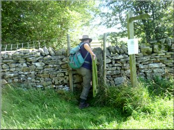
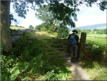
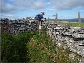
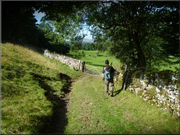
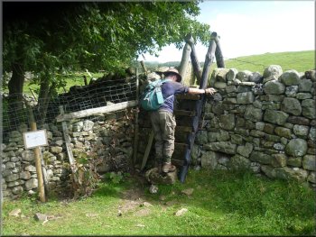
Awkward squeeze stile to the lane above Swinithwaite
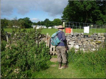
After about 700m we came to a stile onto a lane at map ref. SE041889.
Here we turned left to walk down the lane for about 250m to the village
of Swinithwaite. |
After inspecting the ruins we took the path heading roughly eastwards
along the edge of the grassland next to a strip of woodland running
along the valley side.
Path along the edge of the grassland
The lane entering Swinithwaite
|
The lane down the hillside to Swinithwaite |
Path from Swinithwaite down to the River Ure
Permissive path to Redmire Force
It was lunch time so we stopped at the cafe for a coffee and a very
nice bacon sandwich |
At the village we turned right to walk along the main road (A684)
for about 100m. Here we turned left off the main road to follow a public
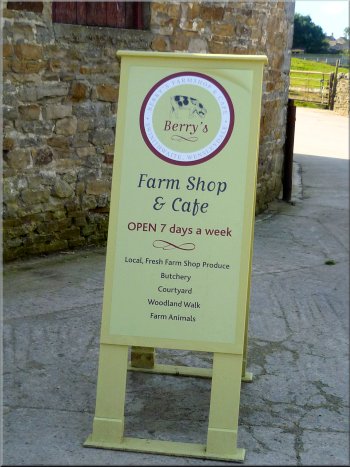
footpath along a stony track past the back of Swinithwaite Hall. At
the entrance to the hall farm there was a sign advertising a cafe
and farm shop called Berry's.
Farm shop & cafe entrance off the path
|
Path across Berry Meadow to the river
The path passed through a series of large mounds to the strip of woodland
above the river Ure. The mounds continue both east and west of here
and they are in fact glacial moraines, heaps of small rounded rocks,
pebbles and gravel dropped by the melting glacier at the end of the
last ice age. |
After our break we continued along the track and about 100m further
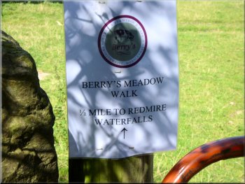
on there is a sign on a field gate informing walkers of a permissive
path across Berry Meadow to the path along the bank of the River
Ure. We turned left off the track to follow this permissive path across
the fields.
Path across Berry Meadow to the river
|
Path across Berry Meadow to the river
|
The path was high above the river
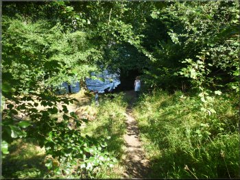
Path down the steep bank to the river's edge
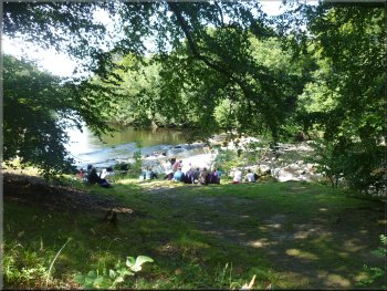
Popular spot on the river bank at Redmire Force
It's a very pretty spot and we stood and watched the river for a while.
Then we followed a broad path back up the hillside and continued through
the moraines along the path above the river.
|
At the river the path was high above the river and we passed through
a gate to some steps down the steep bank to the river's edge at a waterfall
called Redmire Force.
Steps down the steep bank to the river's edge
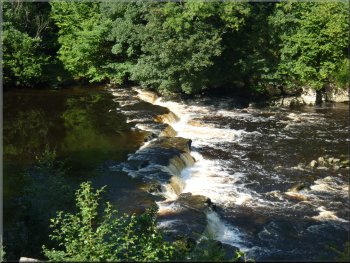
Redmire Force on the River Ure
Broad path back up the hillside from the river
|
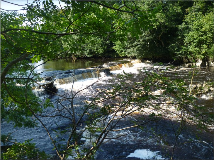
Redmire Force on the River Ure
Path above the river through the moraines
|
Following the path above the River Ure
Following the path above the River Ure
Here there is a finger post indicating a path off to the right heading
south east. |
We followed the path along the riverside for about 1.2km to map ref.
SE054898.
Following the path above the River Ure
Following the path above the River Ure
|
Finger post pointing to a path to the right
The old by-way at Wanlass Farm
At the access road, at map ref. SE059895, we turned right to walk
along the farm access road towards West Witton. |
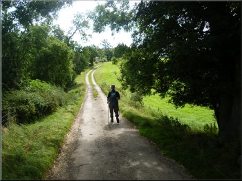
We followed this path for about 350m to join the route of an old
by-way. This old route led us to the access road to Wanlass Farm.
Old by-way to Wanlass Farm
Following the farm access road towards West Witton
|
Looking back along the old by-way from Wanlass Farm |
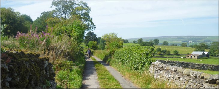
Following the farm access road towards West Witton
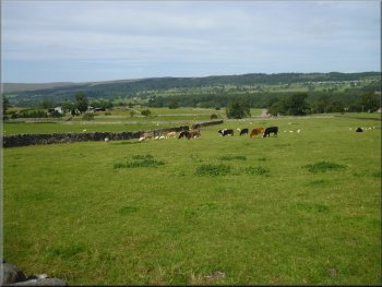
Looking across Wensleydale from the farm road
The whole route had been about 10km and it had taken us around four
hours to walk including our cafe stop for lunch. |
We followed the access road for about 1.4km back to the main road
in West Witton and at the main road we turned left to walk along the
main road back to our car at the lay-by and the end of our walk.
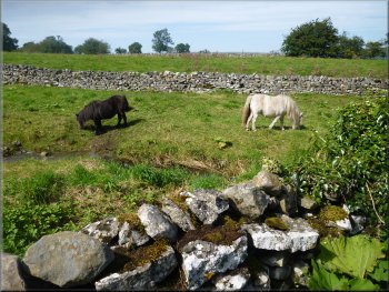
Ponies by the road near West Witton
Following the farm access road towards West Witton
|
Approaching West Witton along the Wanlass farm access road at the end
of the walk
|
Background Notes:
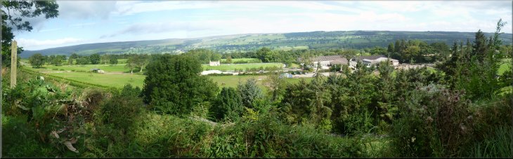
This walk is a circular route of 10km about 6 miles from West Witton in Wensleydale. There's a tradition here of 'Burning the Bartle' on St Bartholemews day each year. Bartle is an old nick-name for Bartholemew and the village church is St Bartholemews. One story tells of the villagers trying to hide a wooden statue of St Bartholemew when such Catholic icons were being destroyed at the Reformation in the 1500's. The traditional event takes an effigy of the statue, 'The Bartle', around the village ending with the burning of the effigy and general festivity. It's likely that the roots of this event go right back to pagan times and represent a festval celebrating the harvest.
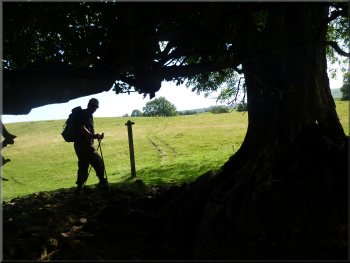
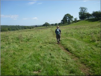
We head out of the village up the south side of the valley along an old track with amazing views across Wensleydale. At one point we pass a mosaic set into a wall. This is one of half a dozen mosaics done by children of the village marking the route taken by the Bartle, called the Bartle Trail.
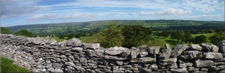
After about 2.5km we reach the ruins of the 'Penhill Preceptory'. This is a chapel built by the Knights Templar around the year 1200. They were an order of monks who were also soldiers. They ran estates, called preceptories, in England to raise funds for the crusades. The walk passes a Victorian copy of a medieval boundry stone marking the extent of the Templars lands. When the crusades ended the Tempars became too rich and powerful and the order was disbanded by the Pope in the early 1300's. The king passed their lands to a more benign order called the Knights Hospitallers and the buildings here fell into disrepair.
From the ruins we head down into the village of Swinithaite where at Swinithwaite Hall Estate there is a very nice cafe and farm shop that opened last Spring. Quite handy for lunch if you time the walk right.
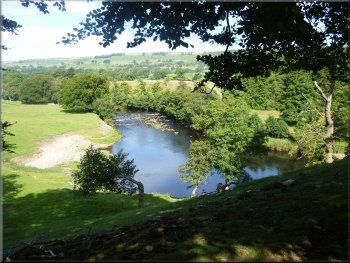
Just below the cafe there is a permissive path called the Berry Meadow Walk that leads down to the River Ure and some very pretty and quite impressive waterfalls called Redmire Force. It's a rock shelf about 2m high running across the river at an angle with a rocky area of white water below the falls. This is quite a popular spot for walkers to stop for a break too.
From the waterfalls we walk along the bank of the River Ure quite high above the river. The land here for a few kilometers in either direction, consists of a series of large rounded grassy mounds, typically about 10m high and around 30m long. This is a whole area of glacial till and moraines, heaps of small boulders, pebbles and gravel left behind as the glaciers melted at the end of the last ice age.
After about a kilometer from Redmire Force we turn away from the river and follow the path and an old by-way back up the hillside into West Witton and the end of our walk.
top of page
|