| 2001 walks | 2002
walks | 2003 walks | 2004
walks |
| 2005 walks | 2006
walks | 2007 walks | 2008
walks |
| 2009 walks | 2010
walks | 2011 walks | 2012 walks |
| 2013 walks | 2014 walks | 2015 walks | 2016 walks |
| 2017 walks | 2018 walks | 2019 walks |2020 walks |
| 2021 walks | 1993-2000 library | Find a Route Index |
| A few Routes to print out | Request a Route... |

Route No. 504 - Tues 9 April 2013
Bickerton Church, Raw Head,
Bulkeley Hill,
Peckforton Hills,
Beeston Castle - 10km
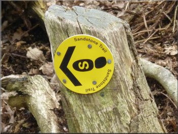
Sandstone Trail, Cheshire . . .
Route map from Ordnance Survey
Open Space
Map: OS Explorer 257 Crew & Nantwich at 1:25000
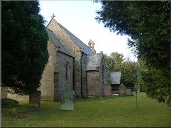
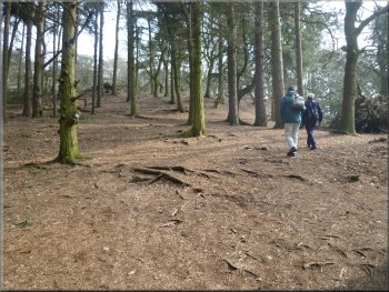
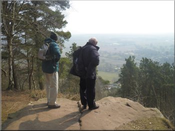
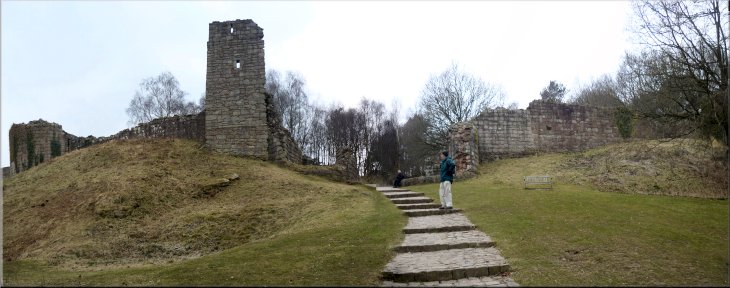
Holy Trinity Church at Bickerton
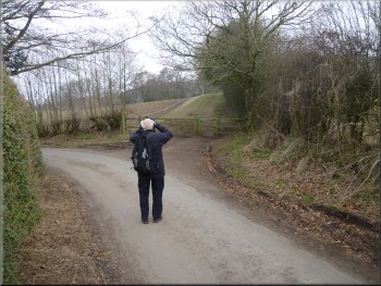
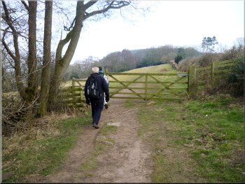
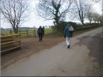
Setting off along the road from the church
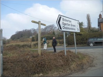
After breakfast we drove
to the car park at Beeston Castle about 5km by road South of Tarporley at map ref. SJ540591. We left my brother-in-law's car there and my wife
drove us another 10km South along the A49 & the A534 to Bickerton Church at map ref. SJ509535. Then she returned to our accommodation for the
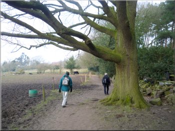
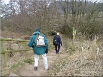
sisters trip to the Cheshire Oaks and left us to walk back to Beeston Castle along the Sandstone Trail. From the Holy Trinity Church in Bickerton we
walked North East along the road for about 400m to the junction with the main road, A534. |
Over the last few years a family tradition has gown up whereby my wife and I and her two sisters and their husbands all have a Spring break together.
This year we are staying near Tarporley in Cheshire and today we three brothers-in-law are walking part of the Cheshire Sandstone trail and the three sisters
are going to the Cheshire Oaks Designer Outlet centre. The Sandstone Trail is a walk of 55km or 34 miles from Frodsham next to the M56 in the
North of Cheshire with the Manchester Ship Canal and the Mersey estuary beyond, to Whitchurch in the South of the county. 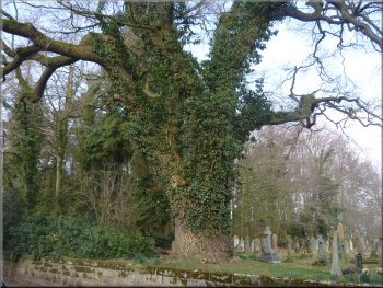
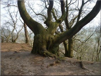
A fine oak tree in the churchyard at Bickerton
Crossing the main road (A534)
|
Stone access road to Chiflik Farm |
Approaching Chiflik Farm along the access road
Snow drift remnant from the snow fall almost a month ago
Snow drift remnant from the snow fall almost a month ago
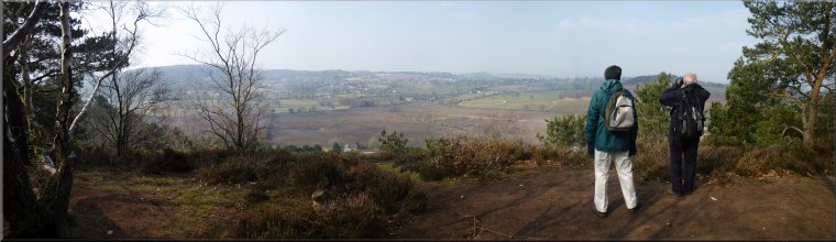
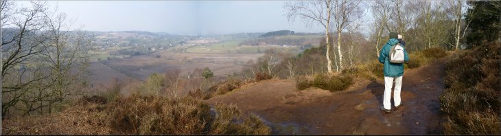
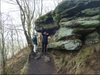
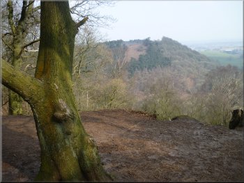
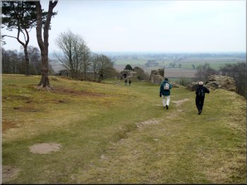
View looking South from the ridge
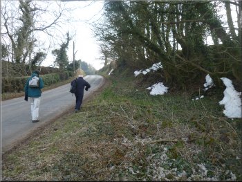
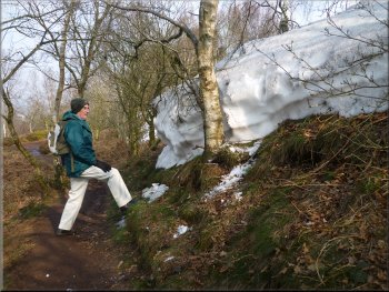
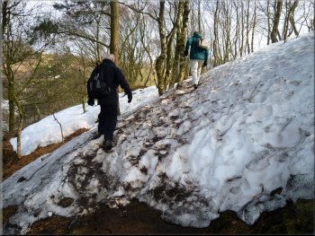
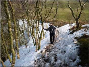
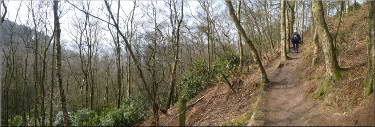
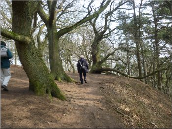
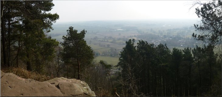
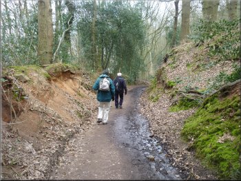
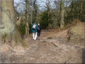
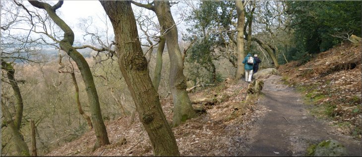
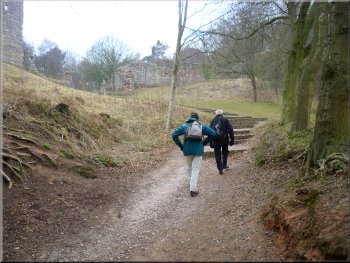
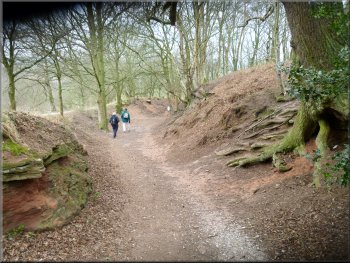
As we followed the path through the wood climbing up towards Raw Head there were still the remains of large
snow drifts from the heavy snow falls almost a month ago. We were walking along a sandstone ridge with views developing away to our left over the
countryside below. |
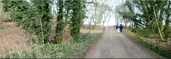
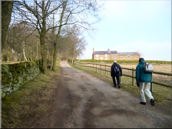
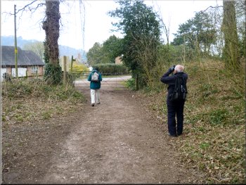
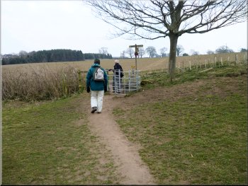
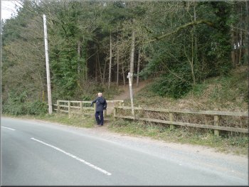
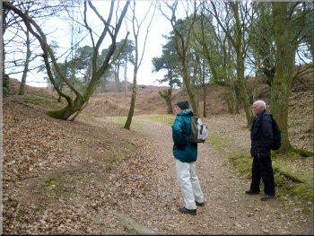
We crossed the main road and continued up a narrow lane
opposite. After a few hundred metres the road became a stone farm access track which we followed past Chiflik Farm and around the edge of Tower
Wood and then through the woods. 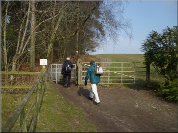
Path at the edge of Tower wood
View looking South as we reached the ridge
Snow drift remnant from the snow fall almost a month ago
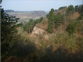
Looking across Musket's Hole to the sandstone cliff opposite
|
The path climbing up through the woods towards Raw Head
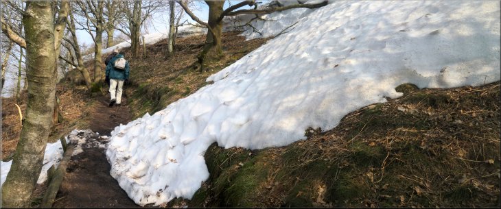
More snow drifts as we made our way up to Raw Head
View from the ridge as we neared Raw Head
|
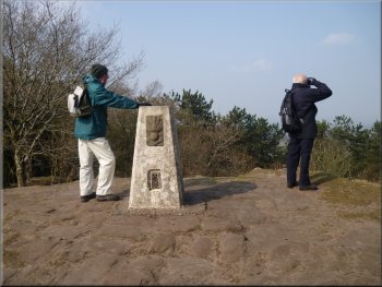
The trig point on Raw Head

Following the path down from Raw Head
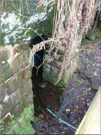
An old well below the path - still in use but via a blue pipe now
From Raw Head we continued along the trail gradually dropping down through the woods. At one point we came to an old well below the path with
a wooden access stairway. |
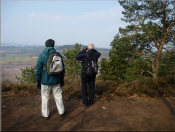
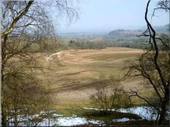
About 1.5km from our start at the church we reached Raw Head. This is the highest point on the Sandstone Trail at 227m or 746ft
above sea level. There's a trig point here on the red sandstone rock with a lovely view to the North East over the farmland, woods and villages below
us. 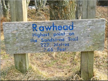
Information board at Raw Head
'Atlas' impression
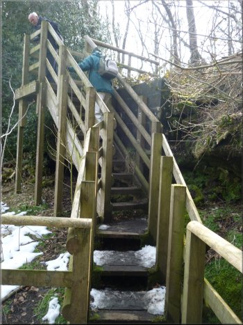
Modern access stair to the old well
|
Looking to Bulkeley Hill as we made our way down from Raw Head
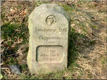
Marker stone by the Sandstone Trail
Climbing up Bulkeley Hill through the woods
Sweet chestnut trees on Bulkeley Hill
Apparently sweet chestnut was introduced to Britain by the Romans to provide a supply of
timber for fencing (the Sandstone Trail leaflet explains). Again from this hill there were wonderful views from our elevated position out across the
countryside below and in places along the ridge too. |
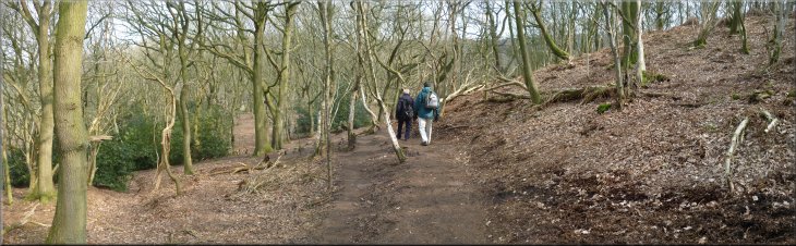
We followed the path down to the farmland below the hill and walked across the fields to the edge of Bulkeley Hill. The
slopes of the hill are wooded and owned by the National Trust. It's lovely open woodland and we climbed steadily to the summit where the trees are
mostly sweet chestnut with their distinctive spiral bark. 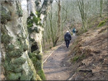
Path coming down through the wood from Raw Head
Leaving the field path to enter the woods on Bulkeley Hill
Looking North East at the view from Bulkeley Hill
Old sweet chestnut tree on Bulkeley Hill
|
The view from Bulkeley Hill looking North East
Path down from Bulkeley Hill through the woods
|
Peckforton Hill seen from Bulkeley Hill
Our lunch stop on a comfy log
Arriving at The Lodge at the foot of Bulkeley Hill
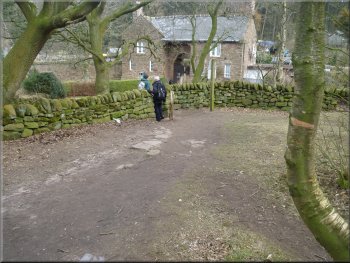
Here we came to the Lodge
on Fowlers Bench Lane at the edge of Peckforton Hill. The track between Bulkeley Hill and Peckforton Hill Is called Peckforton Gap. We followed
the Sandstone Trail around the base of Peckforton Hill. |
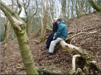
We continued along the trail dropping down from Bulkeley Hill through the woods. We found a fallen birch tree that provided a comfortable seat for our lunch above the path in this very pleasant woodland. After our break we continued to the bottom of the hill.
Path down from Bulkeley Hill through the woods
Sandstone Trail marker
Starting along the path around the foot of Peckforton Hill
|
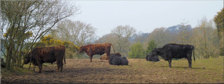
Cattle by the path around the Peckforton Hills
|
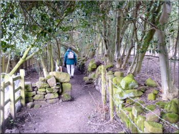
Path around the Peckforton Hills
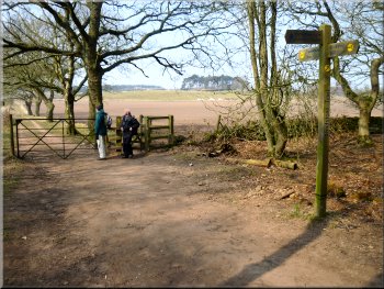
Turning off the lane at map ref SJ525567
Path around the Peckforton Hills
Woodland path around Peckforton Hill
On top of the hill
here, but hidden amongst the trees is Peckforton Castle. This a Victorian building in the style of a medieval castle, now used as a hotel. |
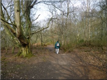
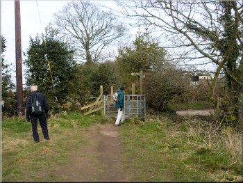
The whole route is well signed with the distinctive yellow and black discs and we continued
across farmland, along a lane and though the woods at the base of the hill to Moathouse Farm at the Northern end of Peckforton Hill.
Path around the Peckforton Hills
Woodland path around Peckforton Hill
Woodland path around Peckforton Hill
Approaching the lane at Moathouse Farm
|
Woodland path around the foot of the Peckforton Hills
|
Start of the path across the fields to Beeston Castle
Path across the fields to Beeston Castle
Path across the fields to Beeston Castle
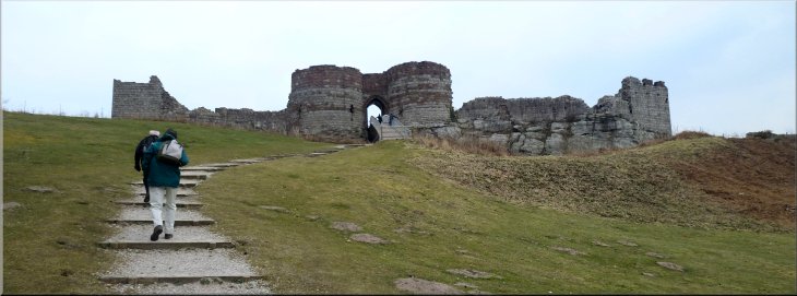
Path around the outer wall of Beeston Castle
We continued
across a minor road and around the outer wall of Beeston Castle to the castle entrance and the car park opposite where we had left the car this
morning. |
From here we followed the
path across the fields where there was a good view of Beeston Castle on its rocky hill top, a really impressive position for a castle.
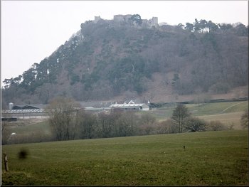
Beeston Castle seen from the path across the fields
Path across the fields to Beeston Castle
Crossing the road at map ref. SJ538588
The gatehouse to Beeston Castle
|
Path leading up through the inner defensive wall towards the fortress on the hill top - Beeston Castle
|
Path up through the castle grounds
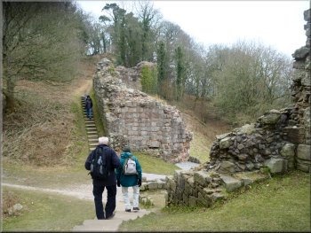
It
seemed that the stone for the fortress had been quarried from a deep, wide trench that formed a dry moat cutting off the fortress from the rest of the
hill. We crossed the bridge through the gateway with a slot for a portcullis and into a wide open area on the top of the rocky hill. |
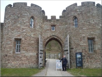
We left our gear in the car and went back to the castle entrance. The castle is owned and managed by English Heritage. We passed through
the impressive gateway in the outer wall, paid the entrance fee and started to climb up the track to the next defensive wall. We passed though the
ruins of a gateway with towers on either side and followed the access track winding up the steep hillside to the main fortified hilltop stronghold.
Path up through the castle grounds
|
Approaching the fortress on the hill top - Beeston Castle
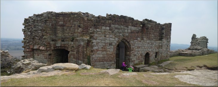
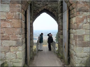
The gateway into the fortress on the hill top

Looking back along the sandstone ridge from Beeston Castle
|
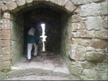
Looking through a firing position in the fortress gatehouse
Descending on the path around the inner defensive wall
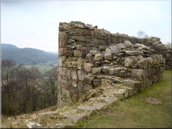
Part of the inner defensive wall
It was quite breezy and it fluttered its wing to keep control of its position and then it
shifted gear and glided out of sight behind the castle wall to our right. It was a female peregrine falcon. They apparently have a nest site on the rocks
below the castle. We left the fortress on the hill top and followed a path down the defensive wall part way up the hill. We walked around this wall
back to the ruins of the gateway we had used on the way up and followed the track down to the main gateway. |
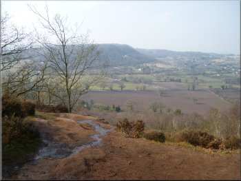
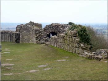
There was a wide outer
wall with rooms within the thickness of the walls and a large well. The views from here were stunning across farmland into the far distance. Looking
south along the sandstone ridge we could see the line of hills that we had crossed on our way from Bickerton Church. On Peckforton Hill we could
see Peckforton Castle, hard to spot because it is against a backdrop of forest on the hill behind. Then as we were about to leave we saw a large bird
of prey hanging on the wind about 50m out from the castle rock.
Looking up at the portcullis slot in the gate way
Part of the inner defensive wall
Returning to the gateway through the inner defensive wall
|
The track back to the gatehouse in the outer wall
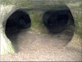
Manmade caves seen through the bars of the locked gates
It had been a fine sunny day
with lovely views of the Cheshire countryside. The whole route had been 10km and it had taken us four and a half hour to walk including our lunch stop
on a convenient log and our extended visit to Beeston Castle at the end of the walk. |
One final sight before we left were the
caves about 200m to one side of the gateway next to the outer wall. There looked as though they had been excavated with pillars of rock left for
support but there was no indication of their original use. We made our way back to the car park and the end of a very enjoyable walk.
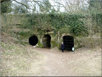
Gated entrances to the caves in the castle grounds
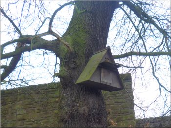
An owl nesting box in the castle grounds
|
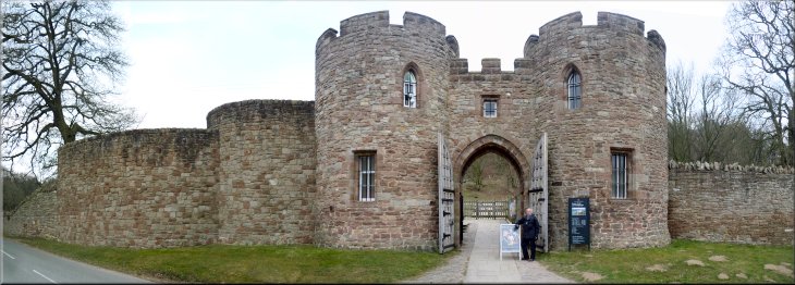
The gatehouse in the outer wall at Beeston Castle |