| 2001 walks | 2002
walks | 2003 walks | 2004
walks |
| 2005 walks | 2006
walks | 2007 walks | 2008
walks |
| 2009 walks | 2010
walks | 2011 walks | 2012 walks |
| 2013 walks | 2014 walks | 2015 walks | 2016 walks |
| 2017 walks | 2018 walks | 2019 walks |2020 walks |
| 2021 walks | 1993-2000 library | Find a Route Index |
| A few Routes to print out | Request a Route... |
Route No. 543 - Thursday 24 April 2014
Roecliffe, Waingates Fm, Newfields Fm, Carr Top Fm,
Staveley Nature Reserve, River Tutt & return - 8km
Boroughbridge Walking Festival . . .
Route map from Ordnance Survey
Open Space service.
Map: OS Explorer 299 Ripon & Boroughbridge
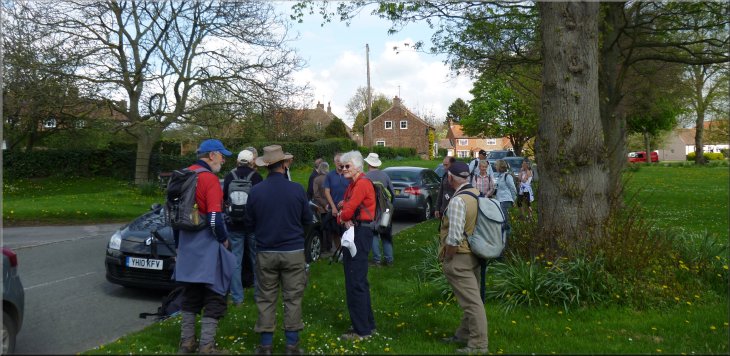
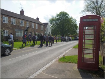
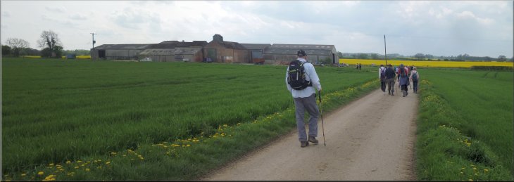
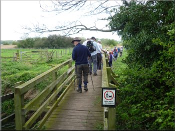
Walkers assembling on the village green at Roecliffe
|
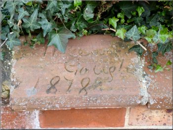
Moses Gough was the foreman at the Roecliffe brick & tile works
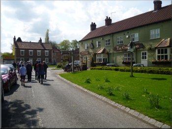
Passing the crown Inn as we left the village
Our walk leader today was "Big John" who lives in
Roecliffe and we also had the expertise of Mike, who is the nature reserve warden for the Yorkshire Wildlife Trust so we were in safe hands. We set
off from the village green along the village street past the Crown Inn at a crossroads.
|
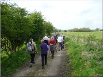
Today my mate, Jim, and I drove over to the village of Roecliffe next to Boroughbridge and parked on the roadside at the village green, map ref.
SE376659. There were a good number of walkers assembling for the afternoon walk to start at 2.00pm to go to the Staveley Nature Reserve. It was
one of the guided walks organised as part of the Boroughbridge Walking Festival this Easter.
Setting off through Roecliffe village
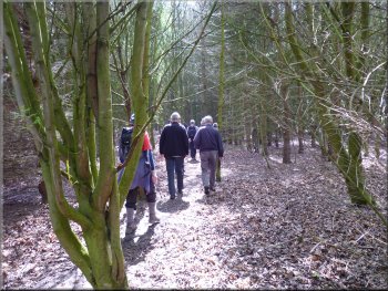
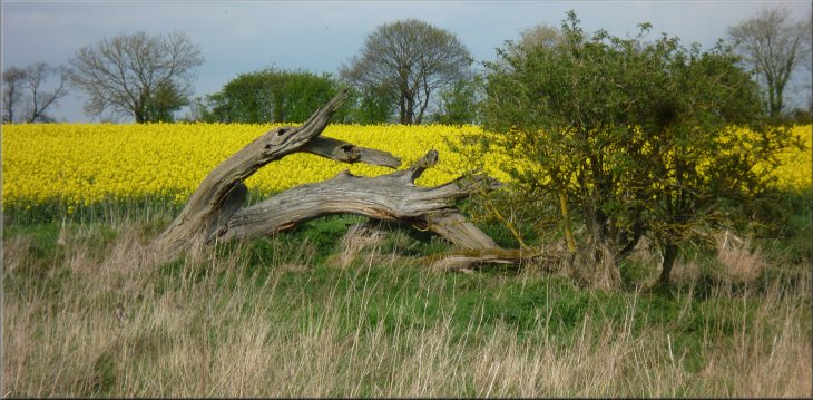
Woodland on the edge of Roecliffe
|
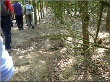
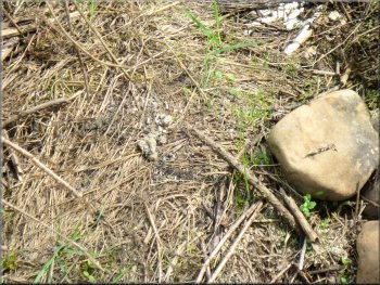
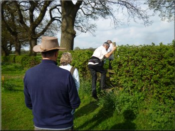
One of the many entrances to the badger sett by the path
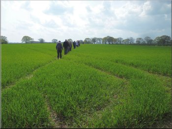
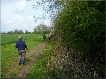
Path across the fields from Roecliffe
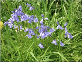
Bluebells on the roadside
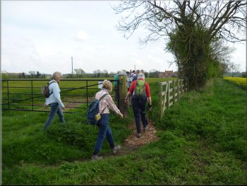
This brought us to a
stile onto the access road to Waingates Farm. Here the redundant farm buildings have been developed into offices for local businesses and it's
known as the Roecliffe Business Centre The path bypasses the centre via a stile to the right of the
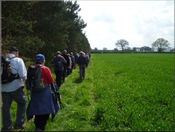
access road and passes round the farm buildings to skirt the edge of a field along a grassy track. |
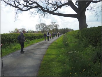
At the crossroads, our route took us straight on along a narrow lane between the buildings. The lane led us past several the front gardens of several
houses and then we were out of the village and into a small wood. In the wood the path passes over a large mound formed by the excavations of
badgers living in a very large sett. From the wood the path emerged to cross diagonally over a couple of large fields of cereals.
Path across the fields from Roecliffe
The access road to Waingates Farm
Path by-passing the Roecliffe Business Centre (Waingates Farm)
|
Farm access track to Newfields Farm
|
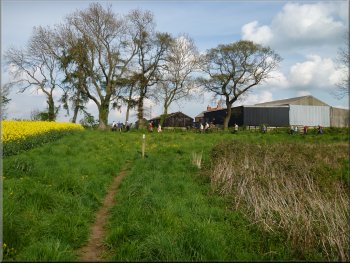
Heading to Carr Top farm from Newfields Farm

Ancient excavator at Carr Top Farm
At the side
of the farm they were clearly having trouble removing the deep rooted stump of a large tree and there was a very elderly excavator on hand to assist
with the heavy work. |
We continued to follow the public footpath along a farm access track to Newfields Farm. At this farm we turned left to follow a path past the farm and
between the fields to Carr Top Farm. Here there were two splendid cockerels strutting in the field with a number of very free range hens.
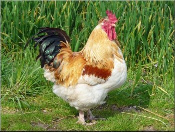
Magnificent cockerel at Carr Top Farm

Making for the River Tutt bridge at Carr Top Farm
|
|
Entering the Staveley Nature Reserve from Carr Top Farm
|
Footbridge over the River Tutt at Carr Top Farm
Our guide, Mike had received information that a pair of tawny owls were to be seen in a particular tree in a small wood on the site. We made a short
diversion along a gravel path into the wood but there was no sign of the owls. They are apparently highly territorial so they would not be far away. As
we returned towards our route Jim spotted the owls high up in a large tree next to the path and everyone stopped to gaze up at them, a lovely sight. |
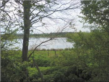
From Car Top Farm the path crossed a footbridge over the River Tutt and came to a sign at the boundary of the Staveley Nature Reserve
. The site is managed by the Yorkshire Wildlife Trust. There are otters on the site as well as
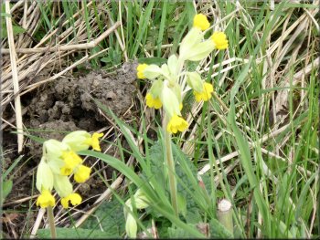
roe deer and foxes. The rafts on the lakes are for common terns to nest. Today there were numerous cow slips in the grassland around the lakes.
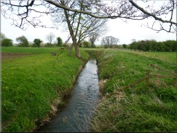
The River Tutt at Car Top Farm
|
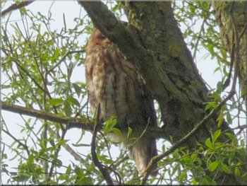
One of a pair of tawny owls . . .
|
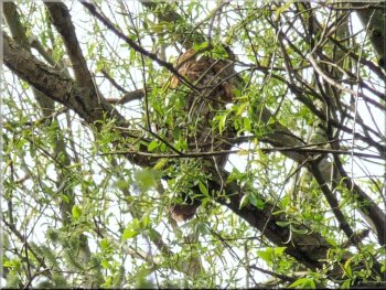
. . . and here's its mate higher up the same tree
|
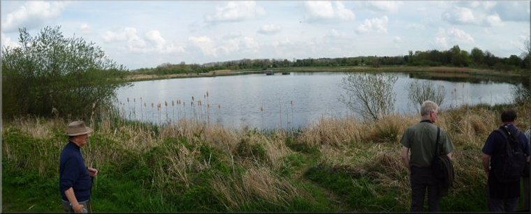
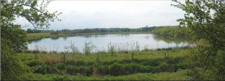
The Staveley Nature Reserve - managed by the Yorkshire Wildlife Trust

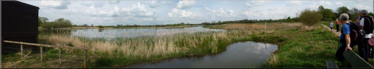
The gravel pit lake in the north east of the reserve
|
|

|

|
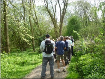
Looking for owls
|
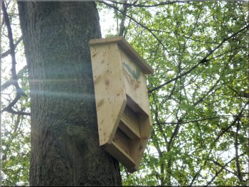
Bat box
|
Feeding debris left by otters
|
|
|
The gravel pit lake in the south west of the reserve
|
Path by the River Tutt heading back to Carr Top Farm
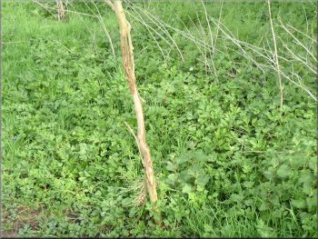
Roe deer rubbing post damage to a sapling
We made our way through the reserve to recross the River Tutt on the western edge of the site. From the footbridge we followed the path by the river back to Car Top Farm and past its ancient excavator. |
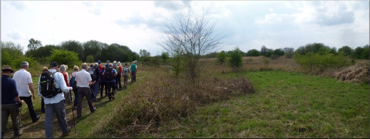
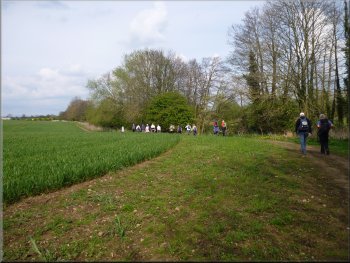
We followed the gravel paths around the reserve past the lakes and a couple of hides where we could have stayed to see what emerged when it was quiet.
Path by the River Tutt heading back to Carr Top Farm
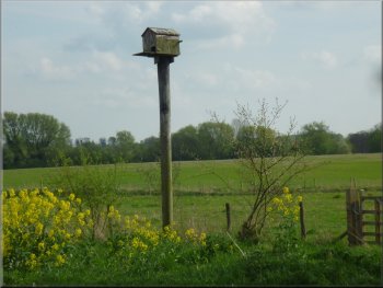
Owl nesting box - one of several dotted around the nature reserve
|
|
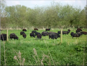
Flock of Hebridean Sheep by the path

Approaching Newfields farm on the way back
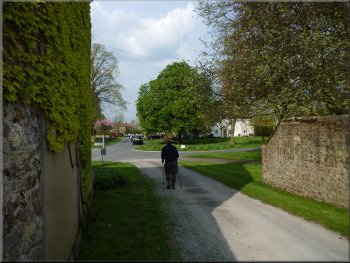
Returning to the village street in Roecliffe
The whole route had been 8km and it had taken us about two and a half hours to walk. It would be easy to have a longer walk and spend more time exploring the Staveley Nature Reserve. There's a car park for the reserve on the edge of Staveley village. |
From Car Top Farm we retraced our steps back to Roecliffe past Newfields Farm and Waingates Farm to the village street by the Crown Inn and the village green at the end of our walk.
Heading back from Carr Top Farm
Path back to Roecliffe across the fields
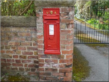
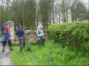
Victorian pillar box in Roecliffe
|
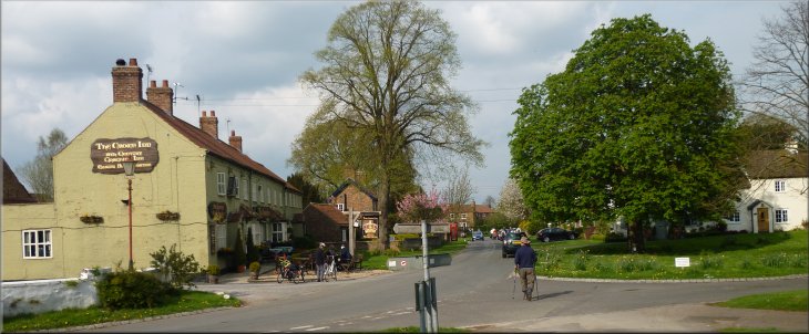
Passing the Crown Inn on our way back to the village green in Roecliffe
|