| 2001 walks | 2002
walks | 2003 walks | 2004
walks |
| 2005 walks | 2006
walks | 2007 walks | 2008
walks |
| 2009 walks | 2010
walks | 2011 walks | 2012 walks |
| 2013 walks | 2014 walks | 2015 walks | 2016 walks |
| 2017 walks | 2018 walks | 2019 walks |2020 walks |
| 2021 walks | 1993-2000 library | Find a Route Index |
| A few Routes to print out | Request a Route... |
Route No. 586 - Thursday 9 July 2015
Studley Deer Park, Whitcliffe Hall,
Hell Wath Nature Reserve, River Skell,
Studley Roger circuit - 10km
Ripon . . .
Route map from Ordnance Survey
Open Space service.
Map: OS Explorer 299 Ripon & Boroughbridge
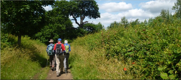
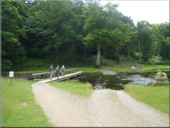
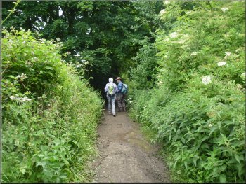
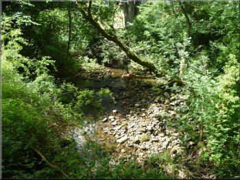
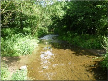
Leaving the car park to walk around the lake shore to the outlet stream, the River Skell
|
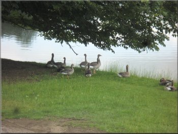
Greylag geese on the lake shore
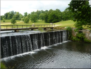
Waterfall at the lake outlet
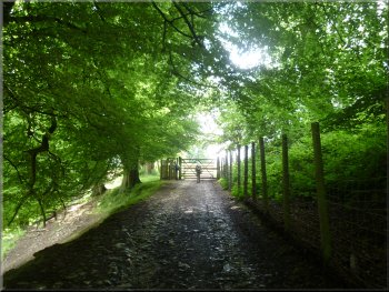
Gate from the woodland track to the fields
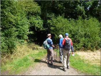
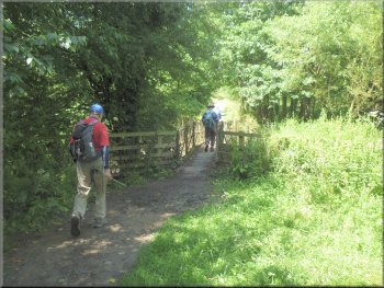
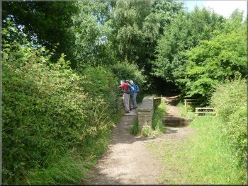
We crossed the outlet stream, the River Skell, on the footbridge and followed the track by
the river for about 25m. Here the track forks and we kept to the right hand fork which led us up the hillside through the trees for about 70m to a gate
(with deer fencing) at the top that led us into a large field. |
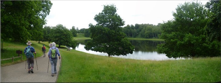
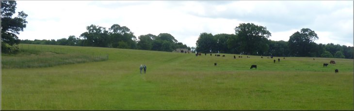
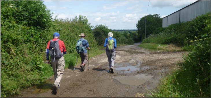
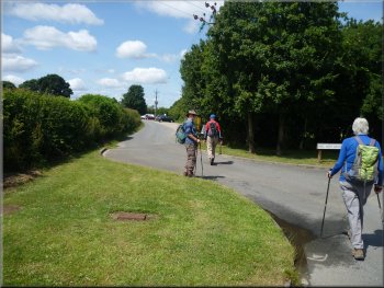
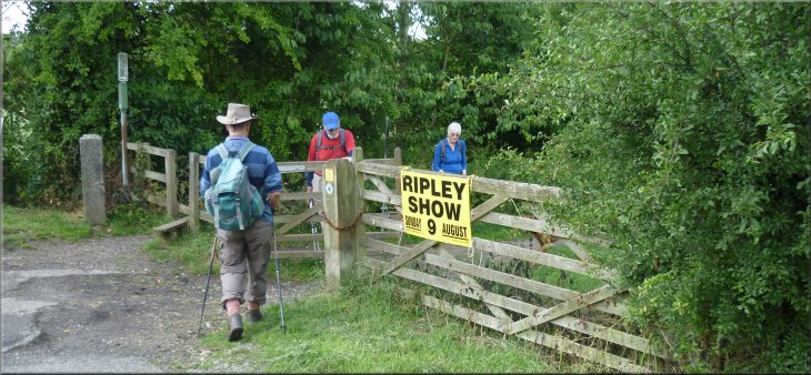
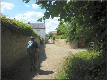
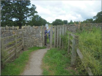
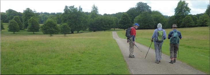
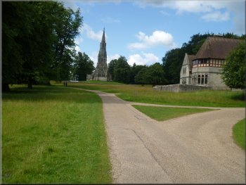
This morning Jim & I met two friends, Ray & Sylvia, at Studley Deer Park near Ripon. Today's walk is one of Ray's routes. There's a large National
Trust car park next to the lake in the deer park at map ref. SE 278 691 (it's "pay & display" unless you're a National Trust member). From the car park
we walked around the edge of the lake to its outlet weir.
Footbridge over the lake outlet
We took the right hand fork in the track
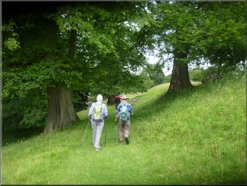
Track across the field
|
Path off the track to cross the field to the stone gateway arch
|
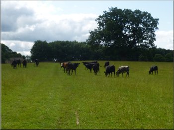
Path took us through a herd of young beef cattle
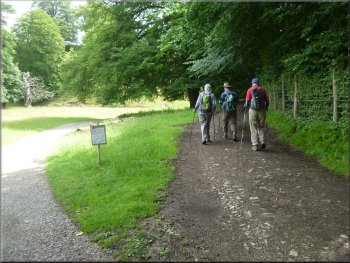
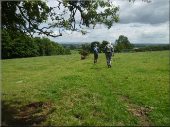
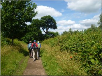
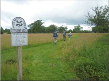
After about 650m we reached an ornamental stone gate arch. Through the gateway arch we turned left to follow a bridleway along a track through woodland. |
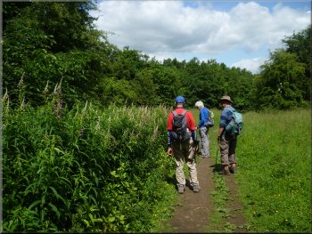
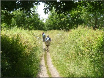
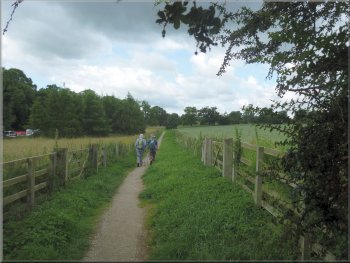
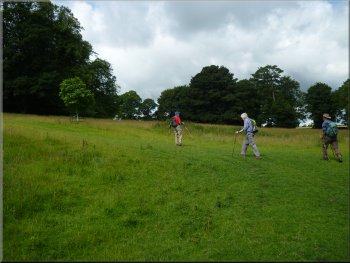
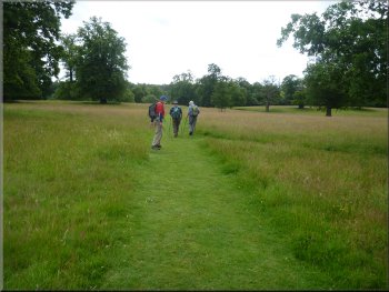
We continued along the track for about 100m then just before the field boundary, we turned right off track past a wooden marker post. We walked
across this large field, through a herd of young beef cattle.
Path took us through a herd of young beef cattle
|
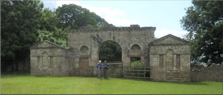
Elaborate stone gateway arch
|
Woodland bridleway from the stone gateway arch
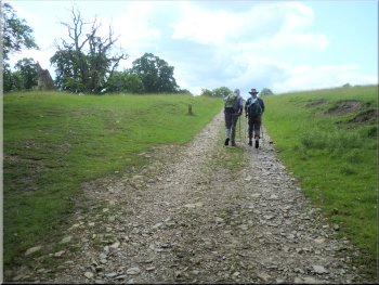
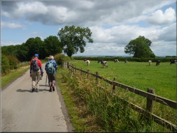
Path across the fields towards Whitcliffe Hall
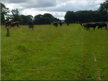
There was a herd of dairy cows laying in the field
chewing the cud in the warm sunshine, a very restful scene. We continued along the bridleway across the field for about 400m to a narrow tarmac access road bounded by
tall hedges just south of Whitcliffe Hall. |
After about 700 we reached a junction in the tracks. The track to our left headed down to cross the River Skell, but we kept straight on and then
bearing left to climb up through the woodland to a gate into the fields at map ref. SE 292 687.
Keeping straight on at the junction in the track
Gate to the access road near Whitfield Hall
|
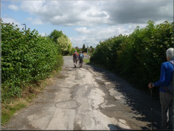
Heading towards Ripon along the access road from Whitfield Hall
|
Heading towards Ripon along the access road
About to turn left at the end of the access road
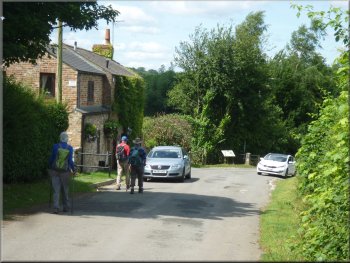
Passing Hell Wath Cottage
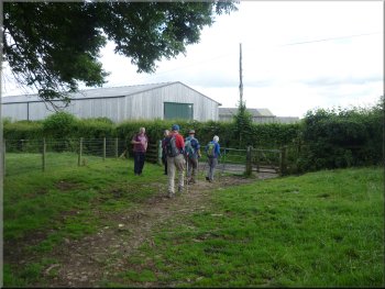
Where the access road reached the housing development roads we turned left skirting the edge of the development and followed the lane to Hell Wath Cottage (map ref. SE 299 699). |
At this access road we turned left and walked along the road past Whitcliffe Hall towards Ripon. We followed the access road for about 1km from
Whitcliffe Hall to the edge of the Ripon housing development at map ref. SE 302 698.
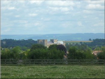
Ripon Cathedral in the distance
Skirting the edge of the housing heading for Hell Wath
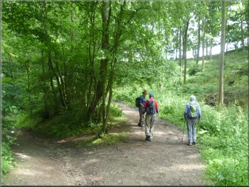
Footpath into Hell Wath Nature Reserve (no signs)
|

Woodland path at Hell Wath Nature Reserve
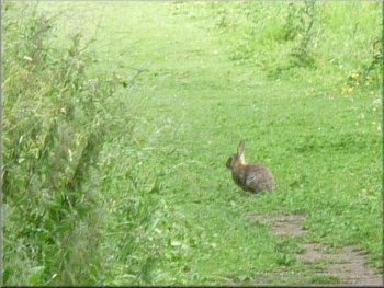
Rabbit deciding when to run for cover
River Skell along the edge of Hell Wath Nature Reserve
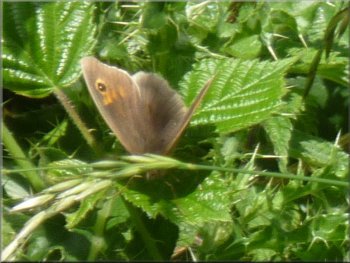
There were
many ringlet and meadow brown butterflies as we made our way along the paths into the reserve and back beside the River Skell to Hell Wath
Cottage. |
Just beyond Hell Wath Cottage is an information board at a wooden fence and here we turned right to follow a footpath into Hell Wath Nature Reserve.
Path through Hell Wath Nature Reserve
One of many Meadow Brown butterflies
Leaving the reserve back to Hell Wath Cottage
|
Turning onto the bridleway just beyond Hell Wath Cottage
|
Bridge over the River Skell
Bridleway between the fields
Turning left at map ref. SE 295 705 to head for Studley Roger
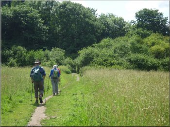
After about 550m from the River Skell where the bridleway crossed a public footpath (map ref. SE 295 705) we turned left and followed the footpath between the field for about 500m into the village of Studley Roger.
|
At the information board near Hell Wath Cottage we turned right and followed a bridleway across a bridge over the River Skell and out between the fields heading towards the B6265.
The River Skell from the bridge
Viewing a lovely big garden from a bridge over a stream
Approaching Studley Roger along the footpath
|
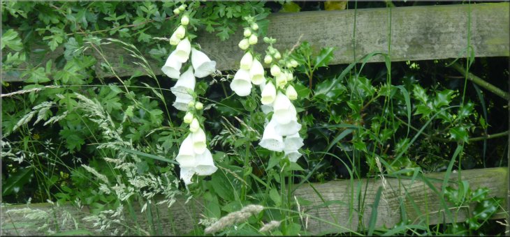
White foxgloves by the footpath near Studley Roger
|
Approaching the road in Studley Roger
Footpath from Studley Roger to the Deer Park
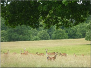
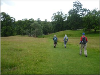
The mown grassy track through the deer park
There were herds of fallow deer and red deer grazing near the path
as we made our way through the park. |
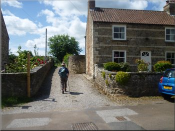
The path crossed the road through Studley Roger and we followed the path out of the village to a gate into Studley Deer Park. Once through the gate
we turned right and followed the mown grassy path around the edge of the park.
Continuing along the footpath across the road in Studley Roger
Gate into Studley Deer Park
Group of Fallow deer in the long grass
|
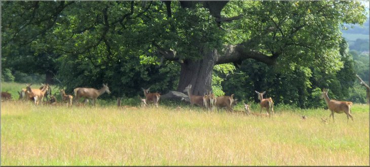
Group of red deer in the shade of a big oak tree
|
Following the grassy track through the deer park

More fallow deer in the long grass
We continued along the valley bottom beyond the bridge for about 100m. We then turned left and made our way up to join the tarmac access road through the park at map ref. SE 278 702.
|
We followed the mown grassy path to a steep sided little valley and continued down to the valley bottom where there is an ornamental stone bridge.
This bridge is under repair at present and we bypassed the fenced off working area.
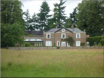
Wheatbrigs House on the edge of the deer park
Grassy path down to the ornamental stone bridge
|
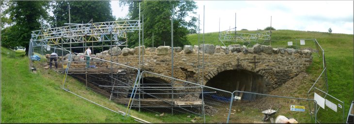
Repairs underway at the ornamental stone bridge
|
Climbing out of the little valley to the access road
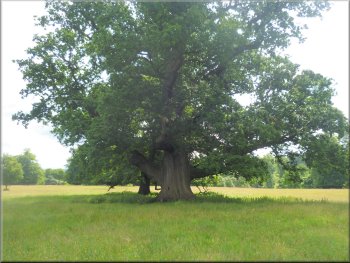
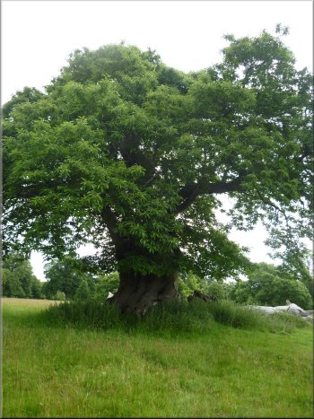
Ancient oak tree by the access road
Close by there is a wild cherry tree, now in the final phase of its life but still
bearing fruit this summer. Both of these trees are on the ancient tree hunt data base. We continued along the access road for about 700m to a
junction where we turned right along the access road to the church and the obelisk. |
At the access road we turned left and walked along it past the old stable block (now desirable apartments). As we walked along the access road
there are some lovely old trees. In particular there is a huge oak tree.
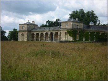
The old stable block now desirable apartments
Ancient cherry tree by the access road
|
Following the access road from the mews apartments
|
Access road leading to the church
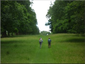
Heading back to the car park along a grassy track
Grassy track down to the car park
The whole walk had been 10km and it had taken us
about 3 hours 30 minutes. to walk it. |
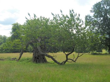
After about 550m we reached the church. Here we turned left off the access road to head down the slope along another mown grassy track. On the
left of the track is another fine old tree, this time a sweet chestnut, that is on the ancient tree hunt data base. We continued along the grassy track
through a grove of huge sweet chestnut trees to reach the National Trust car park above the lake.
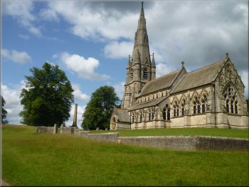
St. Mary's Church in Studley Deer Park
Ancient chestnut tree by the path
|
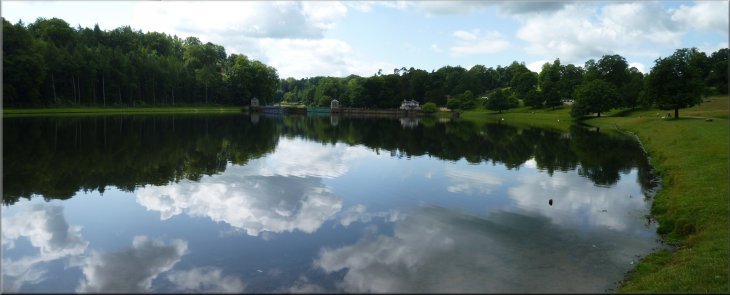
The lake at Studley Deer Park below the National Trust car park
|