| 2001 walks | 2002
walks | 2003 walks | 2004
walks |
| 2005 walks | 2006
walks | 2007 walks | 2008
walks |
| 2009 walks | 2010
walks | 2011 walks | 2012 walks |
| 2013 walks | 2014 walks | 2015 walks | 2016 walks |
| 2017 walks | 2018 walks | 2019 walks |2020 walks |
| 2021 walks | 1993-2000 library | Find a Route Index |
| A few Routes to print out | Request a Route... |
Route No. 642 - Thursday 6 October 2016
Paddock Farm (tea rooms), The Roaches,
Roach End, return via minor road, circuit - 8km
Peak District, Derbyshire/Staffordshire border . . .
Route map from Ordnance Survey
Open Space service.
Map: OS Explorer OL24 The Peak District White Peak area
My friend, Jim, and I have both been granted a 3-day pass from our respective wives and we are staying at a pub in Hulme End on the Derbyshire/Staffordshire border in the Peak District. Today we are planning to walk along the Roaches ridge and return along the minor road to a parking area below Hen Cloud at map ref.SK 007 612, just opposite the tea rooms at Paddock Farm. (Note: It's a very popular area and there are parking restrictions in force. If we hadn't parked here early it may not have been possible to park near the tea shop at the end of our walk)

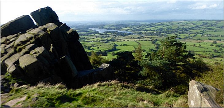
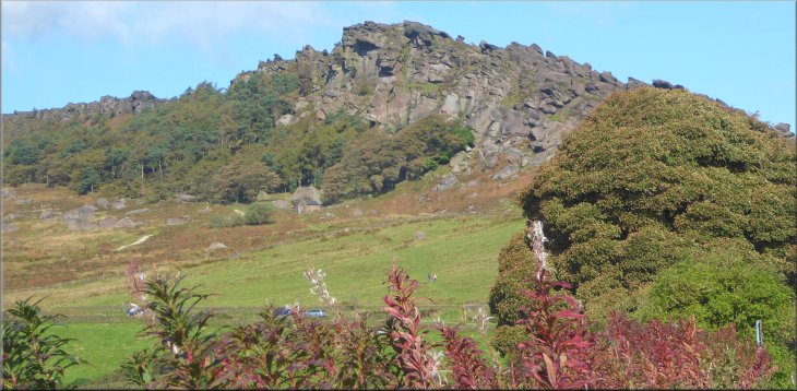
View from map ref. SK 028 596 with (from left to right) Hen Cloud, The Roaches, Shutlingsloe & Ramshaw Rocks
|
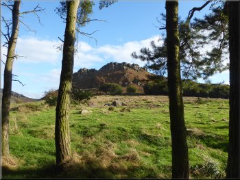
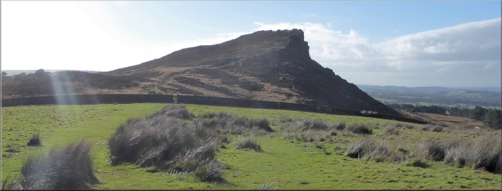
Hen Cloud from the road at the start of our walk
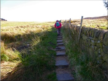
Path to the saddle between The Roaches & Hen Cloud
Here we turned off the road and followed the public footpath directly up the hillside to the saddle between The Roaches and Hen Cloud. |
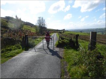
From our parking spot we walked along the road with the towering shape of Hen Cloud above us to our right, heading towards The Roaches. After about 500m along the road, at map ref.SK 006 619 we came to a public footpath on our right.
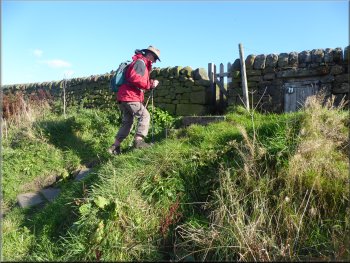
Turning off the road at map ref.SK 006 619
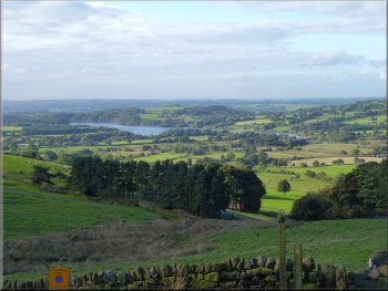
Looking back over Tittesworth Reservoir
|
Hen Cloud seen from the saddle where we turned away from Hen Cloud & towards The Roaches
|
Path leading to The Roaches
As the path became closer to the craggy cliffs of the ridge we came to a working party of volunteers working on behalf of the Staffordshire Wildlife Trust to rebuild a collapsed dry stone wall. |
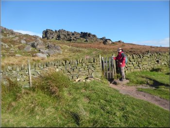
On the saddle the path divides with the right hand branch going to Hen Cloud and the left hand branch, that we took, heading for The Roaches. We approached The Roaches along this path across a rocky area with the craggy ridge of The Roaches on our right.
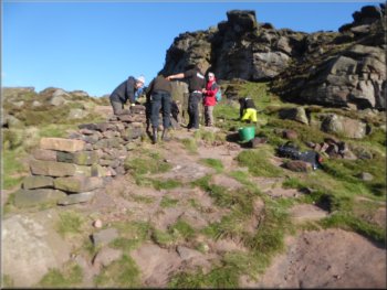
Volunteers rebuilding a collapsed dry stone wall
|
Woodland path just below The Roaches ridge to our right
|

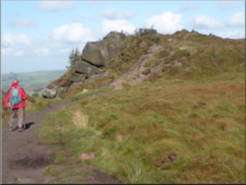
Path just below The Roaches ridge to our right
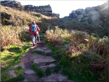
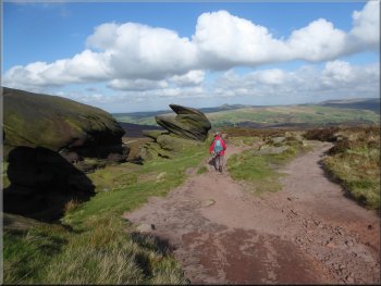
The path turned right to climb onto The Roaches ridge
Looking back down the path from the ridge
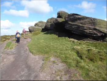
At map ref.SK 005 625, about 400m from the saddle between Hen Cloud & The Roaches, the path turned sharp right and climbed up through a cleft in the rocks to emerge on top of the ridge. |
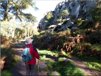
We continued along the path through woodland, with the cliffs of The Roaches ridge next to us on our right. It was a very pretty setting with the combination of the woodland and the gritstone cliffs.
The cliffs of The Roaches ridge on our right
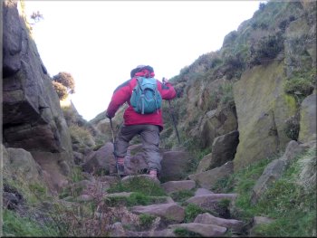
Climbing through a cleft in the rocks onto the ridge
Admiring the views from the ridge
|
Looking back across the valley to Tittesworth Reservoir from The Roaches ridge
|
Path along The Roaches ridge
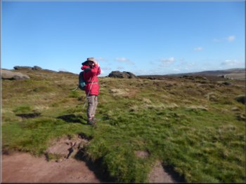
After about 250m along the ridge we came to a small tarn called Doxy Pool. As we approached the pool a Mountain Blackbird or Ring Ouzel took off from the far side and circled round to disappear into the moorland vegetation. |
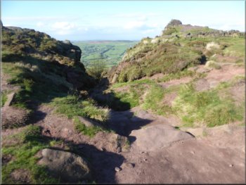
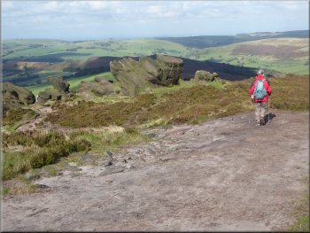
Once at the top we turned left to follow the path along the ridge. There were magnificent views all around us and I was tempted to take far too many photographs.
Path along The Roaches ridge
|
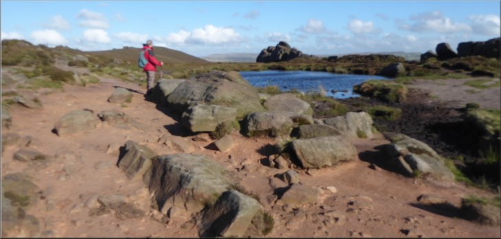
The little tarn called Doxy Pool
|
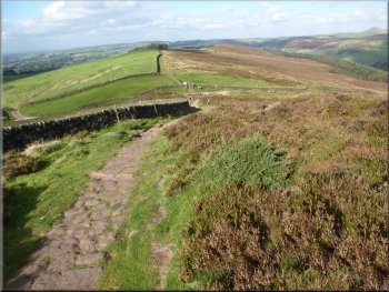
Path along The Roaches ridge heading for the trig point
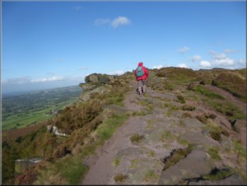
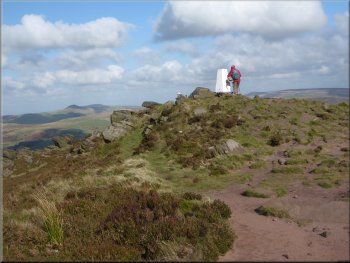
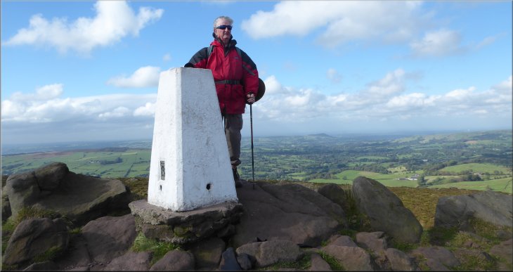
We paused at the trig point to look at the view and then continued along the ridge path. |
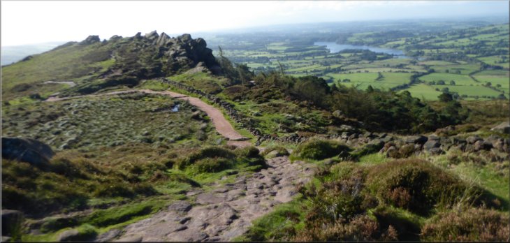
From the pool we continued along the ridge path for about 1km to the trig point on the ridge at map ref.SK 001 638.
The trig point on The Roaches ridge
|
The trig point on The Roaches ridge - it's all down hill from here
|
Beginning the descent from the trig point
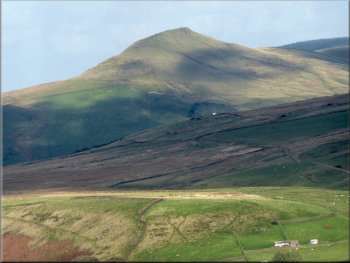
The peak of Shuttlingsloe in the distance ahead of us
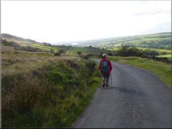
Following the road back towards our parking spot
There were lovely views across the valley to Tittesworth Reservoir to the south and northwest to the hills in the general direction of Macclesfield. |
From the trig point the path was gradually descending and after about 600m we reached the road at map ref.SJ 996 644. At the road we turned left and followed the road back towards our parking spot.
Following the path down from the trig point
The path dropping down to the road
Following the road back towards our parking spot
|
Easy walking along the road with lovely scenery all around us
|
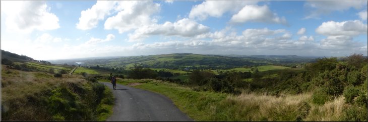
Continuing along the road towards our parking spot
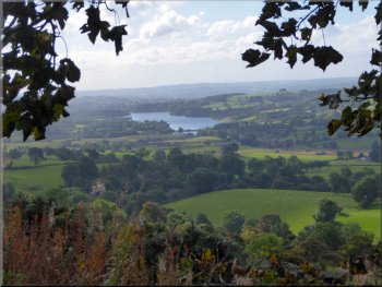
Looking south across the valley over Tittesworth Reservoir
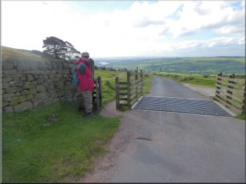
We left our gear in the car and crossed the road to The Roaches Tea Rooms, where we had a very tasty light lunch to round off a fine walk through this lovely countryside. The whole walk had been about 8km and it had taken us around three hours to walk including many photo stops. |
As we returned along the road most of the available parking was taken up even though this was mid week in school term time!. After a little over 3km along the road we arrived back at our parking spot.
Looking northwest across the valley from the road
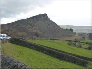
Hen cloud near the end of our walk, all the parking spaces full
|
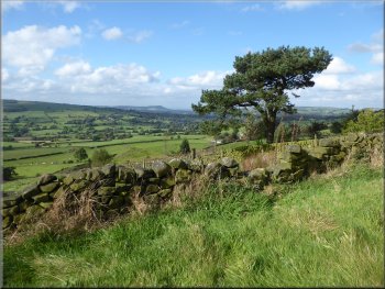
Looking up to The Roaches ridge near the end of our walk
|