|
2001 walks |
2002
walks |
2003 walks |
2004
walks |
|
2005 walks |
2006
walks |
2007 walks |
2008
walks |
|
2009 walks |
2010
walks |
2011 walks |
2012 walks |
|
2013 walks |
2014 walks |
2015 walks |
2016 walks |
|
2017 walks |
2018 walks |
2019 walks |
2020 walks |
|
2021 walks |
1993-2000 library |
Find a Route Index |
|
A few Routes to print out |
Request a Route... |
Route No. 738 - Wednesday 5 September 2018
Coniston, Coppermines YH, Low Water Beck,
Church Beck circuit - 6km
English Lake District . . .
Route map from Ordnance Survey
Open Space service.
Map: OS Explorer OL6 The English Lakes South Western area
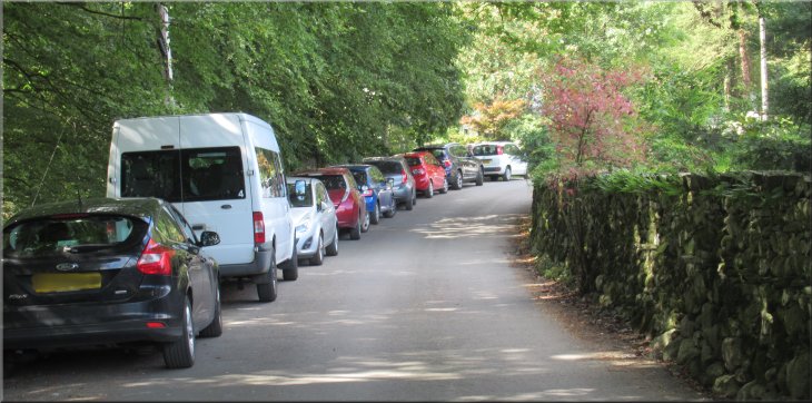
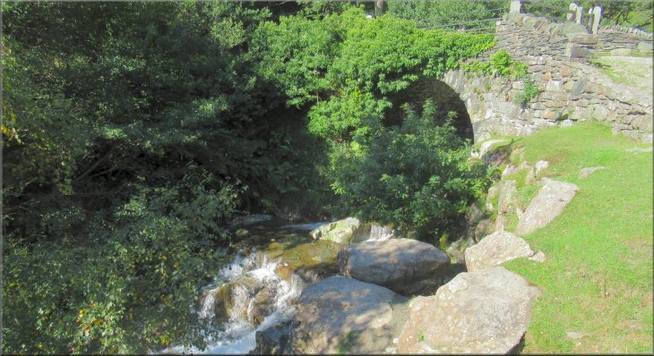
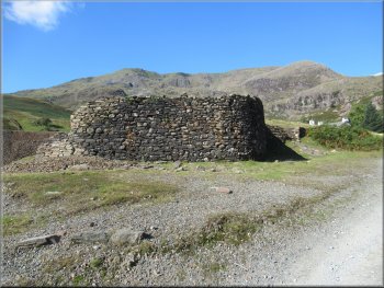
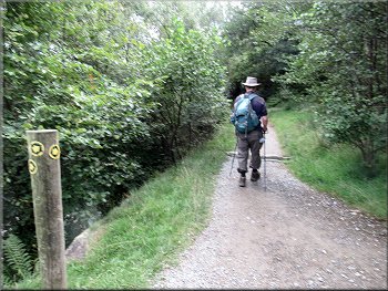
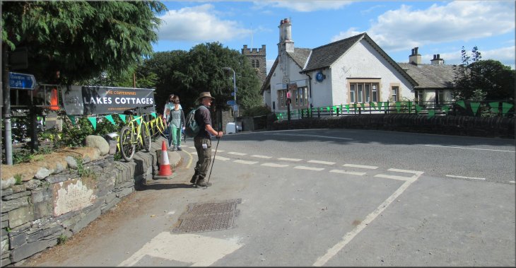
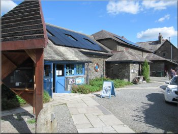
Roadside parking near the Ruskin Museum where we started our walk
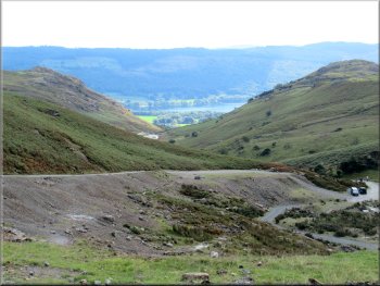
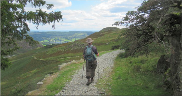
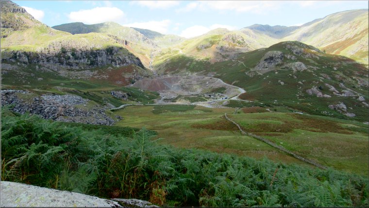
My friend, Jim, and I are having a few days walking in the Lake District staying at a pub in the centre of Coniston. Yesterday, Tuesday, we made our first visit to the National Nature Reserve at Sandscale Haws on the coast near Ulverston. An interesting National Trust site that I intend to visit again before too long. Tomorrow, Thursday, we are having a look at the limestone peninsular of Humphrey Head south of Grange-over-Sands, Route 739, before our drive home. Today we will be walking around the valley of the beck that flows out through the town of Coniston to Coniston Water. The beck changes its name from Levers Water Beck to Church Beck as it nears the town.
The A593 runs North/South through the town and just north of the road bridge over Church Beck there is a left turn just before the Coop Shop. After about 100m the road passes the Ruskin Museum. |

|
|

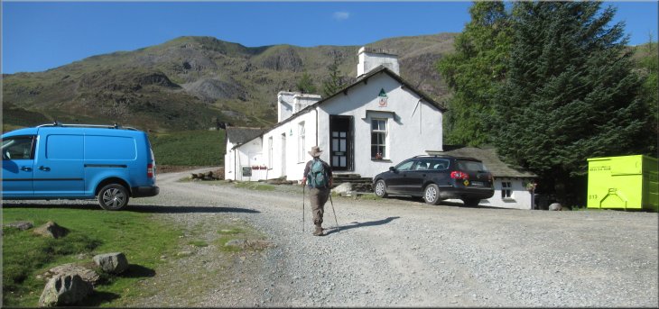
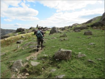
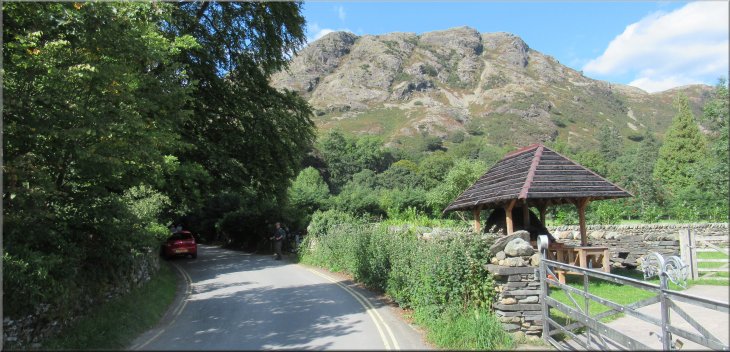
Starting out from our parking spot along the lane
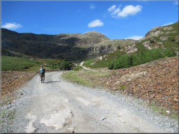
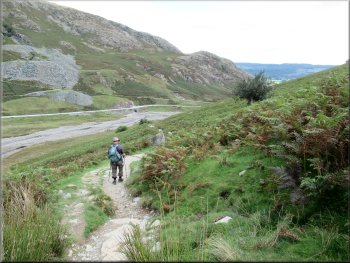
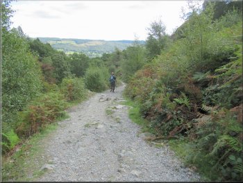
A little way before the cattle grid the surfaced road ended and a stony unsurfaced road began. There are vehicles using this road to access the working slate quarry in the valley and the popular Coppermines Youth Hostel. |
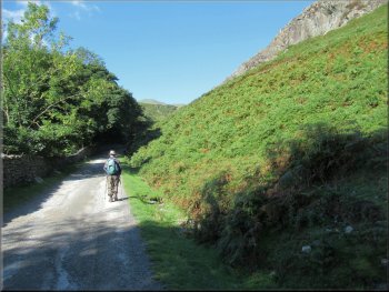
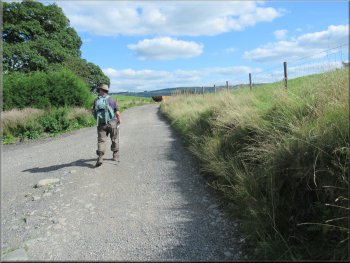
Around the next bend from the Ruskin Museum there is a good long stretch of road side parking at map ref. SD 301 977. This is where we left our car to start the walk. We continued along the road from our parking spot and after about 300m we crossed a cattle grid.
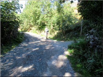
Stony unsurfaced road nearing the cattle grid
|
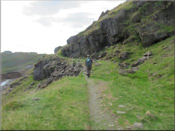
The road from the cattle grid climbed up with woodland on the left and the craggy hillside on our right
|
The road climbing up to the Miners Bridge
The road with the Miners Bridge off to the left
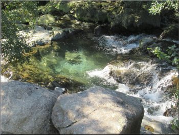
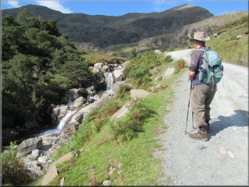
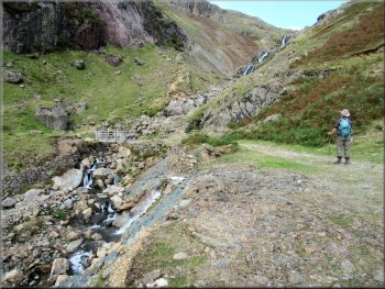
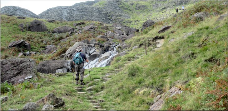
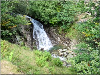
The road climbed quite steeply for a while and we came to 'Miners Bridge' across Church Beck on our left. There were waterfalls on the beck here but hard to get a clear view for the bushes and trees along the sides of the beck.
|
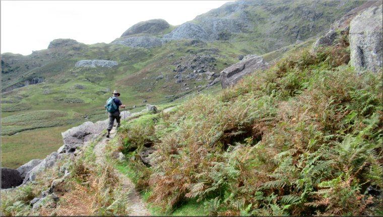
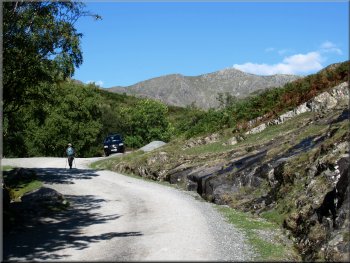
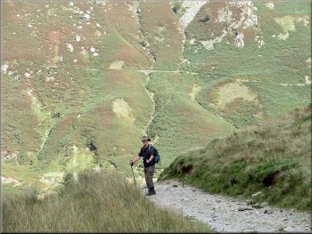
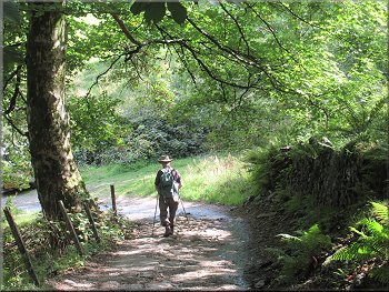
We continued climbing along this road with some woodland on our left and the craggy hillside rising steeply up to our right. It was a bright sunny morning and the scenery was idyllic.
Herdwick Sheep on the hillside
Clear pool below one of the waterfalls on the beck
|
The Miners Bridge across Church Beck
|
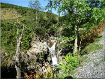
One of the waterfalls on Church Beck
Following the stone access road towards the Youth Hostel
We went inside and found that for a very reasonable charge we could make ourselves a coffee with the materials provided. The warden was busy with his morning jobs but was very friendly and chatty. A coffee stop and a comfortable chair were just what we needed. |
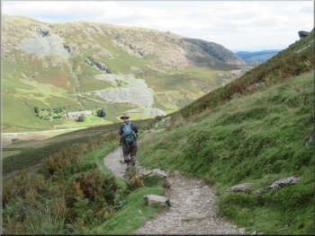
From the Miners Bridge we continued along the stony road still climbing up the valley for another 750m until we came to the white painted Youth Hostel building. There was an intriguing sign advertising the 'Honesty Cafe' there.
Stone slab artwork to enhance our visit I like it
A relic of the copper mining era
|
Arriving at the Coppermines Youth Hostel with it's 'Honesty Cafe'
|
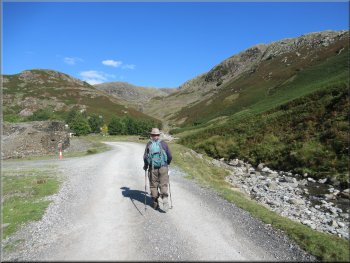
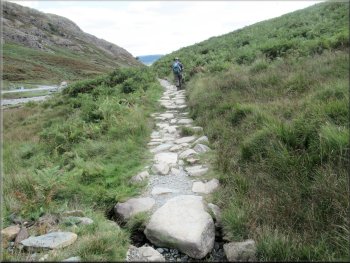
Stony access road from the Youth Hostel heading up the valley
Access road beside the beck now called Levers Water Beck
About 400m from the Youth Hostel there was a Water Company installation ahead of us, related to the Levers Water Reservoir situated higher up the mountainside. Just before this installation a stony track turns sharp right and we followed it climbing up the hillside. |
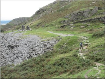
After our coffee we continued along the stony road at the left hand side of the Youth Hostel. This route took us past the remains of the copper mining centre in the valley bottom to the left of the road. There was also a working slate quarry to our left on the far side of the beck, now called Levers Water Beck.
Ruined buildings from the copper mining era
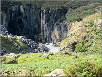
Working slate quarry in the valley bottom
|
Just before the Water Company installation a stony track turns up to the right and we followed it climbing up the hillside
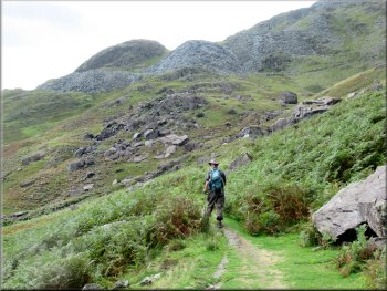
The crag straight ahead is Tongue Brow and the crag to the left is Kennel Crag
|
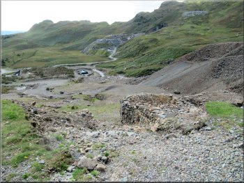
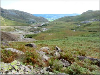
Looking down the valley over the slate quarry access road
and copper mining relics
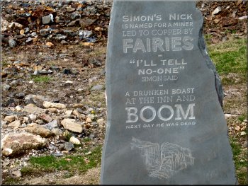
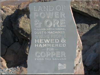
The discovery of copper in just a few words
The stream is Levers Water Beck, the outlet stream from the reservoir out of sight about 350m higher up the mountain side. |
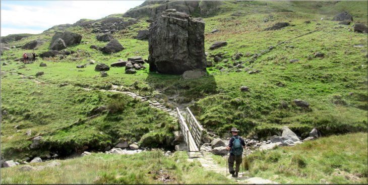
We continued along this track until we reached a wooden footbridge across the stream, Levers Water Beck.
Looking down the valley to Coniston Water far below us now
Approaching the footbridge over Levers Water Beck
|
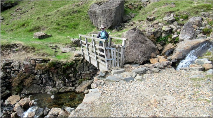
Crossing the footbridge over Levers Water beck at map ref. SD 283 988
|
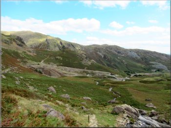
Path along the contour around the head of the valley
Looking back across the valley over the old copper mining sites
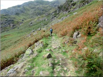
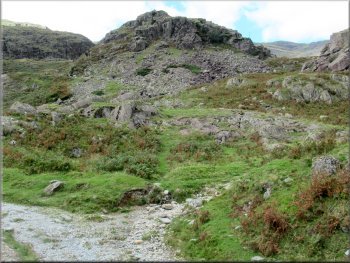
There were spoil heaps from the copper mines at every level all around the valley. About 500m from the wooden footbridge we came to Low Water Beck and the path turned right to climb straight up the hillside next to the beck. |
We crossed the wooden footbridge and kept straight on following a path contouring around the head of the valley. There were great views from this path with the remains of the copper mine buildings visible in the valley bottom.
Path along the contour around the head of the valley
Path along the contour around the head of the valley
|
The path turned right and climbed up the hillside next to Low Water Beck
|
|
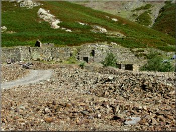
Slate quarry & spoil heaps and relics of the copper mining era
The general level in Coniston is between 50 and 60m above sea level. Across the bridge the path bent to our left to pass the large boulder on our right. |
After climbing up the hillside for about 150m the path turned left to cross a footbridge over Low Water Beck with a large angular boulder straight ahead. This was the highest point of our walk at about 330m above sea level.
Slate quarry & spoil heaps and relics of the copper mining era
|
Footbridge over Low Water Beck & path bending left around the large angular boulder
|
Continuing around the head of the valley
The adit from which all the spoil would have been extracted
From this adit tubs of spoil would have been pushed along a narrow gauge railway track to be tipped down the end of the spoil heap. We continued to follow the path contouring around the head of the valley. |
We continued along the path over the flat top of a spoil head with two large stone cairns on the left of the path. On the right of the path is the entrance to the old copper mine.
About to cross the flat top of an old spoil heap
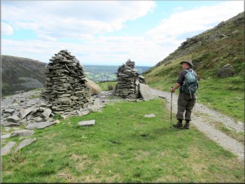
Cairns on top of the spoil heap
|
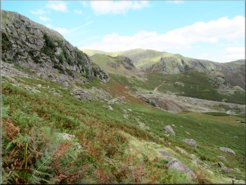
Continuing to follow the contour around the head of the valley
|
Crag at Crowberry Haws
The artist was an elderly gentleman, sitting with his easel painting part of the craggy hillside called Crowberry Haws. The artist was very friendly and showed us his sketchbook full of lovely watercolours. He seemed to be a really accomplished painter. |
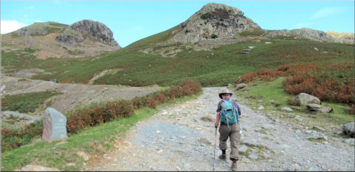
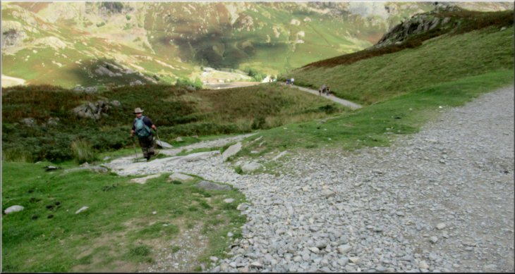
About 600m from the footbridge over Low Water Beck the path dropped down to join the main visitors track climbing up towards the Old Man of Coniston (803m). At the junction we turned left and just beyond the junction there was an artist at work.
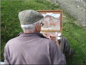
Artist capturing the scene at Crowberry Haws
|
Turning left off the main track to follow a steep path down to Church Beck
|
Path dropping down to Church Beck
Flatter path above Church Beck
We were heading towards the area where Levers Water Beck becomes Church Beck. Until we reached the path beside the beck we were descending quite steeply. Once we were alongside the beck the descent was much less steep. |
We wished the artist well and continued down the track for about 70m. Here the track was bending to our right but we turned left off the track and followed a footpath down the steep hillside.
Path dropping down to Church Beck
Flatter path above Church Beck
|
A last look across the valley to the slate quarry and copper mining relics
|
Miners Bridge on the other side of the beck from this morning
Waterfall on Church Beck downstream of Miners Bridge
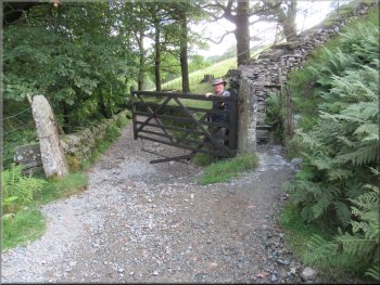
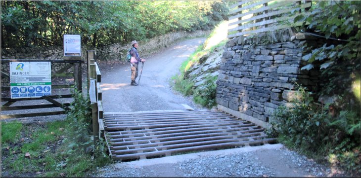
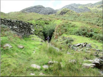
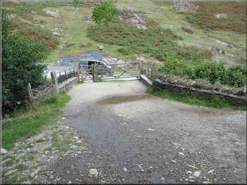
Gate on to a walled track
Through the gate we found ourselves on a stony walled track. We followed the tree lined track down the slope and came out from the trees to a stony access road heading down the valley. |
Soon we were back at the Miners Bridge, and on the opposite side of the beck was the stony access road we had walked up earlier this morning. A few hundred metres beyond the Miners Bridge we came to a gate across the path.
Path by the beck from Miners Bridge
Path down the valley by Church Beck
Walled track heading down through the trees
|
Continuing along the access road heading down the valley
|
Following the road down the valley
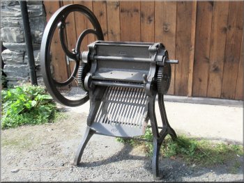
Turnip cutter for animal feed
My grandad had two scared finger ends caused by trying to unblock a jammed turnip cutter like this. The big wheel at one side of the cutter is a fly-wheel that is kept spinning by hand to power the cutter. From the farm we continued along the access road descending back into Coniston. |
We followed the road through a farm yard where there were posters about the local mountain rescue organisation and about holiday cottages in the valley. Next to the path I spotted an old turnip chopper. I noticed it in particular because my grandad who died 1963, was brought up on a farm.
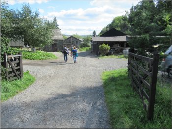
Access road though a farm yard
The road down into Coniston
|
Road junction at the A593 bridge over Church Beck
|
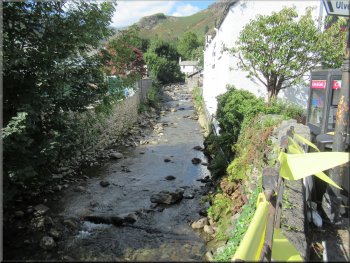
Church Beck seen from the road bridge
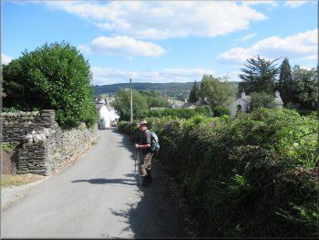
Our left turn off the A593 by the Coop Shop
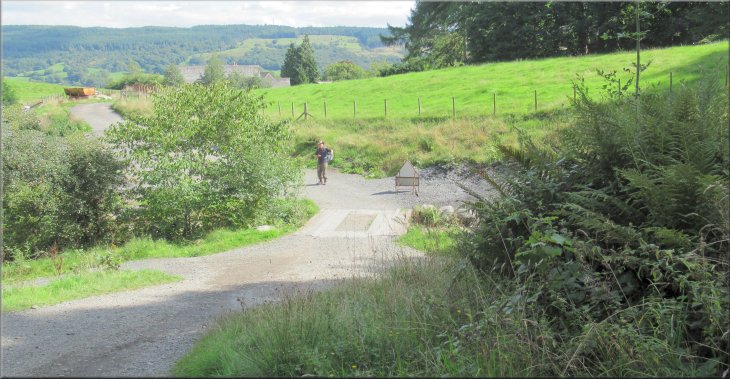
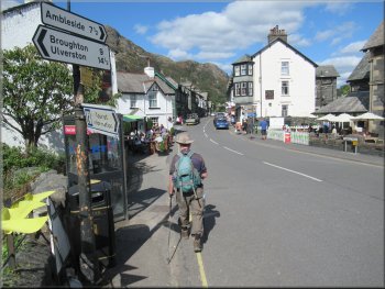
We walked along this road past the entrance to the Ruskin Museum and round the next bend back to our parking spot and the end of our walk. The whole walk had been just 6km and including our break at the Youth Hostel and our chat to the artist it had taken us three hours to walk.
|
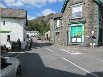
The road brought us to the junction with the A593 next to the road bridge over Church Beck. At the junction we turned left and crossed the road bridge with St. Andrews Church ahead of us across a junction. Across the road bridge we turned left along the A593 and after just a few metres we turned off the A593 along a road just before the Coop Shop.
Walking along the A593 from the bridge over Church Beck
Entrance to the Ruskin Museum on the right of the road
|
Looking up to the southern end of the Yewdale Fells as we approached our parking spot at the end of our walk
|