Menu:
National Parks
The approximate route is shown by a blue line.
Use your mouse to drag the map to the area of interest and
zoom in/out using the controls on the left hand side of the map.
Please use my map to find the route on your own large scale
walking map such as the OS Explorer series at 1:25000.
If you have time if you do this walk please let me know how you get on.
That would be very helpful to me to keep my information accurate and up to date.
Please note that I provide this free service to you as a fellow walker on the
understanding that you walk
the route entirely at your own risk and that the information is not used for
any commercial purpose.
Library Route 930323
Halton Gill, Foxup Road, Hull Pot, Horton-in-Ribblesdale,
Pen-y-ghent, Plover Hill circuit - 21km
Yorkshire Dales . . .
Map: OS Explorer OL2 Yorkshire Dales Southern & Western areas at 1:25000
General Directions (see markers on the route map)
1.) Start in the hamlet of Halton Gill in Littondale at map ref. SD880764. From the road junction there take the road south east for 200m to the road bridge over the River Skirfare. Once across the bridge take the path on the right along the river bank heading upstream for 1km to the hamlet of Foxup. At the road in Foxup turn left on to a bridleway heading south east up the hillside for about 700m to join a track around the hillside called the Foxup Road.
2.) Follow the Foxup Road (moorland track) for about 5km around the hillside below Plover Hill via Swarth Gill Gate and passing above the deep chasm of Hull Pot (map ref. SD823745) below on the left of the track to reach a walled track at map ref. SD822743. Continue along the walled track for another 2km to the B6479 in Horton-in-Ribblesdale.
3.) At the B6479 turn left and follow the road past the church on the left round a sharp left hand bend then after 200m cross Horton Bridge and turn left on to a minor road to pass a school on the right. The road follows an almost semi-circular route to map ref. SD816722. Here turn left off the road to follow a public footpath climbing up the hillside for about 2km to join the Pennine Way below the summit of Pen-y-ghent. Follow the Pennine Way route to the trig point on the summit of Pen-y-ghent at map ref. SD838733.
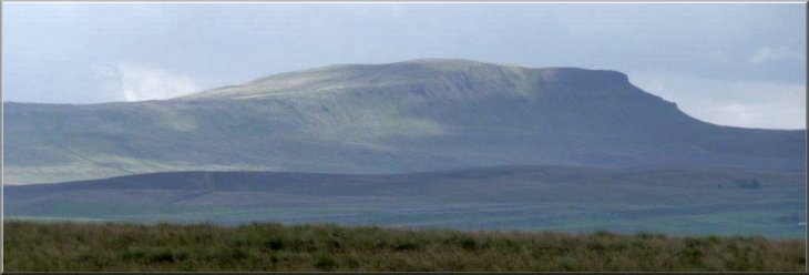
4.) At the summit trig point leave the Pennine Way and follow the path along side the dry stone wall along the summit ridge to Plover Hill about 2km away to the NNE. The land here is very boggy and there are wide detours where people have tried to avoid the worst of it.
5.) From the summit of Plover Hill the path descends for about 250m to a rocky edge and makes a very steep descent through the rocks to drop down on to the Foxup Road, moorland track that was used on the outward route. At the Foxup Road turn right and retrace the outward route back to Halton Gill and the end of the walk.
(top of page)