Menu:
National Parks
The approximate route is shown by a blue line.
Use your mouse to drag the map to the area of interest and
zoom in/out using the controls on the left hand side of the map.
Please use my map to find the route on your own large scale
walking map such as the OS Explorer series at 1:25000.
If you have time if you do this walk please let me know how you get on.
That would be very helpful to me to keep my information accurate and up to date.
Please note that I provide this free service to you as a fellow walker on the
understanding that you walk
the route entirely at your own risk and that the information is not used for
any commercial purpose.
Library Route No. 930426
Garsdale Head, Swarth Fell, Wild Boar Fell, R. Eden,
Lady Anne's Highway, River Ure circuit - 24km
Yorkshire Dales . . .
Map: OS Explorer OL2 Yorkshire Dales Southern & Western areas
General Directions (see markers on the route map)
Point No. 1.) Start on the road below Garsdale station at map ref. SD787918. Walk down the slope to the main road (A684) and cross the main road to take the footpath opposite across the fields past a water fall called Clough Force on Grisedale Beck. Continue long the path past Blake Mire farm and past Rowantree farm to Moor Rigg farm on Grisedale Road . Follow the road to East House and continue along a track for about 250m to map ref. SD777939.
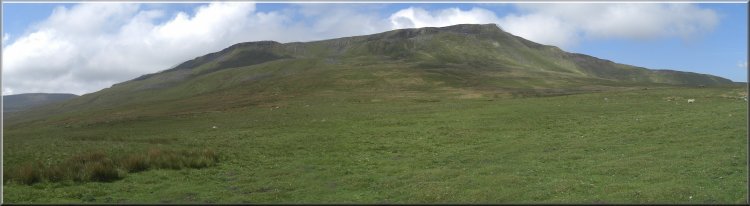
Point No. 2.) Here turn right off the track along a bridleway and after 100m turn left along another bridleway climbing straight up the hillside. After about 350m on the ridge where the county boundary runs turn left and follow the county boundary climbing up along the ridge. There is no defined public footpath but this is open access land and there is a path following the dry stone wall along the ridge. After a little over 2km the route reaches the summit of Swarth Fell Pike at map ref. SD760598.
Point No. 3.) From the summit of Swarth Fell Pike continue along the ridge of Swarth Fell then dropping down to a col with a small tarn between Swarth Fell and Wild Boar Fell and then climbing up on to the summit plateau of Wild Boar fell. Follow the path across the summit plateau past some cairns to the trig point at map ref. SD758988. From the trig point walk out to The Nab, the northernmost point of the summit plateau. This is the point where the path makes a steep descent down the northern end of Wild Boar fell for about 800m to a bridleway at map ref. SD765000.
Point No. 4.) At the bridleway turn right to follow the bridleway for about 1.3km down the hillside to an underpass crossing the railway at map ref. SD778996. Through the underpass turn left and follow the path across the access road to Hazelgill farm and continue across the fields to the access road to deep Gill farm. Follow the access road to the right across the River Eden and out to the road (B6259) near The Thrang. At the road turn right and walk along the road for about 100m to a track called Lady Anne's Highway on the left at map ref. SD783004.
Point No. 5.) Here turn off the road (B6259) and follow the track, Lady Anne's Highway, climbing up the hillside for about 3.5km to Hell Gill at map ref. SD786968. (Along the way there is a sculpture by the track called 'Water Cut') Hell Gill Beck is the source of the River Eden that flows out to the Irish Sea. Continue along the track for about 600m to cross another stream running down the hillside. This is the River Ure that flows down Wensleydale and out to the North Sea. The route has just crossed the watershed of England. Continue along the track for another 1.5km to map ref. SD797949.
Point No. 6.) At map ref. SD797949 turn right off Lady Anne's Highway to follow a public footpath down the hillside for 200m to Shaws. This building was a former Youth Hostel. From here continue along the path down the hillside to the road (B6259) in the valley bottom at map ref. SD790938. At the road turn left to walk along the road for about 600m to a footpath on the right at map ref. SD792935. Here turn right off the road and follow the footpath for 150m to a footbridge over the railway. Then continue along the path across the rough fields for about 1.3km to the main road (A684) in Garsdale. At the road turn right and follow the road for about 300m to the road to Garsdale station on the left and the end of the walk.
(top of page)