Menu:
National Parks
The approximate route is shown by a blue line.
Use your mouse to drag the map to the area of interest and
zoom in/out using the controls on the left hand side of the map.
Please use my map to find the route on your own large scale
walking map such as the OS Explorer series at 1:25000.
If you have time if you do this walk please let me know how you get on.
That would be very helpful to me to keep my information accurate and up to date.
Please note that I provide this free service to you as a fellow walker on the
understanding that you walk
the route entirely at your own risk and that the information is not used for
any commercial purpose.
Library Route No.950108
Clapham, Clapdale, Gaping Gill, Ingleborough,
Simon Fell Breast, Sulber Gate, Long Lane circuit - 17km
Yorkshire Dales . . .
Map: OS Explorer OL2 Yorkshire Dales Southern & Western areas
General Directions (see markers on the route map)
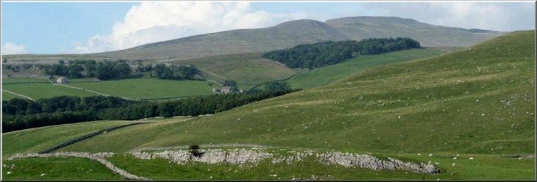
1.) Start in the Yorkshire dales village of Clapham at map ref. SD745693 next to the stone wall of the churchyard (St. James) at the start of a stony lane where there is usually room to park. From here walk down the side of the churchyard along Church Avenue to cross Clapham Beck and then turn right to walk along Riverside to its end at a 'T'-junction with Eggshell Lane. On this bend is the entrance to a toll road leading up the valley to Ingleborough Cave. If you're willing to pay the toll charge it is a very pretty track along the valley. If you do not wish to pay the toll, walk along Eggshell Lane for about 100m to a track on the right hand side at the junction with Cross Haw Lane. Turn right to follow the track, called Clapside Lane, for about 1.4km to Clapdale farm. Just beyond the farm follow the bridleway down to the right to join the track beside Clapham beck and follow the beck to its source where it emerges from Ingleborough Cave. Continue along the path past Ingleborough Cave and along the narrow limestone valley at Trow Gill for about a kilometre to Gaping Gill pot hole.
2.) From Gaping Gill follow the path up the steep hillside for about 1km to the cairn at Little Ingleborough. Continue along the path for another kilometre climbing up to the summit plateau of Ingleborough. At the summit plateau double back for about 200m to the summit trig point (map ref. SD741745), shelter and view point.
3.) On leaving the summit plateau, pass the path used to reach the summit and then after about 100m bear right to follow a path heading south east and dropping down across the southern face of Simon Fell. From the summit plateau of Ingleborough follow this path for 3.5km through an area of limestone pavement to map ref. SD777734, where the path crosses a bridleway running along a track called Clapham Lane.
4.) Turn right to follow Clapham Lane through the limestone pavement. Continue along the Clapham Lane track for almost 3km to map ref. SD758716 where the track turns sharp left above Trow Gill on the opposite side of the valley to Ingleborough Cave.
5.) Continue along the Clapham Lane track with the valley of Clapham Beck below to the right of the track for 2km to a 't'-junction with another stony track called Thwaite Lane. At this junction turn right and follow Thwaite Lane for about 600m back to the parking spot by the church and the end of the walk.
(top of page)