
The Cam High Road
Menu:
National Parks
The approximate route is shown by a blue line.
Use your mouse to drag the map to the area of interest and
zoom in/out using the controls on the left hand side of the map.
Please use my map to find the route on your own large scale
walking map such as the OS Explorer series at 1:25000.
If you have time if you do this walk please let me know how you get on.
That would be very helpful to me to keep my information accurate and up to date.
Please note that I provide this free service to you as a fellow walker on the
understanding that you walk
the route entirely at your own risk and that the information is not used for
any commercial purpose.
Library Route No.950722
Hawse, Burtersett, Marsett, Bardale Head,
Wether Fell, Gayle circuit - 18km
Yorkshire Dales . . .
Map: OS Explorer OL30 Yorkshire Dales Northern & Central areas
General Directions (see markers on the route map)
1.) Start in Hawse (where ever you can get parked) and follow Burtersett Road eastwards out of the town. At map ref. SD878896, about 500m from the town centre, there is a public footpath on the right hand side of the road. There is a lay-by in front of a group of semi-detached houses on the right hand side of the road and at the far end of the lay-by is a finger post and pedestrian gate off the road to a paved footpath across the fields. Follow this path for about 300m to Old Gayle Lane. Cross the lane and continue on the path opposite across the fields for about 1km to the road in Burtersett at map ref. SD890893. The path comes out to the road between the buildings and the one on the right of the path looks as though it's an old chapel converted to a house.
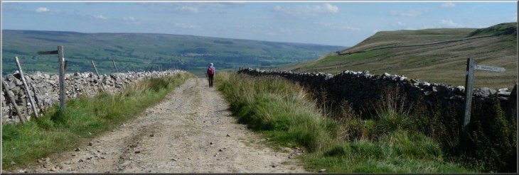
2.) At the road in Burtersett turn right and walk up to the junction about 150m away. At the junction turn left and walk along the road for about 100m to a stone barn on the right hand side of the road. (Note: there's a wide verge here where you could start and finish the walk) Just before you reach the barn turn right off the road through a stile next to the barn and follow a path climbing up across the fields for about 1.5km to the Cam High Road at map ref. SD894877. Cam High Road is a Roman Road coming up from Bainbridge. Cross the Roman Road and follow the footpath opposite for about 1.5km down the steep hillside to a farm access track and out to the road on the edge of Marsett.
3.) At the road on the edge of Marsett, turn right and walk along the road for about 50m towards Marsett Bridge over the beck at map ref. SD903862. The beck changes its name at the village from Bardale Beck upstream to Marsett Beck downstream. About 40m before the bridge turn right off the road to follow a track next to a dry-stone wall to join a footpath heading upstream along the bank of Bardale Beck. Follow this footpath up the valley of Bardale Beck climbing up the hillside above the beck for about 4.5km from Marsett to the road at map ref. SD862845.
4.) At the road turn right and walk along the road for about 200m to a junction. At the junction turn right and continue along the road for another 800m to map ref. SD863853. Turn right here off the road to rejoin the Cam High Road. Follow the Cam High Road for about 1.3km to map ref. SD873864. Turn left here off the Cam High Road to follow a bridleway around the top of Wether Fell for about 2km to map ref. SD882875. Keep to the bridleway on the left here and follow it for about 600m then keep to the left to follow a public footpath down the hillside for about 1.2km to the road on the edge of Gayle at map ref. SD870890. At the road turn right and follow the road through Gayle to the edge of Hawse at map ref. SD870894. Turn right off the road here to follow the route of the Pennine Way along a walled tarmac path for the first 20m then through a stile and continue along the path with Gayle Beck below and to the right for about 350m into the centre of Hawse and the end of the walk.
(top of page)