Menu:
National Parks
The approximate route is shown by a blue line.
Use your mouse to drag the map to the area of interest and
zoom in/out using the controls on the left hand side of the map.
Please use my map to find the route on your own large scale
walking map such as the OS Explorer series at 1:25000.
If you have time if you do this walk please let me know how you get on.
That would be very helpful to me to keep my information accurate and up to date.
Please note that I provide this free service to you as a fellow walker on the
understanding that you walk
the route entirely at your own risk and that the information is not used for
any commercial purpose.
Library Route No. 930429
Bowderdale, Hare Shaw, The Calf,
Hazelgill Knott, West Fell Circuit - 19km
Howgill Fells . . .
Map: OS Explorer OL19 Howgill Fells and Upper Eden Valley at 1:25000
General Directions (see markers on the route map)
1.) There is room to park at map ref. NY684050 on a minor road next to the A685 on the opposite side of the main road to the village of Wath. It's off the minor road from Wath, under the A685 and out to Bowderdale village. From this parking spot follow the road towards Bowderdale village for about 200m, then take the left hand fork in the road. After 700m continue past a track on the left to Scar Sikes. The road becomes a stony track from here. After another 800m keep to the right hand fork in the track and follow the track around the contour of the hill. The track follows the 300m contour until the floor of Bowderdale rises to meet it.
2.) Here the route crosses Bowderdale Beck. Select your own place to ford the beck and climb up a few metres to join the public bridleway following the beck up the valley. Continue along the bridleway for about 3km to map ref. SD678988.
3.) Here, at map ref. SD678988, keep to the right hand fork following the path that starts to climb steeply away from the beckup to Hare Shaw. (Note: the path straight ahead following the stream drops down past the northern end of Cautley Crag) Continue on the path beyond Hare Shaw to the ridge up to The Calf at map ref. SD667970.
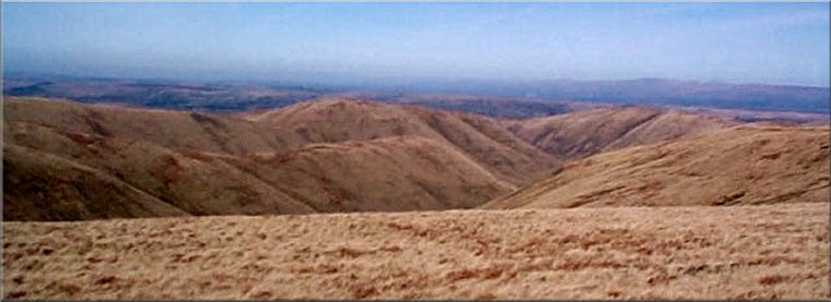
4.) The Calf is the highest point in the Howgill Fells at 676m. There is an amazing 360° panorama from here when it's clear, taking in the North Pennines, The Yorkshire Three Peaks, Morecombe Bay and The Lake District. From the trig point at The Calf retrace your steps for about 400m to the point where the path begins to drop down away from the ridge. Here stay on the ridge. The track marked on the map is a quad bike track in the coarse grass along the ridge. Follow this track along the ridge on the west side of Bowderdale for about 2km to the summit of Hazelgill Knott.
5.) From Hazelgill Knott continue along the ridge for another 2km to West Fell and continue down the ridge for about 1.5km to map ref. NY669035 where the route joins a public footpath by the corner of a walled field. From here follow the footpath into Bowderdale village. At the road in the village turn right and follow the road back to the parking spot and the end of the walk.
(top of page)