Menu:
National Parks
The approximate route is shown by a blue line.
Use your mouse to drag the map to the area of interest and
zoom in/out using the controls on the left hand side of the map.
Please use my map to find the route on your own large scale
walking map such as the OS Explorer series at 1:25000.
If you have time if you do this walk please let me know how you get on.
That would be very helpful to me to keep my information accurate and up to date.
Please note that I provide this free service to you as a fellow walker on the
understanding that you walk
the route entirely at your own risk and that the information is not used for
any commercial purpose.
Route No. 931029
Cotegill, Langdale Knott, West Fell, Hazelgill Knott, The Calf,
Bush Howe, Wind Scarth, Simon Seat, Middleton, Langdale circuit - 18km
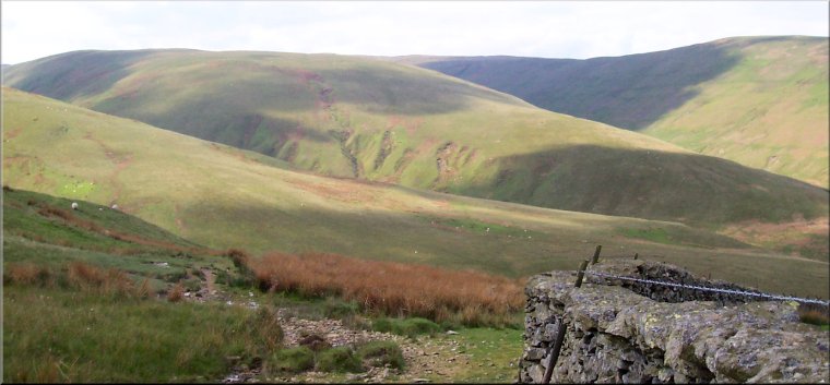
Howgill Fells . . .
Map: OS Explorer OL19 Howgill Fells and Upper Eden Valley at 1:25000
General Directions (see markers on the route map)
1.) Start on the minor road south of the hamlet of Cotegill at map ref. NY659046 where there is room to park off the narrow lane. Head south along the road past Archer Hill Farm where the metalled road ends. Continue along the moorland track for about 1.5km where the main track bends round to the right. Keep straight on to join a quad bike track up the developing ridge of Langdale Knott for another 1.5km to the top of Langdale Knott (477m AOD)at map ref. NY659020.
2.) Continue along the ridge of Langdale Knott as it drops down to the col with West Fell. Continue up the fell side to the track along the ridge of West Fell. At the ridge turn right and follow the track along the ridge. Continue along the ridge for about 2.5km to the top of Hazelgill Knott (578m AOD) at map ref. SD672997.
3.) From Hazellgill Knott continue along the track on the ridge as it climbs up for about 2.5km to the trig point at the Calf (676m AOD) at map ref. SD667970.
4.) From The Calf follow the ridge initially north west past Bush Howe to Breaks Head at map ref. SD654985. At Breaks Head turn right to follow the ridge down to the col below Simon's Seat. Continue straight up the steep fell side to the summit of Simon's Seat (m AOD) at map ref. SD659999.
5.) At the top of Simon's Seat turn left and follow the ridge down from Simon's Seat for about 1.5km to the trig point (484m AOD) on Middleton at map ref. NY652012. From the trig point continue down the ridge for almost 1km to Middledale End. Here turn right and drop down to the ford across Langdale Beck at map ref.NY651022
6.) Cross Langdale Beck at the ford and follow the track climbing diagonally up the hillside to the intake wall at map ref. NY650028. Follow the wall for about 100m then turn right and head across the rough fell side for about 600m to pick up the track used on the outward leg of this walk at map ref. NY655032. Follow the track back to the starting point just beyond Archer Hill farm at map ref. NY659046.
(top of page)