Menu:
National Parks
The approximate route is shown by a blue line.
Use your mouse to drag the map to the area of interest and
zoom in/out using the controls on the left hand side of the map.
Please use my map to find the route on your own large scale
walking map such as the OS Explorer series at 1:25000.
If you have time if you do this walk please let me know how you get on.
That would be very helpful to me to keep my information accurate and up to date.
Please note that I provide this free service to you as a fellow walker on the
understanding that you walk
the route entirely at your own risk and that the information is not used for
any commercial purpose.
Library Route No. 940313
Lund Farm, Bonfield Gill, Rolling Gate, Cinderhill Wath,
Old Kiln, Roppa Wood, Old Fold circuit - 12km
North York Moors . . .
Map: OS Explorer OL26 North York Moors Western area at 1:25000
General Directions (see markers on the route map)
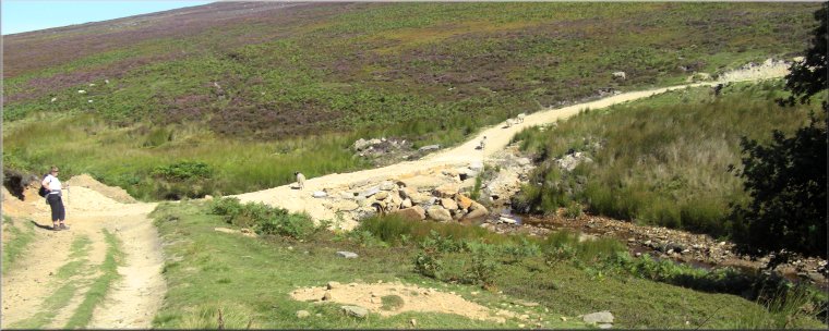
1.) Start at map ref. SE609903 opposite a red public telephone box near Lund Farm about 7km north of Helmsley on the road through Carlton towards Bransdale. From the telephone box head northwards along the road for about 400m to a farm acess track on the right. Follow this acess track to Lund Farm and just before reaching the farm turn left along a track along the field edge. Continue along this track for about 500m to a ford across Bonfield Gill at map ref. SE615908. Follow the path climbing up from the ford for about 150m and there turn left to follow a path climbing steadily up the moor for about 1.5km to an old trackway, called Little Roll Gate, along the ridge of the moor.
2.) At the Little Roll Gate track turn left and follow it for about 1.5km to a junction in the track at map ref. SE617933. The tracks have been cut into deep ruts by the passage of off-road vehicles. At the junction turn left and follow the track down to cross back over Bonfield Gill at Cinderhill Wath, map ref. SE611930. From the stream climb up along the track for about 150m to a right hand bend. On the bend turn left off the track to follow a narrow path climbing diagonally up across the moor for about 500m to a minor road at map ref. SE607924.
3.) Cross the road and take the farm access track opposite heading north west. After about 200m turn left along the access track to Old Kiln farm. Just before the farm turn left to follow a footpath passing in front of the farm and then turn right down the field edge to cross Bogmire Gill at map ref. SE602922. Continue on the path up through the forest for about 150m to a stony forest track. Cross the track and follow the forest track opposite through the forest to the open moor. From the forest edge follow the path along the wall side above Potter House farm and continue around the northern edge of Roppa Wood to the north west corner of the wood at map ref. SE586916.
4.) At the corner of Roppa Wood turn left to cross the stile into the edge of the wood and follow the track diagonally across Roppa Wood to the start of a public minor road at map ref. SE590907. Here bear left to follow a bridleway along a forest track heading south easterly for about 700m. Here there is a single field on the right and a network of fields on the left all the way up to Potter House farm. From the corner of the single field on the right bear left along a public footpath heading north east for 450m and then bending round to the south east to a stone cottage called Old Fold. Continue past the cottage along an access track for about 400m to a footbridge beside a vehicle ford across Bogmire Gill. From the footbridge follow the track for about 150m to a road. At the road turn left and walk along the road for about 150m back to the starting point and the end of the walk.
(top of page)