Menu:
National Parks
The approximate route is shown by a blue line.
Use your mouse to drag the map to the area of interest and
zoom in/out using the controls on the left hand side of the map.
Please use my map to find the route on your own large scale
walking map such as the OS Explorer series at 1:25000.
If you have time if you do this walk please let me know how you get on.
That would be very helpful to me to keep my information accurate and up to date.
Please note that I provide this free service to you as a fellow walker on the
understanding that you walk
the route entirely at your own risk and that the information is not used for
any commercial purpose.
Library Route No. 960105
Boltby, Gurtof Wood, Hambleton Drove Road,
Thorodale, Hawnby, Cleveland Way circuit - 22km
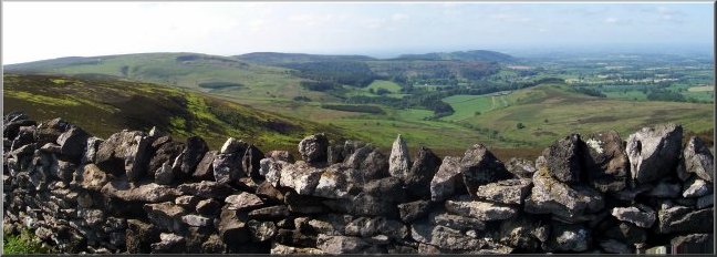
North York Moors . . .
Map: OS Explorer OL26 North York Moors Western area
General Directions (see markers on the route map)
1.) The walk starts at a small lay-by on a bend in the road at the eastern end of Boltby village at map ref. SE494865. From the lay-by walk westwards along the road through the village for about 600m to map ref. SE488866. Turn right here off the road to follow a bridleway up past West Gurtof Farm. At the field boundary about 200m beyond the farm the bridleway turns left but our route keeps straight on along a public footpath. Follow the footpath across the fields for almost 1km to the edge of Gurtof Wood. The route of the public footpath through the forest is hard to find and it's easier to follow the forest access tracks through this open access forestry. From the forest track on the north side of West Moor Slack there is a good path from map ref. SE477882 up to Seta Pike at map ref. SE477888 along the boundary between the open moor and the forest. From Seta Pike follow the bridleway along Windygill Ridge to the gate on to the open moor at Gallow Hill. From Gallow Hill follow the bridleway climbing up over the moor for about 1km to join the Cleveland Way at the Hambleton Drove Road at map ref. SE489909. At the Hambleton Drove Road turn left and follow the wide track for about 1km to map ref. SE490919.
2.) At map ref. SE490919, turn right off the Hambleton Drove Road to follow a bridleway passing south of a small disused quarry. Next to the quarry are the foundations of a ruined drovers' inn called Limekiln House. Continue along the bridleway for about 500m to the edge of a steep descent into the head of Thorodale. Follow the bridleway down the steep slope to the wet land on the floor of the valley. Continue across the valley floor and climb up to the edge of the forest at map ref. SE502915. Turn right here through the gate to follow the bridleway down the valley, through the forest for about 2km to map ref. SE519908. Here the track bends round to the right to head down to Arden Hall, but our route goes straight on at the bend leaving the forest and passing through a gate to follow the field boundary for about 600m to a farm access track. At the track turn left and walk along the access track for about 150m. Turn right here to walk through Mount Pleasant Farm. Contine along the track from the farm for about 300m to a left hand bend in the track.
3.) At the bend turn right off the track to follow a footpath along the edge of a field. There is a fine view here to Hawnby Hill across the River Rye valley. From the corner of the field follow the path down the hill along the edge of woodland for about 300m to Arden Beck. Turn left off the track here to follow a path across the field alongside the beck and then turn left again to follow the path heading upstream along the bank of the River Rye. After about 150m turn right to follow the path over a footbridge across the River Rye. Continue along the path as it climbs up the hillside to Hill End House at map ref. SE536910. At Hill End House turn right to follow the access track in front of the building around the side of Hawnby Hill to the road at map ref. SE540897 on the western edge of Hawnby village. At the road turn right and follow the road down the hillside to the church in the woods by the River Rye. Just past the church turn right off the road to follow a footpath across a footbridge and then climbing up the steep hillside to Sunnybank Farm. Just before the farm turn right to follow the farm track heading westwards for a little over 2km and then bending round to head south around the head of Gowerdale to map ref. SE512890. Here the track bends round to the left but our route turns right off the track to follow a bridleway across the fields for about 800m to the Cleveland Way and Hambleton Drove Road.
4.) Cross the Drove Road track and follow the farm access road opposite past High Paradise Farm. This is the route of the Cleveland Way. About 400m below High Paradise farm the farm access road bends sharply to the right and our route goes straight on, off the road, to continue along the Cleveland way across the fields and through the woodland to the road near the top of Sneck Yate Bank. Cross the road and continue along the Cleveland Way for almost 1km to High Barn at map ref. SE506867. Just past the barn turn right off the Cleveland Way to follow the zig-zag path down the steep hillside to cross Lunshaw Beck at the bottom and then climb up across the field to the road at the lay-by where the route started.
(top of page)