Menu:
National Parks
| Routes Library | North York Moors | Yorkshire Dales |
| Yorkshire Wolds | Howgill Fells | Teesdale |
| Lake District | Peak District |
| 2001 walks | 2002
walks | 2003 walks | 2004
walks |
| 2005 walks | 2006
walks | 2007 walks | 2008
walks |
| 2009 walks | 2010
walks | 2011 walks | 2012 walks |
| 2013 walks | 2014 walks | 2015 walks | 2016 walks |
| 2017 walks | 2018 walks | 2019 walks | 2020 walks |
| 2021 walks | 1993-2000 library | Find a Route Index |
| A few Routes to print out | Request a Route... |
Library Route 960712 - Moor Gate, Bilsdale TV Mast,
Cock Howe, Head House, Arnsgill Ridge,
Low Cote Farm, Locker Bank, Arden Great Moor,
Hambleton Drove Road, Thorodale,
Mount Pleasant Farm, River Rye, Hill End House
24km circuit - Hawnby, North York Moors . . .
Map: OS Explorer OL26 North York Moors Western area
Printer friendly version (opens
in a separate window)
The approximate route is shown by a blue line.
Use your mouse to drag the map to the area of interest and
zoom in/out using the controls on the left hand side of the map.
Please use my map to find the route on your own large scale
walking map such as the OS Explorer series at 1:25000.
If you have time if you do this walk please let me know how you get on.
That would be very helpful to me to keep my information accurate and up to date.
Please note that I provide this free service to you as a fellow walker on the
understanding that you walk
the route entirely at your own risk and that the information is not used for
any commercial purpose.
Library Route 960712 - Moor Gate, Bilsdale TV Mast,
Cock Howe, Head House, Arnsgill Ridge, Low Cote Farm,
Locker Bank, Arden Great Moor, Hambleton Drove Road, Thorodale,
Mount Pleasant Farm, River Rye, Hill End House circuit - 24km
Hawnby, North York Moors . . .
Map: OS Explorer OL26 North York Moors Western area
General Directions
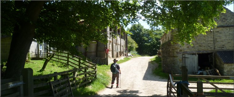
The route starts at Moor Gate at a little parking area on the right off the Hawnby to Osmotherly road about 2km north of Hawnby village just beyond the cattle grid at the start of the open moor at map ref. SE 539 917. From the parking area follow the stony moorland track heading generally northwards climbing up across the open moor to pass the Bilsdale TV transmitter mast a few hundred metres to the east of the track. Continue along the moorland track for another 2km beyond the TV mast to map ref. SE 543 981 about 200m before Cock Howe. Turn left here to follow a bridleway across Arns Gill. The start of the bridleway may be difficult to spot but unless it's misty the intake wall around the fields beside Arns Gill should be visible and the bridleway goes to the north-western corner of these walls and skirts the western side of the intake. Follow the bridleway along Arnsgill Ridge and drop down past Hill End Farm. Continue on the bridleway along the farm access track to the public road at Low Cote Farm. Follow the road southwards to a sharp left hand bend at map ref. SE 510 944 . At this bend turn right off the road to follow a bridleway across Wheat Beck and begin climbing up the hillside. About 30050m along the bridleway from the road turn left off the bridleway to follow a track climbing directly up the hillside for about 500m before zig-zagging to continue the climb up Locker Bank on to Great Arden Moor (open access land). At the top of the climb (map ref. SE 501 934) turn right and follow the track around Great Arden Moor to White Gill Head on the Hambleton Drove Road/Cleveland Way at map ref. SE 490 931. Follow the Drove Road southwards for about 1.2km to map ref. SE 490 919 at the overgrown foundations of an old Drovers' Inn. Turn left here off the Drove Road to follow a bridleway down Thorodale. After about 400m the bridleway makes a steep descent into Thorodale with lovely views of this pretty dale. Continue along the bridleway down Thorodale to map ref. SE 519 908 about 250m from Arden Hall. Here the bridleway makes a sharp right hand turn to drop down to Arden Hall but our route continues straight ahead along a public footpath following the edge of the fields for about 500m to a farm access track at map ref. SE 524 910. At this access track turn left and follow the track for about 200m to Mount Pleasant farm. At the farm turn right and follow the track through the farm buildings and along the field edge for about 300m to map ref. SE 529 912. Turn right here and follow a public footpath along the field edge with a great view of Hawnby Hill across the valley on the left. At the end of the field continue on the footpath along a track down the edge of Half Moon Plantation. After about 300m through the plantation the track crosses a ford over Arden Beck. Immediately beyond the beck turn left to follow a bridleay across the field by Arden Beck to the western bank of the River Rye. Turn left and follow the bridleway along the bank of the River Rye for about 150m to a bridge over the river. Cross the bridge and continue along the bridleway , first along the river bank and then straight up the hillside throught woodland and then across the fields to a track just to the north of Hill End House. At the track turn left and continue along the bridleway following the track around Hawnby Hill for about 750m back to Moor Gate and the parking spot at the end of the walk. The whole route is about 24km and may take between 5 and 8 hours depending how fit you are.
(top of page)