Menu:
National Parks
| Routes Library | North York Moors | Yorkshire Dales |
| Yorkshire Wolds | Howgill Fells | Teesdale |
| Lake District | Peak District |
| 2001 walks | 2002
walks | 2003 walks | 2004
walks |
| 2005 walks | 2006
walks | 2007 walks | 2008
walks |
| 2009 walks | 2010
walks | 2011 walks | 2012 walks |
| 2013 walks | 2014 walks | 2015 walks | 2016 walks |
| 2017 walks | 2018 walks | 2019 walks | 2020 walks |
| 2021 walks | 1993-2000 library | Find a Route Index |
| A few Routes to print out | Request a Route... |
Library Route 970607 - Sinnington,
Wiley Flat Lane, Appleton Mill Farm,
Lower Askew, High Askew, Hollins Farm,
Redman Cross, Lastingham Ridge,
Spaunton, Appleton-le-Moors circuit - 22km
North York Moors . . .
Map: OS Explorer OL27 North York Moors Eastern area at 1:25000
Printer friendly version (opens
in a separate window)
The approximate route is shown by a blue line.
Use your mouse to drag the map to the area of interest and
zoom in/out using the controls on the left hand side of the map.
Please use my map to find the route on your own large scale
walking map such as the OS Explorer series at 1:25000.
If you have time if you do this walk please let me know how you get on.
That would be very helpful to me to keep my information accurate and up to date.
Please note that I provide this free service to you as a fellow walker on the
understanding that you walk
the route entirely at your own risk and that the information is not used for
any commercial purpose.
Library Route 970607
Sinnington, Wiley Flat Lane, Appleton Mill Farm, Lower Askew,
High Askew, Hollins Farm, Redman Cross, Lastingham Ridge,
Spaunton, Appleton-le-Moors circuit - 22km
North York Moors . . .
Map: OS Explorer OL27 North York Moors Eastern area at 1:25000
General Directions
The walk starts on the village green in Sinnington on the east side of the River Seven at map ref. SE 744 858. From the village green follow the lanes northwards and bending to the right (eastwards) to pass the church and The Hall at map ref. SE 746 860. From The Hall turn left and follow the bridleway along the track heading northwards passing Stables Wood on the right (a Woodland Trust site). Continue along this track to a fork in the bridleway at map ref. SE 747 870. At the fork keep to the right hand fork along Wiley Flat Lane for about 600m to map ref. SE 746 877. Here where the bridleway forks again take the left hand fork down the hillside for about 170m. Then turn right to follow a bridleway around the hillside. (The bridleway straight ahead drops down to a ford suitable for horses but would envolve wading for a pedestrian.)
Continue around the hillside dropping down to the lower edge of the woodland. At the edge of the wood turn right out of the wood and cross the field and follow the bridleway across a bridge over the River Seven. Over the bridge turn left and follow the bridleway towards Appleton Mill Farm, then, just before the farm, turn right to follow a public footpath around the edge of the fields next to a wooded hillside. After about 500m the path enters some woodland. After another 500m the path reaches the end of the woodland and continues across the fields to a minor road at Lower Askew (map ref. SE 743 897). Continue northwards along the road for about 250m to a juction. At the junction keep straight on along a narrow lane. After about 200m the lane becomes a farm access track. Follow a bridleway along this farm access track and where the track bends right towards the farm keep straight on to pass High Askew farm on the right of the track.
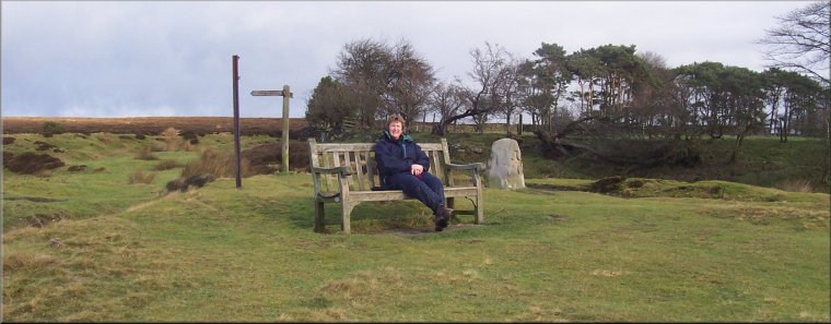
Continue along the bridleway for about 3km from High Askew to map ref SE 733 943 almost at Hollins Farm. Here turn sharp left to follow a bridleway initially heading south east climbing up the moorland, then bending round to the right to head west to map ref. SE 733 936. Here the bridleway heads south west but our route heads north west on a moorland path for about 150m to the remains of Redmand Cross (just the socket stone remains). From Redman Cross follow the moorland tracks heading south west across this open access moor. The track bends round to head south and at map ref. SE 724 926 a bridleway along the parish boundary joins the track. Continue along the track following Lastingham Ridge to map ref. SE 729 909 next the Lastingham Millennium Stone.
Here turn right off the bridleway to follow a path along the boundary of the open access land to cross the steep sided little valley of Hole Beck. Continue around the boundary of the open access land to join the road at map ref. SE 721 903. At the road turn left and walk along the road for about 400m up the slope to a right angle bend in the road at map ref. SE 722 898 in Spaunton.
At this bend in the road keep straight on to follow a track called Spaunton Lane, between the fields. After about 1.3km the track is called Ings Balk and after another 800m Ings Balk meets South Ings Lane. At this junction turn right and follow South Ings Lane for about 1km to the road in Appleton-le-Moors at map ref. SE 734 880. At the road turn left and follow the road through the village for about 350m to a right angle bend to the right.
At this bend in the road keep straight on to follow a bridleway along the edge of the fields heading southwards for about 800m to map ref. SE 737 868. Here take the right hand fork in the bridleway heading up the slope and into Bishop Hagg Wood. Continue along the bridleway as it bend round to the left following the River Seven. The bridleway drops down to a right angle bend in the river at map ref. SE 743 863 and then continued to follow the river southwards back into Sinnington. At the road in the village turn left to cross the River Seven on the road bridge back to the village green and the end of the walk.
(top of page)