Menu:
National Parks
The approximate route is shown by a blue line.
Use your mouse to drag the map to the area of interest and
zoom in/out using the controls on the left hand side of the map.
Please use my map to find the route on your own large scale
walking map such as the OS Explorer series at 1:25000.
If you have time if you do this walk please let me know how you get on.
That would be very helpful to me to keep my information accurate and up to date.
Please note that I provide this free service to you as a fellow walker on the
understanding that you walk
the route entirely at your own risk and that the information is not used for
any commercial purpose.
Library Route 980808,
Millers Dale, Wormhill, Tideswell, Litton,
Wardlow Mires, Cressbrook Dale, River Wye circuit - 19km
Peak District . . .
Map: OS Explorer OL24 The Peak District White Peak area at 1:25000
General Directions (see markers on the route map)
The walk starts at the public car park at map ref. SK 138 732 off the road from Millers Dale to Wormhill. From the car park entrance turn left and walk down the hill to a sharp left hand bend just above the River Wye. Turn right off the road here to follow a public footpath along the northern bank of the River Wye heading upstream. After about 1km there is a footbridge across the river where the path forks. The left fork continues around the northern river bank and our route follows the fork to the right climbing up the steep hillside to the road at map ref. SK 124 739 near Hassop Farm on the way to Wormhill.
At the road turn left and follow the road through Wormhill village. About 500m beyond Hassop Farm turn right off the village street on to a bridleway along a walled track heading roughly eastwards out of the village. Continue along the bridleway for about 1.2km to a minor road where the road crosses Monk’s Dale at map ref. SK 130 752. At the road turn right and follow the road up out of Monk’s Dale to the crossroads near Monksdale House at map ref. SK 136 752.
At the crossroads turn right along a track called Monksdale Lane. Walk along Monksdale Lane for about 300m to map ref. SK 137 750 where there is a finger post and sign indicating a public footpath off the left hand side of the lane. Follow this path across the fields for about 1km to a track called Slancote Lane at map ref. SK 147 753. At this lane turn left and follow the lane north eastwards for about 400m to a minor road called Summer Cross on the edge of Tideswell.
Turn right along Summer Cross for a few metres to the junction with Sherwood Road. At the junction turn left along Sherwood Road for a few metres to the junction with Parke Road. Turn right and walk along Parke Road to the 'T'-junction at High Street. Cross High Street at the stepped junction and on to Commercial Road. About 150m along Commercial road turn right on to Church Lane and follow Church Lane for about 1km to Litton.
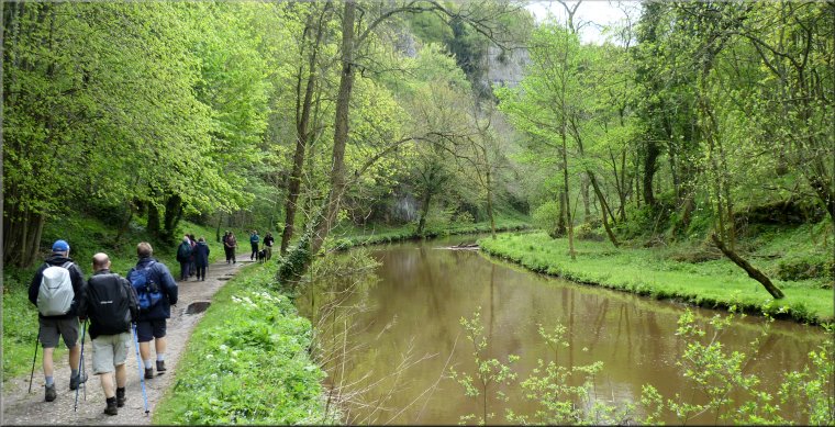
Continue along the road through Litton past Beacon House where the road is now called Mires Lane. At map ref. SK 172 754 turn right off Mires Lane to follow a public footpath across the fields to the A623 at Wardlow Mires. At the road double back along a permissive path for about 50m to join another public footpath heading down Cressbrook Dale. The path passes Peter’s Stone, a limestone feature which to my mind seems to resemble the sandstone mesas of the old western films. Follow the path down Cressbrook Dale for about 2.7km to a minor road in Cressbrook at map ref. SK 171 732.
Continue southwards along the road which has an odd layout here. The road splits into two levels and after about 150m the two roads meet and join up again. Just after the roads rejoin turn right off the road to follow an access way through the old mill buildings to a permissive footpath at the side of the River Wye. As you approach this spot there is a footbridge on the left and our route goes to the right at the water’s edge around the foot of the limestone cliff ahead.
Follow this permissive path for about 2km along the riverside to Litton Mill where the old mill buildings are now appartments (that’s American for flats but appartments sell better) The permissive path passes the main block of appartments to the public road at map ref. SK 159 730. About 30m from the gates to Litton Mill there is a finger post on the left indicating a public footpath that goes down to a footbridge over the River Wye.
Follow this path across the river and then up the steep slope on the other side of the river to join the Monsal Trail on the bed of the disused railway at map ref. SK 158 729. At the Monsal Trail turn right and follow the Monsal Trail westwards along the old railway for a little over 2km to map ref. SK 135 732. Turn right here off the Monsal Trail to double back along a track for about 200m along a track that leads back into the car park at Millers Dale and the end of the walk.
(top of page)