|
 This
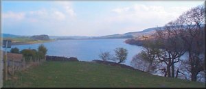
morning we drove to Leighton Reservoir just a few miles from Masham
and parked off the road at map ref. SE 157785. We set off walking around
10.30 and went along the access road to the dam of Roundhill Reservoir
(that's the one just above Leighton reservoir) and followed the road
over the dam. At the end of the dam at map ref. SE 154773 there is a
public footpath that climbs up round the end of Ilton Moor for about
2km to join the old county road at map ref. SE 155754 There are several
of these old unmade public roads over the moors in this area providing
good access to this high wild countryside. This
morning we drove to Leighton Reservoir just a few miles from Masham
and parked off the road at map ref. SE 157785. We set off walking around
10.30 and went along the access road to the dam of Roundhill Reservoir
(that's the one just above Leighton reservoir) and followed the road
over the dam. At the end of the dam at map ref. SE 154773 there is a
public footpath that climbs up round the end of Ilton Moor for about
2km to join the old county road at map ref. SE 155754 There are several
of these old unmade public roads over the moors in this area providing
good access to this high wild countryside.
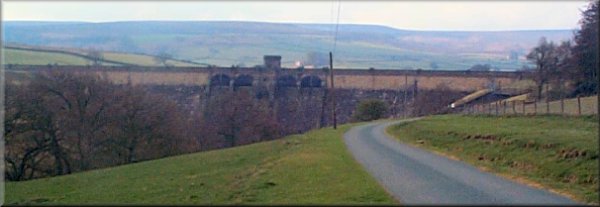
Roundhill
Reservoir Dam
We turned eastwards on the county road for about 4.5km to map
ref. SE 196758 on Wreaks Lane where we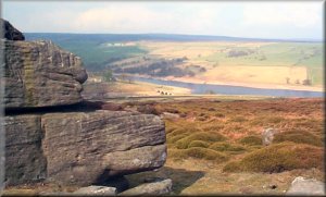 joined the route of the Ripon Rowel walk. We followed the Ripon
Rowel walk, almost half of it on roads, for about 4km to map ref.
SE 179788. Here the route crosses a road and it's well worth diverting
off the route along the road for about 200m into the Druid's Plantation
to see the Druid's temple - a sort of mini stonehenge and other
victorian follies. Then we continued across the fields for just
over 1km to map ref. SE 168793. Here the Ripon Rowel walk almost
doubles back on itself but we took a bridleway down to Pott Beck.
We crossed a footbridge over the beck a few hundred metres below
the Leighton reservoir dam, and following the bridleway, climbed
up to Leighton village. We turned left onto the road and followed
the road for about 1.5km back to our starting point. The whole
route had taken us just over four hours not including a visit
to the Druid's temple, and was about 16.5km.
joined the route of the Ripon Rowel walk. We followed the Ripon
Rowel walk, almost half of it on roads, for about 4km to map ref.
SE 179788. Here the route crosses a road and it's well worth diverting
off the route along the road for about 200m into the Druid's Plantation
to see the Druid's temple - a sort of mini stonehenge and other
victorian follies. Then we continued across the fields for just
over 1km to map ref. SE 168793. Here the Ripon Rowel walk almost
doubles back on itself but we took a bridleway down to Pott Beck.
We crossed a footbridge over the beck a few hundred metres below
the Leighton reservoir dam, and following the bridleway, climbed
up to Leighton village. We turned left onto the road and followed
the road for about 1.5km back to our starting point. The whole
route had taken us just over four hours not including a visit
to the Druid's temple, and was about 16.5km.
|
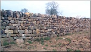
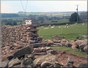
Above:
Newly completed drystone
wall
Right:
Drystone
wall being built (note the rods fixed to give the
proper angle for the sides)
|
|
(Note
taken from the Ramblers
web site) Ripon Rowel Walk Circular around Ripon. £4.95
+ 57p p&p from Ripon Group, 9 Melrose Road, Bishop Monkton,
Harrogate HG3 3RH. Cheques to RA Ripon (Rowel account). Sew-on
badge £1.50 from same source.
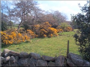
Gorse
in flower near Ilton
|
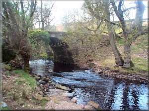
Footbridge
over Pott Beck
below Leighton Reservoir
|
|
top of page
|
|