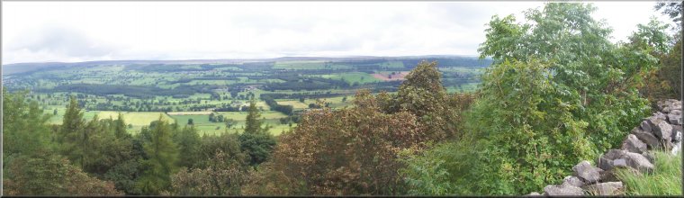
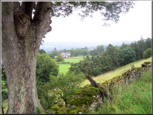
View
across Wensleydale from the gallops above Capple Bank
Menu:
National Parks
 The
weather forecast was for prolonged heavy showers and some bright
intervals today, but we wanted a walk so we drove to West Witton
in Wensleydale. It's a good place to start with several options
for an interesting route. We parked in a large stoney layby
on the A684 just to the east of the village and set off in warm
sunshine along a footpath across the fields from map ref. SE
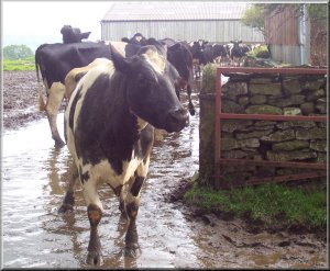
067884 to a farm lane at map ref. SE 075885. As we turned onto
the lane a herd of dairy cows was emerging from the farm yard
and heading along the lane the same way as us. After all the
recent rain the lane was a sea of sloppy mud. We squelched our
way along to the woods and up the steep bank, across more field
and a final steep bank through more woods to emerge onto the
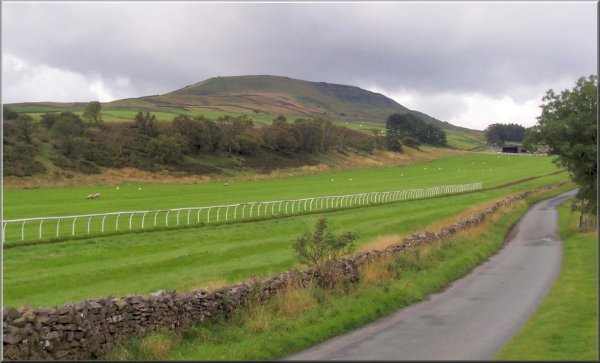
road at map ref. SE 076874. The road runs by the western end
of the Middleham gallops and stretch all the way to the edge
of Middleham. A trio of horses came trotting along the all-weather
track paced by a trainer in a four-wheel drive as we walked
along the road, watching the horses to our left and looking
at the views over Wensleydale to our right.When we reached the
junction at map ref. SE 067874 we took a track between stone
walls for about two kilometers to map ref. SE 051873. From here
we could see some heavy rain heading our way
The
weather forecast was for prolonged heavy showers and some bright
intervals today, but we wanted a walk so we drove to West Witton
in Wensleydale. It's a good place to start with several options
for an interesting route. We parked in a large stoney layby
on the A684 just to the east of the village and set off in warm
sunshine along a footpath across the fields from map ref. SE
067884 to a farm lane at map ref. SE 075885. As we turned onto
the lane a herd of dairy cows was emerging from the farm yard
and heading along the lane the same way as us. After all the
recent rain the lane was a sea of sloppy mud. We squelched our
way along to the woods and up the steep bank, across more field
and a final steep bank through more woods to emerge onto the
road at map ref. SE 076874. The road runs by the western end
of the Middleham gallops and stretch all the way to the edge
of Middleham. A trio of horses came trotting along the all-weather
track paced by a trainer in a four-wheel drive as we walked
along the road, watching the horses to our left and looking
at the views over Wensleydale to our right.When we reached the
junction at map ref. SE 067874 we took a track between stone
walls for about two kilometers to map ref. SE 051873. From here
we could see some heavy rain heading our way 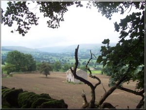 along
the valley, so we stopped for a quick drink and a sandwich before
it arrived. In about 10mins the rain had started and we set
off again. From the end of the track we followed the path down
onto the green road at map ref. SE 044879. We had only been
walking for a few minutes and the rain stopped the dense cloud
up the valley had cleared and there were patches of blue sky
and warm sunshine. So off with the kagouls before we continued
along the track for about 2km. to Morpeth Gate at map ref. SE
026875. Here we took the footpath across the fields to our right
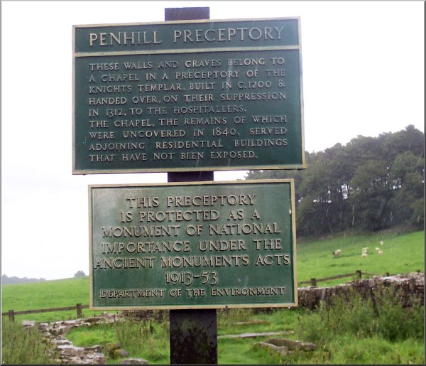
to the remains of the Knights Templars' chapel at map ref. SE
035887. Just before we reached the chapel the rain started again,
this time in earnest and kept going until we finished the walk.
From the chapel we climbed up the hill to join a lane at map
ref. SE 042886 and we followed this lane back into West Witton.
We walked through the village back to the car and drove back
into Leyburn for our traditional drink and a toasted teacake.
The cafe had an"Exceptionally Large mug of filter coffe
plus a free refill" for £2.40, so we both had that
and the refill. It was very good coffee too. The whole route
was over 11km and took us about 4 hours. We walked a bit faster
than usual to get out of the rain.
along
the valley, so we stopped for a quick drink and a sandwich before
it arrived. In about 10mins the rain had started and we set
off again. From the end of the track we followed the path down
onto the green road at map ref. SE 044879. We had only been
walking for a few minutes and the rain stopped the dense cloud
up the valley had cleared and there were patches of blue sky
and warm sunshine. So off with the kagouls before we continued
along the track for about 2km. to Morpeth Gate at map ref. SE
026875. Here we took the footpath across the fields to our right
to the remains of the Knights Templars' chapel at map ref. SE
035887. Just before we reached the chapel the rain started again,
this time in earnest and kept going until we finished the walk.
From the chapel we climbed up the hill to join a lane at map
ref. SE 042886 and we followed this lane back into West Witton.
We walked through the village back to the car and drove back
into Leyburn for our traditional drink and a toasted teacake.
The cafe had an"Exceptionally Large mug of filter coffe
plus a free refill" for £2.40, so we both had that
and the refill. It was very good coffee too. The whole route
was over 11km and took us about 4 hours. We walked a bit faster
than usual to get out of the rain.
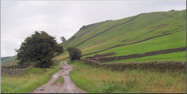
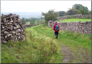 Approaching
West Witton along Langthwaite Lane
Approaching
West Witton along Langthwaite Lane |
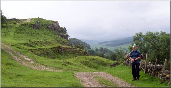
 The
edge of West Witton from Langthwaite Lane
The
edge of West Witton from Langthwaite Lane |