| 2001 walks | 2002
walks | 2003 walks | 2004
walks |
| 2005 walks | 2006
walks | 2007 walks | 2008
walks |
| 2009 walks | 2010
walks | 2011 walks | 2012 walks |
| 2013 walks | 2014 walks | 2015 walks | 2016 walks |
| 2017 walks | 2018 walks | 2019 walks |2020 walks |
| 2021 walks | 1993-2000 library | Find a Route Index |
| A few Routes to print out | Request a Route... |
Route No. 127 - Saturday 12 February 2005
Wass Bank, Scawton, Flassen Dale,
Claythwaite Rigg (monks' trod)
circuit - 14km
Hambleton Hills, North York Moors . . .
Map: OS Explorer OL26 North York Moors Western area at 1:25000
Route
Map on 'Landranger' map base from OS Open Space service
Path through the woods at the top of Wass Bank We sat on a bank in the trees out of the strong cold wind for our lunch.
After our break we continued down Flassen Dale to join the Cleveland Way
at map ref. SE 549845. From here we followed the Cleveland Way past the
duck shooting/ angling ponds to the road at map ref. SE 563844. We continued
along the road to map ref. SE 569843 where we turned right off the road
onto a track up the hill. The track is the route of the old monks' trod
from Rievaulx
Abbey (about 1km north of here) to Byland
Abbey (just at the bottom of Wass bank). We climbed up the hill on the
monk's trod to the main road (A170) at map ref. SE 559817. We crossed the
road and took the path through the woods about 100m to our right to take
us back to our starting point. The whole route was about 14km and took us
Just over 4 hours to walk including our short lunch stop. |
We are planning to have some building work done at home, so this morning
we had to wait in for the plumber to call to look at his part of the job
to give us a quotation. It was almost 10.15 before we could set off to drive
to the top of Wass Bank, map ref. SE 561806. We made our way through the
plantation to the main road (A170) at map ref. SE 551818. Here we turned
left to walk along the road for about 400m. The traffic here is fast and
there's plenty of it, but fortunately there is a reasonably wide grass verge
to walk on clear of the traffic. At map ref. SE 547819 we turned right off
the road on to a walled track between the fieldsand into another plantation.
The track took us to the Scawton road at map ref. SE 547827. We walked along
the road into Scawton and called in the pub, "The Hare" to book
for Sunday lunch tomorrow. In the village opposite the church and next to
the telephone box we turned left on to a footpath over the fields to Flassen
Dale, map ref. SE 537837. 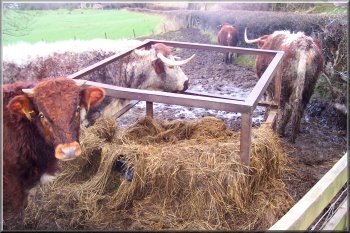
Old English Longhorn cattle at map ref. SE 567844 |
Looking down Nettle Dale |
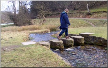
Stepping stones on the Cleveland Way |
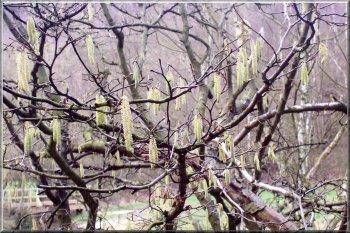
Signs of spring - Hazel catkins |
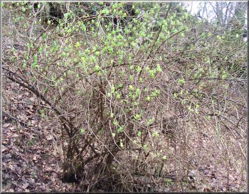
Signs of spring - wild honeysuckle in leaf |
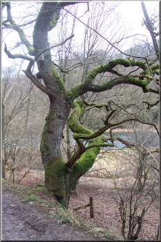
Moss covered oak beside the path |
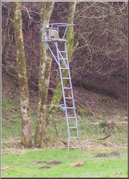
Observation/shooting seat tied to a tree |
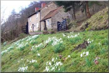
Signs of spring - snowdrops in full flower |
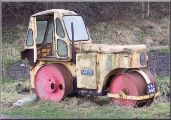
Abandoned road roller |
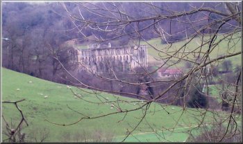
Rievaulx Abbey from the monks' trod |
Looking to Rievaulx Terrace from the monks' trod |
Part of the monks' trod at map ref SE 562830 |
More damage from the recent storms |
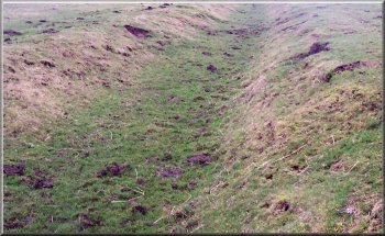
In places the monks' trod is just a sunken track . . . |
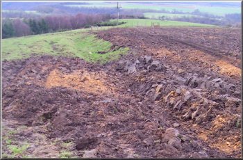
. . . and in places it is being ploughed out |
| 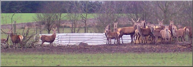
Herd of farmed red deer near the A170
|
Background Notes:
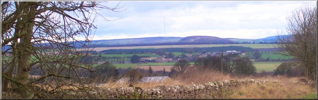
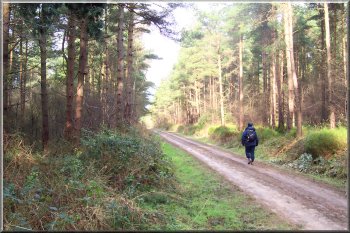
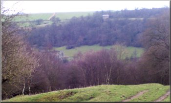
This walk starts at the top of Wass Bank. That's the road up on to the Hambleton Hills from the village of Wass next to Byland Abbey. It's a circular route of 14km, that's almost 9 miles. There's a wide grass verge here to park on and we set off through the forest along a wide forest access road to the far northwesten corner at the A170 Thirsk to Scarborough road.
We walk along the main road for a couple of hundred metres, there's a grass verge to walk on clear of the traffic, and then we turn right off the main road on to a farm access track across the fields. The track takes us through a small plantation to the road into the village of Scawton. The village church was built in the mid 1100's on the instructions of the Abbot of Byland Abbey. It was what is known as a chapel of ease, that's a church some distance away from the main parish church for the convenient use of the local people, in this case it was the village and more importently the manor of the local Lord, Hugh de Malby.
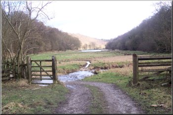
In the village we turn off the road and follow a path across the fields to Flassen Dale. This is a very steep sided, wooded dry valley, well it can be quite muddy but there's no watercoure in it. Our path goes diagonally down through the trees to a open strip along the valley bottom. We follow the valley down to join the Cleveland Way in Nettle Dale. Here we head down the valley following a tributary of the River Rye called Grass Keld.
Alongside this stream are a series of three large fish ponds built by the monks of Rievaulx Abbey in the 1100's and fed by springs. They provided an important source of food for the abbey. A little way beyond the fish ponds the Cleveland Way brings us to a minor road which we follow down the valley for a few hundred metres. For a few years now there have been Old English Long Horn cattle in the fields here. They are impressive beasts and worth looking out for.
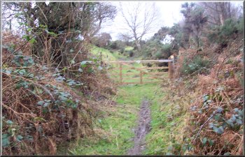
We turn off the road to follow a track climbing up the hillside. Rievaulx Abbey is only a kilometer away up Ryedale and this track is an ancient route linking Rievaulx Abbey and Byland Abbey near Wass at the start of our walk. In fact the rest of our route follows this ancient route to the top of Wass Bank.
The start of the climb is on a stony track along the edge of Claythwaite Wood and further up the hill as we cross the fields on Claythwaite Rigg there are the remains of the paved pannierway. There are some good views looking back across Ryedale towards Rievaulx Abbey as the track gains height above the valley. Near the top of the climb the old route is just a hollow track across the fields and some of it sadly has been ploughed out.
As we pass through the farm at the top of the climb it's worth looking out for some unusual livestock that includes shire horses and red deer. At the top of the climb we cross the A170 again and follow a bridleway through the woods back to the start of our walk at the top of Wass Bank.
top of page
|