| 2001 walks | 2002
walks | 2003 walks | 2004
walks |
| 2005 walks | 2006
walks | 2007 walks | 2008
walks |
| 2009 walks | 2010
walks | 2011 walks | 2012 walks |
| 2013 walks | 2014 walks | 2015 walks | 2016 walks |
| 2017 walks | 2018 walks | 2019 walks |2020 walks |
| 2021 walks | 1993-2000 library | Find a Route Index |
| A few Routes to print out | Request a Route... |
Route No. 166 - Wednesday
1 February 2006
Hole of Horcum: Pigtrough,
Hawdale & Honess Griffs- 10km
North York Moors . . .
Maps: OS Explorer OL27 North York Moors Eastern area at 1:25000
Route
Map on 'Landranger' base from OS Open Space service
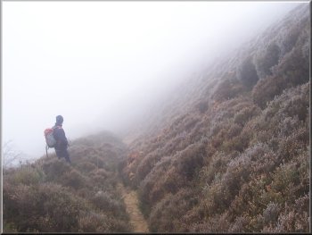
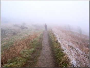
Walking into the Hole of Horcum from the hairpin
bend on the Whitby road
We
followed the path beside the main Whitby road round
to the hairpin bend at map ref. SE 849940 and took the
path down through the frosty heather into the Hole of
Horcum. We could only see about 70m and I soon pulled
my hat down over my ears as the frost started to nip
them.
|
Thick
white mist everywhere this morning and after a slow
frustrating drive I met a friend of mine at the Hole
of Horcum car park (map ref. SE 852936) just before
10am. We didn't really have a plan for today but we
decided to have a rather silly "Boys Own Adventure"
day and explore some narrow rocky valleys off Dundale
Griff that are now available to walk under the new "right
to roam".
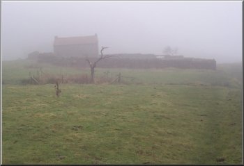
Ruined farm house at Low Horcum
|
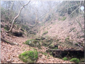
The start of our walk up the bed of Dundale Griff
We
walked upstream to map ref. SE 836918 where Pigtrough
Griff joins Dundale Griff. From here we followed Pigtrough
Griff upstream. The sides of the valley became steeper
and there were several small rocky waterfalls (with
no water in today) that we had to scramble up. It's
a fascinating place with the dead trees left where they
fell and the accumulated debris washed down when the
stream is in spate. It's all eerily quiet and completely
isolated from the open moor above.
|
We
continued through the Hole of Horcum past the ruined farm
house at Low Horcum and made our way to the bottom of
Dundale Griff at map ref. SE 838917. Here we left the
path and dropped down into the bed of the watercourse.
These streams are normally dry and only flow when there
is rain on the moor, but they rise very quickly so these
steep rocky little valleys are no place to be if there
is any rain forecast.
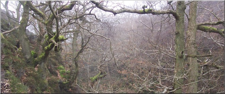
Pigtrough Griff coming into Dundale Griff from our right
|
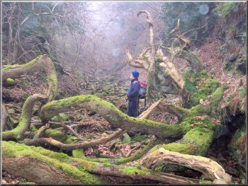
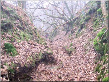
Fallen trees in Pigtrough Griff |
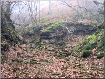
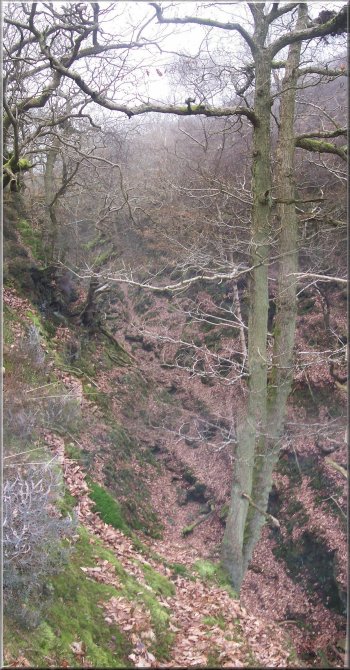
The rocky valley of Pigtrough Griff quickly became
deeper |
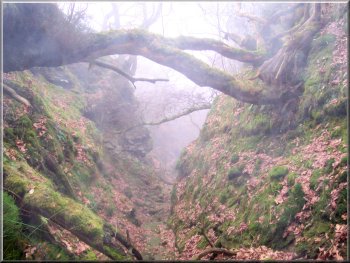
Almost at the top of Pigtrough Griff
From here we intended to follow the little valley, Hawdale
Griff, down to our right for about 1km. There was some
water flowing in this valley and the rocks had a treacherous
coating of algae. The waterfalls were higher and it
quickly became apparent that walking in the stream bed
was well beyond the capabilities of two over-sixties
so we made our way to a point where the valley side
was climbable and scrambled up to a little path running
along the edge of the valley just below the level of
the moor. We followed this path to the confluence of
the streams at map ref. SE 836925.
|
After
a quite tiring scramble we emerged from Pigtrough Griff
on to the open moor beside a square iron age settlement
protected by a ditch and mound, and a few hundred metres
further on we came to a bridleway on a stoney track
across the moor at map ref. SE 829922. We walked along
the track for about 1.5km to Seavy Pond at map ref.
SE 833934.
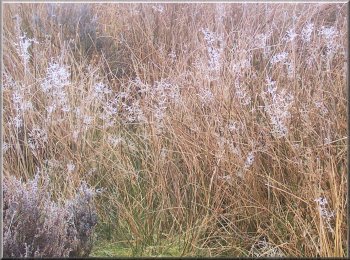
Moorland grasses topped with frost
|
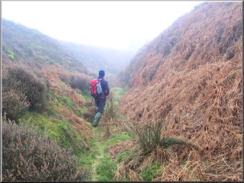
The beginning of Hawdale Griff
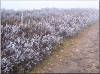
Frost
on the heather by the tack back to the Whitby road
The path back to the Hole of Horcum car park
|
After
a short break we set off upstream again, this time following
Horness Griff. After about 350m we came to a rocky waterfall
over 4m high and we climbed up the valley side to a
narrow path running along the left-hand side of the
valley near the top of the slope. There were numerous
low branches to negotiate but we slowly made our way
along the valley for about 1.3km until we rejoined the
bridleway at map ref. SE 836937. Here we turned on to
the track and followed it back to the hairpin bend on
the Whitby road and retraced our steps back to the Hole
of Horcum car park. The mist was as thick as ever as
I changed my boots for some comfortable shoes ready
to drive home. It had been an interesting day, a bit
different from our usual walks and much more strenuous.
The whole route had been 10km and had taken us about
4 hours to walk and scramble including our breaks.
The steep rocky sides of Horness Griff
|