We
left the town on a walled track heading north from map
ref. SE 002644. The Dales Way leaves the track to go
across the fields to the left but we stayed on the track
for a few hundred metres to rejoin the Dales Way at
map ref. SE SD 998652.
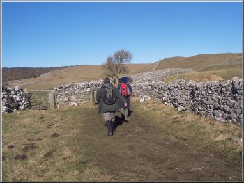
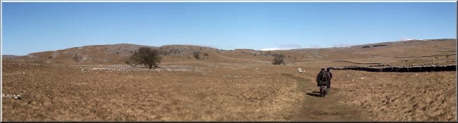
Leaving
Grassington on a walled track heading north
|
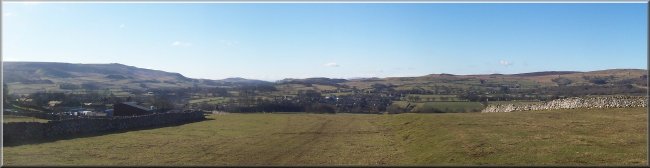
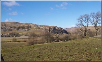
Looking
west from the Dales Way at map ref. SE 996663
We followed this route for almost 3km to map ref. SD993677
where we turned left on to a path down into Conistone
Dib, an interesting limestone gorge.
|
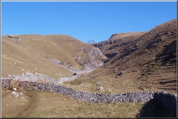
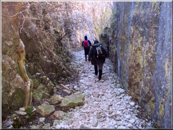
 The
Dales Way heading towards Conistone Dib
The
Dales Way heading towards Conistone Dib |
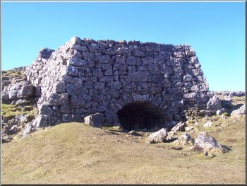
Old
lime kiln built from massive limestone blocks
We
continued down Conistone Dib for about 1km to the village
of Conistone.
|
The
path brought us into the dib about halfway down and
on reflection I was sorry that we had not continued
on the Dales Way to the top of the dib, because the
first part is probably the most spectacular bit.
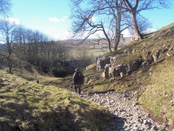
Looking
up Conistone Dib from map ref. SD 990679
|
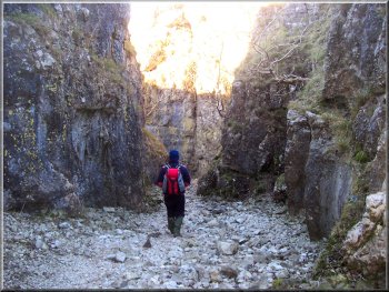 Negotiating
a narrow section of Conistone Dib near the village
Negotiating
a narrow section of Conistone Dib near the village
|
 Negotiating
a narrow section of Conistone Dib near the village
Negotiating
a narrow section of Conistone Dib near the village
|
 Leaving
Conistone Dib above the village
Leaving
Conistone Dib above the village |
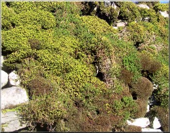 Mossy
wall in the village of Conistone
Mossy
wall in the village of Conistone |
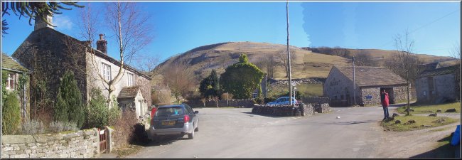 Conistone
village
Conistone
village |
From
the village we followed the road across the river Wharfe
to the B6160 near Kilnsey and turned off the main road
at map ref. SD 976674 on to a path heading westwards
up the hillside to join Mastiles Lane at map ref. SD
968673.
Kilnsey
Crag
|
 The
snowy peak of Buckden Pike just visible over the ridge
The
snowy peak of Buckden Pike just visible over the ridge
|
We
continued along the lane, an old green road, for a few
hundred metres to map ref. SD 964670. Here we turned
left off the lane on to a bridleway heading generally
southwards across Malham Moor.
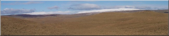
The
snowy ridge of Great Whernside seen from Malham Moor
|
After
about 2km we came to a minor road which climbs up on
to the moor from Threshfield. We crossed the road and
continued along the bridleway for another 2km to map
ref. SD 958630.
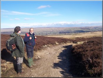
Looking
over Grassington from the moorland track above Threshfield
|
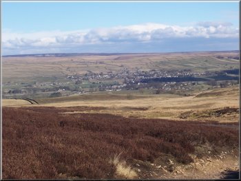
Looking
over Grassington from the moorland track above Threshfield
Here we took the left hand fork of the track. We followed
this track for about almost 3km to the main road above
Threshfield at map ref. SD 987632.
|
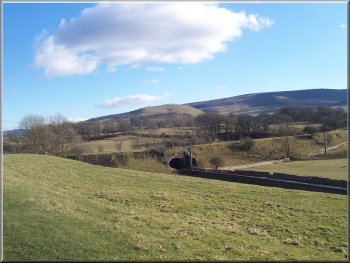 Looking
over the disused railway at Treshfield towards the Thorpe
Looking
over the disused railway at Treshfield towards the Thorpe
|
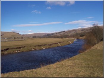
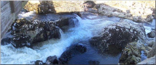
 Wier
on the river Wharfe below Grassington
Wier
on the river Wharfe below Grassington |
We walked along the main road (B6265) for about 300m
into the village where we turned right to cut through
the village to the end of the minor road at a 'T'-junction
where we turned right again for about 150m to map ref.
SD 992634. Here we turned off the road to follow a path
across the fields to a road at map ref. SD 997633.
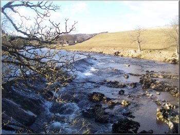
River
Wharfe racing throught the rocks below the wier at Grassington
We
followed the road, left at the junction to a footbridge
over the river Wharfe at map ref. SE 000633. We crossed
the footbridge and followed the path back up to the
car park. The whole route had been 17.5km and had taken
us about 5 hours to walk including a couple of short
refreshment stops.
|
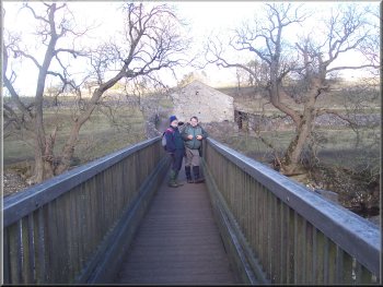 Footbridge
over the Wharfe heading back to the car park in Grassington
Footbridge
over the Wharfe heading back to the car park in Grassington
|
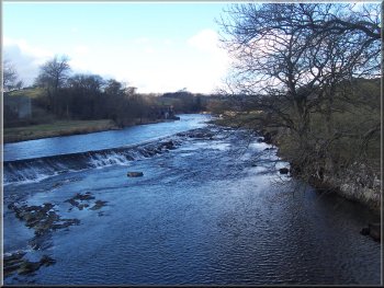 Wier
on the river Wharfe below Grassington
Wier
on the river Wharfe below Grassington |