| 2001 walks | 2002
walks | 2003 walks | 2004
walks |
| 2005 walks | 2006
walks | 2007 walks | 2008
walks |
| 2009 walks | 2010
walks | 2011 walks | 2012 walks |
| 2013 walks | 2014 walks | 2015 walks | 2016 walks |
| 2017 walks | 2018 walks | 2019 walks |2020 walks |
| 2021 walks | 1993-2000 library | Find a Route Index |
| A few Routes to print out | Request a Route... |
Route No. 169 - Tuesday
7 March 2006
Fridaythorpe, Wolds Way circuit - 12km
Yorkshire Wolds . . .
Maps: OS Explorer 294 Market Weighton & Yorkshire Wolds Central
at 1:25000
Route
Map on 'Landranger' base from OS Open Space service
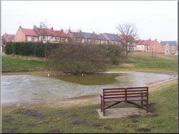 'The
Mere' in Fridaythorpe on the Yorkshire Wolds
'The
Mere' in Fridaythorpe on the Yorkshire Wolds |
It
was a grey drizzly miserable sort of a morning. I met
a friend of mine at the duck pond, rather grandly called
'The Mere', in Fridaythorpe on the Yorkshire Wolds (map
ref. SE 874591) at about 10 o'clock. We set off heading
roughly eastwards on the route of the Wolds Way to cross
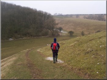
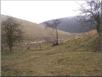
Brubber Dale about 1km east of the village. We climbed
over the hill out of Brubber Dale past Gill's Farm to
cross a minor road and then drop down into Thixen Dale.
Where we reached the path in the bottom of Thixen Dale
(map ref. SE 845590) the Wolds Way turns right to head
north, but we turned left off the Wolds way here and headed
south up Thixen Dale.
|
 Brubber
Dale about 1km east of Fridaythorpe
Brubber
Dale about 1km east of Fridaythorpe |
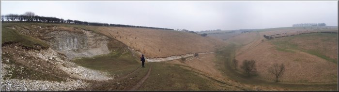
After
about 300m the valley forks and we took the left hand
fork, called Pluckham Dale, which led us up to the main
road (A166) at map ref. SE 849574. We walked along the
road for about 700m to a crossroads at map ref. SE 857576.
Here we turned right off the main road and almost at
once turned left on to a bridleway across the fields
for about 1.5km to Horse Dale.
Following
the Wolds Way into Brubber Dale
|
Looking
back into Brubber Dale
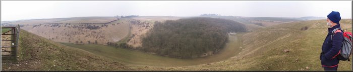
There
is no public footpath down Horse Dale but some of the
dry valleys on the Wolds are now open to walkers under
the CRoW Act ("Right to Roam") and Horse Dale
is one of them. Why they are not all open I do not know.
Maybe some land owners have more influence than others?
Anyway we followed a track down Horse Dale for almost
2kms to rejoin the Wolds Way where Horse Dale meets
Holm Dale. We followed the Wolds Way up Holm Dale and
back into Fridaythorpe.
|
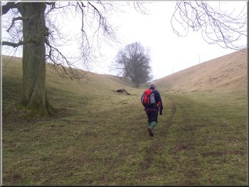 The
Wolds Way approaching Gill's Farm
The
Wolds Way approaching Gill's Farm |
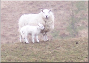 Texel
type ewe with its new lamb on the edge of Thixen Dale
Texel
type ewe with its new lamb on the edge of Thixen Dale
|
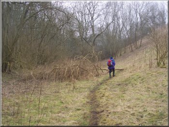
Woodland
near the head of Pluckham Dale
The whole route had been just over 12km and had taken
us about 4 hours to walk including a short refreshment
stop. As we got back to the cars the rain turned heavier
and we were glad to be heading home for a nice hot bath.
|
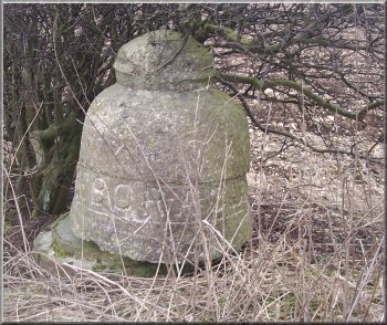 Stone
gateway marker with the inscription Eboracum (Roman name
for York) These markers are at every gateway on this estate
and we were trying to make out the latin inscription on
one in another gateway when after a while we realised
it said 'Keep Britain Tidy' in English!
Stone
gateway marker with the inscription Eboracum (Roman name
for York) These markers are at every gateway on this estate
and we were trying to make out the latin inscription on
one in another gateway when after a while we realised
it said 'Keep Britain Tidy' in English! |
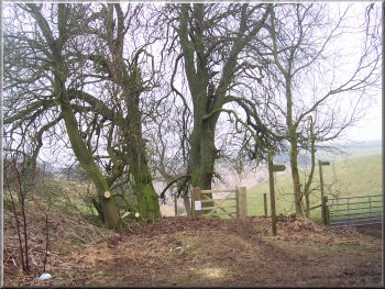 Tall
horse chestnut trees at the head of Holm Dale
Tall
horse chestnut trees at the head of Holm Dale |
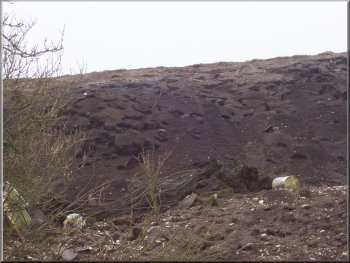 Huge
rat colony in an old tip on the edge of Fridaythorpe
Huge
rat colony in an old tip on the edge of Fridaythorpe
|