| 2001 walks | 2002
walks | 2003 walks | 2004
walks |
| 2005 walks | 2006
walks | 2007 walks | 2008
walks |
| 2009 walks | 2010
walks | 2011 walks | 2012 walks |
| 2013 walks | 2014 walks | 2015 walks | 2016 walks |
| 2017 walks | 2018 walks | 2019 walks |2020 walks |
| 2021 walks | 1993-2000 library | Find a Route Index |
| A few Routes to print out | Request a Route... |
Route No. 173 - Wednesday
5 April 2006
Chop Gate, Cock Howe, Barker's Crags
Lord Stone's Cafe, Raisdale
- 14.5km
Bilsdale, North York Moors . . .
Maps: OS Explorer OL26 North York Moors Eastern area at 1:25000
Route
Map on 'Landranger' base from OS Open Space service
|
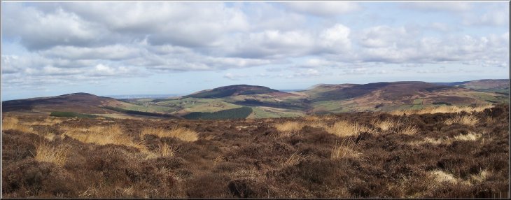
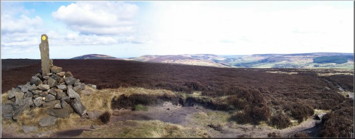
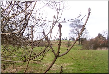
The
head of Bilsdale from the climb up to Cock Howe
|
|
|
Today
my usual walking companion, Jim, was on baby-sitting
duty with his little grand daughter. The weather was
just perfect for a walk - bright, sunny, a cool breeze
- so I decided to have a walk on my own. I drove up
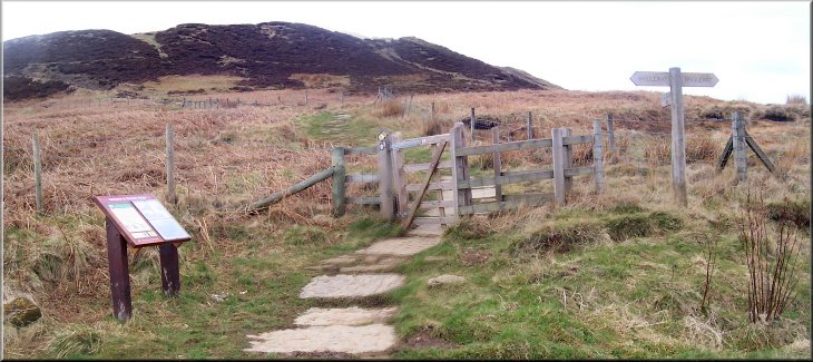
to Chop Gate in Bilsdale and parked at the village hall,
map ref. SE 558993. I set off from the car park heading
roughly south west straight up the hill to Cock Howe,
map ref. SE 542983, at a height of 400m. The views of
Bilsdale on the way up are just stunning. I really like
this place!
Left:
Looking over Chop Gate to Hasty Bank
|
 Looking
north from Cock Howe
Looking
north from Cock Howe |
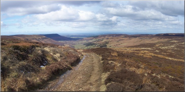
Once
at the top I followed the track northwards along the
ridge for about 3km to Barker's Crags at map ref. NZ
524002. Approaching Barker's Crags there is a lovely
view down Scugdale to the left and over to the Yokshire
dales. I continued on through the crags and over to
Brian's Pond at map ref. NZ 522007. From there I climbed
up to the gliding club airfield and joined the gliding
club access track at map ref. NZ 521022. I walked down
the track to the road where the Cleveland Way crosses
and went into Lord Stone's Cafe for some lunch at map
ref. NZ 524030.
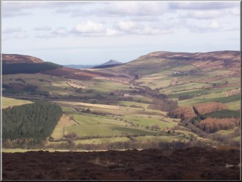
Right:
Roseberry Topping in the distance from Barker's Ridge
|
|
 Looking
down Scugdale
Looking
down Scugdale |
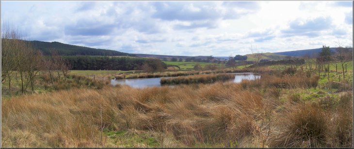
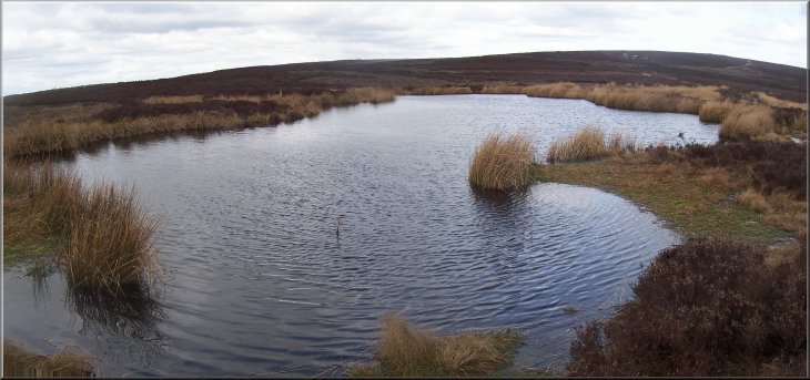 Brian's
Pond
Brian's
Pond |
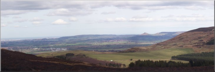 Roseberry
Topping and Teesside from the gliding club access road
Roseberry
Topping and Teesside from the gliding club access road
|
 The
Cleveland Way near Lord Stone's Cafe
The
Cleveland Way near Lord Stone's Cafe |
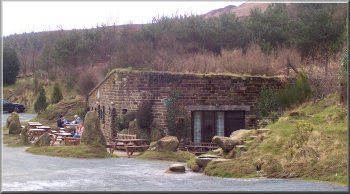
Lord
Stone's Cafe
After
lunch I walked along the road for about 150m and took
the path on the right down a farm track at map ref.
NZ 525029. I followed the path past Thwaites House and
on to Staindale farm.
|
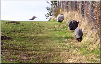 Guinea
fowl at Lord Stone's cafe
Guinea
fowl at Lord Stone's cafe |
 The
track to Thwiates House
The
track to Thwiates House |
 Black
buds on the ash tree, one of the last to come into leaf
well into May
Black
buds on the ash tree, one of the last to come into leaf
well into May |
 Pond
near Thwaites House
Pond
near Thwaites House |
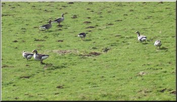
Wild
geese grazing by the path
The path goes through the farm yard and about 200m farther
on it drops down to cross the stream and then follows
the watercourse down the valley for over a kilometre
to Raisedale Mill at map ref. NZ 538005.
|
 Crossing
a side valley to Staindale beck
Crossing
a side valley to Staindale beck |
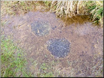 Frogspawn
in a puddle by the path
Frogspawn
in a puddle by the path |
 Tadpoles
starting to develop in the puddle
Tadpoles
starting to develop in the puddle |
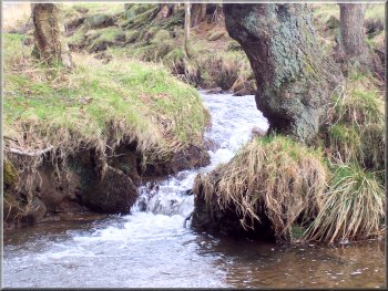 Stream
rushing down to join Raisdale beck
Stream
rushing down to join Raisdale beck |
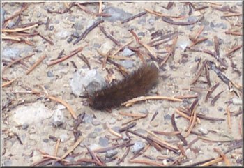 Hairy
caterpillar on the track
Hairy
caterpillar on the track |
 Looking
up to Barker's ridge from Raisedale
Looking
up to Barker's ridge from Raisedale |
At
the mill, now a series of holiday cottages, I followed
the track between the houses and took the path across
the fields to Crossletts farm (now a rather well to
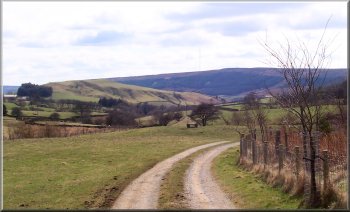
do residence). From here I walked up the farm road,
a pair of concrete strips, to the road.
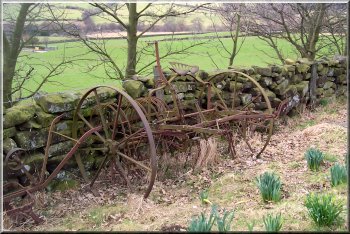
An
old hay rake
|
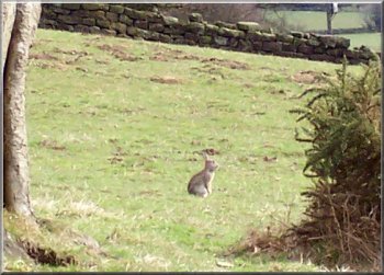
Rabbit
getting ready to run for it!
I crossed the road and turned on to the track on my
right at map ref. NZ 543004. I followed the track to
Westcote farm and continued on the path round the hillside
, then down on to the road at map ref. SE 550999.
|
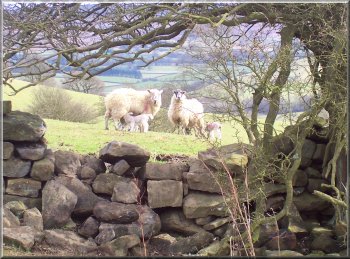
Ewes
and their spring lambs
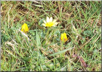
Cellandines
opening in the field by the village hall
|
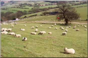
Ewes
in the field nearest to the farm waiting to lamb
I walked along the road for a few hundred metres to
map ref. SE 555995 and turned right off the road to
follow the path across the fields back to the village
hall. The whole route had been about 14.5km and had
taken me almost 5 hours, including nearly an hour's
stop at Lord Stone's Cafe for lunch.
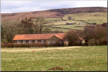
Chop Gate village hall
|
Background Notes:
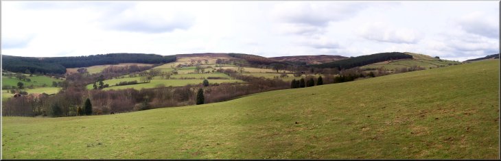
This walk is on the Western side of the North York Moors. It's a bit longer than usual at about 14km (9 miles) and it does include some hills but it's well worth the effort. It's a circular route starting from the public car park at Chop Gate in Bilsdale, about half way between Helmsley and Stokesley on the B1267. There's quite a large car park at the village hall and some public toilets so it's a good starting point to explore Bilsdale. The whole point about this walk is the scenery, not so much history or folklore it's simply the scenery. From the car park the walk starts with the one big climb of the day. It's a climb of 250m, about 850ft, up to the moor top of the Cleveland Hills. At the top is a prehistoric burial mound called Cock Howe and on the way up the views across the head of Bilsdale just get better and better. Chop Gate is situated at a fork in the valley with Raisedale coming in from the Northwest and Bilsdale from the Northeast. At the head of these two dales is a distinctive line of the Cleveland Hill summits with Hasty Bank & the Wainstones, Cold Moor, Cringle Moor and Carlton Bank. The shapes of these hills form a wonderful panorama as you climb up, and as you get higher you can see over these hills to the craggy conical shape of Roseberry Topping and the Tees Estuary beyond often with large tankers at anchor waiting for the tide. I'm getting carried away a bit, but this is one of my favouite places.
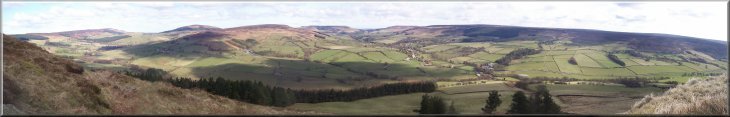
From Cock Howe at the top of the climb the walk follows a moorland track above Raisedale to Barker's Crags and there are great views all round. As the path approaches these crags you cross a stile and just there is a large rock shaped like a sofa and it's surprisingly comfortable. I've stopped here many times to eat my packed lunch with a great view looking down Scugdale running out to the West. The crags above Scugdale are a popular training ground for rock climbers, with access up to the crags from little parking areas on the road in Scugdale.
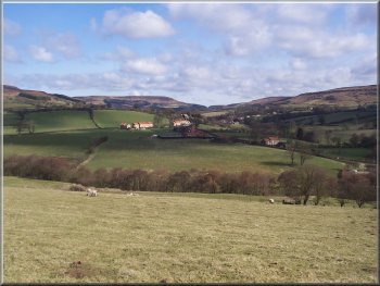
The walk continues along the ridge past a well known landmark called Brian's Pond. I don't know the origin of the name, but I like ponds and this is a dark peaty pond fringed with reeds. From there the path climbs up to the Carlton Gliding Club and crosses the start of a runway, so look out for gliders, then we go down a track to the road at Carlton Bank where there is a cafe called Lord Stone's Cafe. It's cleverly concealed part underground and here there are some toilets and it's a good place for a refreshment stop, with such things as a hot pork roll, home made corn beef pie etc - I just like my food far too much. From the cafe the walk follows a path down Raisedale through farm land, with softer, prettier views quite a contrast to the grandeur of the high moorland on the first part of the walk. After about 3.5 miles from the cafe you are back at Chop Gate. In the sunshine the scenery is simply stunning but on the high moors the weather is changeable and it can all be shrouded in thick mist when good navigation is vital so these hills need to be treated with respect - it's not just a stroll in the park.
Top of Page |