| 2001 walks | 2002
walks | 2003 walks | 2004
walks |
| 2005 walks | 2006
walks | 2007 walks | 2008
walks |
| 2009 walks | 2010
walks | 2011 walks | 2012 walks |
| 2013 walks | 2014 walks | 2015 walks | 2016 walks |
| 2017 walks | 2018 walks | 2019 walks |2020 walks |
| 2021 walks | 1993-2000 library | Find a Route Index |
| A few Routes to print out | Request a Route... |
Route No. 194 - Saturday
9 September 2006
Ladybower Reservoir, Derwent Dam
Woodlands Valley circuit - 15km
Derwent Valley,
Derbyshire
Map: OS
Explorer OL1 The Peak District, Dark Peak area at 1:25000
Route
Map on 'Landranger' base from OS Open Space service
Open this route in Google Earth
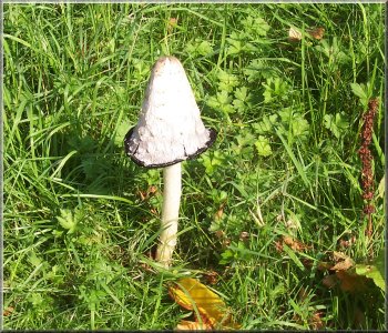
A lovely example of the Shaggy Ink Cap
One
of our friends, Tony, was born and brought up in Hathersage
and he led today's walk, and what a cracker it turned
out to be!
|
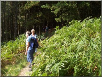
This
morning I met a group of friends at the Heatherdene car
park next to Ladybower reservoir in Derbyshire at map
ref. SK 202860, at around 10.30am.
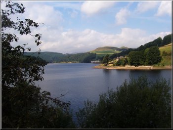
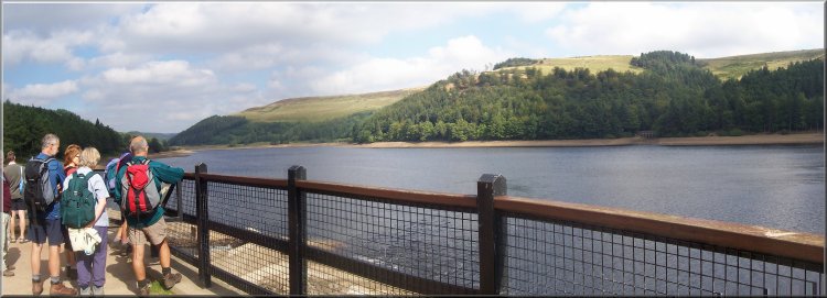
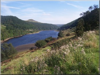
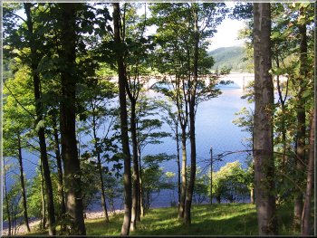
Looking across Ladybower Reservoir from Heatherdene car
park
|
|
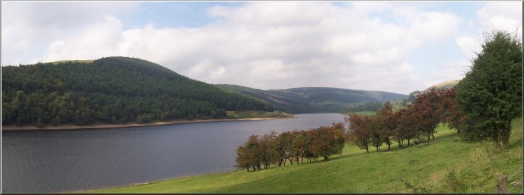
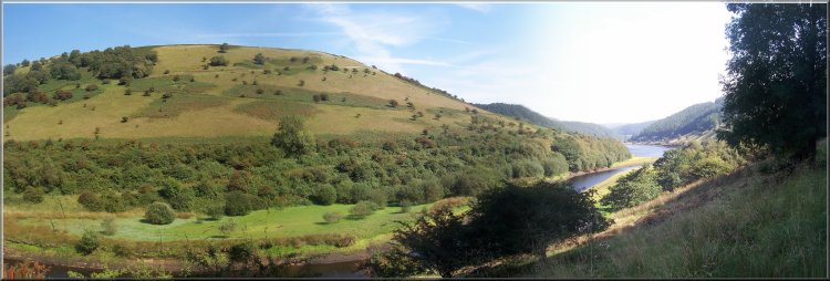
Ladybower reservoir as we set off up the Derwent Valley
|
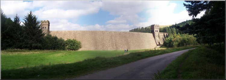
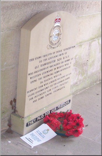
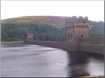
The Derwent Dam where the Dam Buster squadron practiced
during the second world war
It was a lovely sunny day with just enough breeze to be
pleasant. We crossed the road in front of the car park
and walked around the edge of the reservoir on the pavement
at the side of the road for about 1km to map ref. SK 195865.
Here we turned right off the A57 onto a quiet track alongside
the reservoir heading up the derwent valley. We followed
this track, which eventually became a tarmac access road,
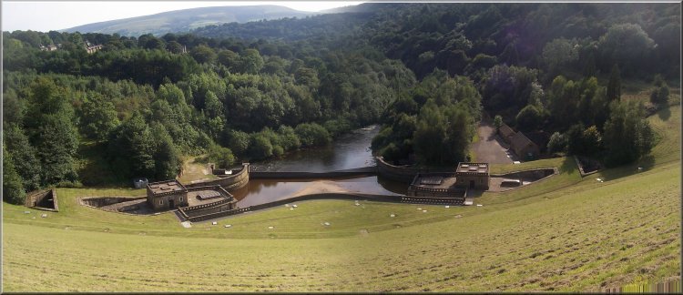
for over 4km to the Derwent Dam. This is a most impressive
stone structure with twin towers and it was used by the
Dam Busters squadron during World War 2 to practice their
approach and bomb aiming device before the raids on the
dams in Germany. There is a memorial to the airmen at
the dam.
|
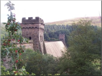
The Derwent Dam
|
The Derwent Dam |
|
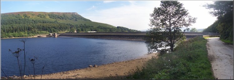
Looking up the Derwent reservoir from the view point at
the dam |
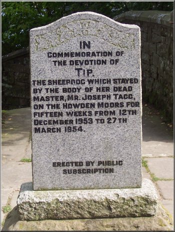
Two very different memorials
both erected by public
subscription at the Derwent Dam |
|
|
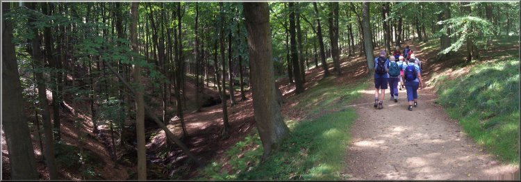
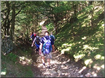
Climbing up to Lockerbrook Farm from Fairholmes
Just below the dam there is a tourist car park, cafe and
toilets at Fairholmes which we made use of (very nice
bacon roll). This is Derbyshire on a sunny weekend so
there were wall to wall people. It's even busy on a cold
wet winter's day because it's such a lovely area set in
the middle of large conurbations around Manchester, Sheffield,
Derby and the Potteries, millions of us all wanting a
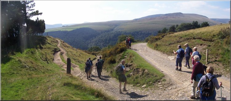
tranquil bit of countryside. From Fairholmes we followed
a way marked trail (the green route) through the woods,
up the valley side to Lockerbrook Farm and onto the ridge
between the Derwent Valley and Woodlands Valley at map
ref. SK 163891, a distance of about 1km.
|
Signpost as we left Fairholmes |
Start of the climb up the valley side from Fairholmes |
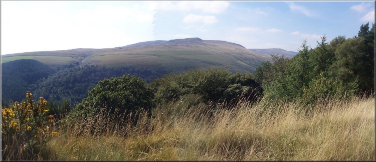
The hill top between the Derwent Valley and Woodlands Valley |
Starting to drop down into Woodlands Valley |
Coming down through the woods into Woodlands Valley |
|
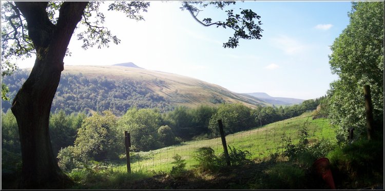
Looking up Woodlands Valley as we came down the hill from
the Derwent valley |
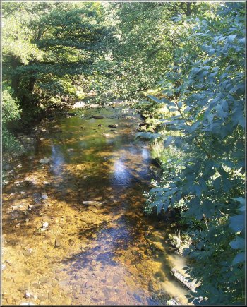
The river Ashop in Woodlands Valley upstream of Ladybower
|
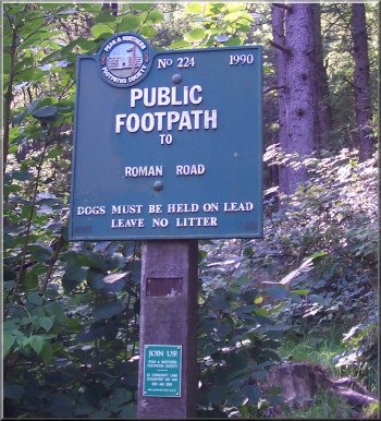
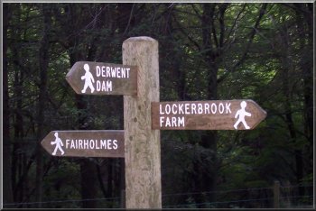
Signpost 224 erected by the Peak
& Northern Footpaths Society
They have an interesting feature on their web site where
you can download a file that puts the location of their
signposts onto Google Earth so that you can zoom in to an
aerial photo of the location of each sign. |
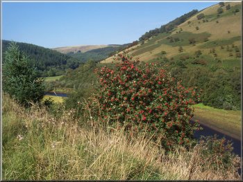
A mountain ash tree covered with clusters of red berries
We
crossed the footbridge over the river and walked along
the path downstream to follow the edge of the reservoir
for almost 6km to the dam at map ref. SK 197855. We crossed
the dam and at the road crossed over and turned left to
walk along a path through the trees back to the car park.
|
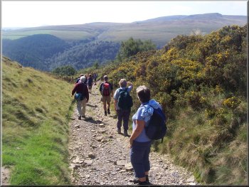
From here we followed the path down into Woodlands Valley
to the main road (A57) at map ref. SK 162886. We crossed
the road - it required both speed and agility to get across
between the fast moving traffic and suicidal motorcyclists.
Once across we followed a path down through some woods
to the river Ashop which flows into this arm of Ladybower
Reservoir.
Looking down Woodlands Valley to Crook Hill
|
|
Looking across Woodlands Valley to Longley Bank |
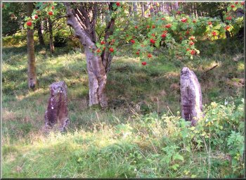
Old stone gate posts now isolated and leading nowhere |
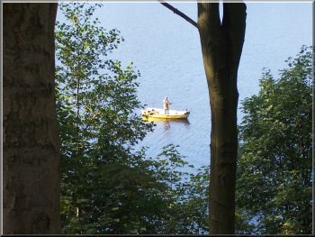
An angler on Ladybower reservoir |
Looking across Ladybower to the A57 bridge |
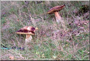
Giant mushrooms by the handle of my walking stick |
|
Approaching Ladybower Dam near the end of our walk |
|
Looking down the face of Ladybower Dam
The whole route had been just over 15km and had taken
us 6 hours to walk including a longish stop at Fairholme,
a stop to pick some sloes to make sloe gin, and a stop
by the edge of the reservoir just to sit in the sun and
admire the view. It had been a lovely walk with amazing
scenery all day and glorious weather too, not to mention
some very nice company. Thanks Tony!
|
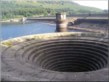
The overflow spillway at Ladybower left high and dry |
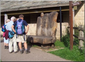
Enormous wooden seat at Heatherdene car park |
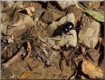
A humble
dung beetle, but where would we be without them?
|
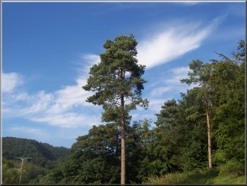
Scots Pine in Heatherdene car park |