| 2001 walks | 2002
walks | 2003 walks | 2004
walks |
| 2005 walks | 2006
walks | 2007 walks | 2008
walks |
| 2009 walks | 2010
walks | 2011 walks | 2012 walks |
| 2013 walks | 2014 walks | 2015 walks | 2016 walks |
| 2017 walks | 2018 walks | 2019 walks |2020 walks |
| 2021 walks | 1993-2000 library | Find a Route Index |
| A few Routes to print out | Request a Route... |
Route No. 277 - Wednesday 17 December 2008
Newgate Bank via River Rye, Rievaulx Abbey
and part of the Cleveland Way to Helmsley - 12km
North York Moors. . .
Ordnance Survey route map on
the Landranger series map base.
View the route in Google Earth
Map: Ordnance Survey Explorer OL26 North York Moors Western area at 1:25000
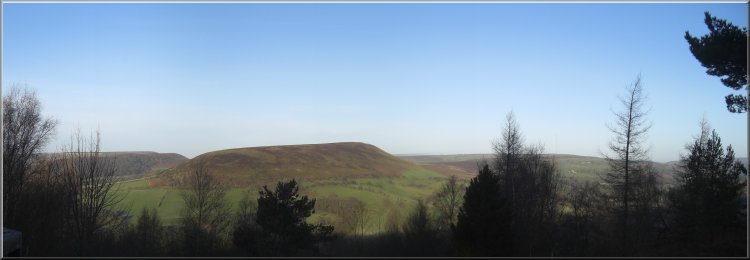
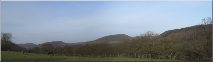
Easterside Hill seen from the viewpoint on Newgate Bank |
|
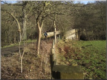
Looking up Bilsdale from Newgate Bank
There is a view point here with a wonderful view up Bilsdale and down
Ryedale. The view point is high on the hill side above the confluence
of the River Seph running down Bilsdale and the River Rye running down
Ryedale.
|
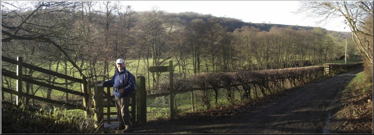
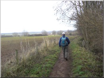
This morning I met my friend, Jim, in the car park by the castle in
Helmsley. We left Jim's car there and drove on to the Forestry Commission
car park at Newgate Bank on the Helmsley to Stokesley road, B1257, at
map ref. SE564890.
Looking down Ryedale from Newgate Bank
|
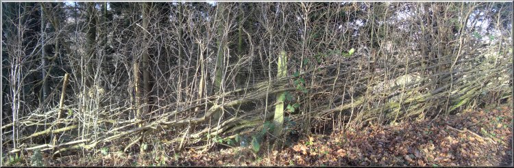
Strong new growth on a hedge laid two or three years ago |
|
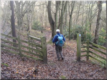
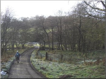
Path down to the road at Shaken Bridge
We turned left to walk south along the farm access road to a minor
road at map ref. SE560883. There is a nice little path down through
the woods that cuts the corner off and brought us out onto the road
at Shaken Bridge over the River Rye. We crossed the bridge and about
100m further on we turned left off the road to walk up the farm access
road towards Shaken Bridge Farm.
|
From the view point platform there is a rough path down the bank to
a small disused quarry at the side of the road, B1257, and from there
we walked down the road for about 200m to a footpath on the left hand
side of the road which we followed down to the farm access road at Fair
Hill farm, map ref. SE560892.
|
|
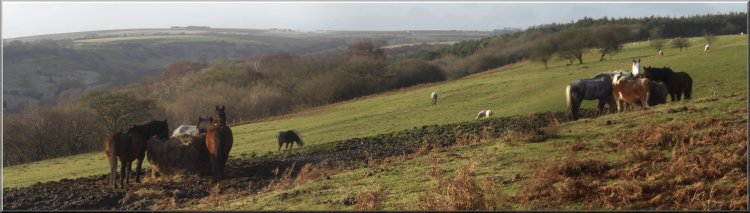
Ponies in their winter quarters near Shaken Bridge Farm
Just before the farm there is a hairpin bend in the road and a footpath
off to the left on the crown of the bend. There is a wooden finger post
there but it is hidden under a holly tree. The public footpath used
to follow the farm road through the farm yard and there was a crazy
border collie running loose that always tried to bite your ankles. Two
of my friends were bitten on separate occasions, but somehow I managed
to avoid it. Anyway this diverted path bypassing the farm is a very
welcome change that removes the conflict between walkers and the farmer.
|
Looking back up Ryedale to Easterside and Hawnby Hills |
|
Crossing the bottom end of Caydale
Here we turned left off the road onto a path across the fields beside
the River Rye. For part of the way there is a substantial boardwalk
on the steep wooded bank above the river. In wet weather the boardwalk
is very slippery and in frosty weather it is positively lethal! Today
it was just slippery.
|
We continued along the public footpath to the top of the hill at map
ref. SE560874. From there we followed a bridleway down the hill to Barnclose
Farm. Through the farm yard we continued along the farm road across
the bottom end of Caydale and up to Tylas Farm. From there we followed
the farm road for about 600m to map ref. SE563862.
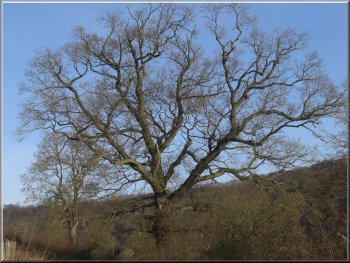
A fine oak tree by the farm road near Tylas Farm
|
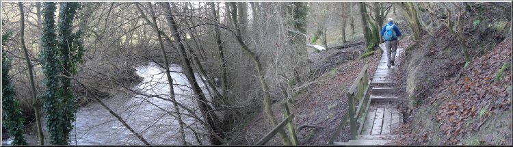
Slippery board walk by the river Rye |
|
Bow Bridge over the river Rye near Rievaulx
About 250m beyond the bridge we took a footpath on
the right back to the riverside and we followed this path for about
700m to the village of Rievaulx and Rievaulx Abbey.
|
The river side path led us to a track at map ref. SE568855.
At the track we turned left to cross the River Rye on Bow Bridge.
Approaching Rievaulx across the fields
|
Path to Rievaulx across the fields from Bow Bridge |
|
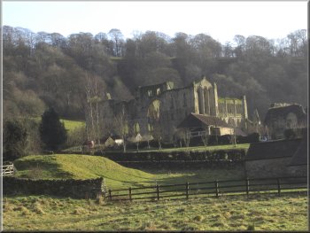
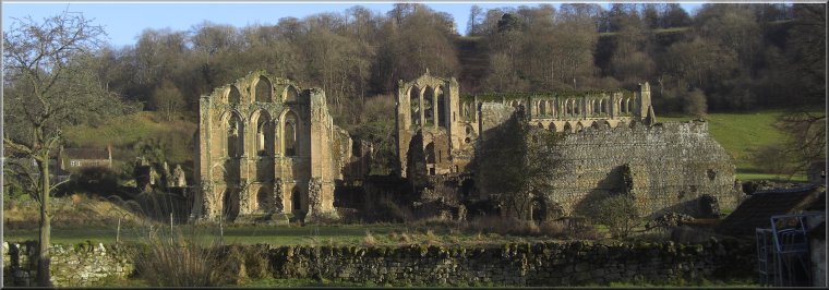
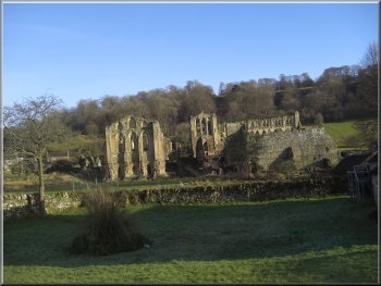
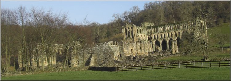
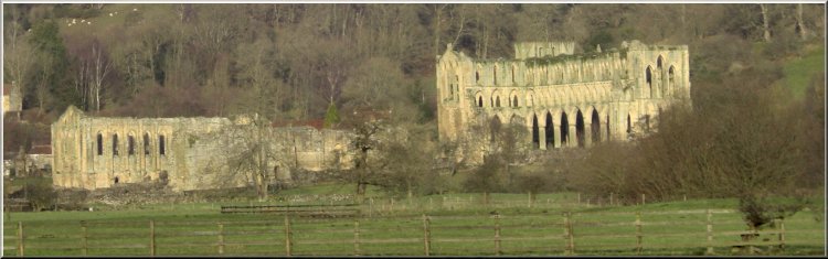
Rievaulx Abbey
After our break we continued for about 200m to the 'T'-junction at
Rievaulx Bridge where we turned left to join the Cleveland Way route
along the road.
|
The coffee shop at the abbey was closed but a few hundred metres past
the abbey we found a very pleasant spot on the river bank to sit for
our lunch.
Rievaulx Abbey
|
Rievaulx Abbey
|
Rievaulx Abbey |
We sat on this bank of the river Rye near Rievaulx Abbey for our lunch
|
|
Rievaulx Bridge over the river Rye
At the top of the wood the path continued around the edge of the wood
with fields to our left where there is the site of the abandoned medieval
village of Griff, but there is nothing to be seen from the path.
|
After about 500m at a bend in the road we followed the Cleveland way
to the right on a path up through Quarry Bank Wood.
The Cleveland Way path through Quarry Bank Wood
|
Stubble fields seen from the Cleveland Way near Griff Lodge |
|
The steep sided little valley in Blackdale Howl Wood
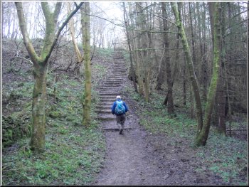
We climbed the steps out of the valley and continued along the Cleveland
Way back to the car park in Helmsley.
|
At Griff Lodge we kept to the Cleveland Way on the left hand fork
and crossed a steep sided little valley where the remains of the bases
of a wartime army camp can be seen amongst the trees.
The Cleveland Way heading for Helmsley
|
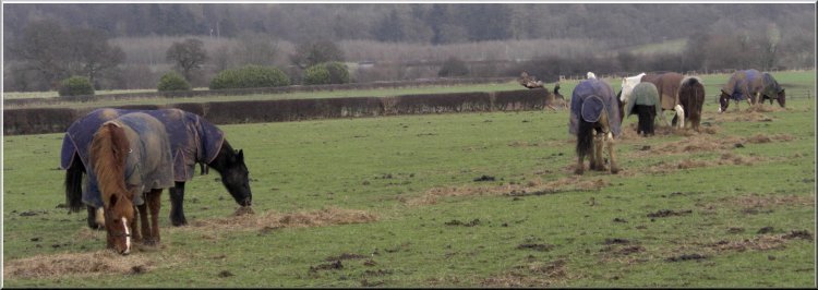
Winter feed for the horses near Helmsley
|
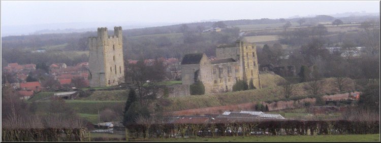
Helmsley Castle seen from the Cleveland Way |
|
We had our usual toasted teacake and cup of coffee at the bakery cafe
near the castle before driving out to Newgate Bank to collect my car
and then return home. I was just in time to collect my grand daughter
from her nursery.
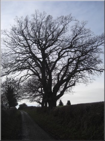
An oak tree by the Cleveland Way
|
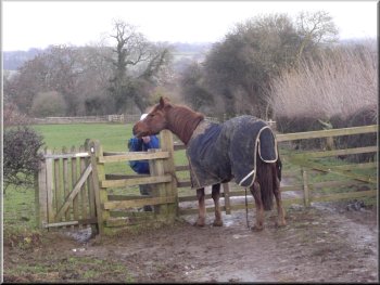
Hungry horse on the Cleveland Way
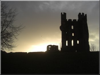
Low winter sun behind Helmsley Castle
The weather had been perfect and it had been a very
pleasant change to do a linear walk in stead of our usual circular routes.
|
Background Notes:
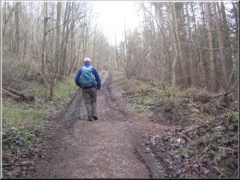
This walk is a linear walk of 12km, about 8 miles from the Forestry Commission car park at Newgate Bank in Bilsdale, along Ryedale to Helmsley. I think it's full of interest and goes through some really lovely countryside.
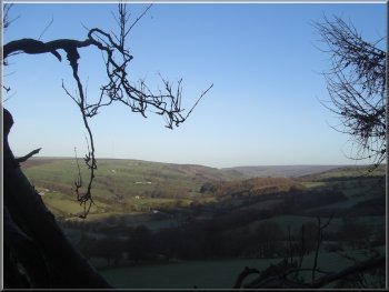
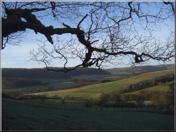
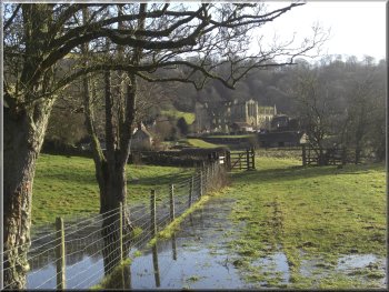
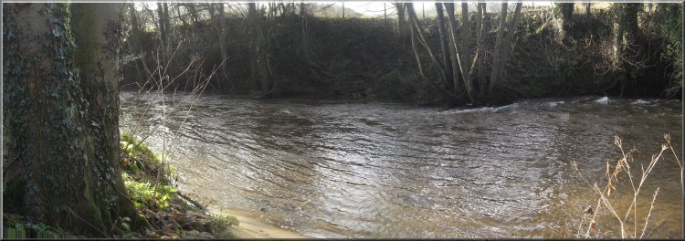
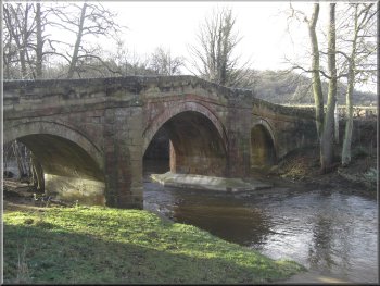
The car park has a viewing platform sited at the top of Newgate Bank overlooking Bilsdale with wonderful views up the valley, across to the distinctive shapes of Easterside Hill and Hawnby Hill and down into Ryedale. From the car park we drop down into the valley and follow a track down the valley to a road bridge over the River Rye called Shaken Bridge. The River Seph that flows down Bilsdale joins the River Rye about 400m up stream of the bridge. The River Rye is subject to flash flooding and Shaken Bridge was damaged by a particularly bad flood in 2005 and was closed until repairs were completed.
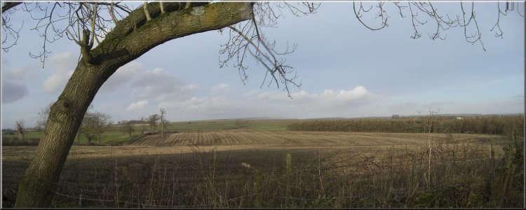
From the bridge we climb up the hillside past East Ley Wood with lovely views of Ryedale before dropping down to cross Caydale Beck just before it joins the River Rye. We follow the river down the valley to Bow Bridge, a grade 2 listed structure dating from around 1800. We cross the bridge and walk along an old track called Arden Lane before crossing the fields to Rievaulx Village. Until the English Civil War in the mid 1600's there was an iron smelting industry here that was started by the monks of Rievaulx Abbey, but it's a small agricultural community now.
In the village we reach Reivaulx Abbey founded in 1136 on land granted by the Lord of Helmsley, William l'Espec. He had a son, also William, who broke his neck in a riding accident and died. His father was grief-striken and resolved to devote himself to spiritual matters. He passed his final few years as a monk at Reivaulx.
Just beyond the abbey we join the route of the Cleveland Way. This is a route of 175km, about 110 miles, from Filey, up the Yorkshire coast and around the northern and western edge of the North York Moors National Park to Helmsley. We follow this route from here all the way into Helmsley.
The path climbs up through Quarry Bank Wood to skirt the edge of Whinny Bank Wood. Here just over the wall to the left is the site of the lost village of Griff. It's just an area of mounds and hollows in a grassy field now, but the village was destroyed by William the Conquerer's army during his brutal, repressive campaign to subdue the North of England in 1069. It's said he left no house standing between York and Durham, not too much of an egageration . No wonder it's called "The Harrying of the North". Our country's North / South divide has some very deep roots.
We continue past a gate house called Griff Lodge and along the edge of Blackdale Howl Wood. The path crosses a deep and steep gulley with steps down and back up the other side. In the gulley are the remnants of a WW2 army camp that can be seen amongst the trees. This was part of the preparations for the D-Day Normandy Landings when units were dispersed across the country so that there was no indication of any assembly point. In their camps they awaited the order to move to their embarkation points for the invasion. Part of the British Army 30th Armoured Brigade was stationed here.
From here we follow the Cleveland Way into Helmsley. This is a popular tourist venue with it's castle, Duncombe Park and many other places of interest to visit at the end of this week's walk.
top of page
|