| 2001 walks | 2002
walks | 2003 walks | 2004
walks |
| 2005 walks | 2006
walks | 2007 walks | 2008
walks |
| 2009 walks | 2010
walks | 2011 walks | 2012 walks |
| 2013 walks | 2014 walks | 2015 walks | 2016 walks |
| 2017 walks | 2018 walks | 2019 walks |2020 walks |
| 2021 walks | 1993-2000 library | Find a Route Index |
| A few Routes to print out | Request a Route... |
Route No. 313 - Wednesday 16 September 2009
Top Hill Low (water treatment works)
Nature Reserve, River Hull circuit - 7km
near Driffield, East Yorkshire . . .
Ordnance Survey route map on
the Landranger series map base.
View the route in Google Earth
Map: Ordnance Survey Explorer 295 Bridlington, Driffield & Hornsea
at 1:25000
|
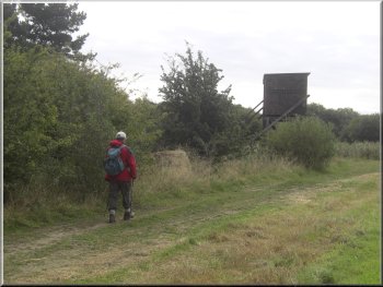
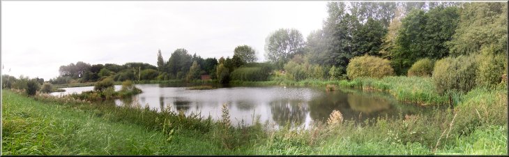
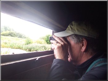
Large hide by the visitor centre car park overlooking the 'D' shaped
reservoir
This large site is a nature reserve with a great variety of water fowl
and other birds. We parked at the visitor center car park at map ref.
TA073485. There is a ticket machine where you have to buy a permit to
enter the site. It's only £1 for people as old as we are.
|
Today my neighbour, Jim, and I drove to a large water treatment works
called Top Hill Low. It's on the River Hull about 6km east of the village
of Watton on the Driffield to Beverley road (A164). Be careful, the
A614 Driffield to Goole road is close by.
Concrete access road between the reservoir and the Beverley & Barmston
Drain
|
|
Valve chamber at the corner of the 'D' shaped reservoir
There is a large substantial hide within 50m of the car park which
we climbed into to see what we could see. It was quite windy today and
the surface of the reservoir was quite choppy. At first we did not notice
any wild fowl at all.
|
We planned to walk a meandering circuit of the site, stopping at the
observation hides along the way. We had our binoculars and a bird book,
so at about 10.15am we set off heading north east out of the car park
just a few metres to the large 'D' shaped reservoir .
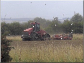
Huge tracked tractor harrowing near the access road
|
|
Approaching the hide at the northern end of the reservoir
They were continually diving so we never knew just how many there
were. After a while we decided to move on and walked about 150m to a
concrete access road running the length of the site from the south west
corner to the north east corner.
|
Then as we looked there were in fact many small groups of birds bobbing
up & down in the waves. With the help of the bird book we identified
a group of tufted duck, all black at this time of year, and several
red necked grebe.
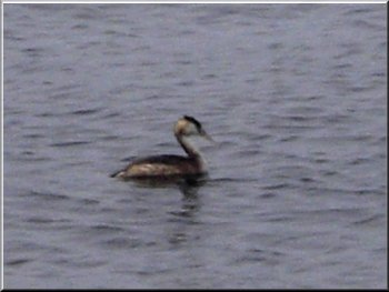
A great crested grebe at the northern end of the reservoir
|
|
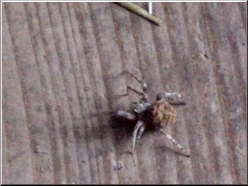
Spider on the floor of the hide. Wild life close enough to photograph
From there we followed the edge of the reservoir round to another
large hide at map ref. TA077494. We climbed the steps into the hide
and settled down again. The wind was blowing from this end of the reservoir
and the water was sheltered by the high concrete perimeter wall.
|
There is a public right of way along the access road. A wide drainage
canal called the Beverley and Barmston drain runs along side the access
road to the river Hull at the northern tip of the site. We walked along
this access road to the north east corner of the 'D' shaped reservoir.
Small pond by the hide
|
|
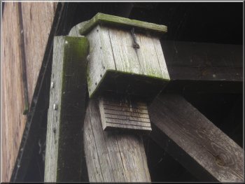
Bat box on one of the hide legs
We returned to the concrete access road where there was a huge tractor
harrowing one of the massive fields in this area. The tractor was driven
by tracks, like a tank, not wheels and a large flock of gulls was following
it to swoop on the tasty morsels it turned up. We continued on the access
road to the corner of the site at map ref. TA078499.
|
At this sheltered end there were hundreds of birds. There were a great
many grebes diving for food, groups of tufted duck and flotillas of
several other ducks that we were not confident enough to positively
identify including some with brown heads that we thought were widgeon.
The hides had been well positioned with a good view and we could see
the birds clearly with our binoculars, but they were too far away for
my little snapshot camera.
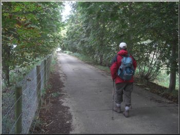
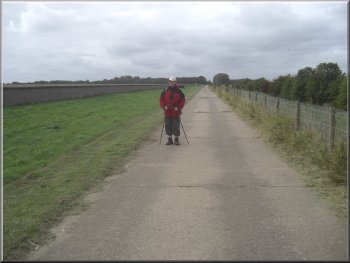
Heading along the access road to the northern tip of the site
|
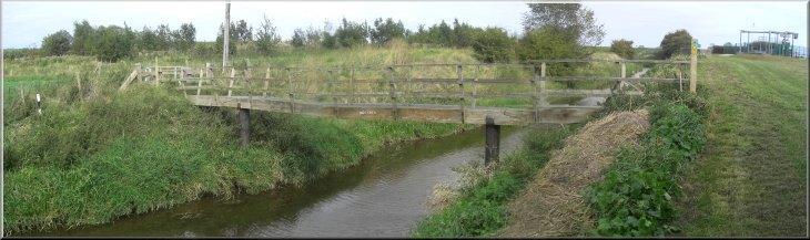
Public right of way across the Beverley & Barmston Drain |
|
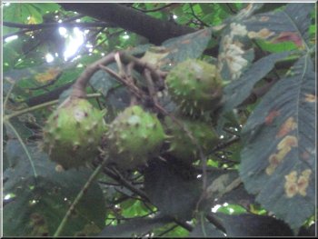
A good crop of conkers by the access road
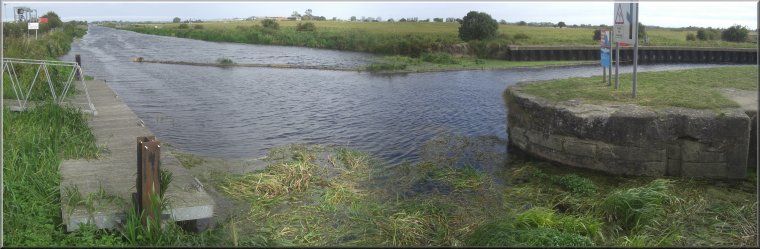
We turned right to the River Hull at Hempholme lock. The river and
its floodbank are outside the nature reserve site.
|
Here the right of way along the access road turned left to cross the
drainage canal on a wooden footbridge.
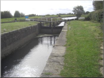
Hempholme Lock on the River Hull
|
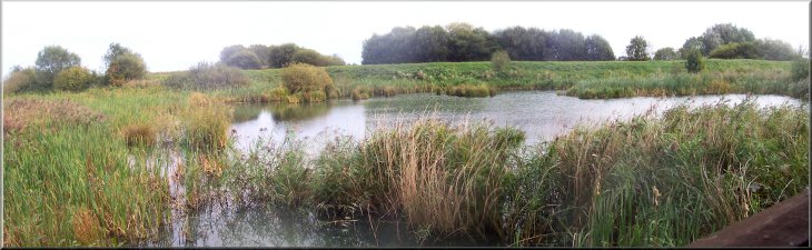
View across the ponds from our lunch stop on the R.Hull floodbank |
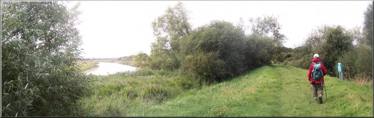
Following the R.Hull along the floodbank |
|

The Beverley & Barmston Drain
Here at the southern tip of the site we joined the right of way alongside
the Beverley & Barmston drain and followed the track around the boundary
of the site. After a few hundred metres there were some large ponds
on our left on the far side of the drainage canal, with large flocks
of geese and cormorants. Inside the Top Hill Low site there is a hide
overlooking these ponds but the only official route too it is along
the side of the drainage canal to the main gate of the site and then
back down the paths inside the reserve to the hide.
|
There is no official way back into the reserve from the floodbank.
After we had walked about 2km along the floodbank we came to a spot
with a pleasant view over two large ponds in the reserve where we sat
for our lunch. It was very peaceful watching the swans on the pond.
After our break we continued along the floodbank until we had walked
a total of just over 3km around the boundary of the waterworks/nature
reserve site to map ref. TA064474.
Scanning the ponds from the comfort of a hide
|
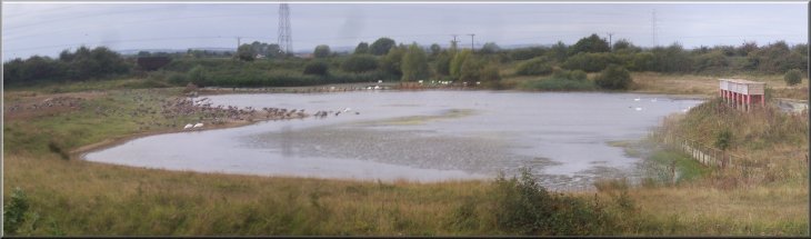
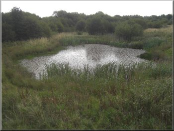
Flocks of geese, swans and cormorants on a pond near the southern end
of the site. The structure on the right is an artificial nesting site
for sand martins |
|
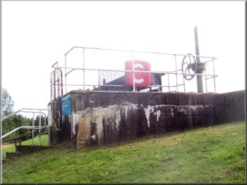
Valve chamber on the round reservoir
We got back to the car park at about 2.30pm after a walk of only 7km
but many long stops in the various hides. It had been a different and
very interesting day. We headed for home and stopped at three cafes
before we found one that would serve us a bacon roll to round off our
day out.
|
When we reached the hide we settled down to scan the flocks of birds,
greylag geese, some Canada geese, swans and a large group of cormorants.
Eventually we made our way back along the paths through the reserve
towards the visitor centre car park and stopped at two more hides along
the way. These both looked out over the two ponds we had seen from the
floodbank when we stopped for lunch.
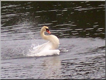
We watched this swan bathing and preening from a hide
|
Looking across the ponds from a hide to the R.Hull floodbank where we
had stopped for our lunch |